|
Scottish Gas Board
The Scottish Gas Board was a state-owned utility providing town gas, gas for light and heat to industries and homes in Scotland. The Board was established on 1 May 1949, and dissolved in 1973 when it became a region of the British Gas Corporation. Problems arising from nationalising part of the British gas industry The first chairman of the board was Andrew Clow, Sir Andrew Clow who established the headquarters at 25 Drumsheugh Gardens and 12 Rothesay Terrace Edinburgh. He served until 30 April 1956. In the last of his quarterly letters to his senior management, he reflected on the experience of centralising the control of over two hundred independent undertakings. The remainder of the article is abstracted from that letter and includes explanatory remarks. Functions of gas undertakings Each undertaking performed the functions of coal gas production and distribution through underground pipes to domestic, commercial and industrial customers, sales promotion, finance, etc. Some wo ... [...More Info...] [...Related Items...] OR: [Wikipedia] [Google] [Baidu] |
State-owned Utility
A public utility company (usually just utility) is an organization that maintains the infrastructure for a public service (often also providing a service using that infrastructure). Public utilities are subject to forms of State ownership, public control and regulation ranging from local community-based groups to statewide state monopoly, government monopolies. Public utilities are meant to supply goods/services that are considered essential; water, gas, electricity, telephone, and other Communications system, communication systems represent much of the public utility market. The transmission lines used in the transportation of electricity, or natural Pipeline transport, gas pipelines, have natural monopoly characteristics. If the infrastructure already exists in a given area, minimal benefit is gained through competing. In other words, these Industry City, industries are characterized by ''economies of scale'' in production. There are many different types of public utilities. ... [...More Info...] [...Related Items...] OR: [Wikipedia] [Google] [Baidu] |
Alloa
Alloa (Received Pronunciation ; educated Scottish pronunciation /ˈaloʊa/; gd, Alamhagh, possibly meaning "rock plain") is a town in Clackmannanshire in the Central Lowlands of Scotland. It is on the north bank of the Forth at the spot where some say it ceases to be the River Forth and becomes the Firth of Forth. Alloa is south of the Ochil Hills, east of Stirling and north of Falkirk; by water Alloa is from Granton. The town, formerly a burgh of barony, is the administrative centre of Clackmannanshire Council. Historically, the economy relied heavily on trade between Glasgow and mainland Europe through its port. This became increasingly uncompetitive and the port stopped operating in 1970. The local economy is now centred on retail and leisure since the closure of major industries; only one brewer and one glassmaker survive today. Parochially, Alloa was linked with Tullibody. The towns are now distinct, albeit with Lornshill in the middle, and Alloa is about twice the si ... [...More Info...] [...Related Items...] OR: [Wikipedia] [Google] [Baidu] |
Dumfries
Dumfries ( ; sco, Dumfries; from gd, Dùn Phris ) is a market town and former royal burgh within the Dumfries and Galloway council area of Scotland. It is located near the mouth of the River Nith into the Solway Firth about by road from the Anglo-Scottish border and just away from Cumbria by air. Dumfries is the county town of the historic county of Dumfriesshire. Before becoming King of Scots, Robert the Bruce killed his rival the Red Comyn at Greyfriars Kirk in the town on 10 February 1306. The Young Pretender had his headquarters here during a 3-day sojourn in Dumfries towards the end of 1745. During the Second World War, the bulk of the Norwegian Army during their years in exile in Britain consisted of a brigade in Dumfries. Dumfries is nicknamed ''Queen of the South''. This is also the name of the town's professional football club. People from Dumfries are known colloquially in Scots language as ''Doonhamers''. Toponymy There are a number of theories on the etymo ... [...More Info...] [...Related Items...] OR: [Wikipedia] [Google] [Baidu] |
Dumbarton
Dumbarton (; also sco, Dumbairton; ) is a town in West Dunbartonshire, Scotland, on the north bank of the River Clyde where the River Leven flows into the Clyde estuary. In 2006, it had an estimated population of 19,990. Dumbarton was the capital of the ancient Kingdom of Strathclyde, and later the county town of Dunbartonshire. Dumbarton Castle, on top of Dumbarton Rock, dominates the area. Dumbarton was a Royal burgh between 1222 and 1975. Dumbarton emerged from the 19th century as a centre for shipbuilding, glassmaking, and whisky production. However these industries have since declined, and Dumbarton today is increasingly a commuter town for Glasgow east-southeast of it. Dumbarton F.C. is the local football club. Dumbarton is home to BBC Scotland's drama studio. History Dumbarton history goes back at least as far as the Iron Age and probably much earlier. It has been suggested that in Ancient Rome, Roman times Dumbarton was the "place of importance" named as Alauna in ... [...More Info...] [...Related Items...] OR: [Wikipedia] [Google] [Baidu] |
Doune
Doune (; from Scottish Gaelic: ''An Dùn'', meaning 'the fort') is a burgh within Perthshire. The town is administered by Stirling Council. Doune is assigned Falkirk postcodes starting "FK". The village lies within the parish of Kilmadock and mainly within the area surrounded by the River Teith and Ardoch Burn. In the 2001 Scottish census, 2.75% residents of Doune could speak Scottish Gaelic. Doune has a small primary school with 183 pupils on the roll (June 2016), drawn from a catchment area which extends outside the town, especially to the north. It is located on the site of Doune Roman fort. Gaelic is taught in Primary 1–7 and Spanish is now taught from P5 upwards . History The town is dominated by Doune Castle, built in the late 14th century. Architecturally it is a mixture of fortress and manor house. Bonnie Prince Charlie passed through Doune in 1745. Doune was also famous for its manufacture of pistols, but this eventually ceased due to the competition of manufactu ... [...More Info...] [...Related Items...] OR: [Wikipedia] [Google] [Baidu] |
Dingwall
Dingwall ( sco, Dingwal, gd, Inbhir Pheofharain ) is a town and a royal burgh in the Highland council area of Scotland. It has a population of 5,491. It was an east-coast harbour that now lies inland. Dingwall Castle was once the biggest castle north of Stirling. On the town's present-day outskirts lies Tulloch Castle, parts of which may date back to the 12th century. In 1411 the Battle of Dingwall is said to have taken place between the Clan Mackay and the Clan Donald. History Its name, derived from the Scandinavian (field or meeting-place of the ''thing'', or local assembly; compare Tynwald, Tingwall, Thingwall in the British Isles alone, plus many others across northern Europe), preserves the Viking connections of the town; Gaels call it (), meaning "the mouth of the Peffery" or meaning "cabbage town". The site of the , and of the medieval Moothill, thought to have been established by the Vikings after they invaded in the 8th century, lies beneath the Cromartie memor ... [...More Info...] [...Related Items...] OR: [Wikipedia] [Google] [Baidu] |
Denny And Dunipace
Denny ( gd, Deanaidh) is a town in the Falkirk council area of Scotland. Historically in Stirlingshire, it is situated west of Falkirk, and northeast of Cumbernauld, adjacent to both the M80 and M876 motorways. At the 2011 census, Denny had a resident population of 8,300. History Denny is separated from neighbouring village Dunipace by the River Carron. A stone bridge was built over the river in 1825. Denny Town House was completed in 1931. Until the early 1980s, Denny was a centre for heavy industry, including several iron foundries, brickworks, a coal mine and paper mills. The first phase of a £7.6 million regeneration scheme in the town centre was completed in 2017. Notable people In the First World War 902 men signed up from Denny and Dunipace. Of those 154 were killed in action or died on service. Decorations were earned by 31 men. * Thomas Bain, politician * John Adam Cramb, historian * David Forrester, divine * George William Gray, chemist * Matthew Hay, doctor * ... [...More Info...] [...Related Items...] OR: [Wikipedia] [Google] [Baidu] |
Darvel
Darvel ( sco, Dairvel, gd, Darbhail) is a small town in East Ayrshire, Scotland. It is at the eastern end of the Loudoun, Irvine Valley and is sometimes referred to as "The Lang Toon" ( en, the Long Town). The town's Latin motto, , means "Not for ourselves, but for others". Location Darvel is situated on the A71 road that runs from Irvine on the west coast to Edinburgh on the east. The town is east of Kilmarnock and is the most easterly of the Irvine Valley Towns, the others being Galston, East Ayrshire, Galston and Newmilns. The town was once linked with Stonehouse, South Lanarkshire, Stonehouse (via Strathaven) by the Caledonian Railway. However, the line was closed by the LMS before the Second World War. The former Glasgow and South Western Railway branch line to Kilmarnock survived for much longer and was closed in 1964 as part of the Beeching Axe. Much of the route of both lines is still in existence, although the rails have long since gone and many road bridges have ... [...More Info...] [...Related Items...] OR: [Wikipedia] [Google] [Baidu] |
Cove And Kilcreggan
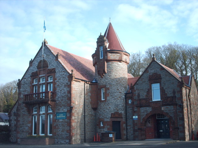
Cove is a village on the south-west coast of the Rosneath Peninsula, on Loch Long, in Argyll and Bute, western Scotland. History Historically in Dunbartonshire, before the local government reorganisation in Scotland in 1975 it formed part of the small Joint Burgh of Cove and Kilcreggan. It remained in Dumbarton District until 1996 when it was transferred to Argyll and Bute with the rest of the peninsula. In common with many villages in the area, Cove provided summer lodgings for the families of wealthy Glasgow merchants, shipowners and businesspeople in the 19th century. Several of the large houses have either been converted or have gone. Houses by Alexander "Greek" Thomson around Cove include: Knockderry Castle, Craigrownie Castle, Glen Eden, Craig Ailey, Ferndean and Seymour Lodge, all dating from the 1850s. Hartfield, designed by Campbell Douglas and completed in 1859, was the summer residence of James Burns, 3rd Baron Inverclyde and later became a YMCA hostel before its ... [...More Info...] [...Related Items...] OR: [Wikipedia] [Google] [Baidu] |
Coatbridge
Coatbridge ( sco, Cotbrig or Coatbrig, gd, Drochaid a' Chòta) is a town in North Lanarkshire, Scotland, about east of Glasgow city centre, set in the central Lowlands. Along with neighbouring town Airdrie, Coatbridge forms the area known as the Monklands (population approximately 90,000 including outlying settlements), often considered to be part of the Greater Glasgow urban area – although officially they have not been included in population figures since 2016 due to small gaps between the Monklands and Glasgow built-up areas. In the last years of the 18th century, the area developed from a loose collection of hamlets into the town of Coatbridge. The town's development and growth have been intimately connected with the technological advances of the Industrial Revolution, and in particular with the hot blast process. Coatbridge was a major Scottish centre for iron works and coal mining during the 19th century and was then described as 'the industrial heartland of Scotland' ... [...More Info...] [...Related Items...] OR: [Wikipedia] [Google] [Baidu] |
Carnoustie
Carnoustie (; sco, Carnoustie, gd, Càrn Ùstaidh) is a town and former police burgh in the council area of Angus, Scotland. It is at the mouth of the Barry Burn on the North Sea coast. In the 2011 census, Carnoustie had a population of 11,394, making it the fourth-largest town in Angus. The town was founded in the late 18th century, and grew rapidly throughout the 19th century due to the growth of the local textile industry. It was popular as a tourist resort from the early Victorian era up to the latter half of the 20th century, due to its seaside location, and is best known for the Carnoustie Golf Links course that often hosts the Open Championship. Carnoustie can be considered a dormitory town for its nearest city, Dundee, which is to the west. It is served principally by Carnoustie railway station, and also by Golf Street railway station. Its nearest major road is the A92, north of the town. History Toponymy The origin of the name Carnoustie is uncertain. Plau ... [...More Info...] [...Related Items...] OR: [Wikipedia] [Google] [Baidu] |
Campbeltown
Campbeltown (; gd, Ceann Loch Chille Chiarain or ) is a town and former royal burgh in Argyll and Bute, Scotland. It lies by Campbeltown Loch on the Kintyre peninsula. Campbeltown became an important centre for Scotch whisky, and a busy fishing port. The 2018 population estimate was 4,600 indicating a reduction since the 2011 census. History Originally known as Kinlochkilkerran (an anglicization of the Gaelic, which means 'head of the loch by the kirk of Ciarán'), Campbeltown was renamed in the 17th century as ''Campbell's Town'' after Archibald Campbell ( Earl of Argyle) was granted the site in 1667. Campbeltown Town Hall was completed in 1760. Whisky Campbeltown is one of five areas in Scotland categorised as a distinct malt whisky producing region, and is home to the Campbeltown single malts. At one point it had over 30 distilleries and proclaimed itself "the whisky capital of the world". However, a focus on quantity rather than quality, and the combination of Prohibiti ... [...More Info...] [...Related Items...] OR: [Wikipedia] [Google] [Baidu] |


.jpg)