|
Schoharie County
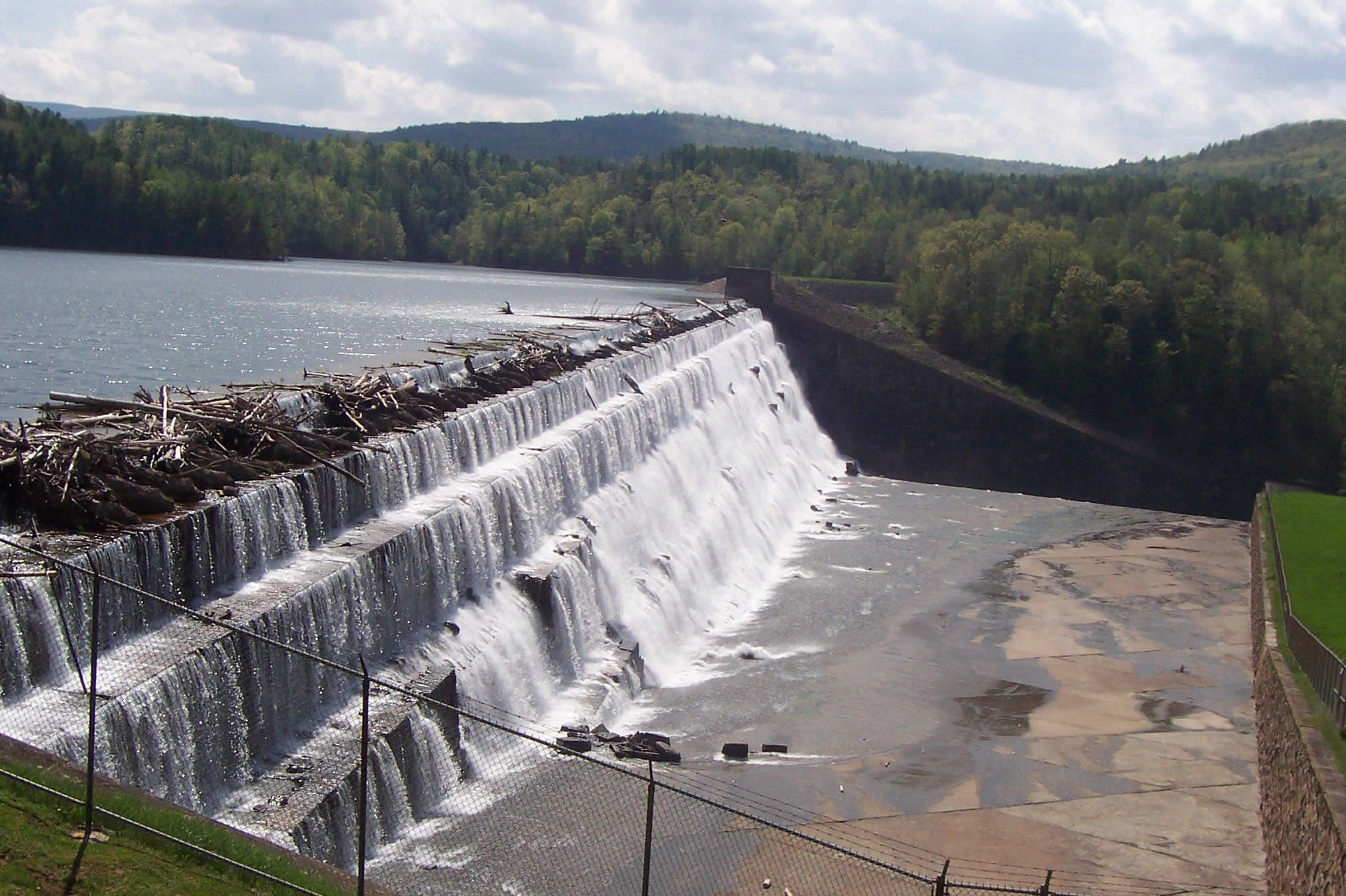
Schoharie County ( ) is a county in the U.S. state of New York. As of the 2020 census, the population was 29,714, making it the state's fifth-least populous county. The county seat is Schoharie. "Schoharie" comes from a Mohawk word meaning "floating driftwood." Schoharie County is part of the Albany-Schenectady-Troy, NY Metropolitan Statistical Area. History The large territory of the county (much of upstate and western New York) was long occupied by the Mohawk Nation and, to the west, the other four tribes of the Haudenosaunee Confederacy (increased to six with the migration of the Tuscarora from the South to New York in 1722). After European colonization of the Northeast started, the Mohawk had a lucrative fur trade with the French coming down from Canada, as well as the early Dutch colonists, and later British and German colonists. Some Palatine Germans, who worked in camps on the Hudson to pay off their passage in 1710, later settled in this county in the 1720s and 3 ... [...More Info...] [...Related Items...] OR: [Wikipedia] [Google] [Baidu] |
Counties Of New York
A county is a geographic region of a country used for administrative or other purposesChambers Dictionary, L. Brookes (ed.), 2005, Chambers Harrap Publishers Ltd, Edinburgh in certain modern nations. The term is derived from the Old French denoting a jurisdiction under the sovereignty of a count (earl) or a viscount.The Oxford Dictionary of English Etymology, C. W. Onions (Ed.), 1966, Oxford University Press Literal equivalents in other languages, derived from the equivalent of "count", are now seldom used officially, including , , , , , , , and ''zhupa'' in Slavic languages; terms equivalent to commune/community are now often instead used. When the Normans conquered England, they brought the term with them. The Saxons had already established the districts that became the historic counties of England, calling them shires;Vision of Britai– Type details for ancient county. Retrieved 31 March 2012 many county names derive from the name of the county town (county seat) with th ... [...More Info...] [...Related Items...] OR: [Wikipedia] [Google] [Baidu] |
Mohawk Indians
The Mohawk people ( moh, Kanienʼkehá꞉ka) are the most easterly section of the Haudenosaunee, or Iroquois Confederacy. They are an Iroquoian-speaking Indigenous people of North America, with communities in southeastern Canada and northern New York State, primarily around Lake Ontario and the St. Lawrence River. As one of the five original members of the Iroquois League, the Kanienʼkehá꞉ka are known as the Keepers of the Eastern Door – the traditional guardians of the Iroquois Confederation against invasions from the east. Historically, the Kanienʼkehá꞉ka people were originally based in the valley of the Mohawk River in present-day upstate New York, west of the Hudson River. Their territory ranged north to the St. Lawrence River, southern Quebec and eastern Ontario; south to greater New Jersey and into Pennsylvania; eastward to the Green Mountains of Vermont; and westward to the border with the Iroquoian Oneida Nation's traditional homeland territory. Kanienʼkehá ... [...More Info...] [...Related Items...] OR: [Wikipedia] [Google] [Baidu] |
Tryon County, New York
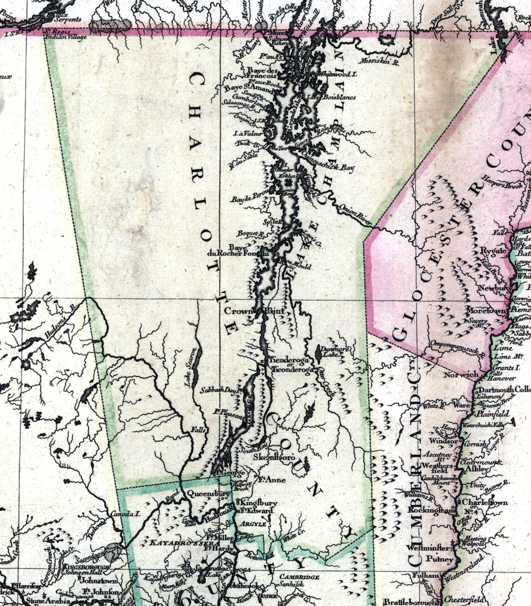
Tryon County was a county in the colonial Province of New York in the British American colonies. It was created from Albany County on March 24, 1772, and was named for William Tryon, the last provincial governor of New York. The county's boundaries extended much further than any current county. Its eastern boundary with the also-new Charlotte County ran "from the Mohawk River to the Canada line, at a point near the old village of St. Regis and passing south to the Mohawk between Schenectady and Albany." It extended north to the St. Lawrence River; its western boundary was the Treaty of Fort Stanwix's Line of Property, following the Unadilla River, Oneida Lake, Onondaga River and Oswego River to Lake Ontario, as the Iroquois Confederacy still controlled locations further west in the Indian Reserve. Tryon County's seat was Johnstown, which is today the county seat of Fulton County. [...More Info...] [...Related Items...] OR: [Wikipedia] [Google] [Baidu] |
Gloucester County, New York
Gloucester County, New York is a former county in New York that became part of the state of Vermont. It was a part of Albany County in the Province of New York until 1770 and was lost to Vermont in 1777. At that time, Vermont was holding itself out as the Republic of Vermont and did not become a state until 1791. The County of Gloucester name was used occasionally in contemporary documents. Yet the 28 February 1770 Order for Erection and many subsequent documents refer to the region as the County of Glocester. arranged under direction of the Hon. Christopher Morgan, Secretary of State. Edited by Edmund Bailey O'Callaghan, 1797-1880., New York (State). Secretary's Office. Page 390. Accessed 8 September 2020. Contemporary maps also refer ... [...More Info...] [...Related Items...] OR: [Wikipedia] [Google] [Baidu] |
Cumberland County, New York
Cumberland County, New York was a county in the Province of New York that became part of the state of Vermont. It was divided out of Albany County in New York in 1766, but eventually became a part of Vermont in 1777. At that time, Vermont was holding itself out as the Republic of Vermont and was not admitted to the Union until 1791. Located south of Gloucester County and east of Charlotte County (Anderson, p. 6, incorporated from Albany County (see map from 1777 Charlotte County, Province of New York), Cumberland County was fused with Gloucester County, New York to become Cumberland County, Vermont, which, along with Bennington County, comprised the only two counties in that state. The Vermont Cumberland County was abolished by being partitioned into several new counties in Vermont and one in New Hampshire. See also *List of former United States counties *List of counties in Vermont There are fourteen counties in the U.S. state of Vermont. These counties together contain ... [...More Info...] [...Related Items...] OR: [Wikipedia] [Google] [Baidu] |
Pacific Ocean
The Pacific Ocean is the largest and deepest of Earth's five oceanic divisions. It extends from the Arctic Ocean in the north to the Southern Ocean (or, depending on definition, to Antarctica) in the south, and is bounded by the continents of Asia and Oceania in the west and the Americas in the east. At in area (as defined with a southern Antarctic border), this largest division of the World Ocean—and, in turn, the hydrosphere—covers about 46% of Earth's water surface and about 32% of its total surface area, larger than Earth's entire land area combined .Pacific Ocean . '' Britannica Concise.'' 2008: Encyclopædia Britannica, Inc. The centers of both the |
Vermont
Vermont () is a state in the northeast New England region of the United States. Vermont is bordered by the states of Massachusetts to the south, New Hampshire to the east, and New York to the west, and the Canadian province of Quebec to the north. Admitted to the union in 1791 as the 14th state, it is the only state in New England not bordered by the Atlantic Ocean. According to the 2020 U.S. census, the state has a population of 643,503, ranking it the second least-populated in the U.S. after Wyoming. It is also the nation's sixth-smallest state in area. The state's capital Montpelier is the least-populous state capital in the U.S., while its most-populous city, Burlington, is the least-populous to be a state's largest. For some 12,000 years, indigenous peoples have inhabited this area. The competitive tribes of the Algonquian-speaking Abenaki and Iroquoian-speaking Mohawk were active in the area at the time of European encounter. During the 17th century, Fr ... [...More Info...] [...Related Items...] OR: [Wikipedia] [Google] [Baidu] |
Albany County, New York
Albany County ( ) is a county in the state of New York, United States. Its northern border is formed by the Mohawk River, at its confluence with the Hudson River, which is to the east. As of the 2020 United States Census, the population was 314,848. The county seat and largest city is Albany, which is also the state capital of New York. As originally established by the English government in the colonial era, Albany County had an indefinite amount of land, but has had an area of since March 3, 1888. The county is named for the Duke of York and of Albany, who became James II of England (James VII of Scotland). Albany County constitutes the central core of the Capital District of New York State, which comprises the Albany-Schenectady-Troy, NY Metropolitan Statistical Area. History Colonial After England took control of the colony of New Netherland from the Dutch, Albany County was created on November 1, 1683, by New York Governor Thomas Dongan, and confirmed on October 1, ... [...More Info...] [...Related Items...] OR: [Wikipedia] [Google] [Baidu] |
Cherry Creek, New York
Cherry Creek is a town in Chautauqua County, New York, United States. The population was 1,036 at the 2020 census. The name is derived from that of a small stream that flows through the town amid many cherry trees. Cherry Creek is situated on the east border of the county, northeast of Jamestown. There is also a hamlet named Cherry Creek located within the town. History The community was first settled ''circa'' 1815, and the town of Cherry Creek was formed in 1829 from part of the town of Ellington. The settlement got its name from a cherry tree planted by Holland Land Company surveyor Joshua Bentley to mark the center of the new town. The village, which was incorporated in 1893, voted on February 2, 2017 to dissolve into the surrounding town. Geography According to the United States Census Bureau, the town has a total area of , of which , or 0.04%, is water. New York State Route 83 is a major north-south highway in the eastern half of the town. Chautauqua County Route 70 ... [...More Info...] [...Related Items...] OR: [Wikipedia] [Google] [Baidu] |
American Revolutionary War
The American Revolutionary War (April 19, 1775 – September 3, 1783), also known as the Revolutionary War or American War of Independence, was a major war of the American Revolution. Widely considered as the war that secured the independence of the United States, fighting began on April 19, 1775, followed by the Lee Resolution on July 2, 1776, and the Declaration of Independence on July 4, 1776. The American Patriots were supported by the Kingdom of France and, to a lesser extent, the Dutch Republic and the Spanish Empire, in a conflict taking place in North America, the Caribbean, and the Atlantic Ocean. Established by royal charter in the 17th and 18th centuries, the American colonies were largely autonomous in domestic affairs and commercially prosperous, trading with Britain and its Caribbean colonies, as well as other European powers via their Caribbean entrepôts. After British victory over the French in the Seven Years' War in 1763, tensions between the motherland and he ... [...More Info...] [...Related Items...] OR: [Wikipedia] [Google] [Baidu] |
Scotch-Irish American
Scotch-Irish (or Scots-Irish) Americans are American descendants of Ulster Protestants who emigrated from Ulster in northern Ireland to America during the 18th and 19th centuries, whose ancestors had originally migrated to Ireland mainly from the Scottish Lowlands and Northern England in the 17th century. In the 2017 American Community Survey, 5.39 million (1.7% of the population) reported Scottish ancestry, an additional 3 million (0.9% of the population) identified more specifically with Scotch-Irish ancestry, and many people who claim "American ancestry" may actually be of Scotch-Irish ancestry. The term ''Scotch-Irish'' is used primarily in the United States,Leyburn 1962, p. 327. with people in Great Britain or Ireland who are of a similar ancestry identifying as Ulster Scots people. Many left for America but over 100,000 Scottish Presbyterians still lived in Ulster in 1700. Many English-born settlers of this period were also Presbyterians. When King Charles I of England, ... [...More Info...] [...Related Items...] OR: [Wikipedia] [Google] [Baidu] |
Palatine Germans
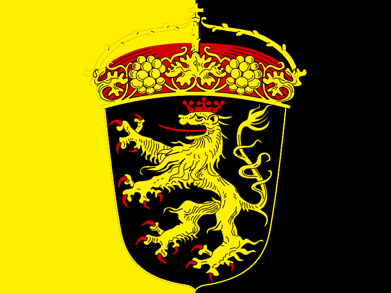
Palatines (german: Pfälzer), also known as the Palatine Dutch, are the people and princes of Palatinates ( Holy Roman principalities) of the Holy Roman Empire. The Palatine diaspora includes the Pennsylvania Dutch and New York Dutch. In 1709, England found itself hosting thousands of Palatines and other Germans who were fleeing famine, war and religious persecution in their native lands. Many of the first arrivals came from the Rhenish and Bavarian Palatinates, and the refugees became collectively known as the "Poor Palatines". They had been displaced by French invasions and famine during the Nine Years' War and the War of the Spanish Succession. After arriving in London, many were resettled in Ireland and British America. Towards the end of the 17th century and into the 18th, the wealthy region was repeatedly invaded by French troops during two wars. At that time the region had not yet fully recovered from the Thirty Years' War. They imposed a scorched-earth policy and con ... [...More Info...] [...Related Items...] OR: [Wikipedia] [Google] [Baidu] |


.jpg)


