|
Schlachte
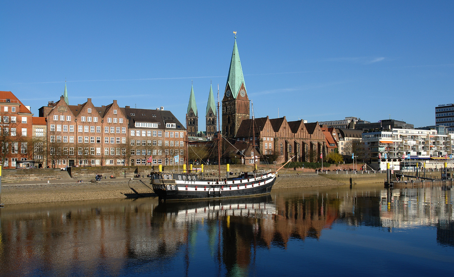
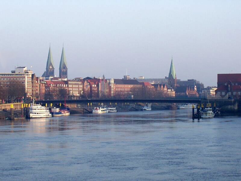
The Schlachte is a promenade along the east bank of the River Weser in the old town of Bremen in the north of Germany. Once one of the city's harbours, it is now popular for its restaurants, beer gardens and river boats. Etymology ''Schlachte'' is a Low German word for a river bank reinforced with wooden piles driven in by the action of hammering (cf. German ''eingeschlagenen''). The word ''slait'' was used as early as 1250 to refer to the river bank in Bremen. History In 1247, following authorisation from Archbishop Gerhard II, the area between St Martini's Church and Zweite Schlachtpforte (a street meaning "second quayside gate") was settled by local citizens and traders. In 1250, those privileged to operate water mills were required to maintain the wooden piles used to reinforce the river bank. In the 13th century, both the Schlachte and the Balge were used as harbours for wood (used as firewood) and limestone although the banks of the Balge soon became Bremen's main port. Bo ... [...More Info...] [...Related Items...] OR: [Wikipedia] [Google] [Baidu] |
Schlachte Great Crane
The Schlachte Cranes were important to the port of Bremen as they enabled heavy loads to be moved off boats on the River Weser. The Schlachte became an important harbour for the city after silting prevented the use of the Balge as a harbour. Today, only the foundations of a 19th-century crane remain on the Weser waterfront. History A map of Bremen made around 1640 clearly shows what must be a large crane. The wooden structure was built around a central mast that allowed the crane to turn. A new harbour crane installed in 1684 is attributed to Jacob Leupold.Theatrum Machinarum Generale ("The General Theory of Machines"), Jacob Leupold. This crane could also rotate but two large treadwheels enabled six men to lift a load of three tonnes. In his book on the theory of machines, Leupold illustrates two cranes at Bremen. The more ambitious model is pictured here. The boom would have been much longer as it has been shortened to fit within the illustration. The crane would have been u ... [...More Info...] [...Related Items...] OR: [Wikipedia] [Google] [Baidu] |
Bremen Hansekogge RolandvonBremen
Bremen (Low German also: ''Breem'' or ''Bräm''), officially the City Municipality of Bremen (german: Stadtgemeinde Bremen, ), is the capital of the Germany, German States of Germany, state Bremen (state), Free Hanseatic City of Bremen (''Freie Hansestadt Bremen''), a two-city-state consisting of the cities of Bremen and Bremerhaven. With about 570,000 inhabitants, the Hanseatic League, Hanseatic city is the List of cities in Germany by population, 11th largest city of Germany and the second largest city in Northern Germany after Hamburg. Bremen is the largest city on the River Weser, the longest river flowing entirely in Germany, lying some upstream from its River mouth, mouth into the North Sea, and is surrounded by the state of Lower Saxony. A commercial and industrial city, Bremen is, together with Oldenburg (city), Oldenburg and Bremerhaven, part of the Bremen/Oldenburg Metropolitan Region, with 2.5 million people. Bremen is contiguous with the Lower Saxon towns of Delmenhor ... [...More Info...] [...Related Items...] OR: [Wikipedia] [Google] [Baidu] |
Bremen
Bremen (Low German also: ''Breem'' or ''Bräm''), officially the City Municipality of Bremen (german: Stadtgemeinde Bremen, ), is the capital of the German state Free Hanseatic City of Bremen (''Freie Hansestadt Bremen''), a two-city-state consisting of the cities of Bremen and Bremerhaven. With about 570,000 inhabitants, the Hanseatic city is the 11th largest city of Germany and the second largest city in Northern Germany after Hamburg. Bremen is the largest city on the River Weser, the longest river flowing entirely in Germany, lying some upstream from its mouth into the North Sea, and is surrounded by the state of Lower Saxony. A commercial and industrial city, Bremen is, together with Oldenburg and Bremerhaven, part of the Bremen/Oldenburg Metropolitan Region, with 2.5 million people. Bremen is contiguous with the Lower Saxon towns of Delmenhorst, Stuhr, Achim, Weyhe, Schwanewede and Lilienthal. There is an exclave of Bremen in Bremerhaven, the "Citybremian Overseas Port ... [...More Info...] [...Related Items...] OR: [Wikipedia] [Google] [Baidu] |
Bremen In The 16th Century - Hans Weigel - 1564-crop
Bremen (Low German also: ''Breem'' or ''Bräm''), officially the City Municipality of Bremen (german: Stadtgemeinde Bremen, ), is the capital of the German state Free Hanseatic City of Bremen (''Freie Hansestadt Bremen''), a two-city-state consisting of the cities of Bremen and Bremerhaven. With about 570,000 inhabitants, the Hanseatic city is the 11th largest city of Germany and the second largest city in Northern Germany after Hamburg. Bremen is the largest city on the River Weser, the longest river flowing entirely in Germany, lying some upstream from its mouth into the North Sea, and is surrounded by the state of Lower Saxony. A commercial and industrial city, Bremen is, together with Oldenburg and Bremerhaven, part of the Bremen/Oldenburg Metropolitan Region, with 2.5 million people. Bremen is contiguous with the Lower Saxon towns of Delmenhorst, Stuhr, Achim, Weyhe, Schwanewede and Lilienthal. There is an exclave of Bremen in Bremerhaven, the "Citybremian Overseas Port Ar ... [...More Info...] [...Related Items...] OR: [Wikipedia] [Google] [Baidu] |
Balge (river)
The Balge (also known as the Balje) was a short branch of the Weser on its eastern side, running through what is now the centre of Bremen. As it served as a harbour in the early Middle Ages, it significantly contributed to Bremen's development as a port. The river gradually narrowed until in 1608, it was canalised. In 1838, it was completely filled with earth. Early Middle Ages At the time when the diocese was founded, the low-lying land around Bremen was swampy with several islands formed by the Weser and its branches. In 1988/1989 construction work involving excavations at the corner of Martinistrasse and Wachtstrasse revealed three small waterway channels from around the year 800 in an area of . There was also a river boat from the 9th century. From the 9th century onwards, the terrain changed significantly, partly as a result of floods which brought sand into the area, partly through increased human settlement. Gradually, the marshes and the river's minor branches disappear ... [...More Info...] [...Related Items...] OR: [Wikipedia] [Google] [Baidu] |
Teerhof
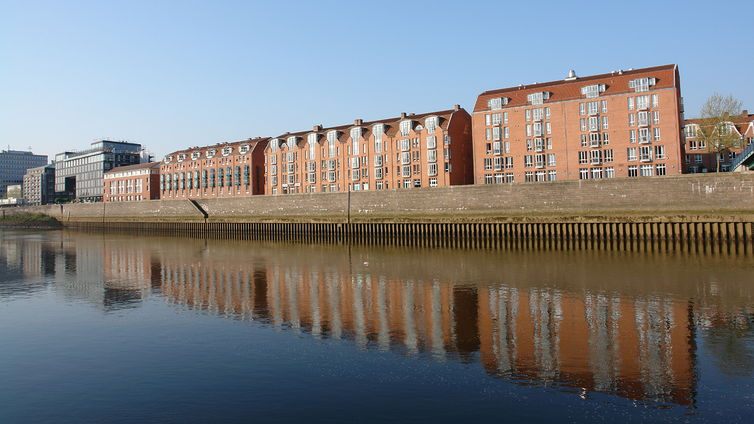
The Teerhof is a peninsula between the River Weser and the Kleine Weser, opposite the city centre of Bremen, Germany. It was first mentioned in 1624 as "Theerhof" when it was the northernmost part of an island. Today it consists mainly of residential buildings and the Weserburg modern art museum. History The name Teerhof means "tarring yard" as it was here ship hulls and ropes were once tarred for the local shipyard. Up to the end of the 19th century, mixed industrial and residential developments led to a widely varying collection of buildings. By the 1930s, the Teerhof was made up of storehouses, small production facilities, a coffee factory and housing. All the buildings were almost completely destroyed during the Second World War. The Weserburg coffee factory which was also seriously damaged was repaired and reopened in 1949. When it closed in 1973, the building was sold to the city and was used for various cultural events including artists' ateliers and art exhibitions, unti ... [...More Info...] [...Related Items...] OR: [Wikipedia] [Google] [Baidu] |
Culture In Bremen (city)
Culture () is an umbrella term which encompasses the social behavior, institutions, and norms found in human societies, as well as the knowledge, beliefs, arts, laws, customs, capabilities, and habits of the individuals in these groups.Tylor, Edward. (1871). Primitive Culture. Vol 1. New York: J.P. Putnam's Son Culture is often originated from or attributed to a specific region or location. Humans acquire culture through the learning processes of enculturation and socialization, which is shown by the diversity of cultures across societies. A cultural norm codifies acceptable conduct in society; it serves as a guideline for behavior, dress, language, and demeanor in a situation, which serves as a template for expectations in a social group. Accepting only a monoculture in a social group can bear risks, just as a single species can wither in the face of environmental change, for lack of functional responses to the change. Thus in military culture, valor is counted a typica ... [...More Info...] [...Related Items...] OR: [Wikipedia] [Google] [Baidu] |
Buildings And Structures In Bremen (city)
A building, or edifice, is an enclosed structure with a roof and walls standing more or less permanently in one place, such as a house or factory (although there's also portable buildings). Buildings come in a variety of sizes, shapes, and functions, and have been adapted throughout history for a wide number of factors, from building materials available, to weather conditions, land prices, ground conditions, specific uses, prestige, and aesthetic reasons. To better understand the term ''building'' compare the list of nonbuilding structures. Buildings serve several societal needs – primarily as shelter from weather, security, living space, privacy, to store belongings, and to comfortably live and work. A building as a shelter represents a physical division of the human habitat (a place of comfort and safety) and the ''outside'' (a place that at times may be harsh and harmful). Ever since the first cave paintings, buildings have also become objects or canvasses of much artistic ... [...More Info...] [...Related Items...] OR: [Wikipedia] [Google] [Baidu] |
Cog (ship)
A cog is a type of ship that first appeared in the 10th century, and was widely used from around the 12th century on. Cogs were clinker-built, generally of oak. These vessels were fitted with a single mast and a square-rigged single sail. They were mostly associated with seagoing trade in north-west medieval Europe, especially the Hanseatic League. Typical seagoing cogs ranged from about 15 to 25 meters (49 to 82 ft) in length, with a beam of 5 to 8 meters (16 to 26 ft) and were 30–200 tons burthen. Cogs were rarely as large as 300 tons although a few were considerably larger, over 1,000 tons. Although the name cog is recorded as early as the 9th century, the seagoing vessel of that name seems to have evolved on the Frisian coast during the 12th century. Cogs progressively replaced Viking-type ships in northern waters during the 13th century. Why this was the case is uncertain, but cogs could carry more cargo than knarr of a similar size. Their flat bottoms allowe ... [...More Info...] [...Related Items...] OR: [Wikipedia] [Google] [Baidu] |
Berth (moorings)
A berth is a designated location in a port or harbour used for mooring vessels when they are not at sea. Berths provide a vertical front which allows safe and secure mooring that can then facilitate the unloading or loading of cargo or people from vessels. Locations in a port Berth is the term used in ports and harbors for a designated location where a vessel may be moored, usually for the purposes of loading and unloading. Berths are designated by the management of a facility (e.g., port authority, harbor master). Vessels are assigned to berths by these authorities. Most berths are alongside a quay or a jetty (large ports) or a floating dock (small harbors and marinas). Berths are either general or specific to the types of vessel that use them. The size of the berths varies from for a small boat in a marina to over for the largest tankers. The rule of thumb is that the length of a berth should be roughly 10% longer than the longest vessel to be moored at the berth. Ber ... [...More Info...] [...Related Items...] OR: [Wikipedia] [Google] [Baidu] |
Pedestrian Zone
Pedestrian zones (also known as auto-free zones and car-free zones, as pedestrian precincts in British English, and as pedestrian malls in the United States and Australia) are areas of a city or town reserved for pedestrian-only use and in which most or all automobile traffic is prohibited. Converting a street or an area to pedestrian-only use is called ''pedestrianisation''. Pedestrianisation usually aims to provide better accessibility and mobility for pedestrians, to enhance the amount of shopping and other business activities in the area or to improve the attractiveness of the local environment in terms of aesthetics, air pollution, noise and crashes involving motor vehicle with pedestrians. However, pedestrianisation can sometimes lead to reductions in business activity, property devaluation, and displacement of economic activity to other areas. In some cases, traffic in surrounding areas may increase, due to displacement, rather than substitution of car traffic. None ... [...More Info...] [...Related Items...] OR: [Wikipedia] [Google] [Baidu] |


.jpg)


.jpg)
