|
Saskatchewan Highway 301
{{Saskatchewan-road-stub ...
Highway 301 is a highway in the Canadian province of Saskatchewan. It runs from the Highway 1- Highway 39 intersection near Pasqua (east of Moose Jaw) to Highway 202 near Buffalo Pound Provincial Park. Highway 301 is about long. Highway 301 also passes through Pleasant Mount. References External linksBuffalo Pound Provincial Park 301 __NOTOC__ Year 301 ( CCCI) was a common year starting on Wednesday (link will display the full calendar) of the Julian calendar. At the time, it was known as the Year of the Consulship of Postumius and Nepotianus (or, less frequently, year 1054 ... [...More Info...] [...Related Items...] OR: [Wikipedia] [Google] [Baidu] |
Moose Jaw
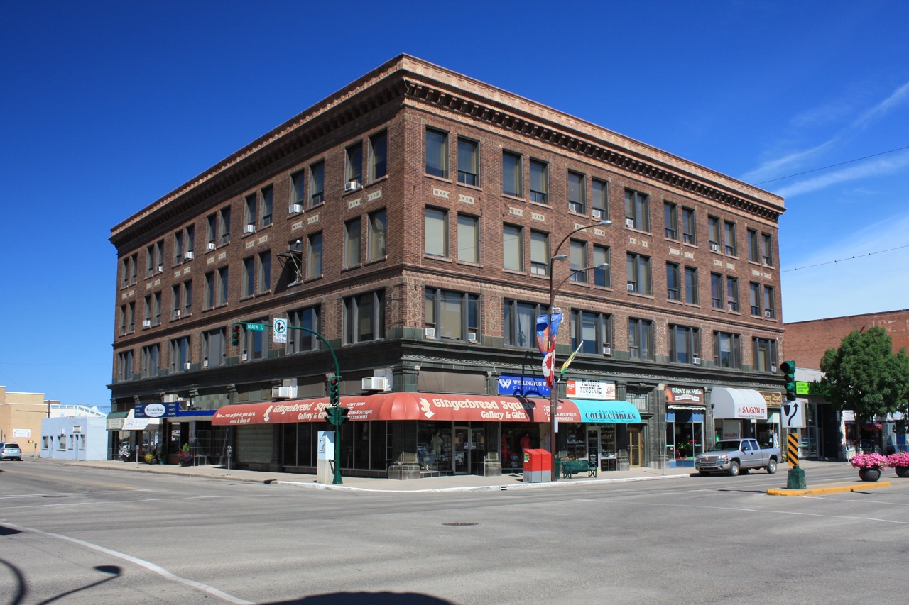
Moose Jaw is the fourth largest city in Saskatchewan, Canada. Lying on the Moose Jaw River in the south-central part of the province, it is situated on the Trans-Canada Highway, west of Regina. Residents of Moose Jaw are known as Moose Javians. The city is surrounded by the Rural Municipality of Moose Jaw No. 161. Moose Jaw is an industrial centre and important railway junction for the area's agricultural produce. CFB Moose Jaw is a NATO flight training school, and is home to the Snowbirds, Canada's military aerobatic air show flight demonstration team. Moose Jaw also has a casino and geothermal spa. History Cree and Assiniboine people used the Moose Jaw area as a winter encampment. The Missouri Coteau sheltered the valley and gave it warm breezes. The narrow river crossing and abundance of water and game made it a good location for settlement. Traditional native fur traders and Métis buffalo hunters created the first permanent settlement at a place called "the turn", at p ... [...More Info...] [...Related Items...] OR: [Wikipedia] [Google] [Baidu] |
Buffalo Pound Provincial Park
Buffalo Pound Provincial Park is a provincial park located in southern Saskatchewan, Canada, about north-east of downtown Moose Jaw and north-west of the city of Regina. The park centres on Buffalo Pound Lake, a prairie lake formed from glaciation about 10,000 years ago. Seasonal recreation activities include swimming (two public beaches and a pool), camping, fishing, mini-golf, biking, hiking, and access to the Trans Canada Trail. The park also features a captive herd of buffalo, along with the Nicolle Flats Marsh where a variety of wildlife can be observed. There is also a trout pond, known as Buffalo Pond, which is stocked with rainbow, brown, and tiger trout. Highways 202 and 301 intersect near the park. Amenities and attractions There are seven different camping areas in the park with a total of about 270 campsites. Many of the individual sites have electric, water, and sewer services. The seven campgrounds are Lake Side, Elm View, Valley, Maple Vale, Shady Lane, Tr ... [...More Info...] [...Related Items...] OR: [Wikipedia] [Google] [Baidu] |
Moose Jaw No
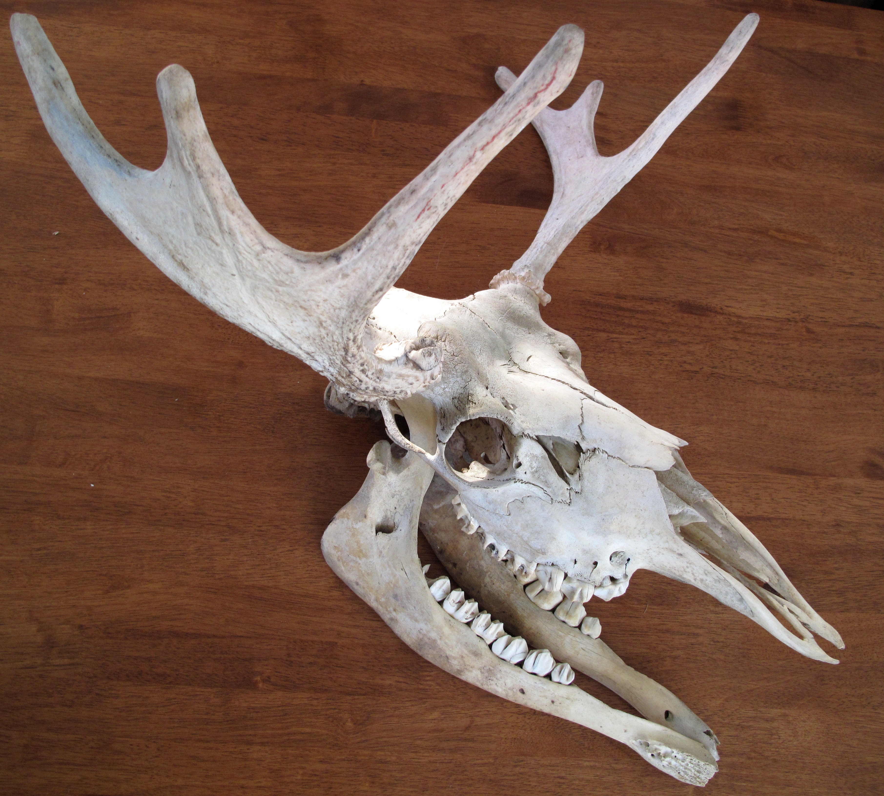
The moose (in North America) or elk (in Eurasia) (''Alces alces'') is a member of the New World deer subfamily and is the only species in the genus ''Alces''. It is the largest and heaviest extant species in the deer family. Most adult male moose have distinctive broad, palmate ("open-hand shaped") antlers; most other members of the deer family have antlers with a dendritic ("twig-like") configuration. Moose typically inhabit boreal forests and temperate broadleaf and mixed forests of the Northern Hemisphere in temperate to subarctic climates. Hunting and other human activities have caused a reduction in the size of the moose's range over time. It has been reintroduced to some of its former habitats. Currently, most moose occur in Canada, Alaska, New England (with Maine having the most of the lower 48 states), New York State, Fennoscandia, the Baltic states, Poland, Kazakhstan, and Russia. Its diet consists of both terrestrial and aquatic vegetation. Predators of moose incl ... [...More Info...] [...Related Items...] OR: [Wikipedia] [Google] [Baidu] |
Marquis No
A marquess (; french: marquis ), es, marqués, pt, marquês. is a nobleman of high hereditary rank in various European peerages and in those of some of their former colonies. The German language equivalent is Markgraf (margrave). A woman with the rank of a marquess or the wife (or widow) of a marquess is a marchioness or marquise. These titles are also used to translate equivalent Asian styles, as in Imperial China and Imperial Japan. Etymology The word ''marquess'' entered the English language from the Old French ("ruler of a border area") in the late 13th or early 14th century. The French word was derived from ("frontier"), itself descended from the Middle Latin ("frontier"), from which the modern English word ''march'' also descends. The distinction between governors of frontier territories and interior territories was made as early as the founding of the Roman Empire when some provinces were set aside for administration by the senate and more unpacified or vulnerab ... [...More Info...] [...Related Items...] OR: [Wikipedia] [Google] [Baidu] |
Highway
A highway is any public or private road or other public way on land. It is used for major roads, but also includes other public roads and public tracks. In some areas of the United States, it is used as an equivalent term to controlled-access highway, or a translation for ''autobahn'', '' autoroute'', etc. According to Merriam Webster, the use of the term predates the 12th century. According to Etymonline, "high" is in the sense of "main". In North American and Australian English, major roads such as controlled-access highways or arterial roads are often state highways (Canada: provincial highways). Other roads may be designated "county highways" in the US and Ontario. These classifications refer to the level of government (state, provincial, county) that maintains the roadway. In British English, "highway" is primarily a legal term. Everyday use normally implies roads, while the legal use covers any route or path with a public right of access, including footpaths etc. Th ... [...More Info...] [...Related Items...] OR: [Wikipedia] [Google] [Baidu] |
Canada
Canada is a country in North America. Its ten provinces and three territories extend from the Atlantic Ocean to the Pacific Ocean and northward into the Arctic Ocean, covering over , making it the world's second-largest country by total area. Its southern and western border with the United States, stretching , is the world's longest binational land border. Canada's capital is Ottawa, and its three largest metropolitan areas are Toronto, Montreal, and Vancouver. Indigenous peoples have continuously inhabited what is now Canada for thousands of years. Beginning in the 16th century, British and French expeditions explored and later settled along the Atlantic coast. As a consequence of various armed conflicts, France ceded nearly all of its colonies in North America in 1763. In 1867, with the union of three British North American colonies through Confederation, Canada was formed as a federal dominion of four provinces. This began an accretion of provinces an ... [...More Info...] [...Related Items...] OR: [Wikipedia] [Google] [Baidu] |
Saskatchewan
Saskatchewan ( ; ) is a Provinces and territories of Canada, province in Western Canada, western Canada, bordered on the west by Alberta, on the north by the Northwest Territories, on the east by Manitoba, to the northeast by Nunavut, and on the south by the United States, U.S. states of Montana and North Dakota. Saskatchewan and Alberta are the only landlocked provinces of Canada. In 2022, Saskatchewan's population was estimated at 1,205,119. Nearly 10% of Saskatchewan’s total area of is fresh water, mostly rivers, reservoirs and List of lakes in Saskatchewan, lakes. Residents primarily live in the southern prairie half of the province, while the northern half is mostly forested and sparsely populated. Roughly half live in the province's largest city Saskatoon or the provincial capital Regina, Saskatchewan, Regina. Other notable cities include Prince Albert, Saskatchewan, Prince Albert, Moose Jaw, Yorkton, Swift Current, North Battleford, Melfort, Saskatchewan, Melfort, and ... [...More Info...] [...Related Items...] OR: [Wikipedia] [Google] [Baidu] |
Saskatchewan Highway 1
Highway 1 is the Saskatchewan section of the Trans-Canada Highway mainland route. The total distance of the Trans-Canada Highway in Saskatchewan is . The highway traverses Saskatchewan from the western border with Alberta, from Highway 1, to the Manitoba border where it continues as PTH 1. The Trans-Canada Highway Act was passed on December 10, 1949. The Saskatchewan segment was completed August 21, 1957, and completely twinned on November 6, 2008. The speed limit along the majority of the route is 110 kilometres per hour (70 mph) with urban area thoroughfares slowing to a speed of 80–100 kilometres per hour (50–62 mph). Portions of the highway—the section through Swift Current, an section east of Moose Jaw, and a section between the West Regina Bypass and Balgonie—are controlled-access. Highway 1 serves as a major east-west transport route for commercial traffic. It is the main link between southern Saskatchewan's largest cit ... [...More Info...] [...Related Items...] OR: [Wikipedia] [Google] [Baidu] |
Saskatchewan Highway 39
Highway 39 is a provincial, paved, undivided highway located in the southern portion of the Canadian province of Saskatchewan connecting North Portal and Moose Jaw in the north. This is a primary Saskatchewan highway maintained by the provincial and national governments and providing a major trucking and tourism route between the United States via Portal, Burke County, North Dakota, and North Portal, Saskatchewan. On July 3, 2000, Highways and Transportation Minister Maynard Sonntag officiated at the ribbon cutting ceremony opening the new duty-free shop and the twinned highway at Saskatchewan's busiest border crossing. Highway 39 is one of Canada's busiest highways, facilitating transport for $6 billion in trade goods via approximately 100,000 trucks over the year. The entire length of highway 39 is paved. The CanAm Highway comprises Saskatchewan Highways Hwy 35, Hwy 39, Hwy 6, Hwy 3, as well as Hwy 2. of Saskatchewan Highway 39 contribute to the CanAm Highway between ... [...More Info...] [...Related Items...] OR: [Wikipedia] [Google] [Baidu] |
Moose Jaw, Saskatchewan
Moose Jaw is the fourth largest city in Saskatchewan, Canada. Lying on the Moose Jaw River in the south-central part of the province, it is situated on the Trans-Canada Highway, west of Regina, Saskatchewan, Regina. Residents of Moose Jaw are known as Moose Javians. The city is surrounded by the Moose Jaw No. 161, Saskatchewan, Rural Municipality of Moose Jaw No. 161. Moose Jaw is an industrial centre and important railway junction for the area's agricultural produce. CFB Moose Jaw is a NATO flight training school, and is home to the Snowbirds, Canada's military aerobatic air show flight demonstration team. Moose Jaw also has a Casino Moose Jaw, casino and Temple Gardens Mineral Hell Resort, geothermal spa. History Cree and Assiniboine people used the Moose Jaw area as a winter encampment. The Missouri Coteau sheltered the valley and gave it warm breezes. The narrow river crossing and abundance of water and game made it a good location for settlement. Traditional native fur tr ... [...More Info...] [...Related Items...] OR: [Wikipedia] [Google] [Baidu] |


.jpg)
.jpg)


.jpg)