|
Suratgarh Tehsil
Suratgarh tehsil (in Hindi and Rajasthani सूरतगढ़ तहसील ) is the largest administrative region (tehsil) in the Ganganagar district. It is bordered on the north by Padampur tehsil, on the west by Vijaynagar tehsil and Raisinghnagar tehsil, on the south by Bikaner district, and on the east by Hanumangarh district. Suratgarh is a Brand . Geography Suratgarh tehsil is located in the Thar desert. The seasonal Ghaggar-Hakra River runs in the northern area of the tehsil and the south region is called Uncha Tibba. The Indira Gandhi Canal crosses the tehsil. Some Remarkable area in Suratgarh are Super Critical Thermal Power Plant, Shree Cement Plant Udaipur Village, All Indio Radio Station Aakashwani, Airforce Station, Military Area. * PIN code of Suratgarh Tehsil's Villages Are -- #335804 (Suratgarh S.O.) - Suratgarh, Ghamandia, Sardarpura Bika, Rampura Neola, Ramsara Jakhran, Nirwana, Manaksar, Bhagwansar, Birdhwal Head, Deidaspura, Rajiasar, Farm Colony, M ... [...More Info...] [...Related Items...] OR: [Wikipedia] [Google] [Baidu] |
Ganganagar District
Sri Ganganagar district is the northernmost district of Rajasthan state in western India. History Named after Maharaja Ganga Singh of Bikaner, Sri Ganganagar district was part of Bikaner state. This was a mostly uninhabited region. The history of this district is testimony to the vision and efforts of Maharaja Ganga Singh, who visualised and built the Ganga Canal after the Indian famine of 1899–1900. The waters of the Sutlej River were brought into the region through the 89-mile long Gang Canal in 1927, turning this region into a "Food Basket" of Rajasthan. Geography Location and area Sri Ganganagar district is located between Latitude 28.4 to 30.6 and Longitude 72.2 to 75.3 The total area of Sri Ganganagar is 11,154.66 km2 or 1,115,466 hectares. It is surrounded on the east by Hanumangarh district, (Hanumangarh district was carved out of it on 12 July 1994) on the south by Bikaner district, and on the west by Bahawalnagar district of Pakistani Punjab and on the n ... [...More Info...] [...Related Items...] OR: [Wikipedia] [Google] [Baidu] |
Raghunathpura
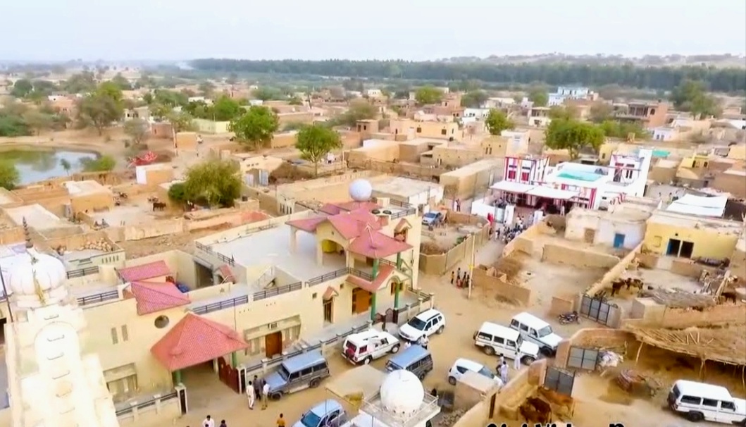
Raghunathpura is a village in Sri Ganganagar district of Rajasthan.It is situated on the right bank of Anupgarh branch that is largest and fastest branch of Indira gandhi Nahar pariyojna (IGNP) This is largest irrigation system of Rajasthan. It is a major village in the district. It is divided into two suburbs, Raghunathpura and Raghunathpura Aabadi. It is an Historical village located some 41 km south- west of Suratgarh and around 103 km off to Sriganganagar. Kalyankot is the nearest railway station of Raghunathpura. It is 28 km off National Highway NH-62 and 399 km from the state capital, Jaipur. Raghunthpura is located on the link road of Sri vijaynagar to Rajiyasar. In Raghunathpura 11 ward zones are situated and ward no. 06 is the oldest area of the village. In Raghunthapura there are so many spiritual places are situated. Old Hanuman ji temple, Thakur ji Maharaj temple, Gusai ji Maharaj temple, Bhabhuta siddh temple, Hariram baba temple and Ram ... [...More Info...] [...Related Items...] OR: [Wikipedia] [Google] [Baidu] |
Dhaban Jhallar(15Lks)
Dhaban is a village in Sangaria Tehsil in Hanumangarh District of Rajasthan State, India. It belongs to Bikaner Division . It is located 39 km towards North from District headquarters Hanumangarh. 12 km from Sangaria. 413 km from State capital Jaipur Jaipur (; Hindi Language, Hindi: ''Jayapura''), formerly Jeypore, is the List of state and union territory capitals in India, capital and largest city of the Indian States and union territories of India, state of Rajasthan. , the city had a pop .... Co-ordinates of village main bus stan29°52'34.8"N 74°30'33.3"E References Villages in Hanumangarh district {{Rajasthan-geo-stub ... [...More Info...] [...Related Items...] OR: [Wikipedia] [Google] [Baidu] |
Punjabi Language
Punjabi (; ; , ), sometimes spelled Panjabi, is an Indo-Aryan language of the Punjab region of Pakistan and India. It has approximately 113 million native speakers. Punjabi is the most widely-spoken first language in Pakistan, with 80.5 million native speakers as per the 2017 census, and the 11th most widely-spoken in India, with 31.1 million native speakers, as per the 2011 census. The language is spoken among a significant overseas diaspora, particularly in Canada, the United States, and the United Kingdom. In Pakistan, Punjabi is written using the Shahmukhi alphabet, based on the Perso-Arabic script; in India, it is written using the Gurmukhi alphabet, based on the Indic scripts. Punjabi is unusual among the Indo-Aryan languages and the broader Indo-European language family in its usage of lexical tone. History Etymology The word ''Punjabi'' (sometimes spelled ''Panjabi'') has been derived from the word ''Panj-āb'', Persian for 'Five Waters', referring to the ... [...More Info...] [...Related Items...] OR: [Wikipedia] [Google] [Baidu] |
Rajasthani Language
Rajasthani (Devanagari: ) refers to a group of Indo-Aryan languages and dialects spoken primarily in the state of Rajasthan and adjacent areas of Haryana, Gujarat, and Madhya Pradesh in India. There are also speakers in the Pakistani provinces of Punjab and Sindh. Rajasthani varieties are closely related to and partially intelligible with their sister languages Gujarati and Sindhi. It is spoken by 65.04% of the population of Rajasthan. The comprehensibility between Rajasthani and Gujarati goes from 60 to 85% depending on the geographical extent of its dialects. The term ''Rajasthani'' is also used to refer to a literary language mostly based on Marwari, which is being promoted as a standard language for the state of Rajasthan. History Rajasthani has a literary tradition going back approximately 1500 years. The Vasantgadh Inscription from modern day Sirohi that has been dated to the 7th century AD uses the term Rajasthaniaditya in reference to the official or maybe for a poe ... [...More Info...] [...Related Items...] OR: [Wikipedia] [Google] [Baidu] |
Bagri Dialect
The Bagri language (باگڑی/बागड़ी) is a language that forms a dialect bridge between Haryanvi, Rajasthani, and Punjabi and takes its name from the Bagar tract region of Northwestern India. The speakers are mostly in India, with pockets in the Bahawalpur and Bahawalnagar districts of Punjab in Pakistan. Bagri is a typical Indo-Aryan language akin to Haryanvi, Punjabi and Rajasthani with SOV word order. The most striking phonological feature of Bagri is the presence of three lexical tones: high, mid, and low, akin to Punjabi. The language has a very high (65%) lexical similarity with Haryanvi. According to the 2011 Census, there are 234,227 speakers of Bagri Rajasthani and 1,656,588 speakers of Punjabi Bagri. Features Phonology Bagri distinguishes 31 consonants including a retroflex series, 10 vowels, 2 diphthongs and 3 tones. Declension *There are two numbers: singular and plural. *Two genders: masculine and feminine. *Three cases: simple, oblique, and vocat ... [...More Info...] [...Related Items...] OR: [Wikipedia] [Google] [Baidu] |
Paddy Fields In The Ghaggar River
*
{{disambiguation ...
Paddy may refer to: People *Paddy (given name), a list of people with the given name or nickname *An ethnic slur for an Irishman Birds *Paddy (pigeon), a Second World War carrier pigeon *Snowy sheathbill or paddy, a bird species *Black-faced sheathbill, also known as the paddy bird Entertainment * ''Paddy'' (film), a 1970 Irish comedy *Paddy Kirk, a fictional character in the British soap opera ''Emmerdale'' Other uses *Paddy field, a type of cultivated land *Paddy (unmilled rice) *Paddy mail, a train for construction workers *Paddy Whiskey, a liquor See also *Patty (other) * Paddi (other) *Padi (other) Padi, PADI or Pa Di may refer to: * Padi, Chennai, India, a locality and neighbourhood in the city of Chennai ** Padi railway station * Padi, Iran, a village * Padi Boyd, American astrophysicist * Padi Richo, Indian politician * Padi (band), a ... [...More Info...] [...Related Items...] OR: [Wikipedia] [Google] [Baidu] |
Rangmahal
Rangmahal is a village in North Guwahati, Kamrup rural district, situated in north bank of river Brahmaputra The Brahmaputra is a trans-boundary river which flows through Tibet, northeast India, and Bangladesh. It is also known as the Yarlung Tsangpo in Tibetan, the Siang/Dihang River in Arunachali, Luit in Assamese, and Jamuna River in Bangla. I .... Transport The village is near National Highway 31, and connected to nearby towns and cities with regular buses and other modes of transportation. See also * Rani * Rampur References {{reflist Villages in Kamrup district ... [...More Info...] [...Related Items...] OR: [Wikipedia] [Google] [Baidu] |
Sri Gurusar Modia
Sri Gurusar Modia is a village in the Indian state of Rajasthan situated near borders of Rajasthan, Haryana and Punjab states and the international border of India and Pakistan. This village is located in the tehsil Suratgarh of district Sriganganagar. Suratgarh, once known as Sodhal was believed to be surrounded by the confluence of Saraswati and Drishyati rivers but now the land is a deserted one lying amidst the expanse of The great Indian Thar desert. Suratgarh is famous for its agriculture, air force and army base stations, largest thermal power plant of Rajasthan and largest radio station of Rajasthan called as "Cotton City Channel". Sri Gurusar Modia came into limelight when a controversial self-proclaimed saint and spiritual leader Gurmeet Ram Rahim Singh (who later on convicted for various crimes) was believed to be incarnated there and crowned to the throne of Dera Sacha Sauda at Sirsa in 1991. With setting up of Shah Satnam Schools for both boys and girls, super special ... [...More Info...] [...Related Items...] OR: [Wikipedia] [Google] [Baidu] |
Gram Panchayats
Gram Panchayat () is a basic village-governing institute in Indian villages. It is a democratic structure at the grass-roots level in India. It is a political institute, acting as cabinet of the village. The Gram Sabha work as the general body of the Gram Panchayat. The members of the Gram Panchayat are elected by the Gram Sabha. There are about 250,000+ Gram Panchayats in India. History Established in various states of India, the Panchayat Raj system has three tiers: Zila Parishad, at the district level; Panchayat Samiti, at the block level; and Gram Panchayat, at the village level. Rajasthan was the first state to establish Gram Panchayat, Bagdari Village (Nagaur District) being the first village where Gram Panchayat was established, on 2 October 1959. The failed attempts to deal with local matters at the national level caused, in 1992, the reintroduction of Panchayats for their previously used purpose as an organisation for local self-governance. Structure Gram P ... [...More Info...] [...Related Items...] OR: [Wikipedia] [Google] [Baidu] |
Dhaban
Dhaban is a village in Sangaria Tehsil in Hanumangarh District of Rajasthan State, India. It belongs to Bikaner Division . It is located 39 km towards North from District headquarters Hanumangarh. 12 km from Sangaria. 413 km from State capital Jaipur Jaipur (; Hindi Language, Hindi: ''Jayapura''), formerly Jeypore, is the List of state and union territory capitals in India, capital and largest city of the Indian States and union territories of India, state of Rajasthan. , the city had a pop .... Co-ordinates of village main bus stan29°52'34.8"N 74°30'33.3"E References Villages in Hanumangarh district {{Rajasthan-geo-stub ... [...More Info...] [...Related Items...] OR: [Wikipedia] [Google] [Baidu] |


