|
Suamargad
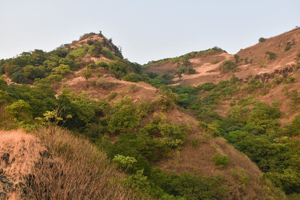
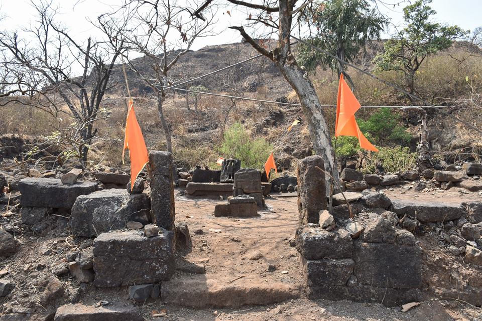
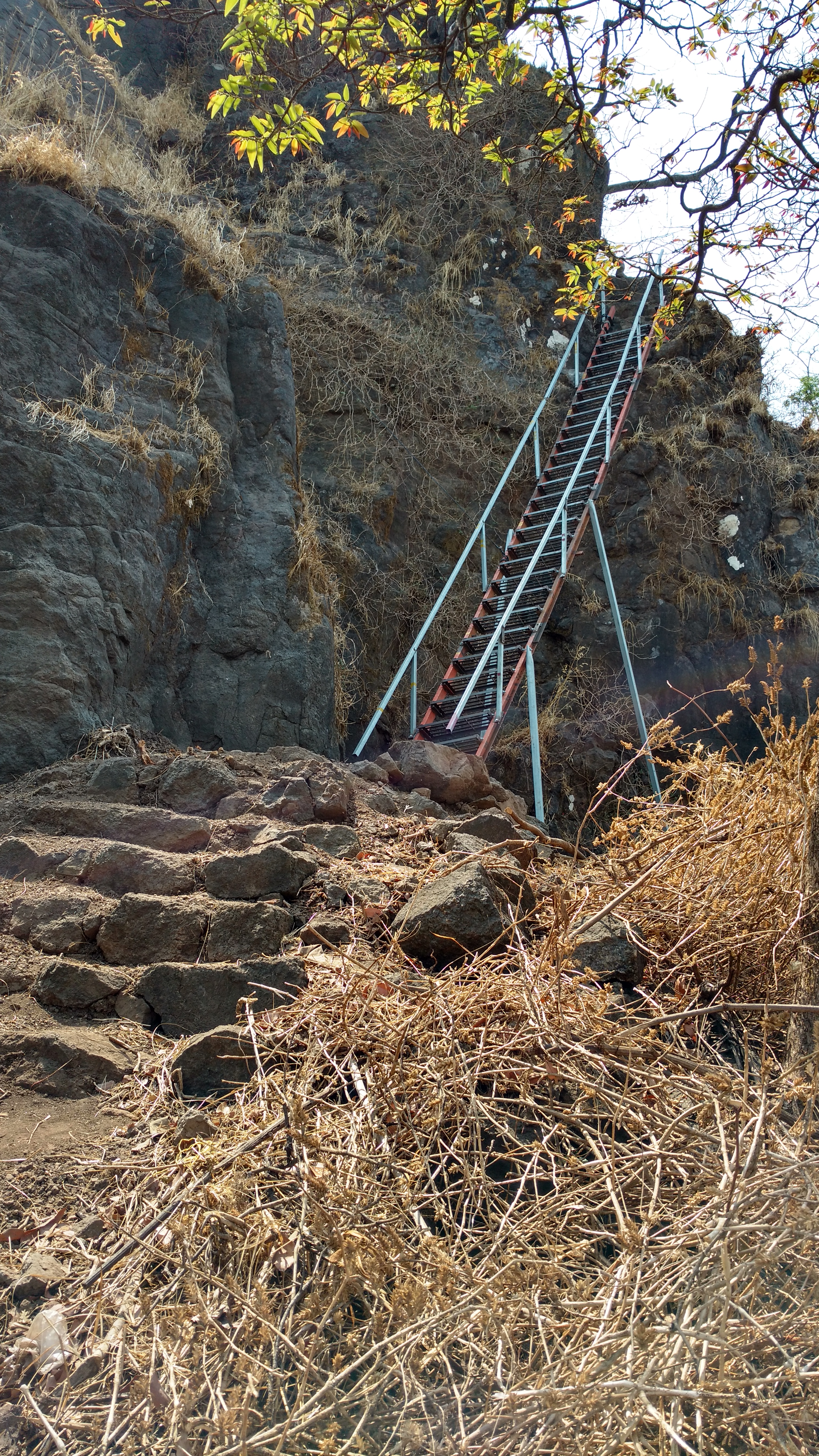
Sumargad is a less visited fort in Ratnagiri district. This fort lies east of the Khed. It is about from Khed City. There are no human settlements around the fort. There are two ways to reach Sumargad one; is from Mahipatgad and the other one from Rasalgad. The trek to this fort is through remote forest area. Very less history is known about this fort. The fort has steep cliffs on all the sides. It is a very small fort, with fortification over an area of 1–2 acres. There are many rock cut water cisterns on the fort. Only two cisterns have clear potable water. There is a cave on the fort with Shivalinga. From the top of fort Mahipatgad, Rasalgad Rasalgad is a fort in the Maharashtra state of India. It lies 15 km east of Khed City. The fort has been developed as tourist attraction. Its fortification in good condition. The fort lied on a south end of a narrow spur which joins with Su ..., Chakdev and Parvatgad are seen. References {{Reflist Forts in Maharashtra ... [...More Info...] [...Related Items...] OR: [Wikipedia] [Google] [Baidu] |
Rasalgad
Rasalgad is a fort in the Maharashtra state of India. It lies 15 km east of Khed City. The fort has been developed as tourist attraction. Its fortification in good condition. The fort lied on a south end of a narrow spur which joins with Suamargad and Mahipatgad in the north direction. In 2003 the fort was declared a protected monument by the Archaeological Survey of India. History Very little history is known about this fort. This fort was in the captivity of Morè (clan) of Javli from whom Shivaji Maharaj captured this fort. In 1818 British forces captured it from the Peshwas Places to see The fort has a rush of visitors on weekends. It is on a small triangular plateau of five acres, fortified on all the sides. The two entrance gates are in good condition. There is a Veer Maruti idol near the first gate. There is a Zolayidevi temple on the fort with a stone Deepmala and Tulsi Vrindavan in the front.url=http://trekshitiz.com/trekshitiz/marathi/Rasalgad-Trek-R-Alpha.html ... [...More Info...] [...Related Items...] OR: [Wikipedia] [Google] [Baidu] |
Mahipatgad
Mahipatgad is a hill fort situated on the east of the Khed. It is one of the largest forts in Maharashtra, with an area of 120 acres. This fort is located 19 km from the Khed City. The Mahipatgad. Suamargad and Rasalgad are situated on a same spur 8 km long, which runs parallel to the western ghats. The Mahipatgad is on the northernmost end of the spur. The altitude of Mahipatgad is 3090 feet. History This fort was built by Adilshah of Bijapur in the 15th century. This fort was captured by King Shivaji in 1661. Later it passed to the Peshwas and finally to the British in 1818. There are 10 houses in the Beldarvadi village, which is at the foot hill of the fort. The villagers are said to have been brought by Shivaji as bricklayers for construction of the fort. Places to see The Mahipatgad looks like a hill-top covered with dense forest of Jamun, Pisa and similar trees found at higher altitude similar to that of Mahabaleshwar. There are leopards, wild pigs and barki ... [...More Info...] [...Related Items...] OR: [Wikipedia] [Google] [Baidu] |
Ratnagiri District
Ratnagiri District (Marathi pronunciation: �ət̪n̪aːɡiɾiː is a district in the state of Maharashtra, India. The administrative headquarter of the district is located in the town of Ratnagiri. The district is 11.33% urban. The district is bounded by the Arabian Sea to the west, Sindhudurg district to the south, Raigad district to the north and Satara, Sangli and Kolhapur districts to the east. This district is part of Konkan division. Officer Members of Parliament *Sunil Tatkare (NCP) - Raigad Vinayak Raut ( SHS (UBT)) Guardian Minister list of Guardian Minister District Magistrate/Collector list of District Magistrate / Collector History From pre-Christian times until 1312, the area - like the entire region - was ruled by various Buddhist and Hindu rulers. The first state known by name was the Maurya Empire, the last non-Muslim dynasty were the Yadavas of Devagiri. After decades of military clashes with Muslim rulers in northern India, it was occupied ... [...More Info...] [...Related Items...] OR: [Wikipedia] [Google] [Baidu] |
Maharashtra
Maharashtra (; , abbr. MH or Maha) is a states and union territories of India, state in the western India, western peninsular region of India occupying a substantial portion of the Deccan Plateau. Maharashtra is the List of states and union territories of India by population, second-most populous state in India and the second-most populous country subdivision globally. It was formed on 1 May 1960 by splitting the bilingual Bombay State, which had existed since 1956, into majority Marathi language, Marathi-speaking Maharashtra and Gujarati language, Gujarati-speaking Gujarat. Maharashtra is home to the Marathi people, the predominant ethno-linguistic group, who speak the Marathi language, Marathi language, the official language of the state. The state is divided into 6 Divisions of Maharashtra, divisions and 36 List of districts of Maharashtra, districts, with the state capital being Mumbai, the List of million-plus urban agglomerations in India, most populous urban area in India ... [...More Info...] [...Related Items...] OR: [Wikipedia] [Google] [Baidu] |
India
India, officially the Republic of India (Hindi: ), is a country in South Asia. It is the seventh-largest country by area, the second-most populous country, and the most populous democracy in the world. Bounded by the Indian Ocean on the south, the Arabian Sea on the southwest, and the Bay of Bengal on the southeast, it shares land borders with Pakistan to the west; China, Nepal, and Bhutan to the north; and Bangladesh and Myanmar to the east. In the Indian Ocean, India is in the vicinity of Sri Lanka and the Maldives; its Andaman and Nicobar Islands share a maritime border with Thailand, Myanmar, and Indonesia. Modern humans arrived on the Indian subcontinent from Africa no later than 55,000 years ago., "Y-Chromosome and Mt-DNA data support the colonization of South Asia by modern humans originating in Africa. ... Coalescence dates for most non-European populations average to between 73–55 ka.", "Modern human beings—''Homo sapiens''—originated in Africa. Then, int ... [...More Info...] [...Related Items...] OR: [Wikipedia] [Google] [Baidu] |
Sumargad Fort
Sumargad is a less visited fort in Ratnagiri district. This fort lies east of the Khed. It is about from Khed City. There are no human settlements around the fort. There are two ways to reach Sumargad one; is from Mahipatgad and the other one from Rasalgad. The trek to this fort is through remote forest area. Very less history is known about this fort. The fort has steep cliffs on all the sides. It is a very small fort, with fortification over an area of 1–2 acres. There are many rock cut water cisterns on the fort. Only two cisterns have clear potable water. There is a cave on the fort with Shivalinga. From the top of fort Mahipatgad, Rasalgad Rasalgad is a fort in the Maharashtra state of India. It lies 15 km east of Khed City. The fort has been developed as tourist attraction. Its fortification in good condition. The fort lied on a south end of a narrow spur which joins with Su ..., Chakdev and Parvatgad are seen. References {{Reflist Forts in Maharashtra ... [...More Info...] [...Related Items...] OR: [Wikipedia] [Google] [Baidu] |
Sumargad Fort1
Sumargad is a less visited fort in Ratnagiri district. This fort lies east of the Khed. It is about from Khed City. There are no human settlements around the fort. There are two ways to reach Sumargad one; is from Mahipatgad and the other one from Rasalgad. The trek to this fort is through remote forest area. Very less history is known about this fort. The fort has steep cliffs on all the sides. It is a very small fort, with fortification over an area of 1–2 acres. There are many rock cut water cisterns on the fort. Only two cisterns have clear potable water. There is a cave on the fort with Shivalinga. From the top of fort Mahipatgad, Rasalgad Rasalgad is a fort in the Maharashtra state of India. It lies 15 km east of Khed City. The fort has been developed as tourist attraction. Its fortification in good condition. The fort lied on a south end of a narrow spur which joins with Su ..., Chakdev and Parvatgad are seen. References {{Reflist Forts in Maharashtra ... [...More Info...] [...Related Items...] OR: [Wikipedia] [Google] [Baidu] |
Sumargad Fort2
Sumargad is a less visited fort in Ratnagiri district. This fort lies east of the Khed. It is about from Khed City. There are no human settlements around the fort. There are two ways to reach Sumargad one; is from Mahipatgad and the other one from Rasalgad. The trek to this fort is through remote forest area. Very less history is known about this fort. The fort has steep cliffs on all the sides. It is a very small fort, with fortification over an area of 1–2 acres. There are many rock cut water cisterns on the fort. Only two cisterns have clear potable water. There is a cave on the fort with Shivalinga. From the top of fort Mahipatgad, Rasalgad Rasalgad is a fort in the Maharashtra state of India. It lies 15 km east of Khed City. The fort has been developed as tourist attraction. Its fortification in good condition. The fort lied on a south end of a narrow spur which joins with Su ..., Chakdev and Parvatgad are seen. References {{Reflist Forts in Maharashtra ... [...More Info...] [...Related Items...] OR: [Wikipedia] [Google] [Baidu] |
Khed City
Khed City is an Industrial park near Pune, India. With an area of over 4200 acres, Khed city is a joint venture between Kalyani Group, Kalyani group and MIDC (Maharashtra Industrial Development Corporation, Maharashtra Industrial Development Corporation). History Khed City came into existence in the year 2010. Khed City, was formed under Khed Economic Infrastructure Ltd (KEIPL), which is a joint venture between Maharashtra Industrial Development Corporation (MIDC) and Kalyani Group. Civic Administration The 4200 acres of land is divided into Domestic tariff area, Domestic Tariff Area, a sector specific Special economic zone, SEZ (Engineering and Electronic sector), and social infrastructure along with a rehabilitation and resettlement area for the displaced locals. It falls under the ‘C’ zone as per the Maharashtra Industrial policy 2013. The Non-industrial area has a provision of support services including academic, social, entertainment, healthcare, and other facilities ... [...More Info...] [...Related Items...] OR: [Wikipedia] [Google] [Baidu] |
Shivalinga
A lingam ( sa, लिङ्ग , lit. "sign, symbol or mark"), sometimes referred to as linga or Shiva linga, is an abstract or aniconic representation of the Hindu god Shiva in Shaivism. It is typically the primary ''murti'' or devotional image in Hindu temples dedicated to Shiva, also found in smaller shrines, or as self-manifested natural objects. It is often represented within a disc-shaped platform, the ''yoni'' – its feminine counterpart, consisting of a flat element, horizontal compared to the vertical lingam, and designed to allow liquid offerings to drain away for collection. Together, they symbolize the merging of microcosmos and macrocosmos, the divine eternal process of creation and regeneration, and the union of the feminine and the masculine that recreates all of existence. The original meaning of ''lingam'' as "sign" is used in Shvetashvatara Upanishad, which says "Shiva, the Supreme Lord, has no liūga", liuga ( sa, लिऊग ) meaning he is trans ... [...More Info...] [...Related Items...] OR: [Wikipedia] [Google] [Baidu] |
Forts In Maharashtra
A fortification is a military construction or building designed for the defense of territories in warfare, and is also used to establish rule in a region during peacetime. The term is derived from Latin ''fortis'' ("strong") and ''facere'' ("to make"). From very early history to modern times, defensive walls have often been necessary for cities to survive in an ever-changing world of invasion and conquest. Some settlements in the Indus Valley civilization were the first small cities to be fortified. In ancient Greece, large stone walls had been built in Mycenaean Greece, such as the ancient site of Mycenae (famous for the huge stone blocks of its 'cyclopean' walls). A Greek '' phrourion'' was a fortified collection of buildings used as a military garrison, and is the equivalent of the Roman castellum or English fortress. These constructions mainly served the purpose of a watch tower, to guard certain roads, passes, and borders. Though smaller than a real fortress, they acted ... [...More Info...] [...Related Items...] OR: [Wikipedia] [Google] [Baidu] |


