|
Strathblane
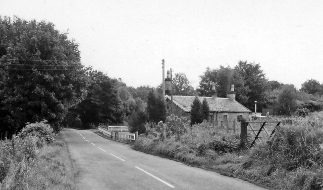
Strathblane ( gd, Strath Bhlàthain, ) is a village and parish in the registration county of Stirlingshire, situated in the southwestern part of the Stirling council area, in central Scotland. It lies at the foothills of the Campsie Fells and the Kilpatrick Hills on the Blane Water, north of Glasgow, east-southeast of Dumbarton, and southwest of Stirling. Strathblane is a dormitory village for Greater Glasgow, and has a total resident population of 1,811. Historically, Strathblane was the name of a parish in Stirlingshire which comprised three villages: Edenkill, Netherton and Mugdock. Mugdock was the ancient seat of the Earls of Lennox, and to the east of Strathblane lies the town of Lennoxtown. Blanefield is a settlement contiguous with Strathblane's northwestern fringe. To the west is the volcanic plug Dumgoyne, Glengoyne Distillery and the Trossachs National Park. The West Highland Way—a long-distance trail—passes close to the village. The Gaelic name ''Srath Bhl� ... [...More Info...] [...Related Items...] OR: [Wikipedia] [Google] [Baidu] |
Stirlingshire
Stirlingshire or the County of Stirling, gd, Siorrachd Sruighlea) is a historic county and registration countyRegisters of Scotland. Publications, leaflets, Land Register Counties. of Scotland. Its county town is Stirling. It borders Perthshire to the north, Clackmannanshire and West Lothian to the east, Lanarkshire to the south, and Dunbartonshire to the south-east and south-west (this latter boundary is split in two owing to Dunbartonshire's Cumbernauld exclave). Coat of arms The County Council of Stirling was granted a coat of arms by Lord Lyon King of Arms on 29 September 1890. The design of the arms commemorated the Scottish victory at the Battle of Bannockburn in the county. On the silver saltire on blue of St Andrew was placed the rampant red lion from the royal arms of Scotland. Around this were placed two caltraps and two spur-rowels recalling the use of the weapons against the English cavalry. On the abolition of the Local Government council in 1975, the arms ... [...More Info...] [...Related Items...] OR: [Wikipedia] [Google] [Baidu] |
Dumgoyne
Dumgoyne is a hill prominent on the edge of the Campsie Fells and is a well-known landmark visible from Glasgow. It is a volcanic plug and is high. The plug is readily reached from a path beside Glengoyne Distillery or via a water-board track from the contiguous villages of Strathblane and Blanefield to the east or Killearn to the west. From Strathblane-Blanefield, the path begins as Campsie Dene Road, which almost immediately becomes a private road after passing between the village's war memorial and the grounds of St. Kessog's Catholic Church. Public parking is not permitted on the private road, but several cars can be parallel parked on the church-side of the road between the main road and the driveway to the church (the Number 10 bus from Glasgow also stops close by), and the walk begins by following this private road for approximately . After passing several gates on the way, turn to the right where there is another gate. Follow this path up and around the side Dumfoyn ... [...More Info...] [...Related Items...] OR: [Wikipedia] [Google] [Baidu] |
Kilpatrick Hills
The Kilpatrick Hills are a range of hills in central Scotland, stretching from Dumbarton in the west to Strathblane in the east. Strathblane divides the Kilpatricks from the Campsie Fells to the east, while to the north is part of the Loch Lomond and the Trossachs National Park. To west and south the hills are fringed by the settlements of Balloch, Dumbarton, Milton, Bowling, Old Kilpatrick, Clydebank, Bearsden and Milngavie. The majority of the range is within West Dunbartonshire, although it extends into the East Dunbartonshire and Stirling areas. The highest points in the range are Duncolm () and Fynloch (). The Kilpatricks offer a number of viewpoints and places of interest: among the best known are Doughnot Hill and The Whangie. The area features several reservoirs. The hills are of volcanic origin, modified by subsequent glaciation. Geology The Kilpatrick Hills are a part of the Clyde Plateau Lavas. These are about 340 million years old. Basaltic types of rock ... [...More Info...] [...Related Items...] OR: [Wikipedia] [Google] [Baidu] |
Campsie Fells
The Campsie Fells (also known as the Campsies; Scottish Gaelic: ''Monadh Chamaisidh'') are a range of hills in central Scotland, stretching east to west from Denny Muir to Dumgoyne in Stirlingshire and overlooking Strathkelvin to the south. The southern extent of the range falls within East Dunbartonshire. The range overlooks the villages of Strathblane, Blanefield, Milton Of Campsie, Lennoxtown and Torrance to the south; Killearn to the west, and Fintry and Strathendrick to the north. The Fintry Hills lie further to the north; Kilpatrick Hills lie to the west and the Kilsyth Hills to the east. Walking Earl's Seat is the highest point of the Campsie Fells, measuring 578 m (1,896 ft). On the top of Earl's Seat is a trig point. Two main ways of climbing Earl's Seat are by going past Dumgoyne from the Glengoyne Distillery or going up the Fin Glen from Clachan of Campsie. Etymology The name is taken from one of the individual hills in the range, called Campsie; m ... [...More Info...] [...Related Items...] OR: [Wikipedia] [Google] [Baidu] |
Stirling (council Area)
The Stirling council area ( sco, Stirlin; gd, Sruighlea) is one of the 32 council areas of Scotland, and has a population of about ( estimate). It was created under the Local Government etc (Scotland) Act 1994 with the boundaries of the Stirling district of the former Central local government region, and it covers most of Stirlingshire (except Falkirk) and the south-western portion of Perthshire. Both counties were abolished for local government purposes under the Local Government (Scotland) Act 1973. The administrative centre of the area is the city of Stirling, with the headquarters at Old Viewforth. The area borders the council areas of Clackmannanshire (to the east), North Lanarkshire (to the south), Falkirk (to the south east), Perth and Kinross (to the north and north east), Argyll and Bute (to the north and north west), and both East and West Dunbartonshire to Stirling's southwest. The majority of the population of the area is located in its southeast corne ... [...More Info...] [...Related Items...] OR: [Wikipedia] [Google] [Baidu] |
List Of Civil Parishes In Scotland
This is a list of the 871 civil parishes in Scotland. *The 871 parishes are listed here Context From 1845 to 1930, parishes formed part of the local government system of Scotland: having parochial boards from 1845 to 1894, and parish councils from 1894 until 1930. The parishes, which had their origins in the ecclesiastical parishes of the Church of Scotland, often overlapped county boundaries, largely because they reflected earlier territorial divisions. In the early 1860s, many parishes which were physically detached from their county were re-allocated to the county by which they were surrounded; some border parishes were transferred to neighbouring counties. This affects the indexing of such things as birth, marriage, and death registrations and other records indexed by county. In 1891, there were further substantial changes to the areas of many parishes, as the boundary commission appointed under the Local Government (Scotland) Act 1889 eliminated many anomalies, and ... [...More Info...] [...Related Items...] OR: [Wikipedia] [Google] [Baidu] |
Loch Lomond
Loch Lomond (; gd, Loch Laomainn - 'Lake of the Elms'Richens, R. J. (1984) ''Elm'', Cambridge University Press.) is a freshwater Scottish loch which crosses the Highland Boundary Fault, often considered the boundary between the lowlands of Central Scotland and the Highlands. Tom Weir. ''The Scottish Lochs''. pp. 33-43. Published by Constable and Company, 1980. Traditionally forming part of the boundary between the counties of Stirlingshire and Dunbartonshire, Loch Lomond is split between the council areas of Stirling, Argyll and Bute and West Dunbartonshire. Its southern shores are about northwest of the centre of Glasgow, Scotland's largest city. The Loch forms part of the Loch Lomond and The Trossachs National Park which was established in 2002. Loch Lomond is long and between wide, with a surface area of . It is the largest lake in Great Britain by surface area; in the United Kingdom, it is surpassed only by Lough Neagh and Lough Erne in Northern Ireland. In the ... [...More Info...] [...Related Items...] OR: [Wikipedia] [Google] [Baidu] |
Endrick Water
The Endrick Water or River Endrick ( gd, Eunarag) is a river which flows into the eastern end of Loch Lomond, Scotland. Its drainage basin covers a large part of the west of Stirling District. The Burnfoot Burn rising on the southern slopes of the Gargunnock Hills and the Backside Burn rising on the eastern slopes of the Fintry Hills combine to form the Endrick Water which flows south before turning sharply westwards at the foot of the western dam of Carron Valley Reservoir. The river flows through Strathendrick, the village of Fintry and past Balfron and Drymen Drymen (; from gd, Druiminn ) is a village in the Stirling district of central Scotland. Once a popular stopping place for cattle drovers, it is now popular with visiting tourists given its location near Loch Lomond. The village is centred aroun ... before entering Loch Lomond. External links Sites of Special Scientific Interest in Scotland Rivers of Stirling (council area) Rivers of West Dunbartonshire ... [...More Info...] [...Related Items...] OR: [Wikipedia] [Google] [Baidu] |
William Forbes Skene
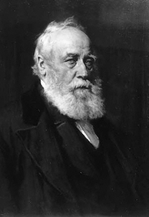
William Forbes Skene WS FRSE FSA(Scot) DCL LLD (7 June 1809 – 29 August 1892), was a Scottish lawyer, historian and antiquary. He co-founded the Scottish legal firm Skene Edwards which was prominent throughout the 20th century but disappeared in 2008 when it merged with Morton Fraser. Life He was born in Inverey, the second son of Sir Walter Scott's friend, James Skene (1775–1864), of Rubislaw, near Aberdeen, and his wife, Jane Forbes, daughter of Sir William Forbes, 6th Baronet of Pitsligo. The family moved to Edinburgh in 1817, originally living with his uncle, Andrew Skene then from 1820 living at 126 Princes Street facing Edinburgh Castle.Edinburgh Post Office Directory 1820 He was educated at the High School in Edinburgh. He was then apprenticed as a lawyer first to Francis Wilson WS at Parliament Square then to Henry Jardine WS also at Parliament Square. He then studied law at the University of St Andrews and Edinburgh University, also taking a special inte ... [...More Info...] [...Related Items...] OR: [Wikipedia] [Google] [Baidu] |
Britons (historic)
The Britons ( *''Pritanī'', la, Britanni), also known as Celtic Britons or Ancient Britons, were people of Celtic language and culture who inhabited Great Britain from at least the British Iron Age and into the Middle Ages, at which point they diverged into the Welsh, Cornish and Bretons (among others). They spoke the Common Brittonic language, the ancestor of the modern Brittonic languages. The earliest written evidence for the Britons is from Greco-Roman writers and dates to the Iron Age.Koch, pp. 291–292. Celtic Britain was made up of many tribes and kingdoms, associated with various hillforts. The Britons followed an Ancient Celtic religion overseen by druids. Some of the southern tribes had strong links with mainland Europe, especially Gaul and Belgica, and minted their own coins. The Roman Empire conquered most of Britain in the 1st century, creating the province of Britannia. The Romans invaded northern Britain, but the Britons and Caledonians in the nort ... [...More Info...] [...Related Items...] OR: [Wikipedia] [Google] [Baidu] |
Alabaster
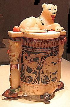
Alabaster is a mineral or rock that is soft, often used for carving, and is processed for plaster powder. Archaeologists and the stone processing industry use the word differently from geologists. The former use it in a wider sense that includes varieties of two different minerals: the fine-grained massive type of gypsum and the fine-grained banded type of calcite.''More about alabaster and travertine'', brief guide explaining the different use of these words by geologists, archaeologists, and those in the stone trade. Oxford University Museum of Natural History, 2012/ref> Geologists define alabaster only as the gypsum type. Chemically, gypsum is a hydrous sulfate of calcium, while calcite is a carbonate of calcium. The two types of alabaster have similar properties. They are usually lightly colored, translucent, and soft stones. They have been used throughout history primarily for carving decorative artifacts."Grove": R. W. Sanderson and Francis Cheetham. "Alabaster", Grove ... [...More Info...] [...Related Items...] OR: [Wikipedia] [Google] [Baidu] |
Limestone
Limestone ( calcium carbonate ) is a type of carbonate sedimentary rock which is the main source of the material lime. It is composed mostly of the minerals calcite and aragonite, which are different crystal forms of . Limestone forms when these minerals precipitate out of water containing dissolved calcium. This can take place through both biological and nonbiological processes, though biological processes, such as the accumulation of corals and shells in the sea, have likely been more important for the last 540 million years. Limestone often contains fossils which provide scientists with information on ancient environments and on the evolution of life. About 20% to 25% of sedimentary rock is carbonate rock, and most of this is limestone. The remaining carbonate rock is mostly dolomite, a closely related rock, which contains a high percentage of the mineral dolomite, . ''Magnesian limestone'' is an obsolete and poorly-defined term used variously for dolomite, for lime ... [...More Info...] [...Related Items...] OR: [Wikipedia] [Google] [Baidu] |


