|
Stranadarragh
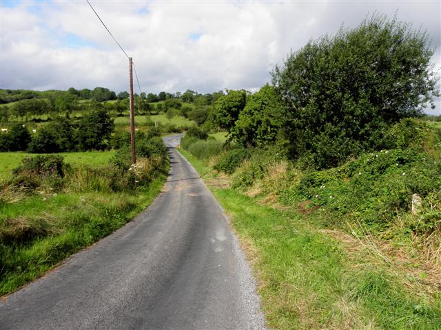
Stranadarragh () is a townland in the civil parishes in Ireland, civil parish of Templeport, County Cavan, Republic of Ireland, Ireland. It lies in the Roman Catholic parish of Templeport and barony of Tullyhaw. Geography Stranadarragh is bounded on the north by Drumlougher townland, on the west by Bellaleenan and Ballymagirril townlands, on the south by Cornagunleog and Boley, Templeport, Boley townlands and on the east by Owengallees townland. Its chief geographical features are the River Blackwater, County Cavan, marshes and dug wells. Stranadarragh is traversed by minor roads and rural lanes. The townland covers 155 statute acres. History In medieval times the McGovern barony of Tullyhaw was divided into economic taxation areas called ballibetoes, from the Irish ''Baile Biataigh'' (Anglicized as 'Ballybetagh'), meaning 'A Provisioner's Town or Settlement'. The original purpose was to enable the farmer, who controlled the baile, to provide hospitality for those who needed ... [...More Info...] [...Related Items...] OR: [Wikipedia] [Google] [Baidu] |
Cornagunleog
Cornagunleog () is a townland in the civil parish of Templeport, County Cavan, Ireland. It lies in the Roman Catholic parish of Templeport and barony of Tullyhaw. Geography Cornagunleog is bounded on the north by Stranadarragh townland, on the west by Ballymagirril and Greagh townlands, on the south by Knocks and Glebe townlands in County Leitrim and on the east by Boley townland. Its chief geographical features are a stream, a wood and dug wells. Cornagunleog is traversed by the L1037 road, minor roads and rural lanes. The townland covers 183 statute acres. History In medieval times the McGovern barony of Tullyhaw was divided into economic taxation areas called ballibetoes, from the Irish ''Baile Biataigh'' (Anglicized as 'Ballybetagh'), meaning 'A Provisioner's Town or Settlement'. The original purpose was to enable the farmer, who controlled the baile, to provide hospitality for those who needed it, such as poor people and travellers. The ballybetagh was further divided in ... [...More Info...] [...Related Items...] OR: [Wikipedia] [Google] [Baidu] |
Ballymagirril
Ballymagirril () is a townland in the civil parishes in Ireland, civil parish of Templeport, County Cavan, Republic of Ireland, Ireland. It lies in the Roman Catholic parish of Templeport and barony of Tullyhaw. Geography Ballymagirril is bounded on the north by Bellaleenan townland, on the west by Sraloaghan townland in County Leitrim, on the south by Greagh townland and on the east by Stranadarragh and Cornagunleog townlands. Its chief geographical features are the River Blackwater, County Cavan, spring wells and dug wells. Ballymagirril is traversed by minor roads and rural lanes. The townland covers 157 statute acres. Etymology The McGirl family probably owned the townland. The name is still common in the area, e.g. John Joe McGirl. History In medieval times the McGovern barony of Tullyhaw was divided into economic taxation areas called ballibetoes, from the Irish ''Baile Biataigh'' (Anglicized as 'Ballybetagh'), meaning 'A Provisioner's Town or Settlement'. The original ... [...More Info...] [...Related Items...] OR: [Wikipedia] [Google] [Baidu] |
Drumlougher
Drumlougher () is a townland in the civil parish of Templeport, County Cavan, Ireland. It lies in the Roman Catholic parish of Templeport and barony of Tullyhaw. Geography Drumlougher is bounded on the north by Gortnacargy and Teeboy townlands in Corlough parish, on the west by Culliagh townland in Corlough parish and Bellaleenan townland, on the south by Stranadarragh townland and on the east by Owengallees townland. Its chief geographical features are Bunerky Lough (Irish = Loch Bun Adhairc = The Lake of the Butt of the Horn), the River Blackwater, County Cavan and a forestry plantation. Drumlougher is traversed by minor roads and rural lanes. The townland covers 339 statute acres. History Up until the Cromwellian Act for the Settlement of Ireland 1652 Drumlougher formed part of Owengallees townland and its history until then is the same. A grant dated 3 November 1666 from King Charles II of England to Sir Tristram Beresford, 1st Baronet included, inter alia, lands of '' ... [...More Info...] [...Related Items...] OR: [Wikipedia] [Google] [Baidu] |
Owengallees
Owengallees () is a townland in the civil parish of Templeport, County Cavan, Ireland. It lies in the Roman Catholic parish of Templeport and barony of Tullyhaw. Geography Owengallees is bounded on the north by Gortnacargy in Corlough parish and Newtown, Templeport townlands, on the west by Drumlougher and Stranadarragh townlands, on the south by Boley townland and on the east by Gowlagh South, Mullaghmore, Templeport and Lakefield townlands. Its chief geographical features are Bunerky Lough (Irish = Loch Bun Adhairc = The Lake of the Butt of the Horn), Lakefield Lough, the River Blackwater, County Cavan, a forestry plantation, a spring well, some dug wells and some stone quarries. Owengallees is traversed by the L1037 road, minor roads and rural lanes. The townland covers 470 statute acres. A sub-division of the townland is called Owendoon (Abhain a Dúin = The Rivers of the Fort). History In medieval times the McGovern barony of Tullyhaw was divided into economic taxation ... [...More Info...] [...Related Items...] OR: [Wikipedia] [Google] [Baidu] |
Bellaleenan
Bellaleenan () is a townland in the civil parish of Templeport, County Cavan, Ireland. It lies in the Roman Catholic parish of Templeport and barony of Tullyhaw. Geography Bellaleenan is bounded on the north by Culliagh and Torrewa townlands in Corlough parish, on the west by Drumlaydan townland in Corlough parish, on the south by Sraloaghan, County Leitrim and Ballymagirril townlands and on the east by Stranadarragh and Drumlougher townlands. Its chief geographical features are the River Blackwater, County Cavan, forestry plantations and dug wells. Bellaleenan is traversed by minor roads and rural lanes. The townland covers 222 statute acres. History In medieval times the McGovern barony of Tullyhaw was divided into economic taxation areas called ballibetoes, from the Irish ''Baile Biataigh'' (Anglicized as 'Ballybetagh'), meaning 'A Provisioner's Town or Settlement'. The original purpose was to enable the farmer, who controlled the baile, to provide hospitality for those w ... [...More Info...] [...Related Items...] OR: [Wikipedia] [Google] [Baidu] |
Templeport
Templeport () is a civil parish in the barony of Tullyhaw, County Cavan, Ireland. The chief towns in the parish are Bawnboy and Ballymagauran. The large Roman Catholic parish of Templeport containing 42,172 statute acres was split up in the 18th & 19th centuries into three new parishes, Templeport, Corlough and Glangevlin. Etymology The name of Templeport parish derives from the old townland of Templeport (which is now shortened to Port) which is the anglicisation of the Gaelic 'Teampall An Phoirt' ("The Church of the Port or Bank or Landing-Place"). The church referred to is the old church on St. Mogue's Island in the middle of Port Lake. This church fell into disuse in medieval times and a new church was built on the opposite shore of the lake. It was forfeited to Queen Elizabeth in 1590 and started use as a Protestant church in about 1610. It is very unlikely that the island church ever served as the parish church because there was only one boat available and it would have ... [...More Info...] [...Related Items...] OR: [Wikipedia] [Google] [Baidu] |
Boley, Templeport
Boley () is a townland in the civil parish of Templeport, County Cavan, Ireland. It lies in the Roman Catholic parish of Templeport and barony of Tullyhaw. Geography Boley is bounded on the north by Stranadarragh, Owengallees and Gowlagh South townlands, on the west by Cornagunleog townland, on the south by Killyran townland and by Glebe townland in County Leitrim and on the east by Gortaclogher townland. Its chief geographical features are the River Blackwater, County Cavan, a spring well, dug wells and forestry plantations. Boley is traversed by the L1037 road, minor public roads and rural lanes. The townland covers 295 statute acres. History In medieval times the McGovern barony of Tullyhaw was divided into economic taxation areas called ballibetoes, from the Irish ''Baile Biataigh'' (Anglicized as 'Ballybetagh'), meaning 'A Provisioner's Town or Settlement'. The original purpose was to enable the farmer, who controlled the baile, to provide hospitality for those who neede ... [...More Info...] [...Related Items...] OR: [Wikipedia] [Google] [Baidu] |
Charles II Of England
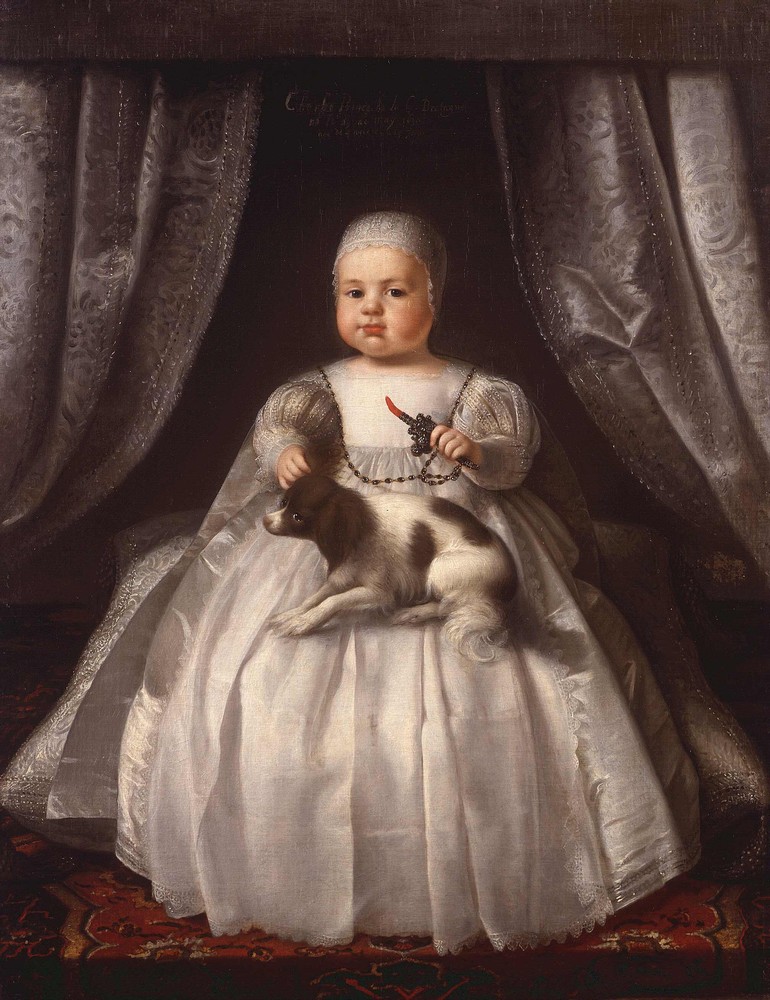
Charles II (29 May 1630 – 6 February 1685) was King of Scotland from 1649 until 1651, and King of England, Scotland and Ireland from the 1660 Restoration of the monarchy until his death in 1685. Charles II was the eldest surviving child of Charles I of England, Scotland and Ireland and Henrietta Maria of France. After Charles I's execution at Whitehall on 30 January 1649, at the climax of the English Civil War, the Parliament of Scotland proclaimed Charles II king on 5 February 1649. But England entered the period known as the English Interregnum or the English Commonwealth, and the country was a de facto republic led by Oliver Cromwell. Cromwell defeated Charles II at the Battle of Worcester on 3 September 1651, and Charles fled to mainland Europe. Cromwell became virtual dictator of England, Scotland and Ireland. Charles spent the next nine years in exile in France, the Dutch Republic and the Spanish Netherlands. The political crisis that followed Cromwell's death in 1 ... [...More Info...] [...Related Items...] OR: [Wikipedia] [Google] [Baidu] |
Sir Tristram Beresford, 1st Baronet
Sir Tristram Beresford, 1st Baronet (died 15 January 1673) was an Irish soldier and politician. He was the ancestor of the Marquesses of Waterford, the Barons Decies and the Beresford baronets, of William Beresford, 1st Viscount Beresford and Charles Beresford, 1st Baron Beresford. He was born the eldest son of Tristram Beresford, who had originated from Kent and settled in Ireland, and his wife Susannah Brooke. Beresford became manager of the Corporation of London's Londonderry Plantation and entered the Irish House of Commons in 1634 as the member for County Londonderry. He then represented the counties of Londonderry, Donegal and Tyrone from 1656 until 1658 in the Second Protectorate Parliament at Westminster. After the Restoration of 1660 he finally stood successfully for Londonderry in the Irish Parliament of 1661, holding the seat for the next five years. He was knighted in 1664 and was created a Baronet, of Coleraine in the County of Londonderry, on 5 May of the followin ... [...More Info...] [...Related Items...] OR: [Wikipedia] [Google] [Baidu] |
George Carew, 1st Earl Of Totnes
George may refer to: People * George (given name) * George (surname) * George (singer), American-Canadian singer George Nozuka, known by the mononym George * George Washington, First President of the United States * George W. Bush, 43rd President of the United States * George H. W. Bush, 41st President of the United States * George V, King of Great Britain, Ireland, the British Dominions and Emperor of India from 1910-1936 * George VI, King of Great Britain, Ireland, the British Dominions and Emperor of India from 1936-1952 * Prince George of Wales * George Papagheorghe also known as Jorge / GEØRGE * George, stage name of Giorgio Moroder * George Harrison, an English musician and singer-songwriter Places South Africa * George, Western Cape ** George Airport United States * George, Iowa * George, Missouri * George, Washington * George County, Mississippi * George Air Force Base, a former U.S. Air Force base located in California Characters * George (Peppa Pig), a 2-year-old pig ... [...More Info...] [...Related Items...] OR: [Wikipedia] [Google] [Baidu] |
Griffith's Valuation
Griffith's Valuation was a boundary and land valuation survey of Ireland completed in 1868. Griffith's background Richard John Griffith started to value land in Scotland, where he spent two years in 1806-1807 valuing terrain through the examination of its soils. He used 'the Scotch system of valuation' and it was a modified version of this that he introduced into Ireland when he assumed the position of Commissioner of Valuation. Tasks in Ireland In 1825 Griffith was appointed by the British Government to carry out a boundary survey of Ireland. He was to mark the boundaries of every county, barony, civil parish and townland in preparation for the first Ordnance Survey. He completed the boundary work in 1844. He was also called upon to assist in the preparation of a Parliamentary bill to provide for the general valuation of Ireland. This Act was passed in 1826, and he was appointed Commissioner of Valuation in 1827, but did not start work until 1830 when the new 6" maps, became av ... [...More Info...] [...Related Items...] OR: [Wikipedia] [Google] [Baidu] |


.jpg)


