|
Stewiacke
Stewiacke () is a town located in southern Colchester County, Nova Scotia, Canada. The town was incorporated on August 30, 1906. Geography The town is located in the Stewiacke Valley, at the confluence of the Stewiacke and Shubenacadie Rivers, and is a service and support centre for local agricultural communities as well as a service exit on Highway 102. The town is noted as being located halfway between the North Pole and the Equator (which is actually in Alton, Nova Scotia). Controversy in the past over that claim stems from the fact that the Earth is not a perfect sphere and so the halfway mark lies approximately 16 km north of the 45th parallel. History Stewiacke was named in the language of the local Mi'kmaq First Nations and is a word meaning "flowing out in small streams" and "winding river" or "whimpering or whining as it goes". During the French and Indian War, the British built Fort Ellis in the area to protect New England Planters from Mi'kmaq raids. In ... [...More Info...] [...Related Items...] OR: [Wikipedia] [Google] [Baidu] |
Stewiacke Valley
The Stewiacke Valley is a Canadian rural region in central Nova Scotia running from western Pictou County through southern Colchester County to the Shubenacadie River . The Stewiacke River flows through the length of the valley. The economy is primarily farming and lumbering. Nova Scotia Route 289 is the primary road running through the valley. Communities *Stewiacke *Upper Stewiacke Upper Stewiacke is a small community located in Colchester County in central Nova Scotia. Upper Stewiacke can be reached by road via Route 289. Upper Stewiacke was founded in 1783 by Matthew Johnson, son of James Johnson, a Grantee of Truro ... * Middle Stewiacke * Brookfield *Upper Brookfield * Pleasant Valley * Green Creek * Green Oaks * Sheepherders Junction *Forest Glen * Brentwood * Cloverdale ReferencesUpper Stewiacke [...More Info...] [...Related Items...] OR: [Wikipedia] [Google] [Baidu] |
Colchester County, Nova Scotia
Colchester County is a county in the Canadian province of Nova Scotia. With a population of 51,476 the county is the fourth largest in Nova Scotia. Colchester County is located in north central Nova Scotia. The majority of the county is governed by the Municipality of the County of Colchester, the county also is home to two independent incorporated towns, Stewiacke and Truro, two village commissions in Bible Hill and Tatamagouche, and the Millbrook 27 First Nations reserve. History The glaciers began their retreat from in the Maritimes approximately 13,500 years ago. The earliest evidence of Palaeo-Indian settlement in the region follows rapidly after deglaciation. The record of continuous habitation through the paleo and archaic period over ten thousand years culminated in the development of the culture, traditions, and language now known as the Mi'kmaq. For several thousand years the territory of the province has been a part of the territory of the Mi'kmaq nation of Mi ... [...More Info...] [...Related Items...] OR: [Wikipedia] [Google] [Baidu] |
Stewiacke River
The Stewiacke River is a river in the Canadian province of Nova Scotia that starts at Round Lake in Pictou County and flows into the Shubenacadie River in Colchester County running through the Stewiacke Valley. See also *List of rivers of Nova Scotia Nova Scotia's rivers all flow into the Atlantic Ocean through four unique watersheds: the Gulf of Maine, the Northumberland Strait, the Gulf of Saint Lawrence and into the Atlantic Ocean itself. Gulf of Maine The Gulf of Maine system includes ... References Stewiacke River ParkNova Scotia Watershed Map Rivers of Nova Scotia {{NovaScotia-river-stub ... [...More Info...] [...Related Items...] OR: [Wikipedia] [Google] [Baidu] |
List Of B Postal Codes Of Canada
__NOTOC__ This is a list of postal codes in Canada where the first letter is B. Postal codes beginning with B are located within the Canadian province of Nova Scotia. Only the first three characters are listed, corresponding to the Forward Sortation Area. Canada Post provides a free postal code look-up tool on its website, via its mobile apps for such smartphones as the iPhone and BlackBerry, and sells hard-copy directories and CD-ROMs. Many vendors also sell validation tools, which allow customers to properly match addresses and postal codes. Hard-copy directories can also be consulted in all post offices, and some libraries. Nova Scotia Nova Scotia ( ; ; ) is one of the thirteen provinces and territories of Canada. It is one of the three Maritime provinces and one of the four Atlantic provinces. Nova Scotia is Latin for "New Scotland". Most of the population are native Eng ... - 77 FSAs B7* and B8* codes are not used. Urban Rural Most populated FSAshttp://www12. ... [...More Info...] [...Related Items...] OR: [Wikipedia] [Google] [Baidu] |
List Of Communities In Nova Scotia
This is a list of communities in the Canadian province of Nova Scotia, as designated by thUnion of Nova Scotia Municipalities For the purposes of this list, a community is defined as an unincorporated settlement inside or outside a municipality. Regional municipalities Nova Scotia has four regional municipalities. Towns Nova Scotia has 27 towns. Municipal districts Nova Scotia has 12 municipal districts. Villages Nova Scotia has 21 villages. Other communities A * Abbots Dyke * Acaciaville * Acacia Valley *Advocate Harbour * Africville * Afton *Aldershot * Argyle Sound *Arichat *Arisaig * Arlington *Aspen *Atlanta *Atlantic * Atwoods Brook * Aylesford * Auburn B * Baccaro * Bald Rock * Bangor * Barrachois (Cape Breton County) * Barrachois (Colchester County) * Barrington *Barrington Passage * Barrington West * Bass River * Baxters Harbour * Bayport * Bayside * Bay St. Lawrence * Bear Cove (Digby) * Bear Cove (Halifax) * Bear Point * Bear River *Beaver Da ... [...More Info...] [...Related Items...] OR: [Wikipedia] [Google] [Baidu] |
Nova Scotia Highway 102
Highway 102 is a north-south highway in the Canadian province of Nova Scotia that runs from Halifax to Onslow, immediately north of the town of Truro. It is the busiest highway in Atlantic Canada. In 2000, the section of Highway 102 between Fall River and Truro was redesignated as Veterans Memorial Highway. Between Fall River and Halifax it is known as Bicentennial Drive or the Bicentennial Highway. History The highway parallels the route of its predecessor, Trunk 2, and was developed in stages from 1958 to the 1970s. Initially, some sections were controlled access two-lane, as well as four-lane. The route has also changed somewhat, particularly during the mid-1970s when the last part to be constructed resulted in the bypass of Shubenacadie and Stewiacke. The initial speed limit on the highway was 100 km/h (60 mph) until 1997, when it was raised to 110 km/h (70 mph) for the section between the interchange with Highway 118 (approximately km 26) and exit ... [...More Info...] [...Related Items...] OR: [Wikipedia] [Google] [Baidu] |
Shubenacadie River
The Shubenacadie River is a river in Nova Scotia, Canada. It has a meander length of approximately 72 km from its source at Shubenacadie Grand Lake to its mouth at the historic seaport village of Maitland on Cobequid Bay, site of the building of the '' William D. Lawrence'', the largest wooden ship ever built in Canada. In 2009, the ''I Backpack Canada'' blog named the Shubenacadie one of the top five whitewater rivers in Canada. The lower 30 km of the river (from the point where the Stewiacke River meets to the mouth) is tidal and the river experiences a tidal bore twice daily, with some bores reaching up to 3 m in height at certain points along the river. Local tourism operators offer adventure seekers a chance to ride with the bore on high-horse power Zodiac Hurricanes. Tidal Bore Rafting was invented at the Tidal Bore Rafting Resort by H. Knoll. It is also a popular surfing spot for experienced Sea Kayakers. The river flows through part of northern Halifax Coun ... [...More Info...] [...Related Items...] OR: [Wikipedia] [Google] [Baidu] |
Fort Ellis (Nova Scotia)
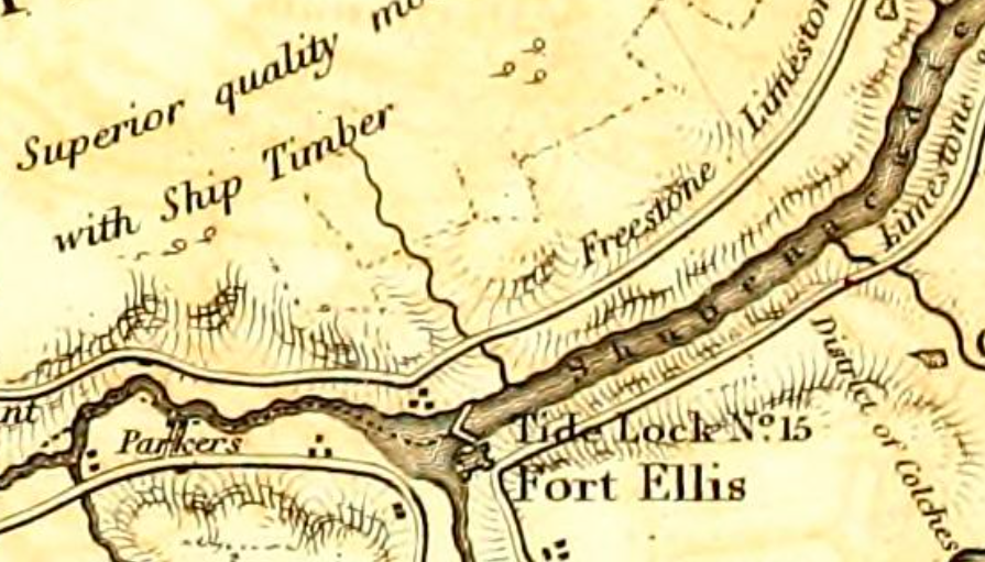
Fort Ellis was a British fort or blockhouse built during the French and Indian War, located at the junction of the Shubenacadie and Stewiacke Rivers, close to Stewiacke, Nova Scotia, Canada. The location was labelled Ville Pierre Hebert by Charles Morris. The 14 Acadian families in the area vacated with the Acadian Exodus. Charles Morris recommended a Fort on the Shubenacadie River in 1753. Governor Lawrence first considered the fort in 1754 as a means to protect Halifax from Mi'kmaq raids. Lawrence decided the fort would not be effective until after the Battle of Fort Beauséjour. The fort was completed on October 18, 1761, shortly after the Halifax Treaties were signed. The fort was to guard the new road built to connect Truro and Halifax against Mi'kmaq raids. The fort was called Fort Ellis after Governor Henry Ellis, who was appointed governor weeks after the forts completion. The fort was never garrisoned and eventually abandoned in 1767. Fort Belcher, named after Governor ... [...More Info...] [...Related Items...] OR: [Wikipedia] [Google] [Baidu] |
French And Indian War
The French and Indian War (1754–1763) was a theater of the Seven Years' War, which pitted the North American colonies of the British Empire against those of the French, each side being supported by various Native American tribes. At the start of the war, the French colonies had a population of roughly 60,000 settlers, compared with 2 million in the British colonies. The outnumbered French particularly depended on their native allies. Two years into the French and Indian War, in 1756, Great Britain declared war on France, beginning the worldwide Seven Years' War. Many view the French and Indian War as being merely the American theater of this conflict; however, in the United States the French and Indian War is viewed as a singular conflict which was not associated with any European war. French Canadians call it the ('War of the Conquest').: 1756–1763 The British colonists were supported at various times by the Iroquois, Catawba, and Cherokee tribes, and the French ... [...More Info...] [...Related Items...] OR: [Wikipedia] [Google] [Baidu] |
Mastodon
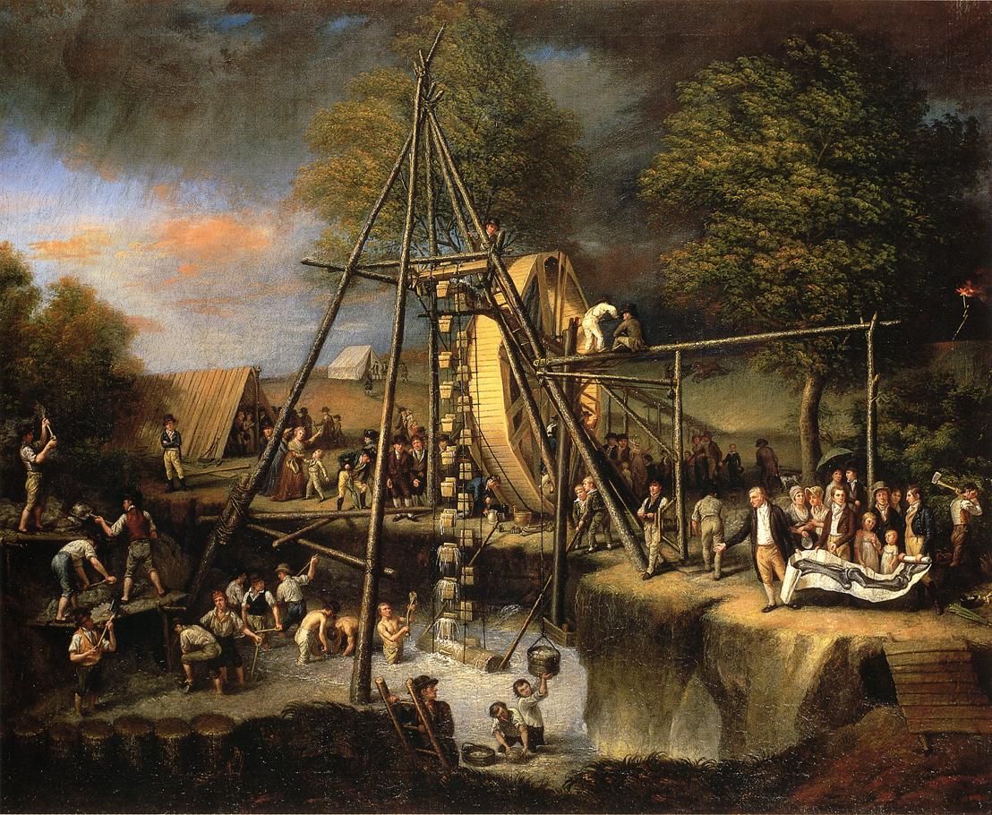
A mastodon ( 'breast' + 'tooth') is any proboscidean belonging to the extinct genus ''Mammut'' (family Mammutidae). Mastodons inhabited North and Central America during the late Miocene or late Pliocene up to their extinction at the end of the Pleistocene 10,000 to 11,000 years ago. They lived in herds and were predominantly forest-dwelling animals. They generally had a browsing diet, distinct from that of the contemporary Columbian mammoth, which tended towards grazing. ''M. americanum'', the American mastodon, and ''M. pacificus'', the Pacific mastodon, are the youngest and best-known species of the genus. Mastodons disappeared from North America as part of a mass extinction of most of the Pleistocene megafauna, widely believed to have been caused by a combination of climate changes at the end of the Pleistocene and overexploitation by Paleo-Indians. History A Dutch tenant farmer found the first recorded remnant of ''Mammut'', a tooth some in weight, in the village of ... [...More Info...] [...Related Items...] OR: [Wikipedia] [Google] [Baidu] |
Mi'kmaq Language
The Mi'kmaq (also ''Mi'gmaq'', ''Lnu'', ''Miꞌkmaw'' or ''Miꞌgmaw''; ; ) are a First Nations people of the Northeastern Woodlands, indigenous to the areas of Canada's Atlantic Provinces and the Gaspé Peninsula of Quebec as well as the northeastern region of Maine. The traditional national territory of the Mi'kmaq is named Miꞌkmaꞌki (or Miꞌgmaꞌgi). There are 170,000 Mi'kmaq people in the region, (including 18,044 members in the recently formed Qalipu First Nation in Newfoundland.) Nearly 11,000 members speak Miꞌkmaq, an Eastern Algonquian language. Once written in Miꞌkmaw hieroglyphic writing, it is now written using most letters of the Latin alphabet. The Mi'kmaq, Maliseet, and Pasamaquoddy nations signed a series of treaties known as the Covenant Chain of Peace and Friendship Treaties with the British Crown throughout the eighteenth century; the first was signed in 1725, and the last in 1779. The Miꞌkmaq maintain that they did not cede or give up their land t ... [...More Info...] [...Related Items...] OR: [Wikipedia] [Google] [Baidu] |


