|
State Highway 113 (Tamil Nadu)
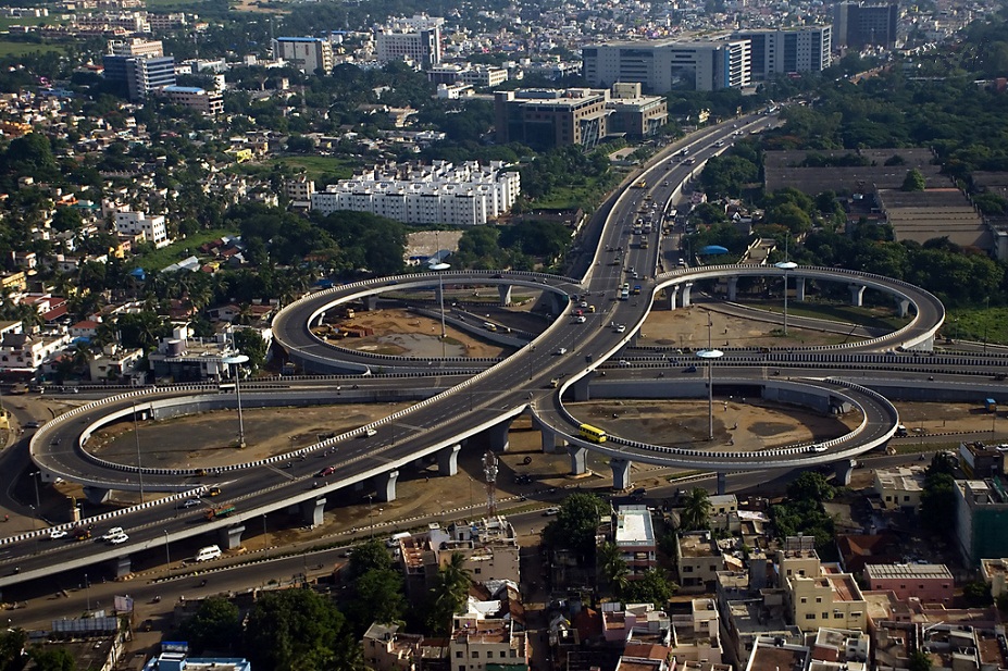
Arcot Road (also known as N. S. Krishnan Salai) ( SH-113) is one of the main arterial roads of the city of Chennai in Tamil Nadu, India. It runs for 12 kilometres and connects Nungambakkam with Porur. The road was constructed during the early 1940s and has been responsible for the development of the outlying areas on the western fringes of Chennai city. Alignment A span of 6 kilometres of the Arcot Road is located within the Chennai district and the remaining 6 kilometres are located in the Poonamallee taluk of Thiruvallur district. The Chennai Metro Rail Limited, along with the Highways Department planned to build a 400-metre long flyover along Inner Ring Road, Chennai at the junction of Arcot Road in Vadapalani on either side of the metro viaduct. The Highways Department is building another flyover at the junction of Arcot Road with Mount-Poonamallee Road near Porur. Neighbourhoods traversed by Arcot Road * Nungambakkam * Kodambakkam * Vadapalani * Saligrammam * Virugamb ... [...More Info...] [...Related Items...] OR: [Wikipedia] [Google] [Baidu] |
Kodambakkam
Kodambakkam (also known as K-Town or Kollywood) is a business and residential neighbourhood in Central Chennai, Tamil Nadu, India. The neighbourhood is served by Kodambakkam railway station of the Chennai Suburban Railway Network. Kodambakkam has a high concentration of film studios and has been known for its status as the hub of the Tamil film industry, lending its name to the industry's monicker Kollywood. Location Kodambakkam is situated at 13.0481 N latitude and 80.2214 E longitude. It is one of the westerly located neighbourhoods of Chennai city. It is bounded by the neighbourhoods of Nungambakkam to the east and West Mambalam and T. Nagar to the south. It is bounded by Vadapalani to the west and K. K. Nagar and Ashok Nagar to the south-west. Kodambakkam is located at a distance of 8 kilometres from Fort St. George. Etymology It is believed that the name "Kodambakkam" itself might have been derived from the Urdu word ''Ghoda Bagh'' meaning "garden of horses". Another v ... [...More Info...] [...Related Items...] OR: [Wikipedia] [Google] [Baidu] |
Vadapalani
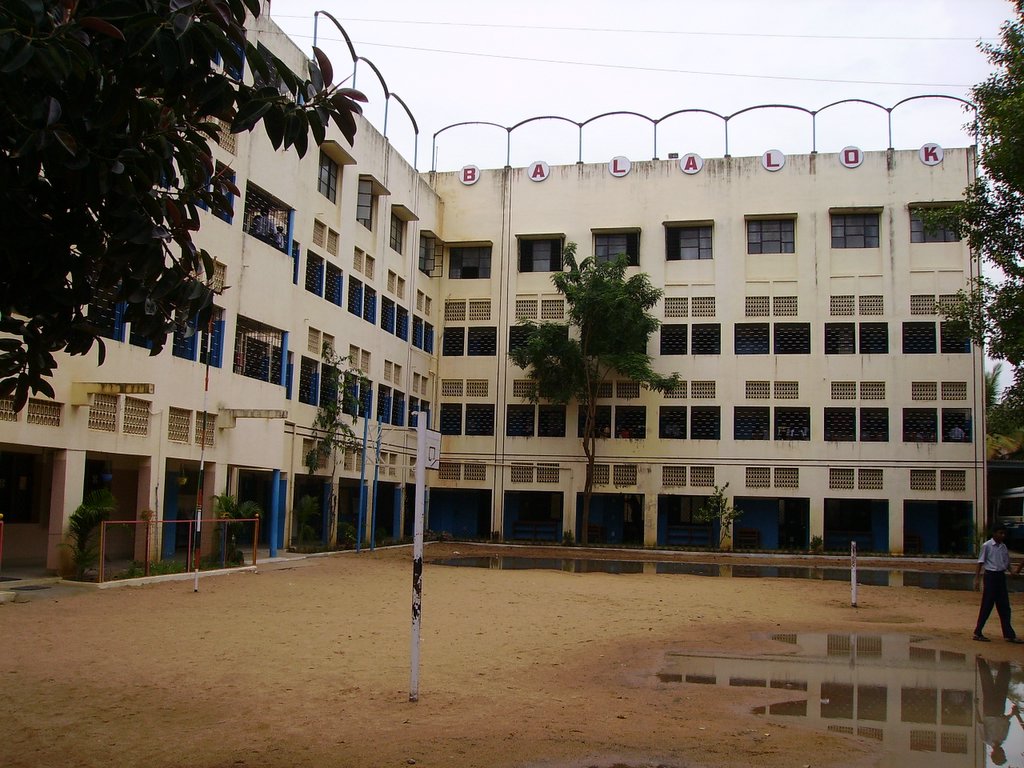
Vadapalani is a neighbourhood in the city of Chennai in Tamil Nadu, India. It is known for its film studios and the Vadapalani Andavar Temple, which is an important pilgrimage centre. Situated in the western part of Chennai, Vadapalani is an important bus terminus on Arcot Road. Vadapalani is one of the busiest and densely populated areas in Chennai. Malls The Forum Vijaya Mall, the biggest mall in the neighbourhood, is located on Arcot Road. The mall comprises a total of 14,72,000 sq.ft of floor space including 6 levels of retail space and 13 levels of parking space. Film industry Along with Kodambakkam, Vadapalani is well known for its film studios and other cine infrastructure. The Vijaya Vauhini Studios, Vikram Studios are located in the neighbourhood, whereas the Prasad Colour Lab and Prasad Studios, Efx Studios, and AVM Studio are in the adjacent Saligramam area. The residence of several actors are located in Vadapalani. Schools Saraswati Vidyalaya, established in 1 ... [...More Info...] [...Related Items...] OR: [Wikipedia] [Google] [Baidu] |
Transport In Chennai
Transport in Chennai includes various modes of air, sea, road and rail transportation in the city and its suburbs. Chennai's economic development has been closely tied to its port and transport infrastructure, and it is considered one of the best infrastructure systems in India. History The city of Chennai is the birthplace of the railway system in India. In 1831–33, Madras Parliament first came up with the idea. In 1832, the first proposal of railway under the British administration was made in Madras, 21 years before the first operational railway line in India. Later in 1836 A. P. Cotton, a civil engineer in Madras, advocated the construction of a railroad in India. Meanwhile, in 1835, a short railway line intended to carry granite stones was laid at Chintadripet on an experimental basis, which later became to known as Red Hill Railroad line. Construction on this line began in 1836 and the line was opened in 1837. Despite a few troubles, the line became operational in the ... [...More Info...] [...Related Items...] OR: [Wikipedia] [Google] [Baidu] |
Alapakkam
Alapakkam () is a neighbourhood in western part of Central Chennai. It belongs to Central Chennai Revenue Division of Chennai district. It is surrounded by Porur, Valasaravakkam and Maduravoyal. It is part of Chennai corporation under zone 11. Entry in to Alapakkam is through two main roads, that is, Arcot Road and Poonamallee High Road. Alapakkam belongs to Sriperumbudur Lok Sabha constituency and Maduravoyal Maduravoyal is a residential neighbourhood located in the west of Chennai, India. As of 2011, the town had a population of 86,195. Maduravoyal also has a name as "ettam kal" (8th mile), so it could be famous in British Period too, it is exac ... assembly constituency. Educational institutions Educational institutions in the neighbourhood include: * Government Higher secondary school * Chennai Corporation school * Velammal Vidyalaya School * Sree Adithya Matriculation School * Meenakshi Dental College * Seven Hills Polytechnic * Muthukumaran Engineering college * ... [...More Info...] [...Related Items...] OR: [Wikipedia] [Google] [Baidu] |
Valasarawakkam
Valasaravakkam is a neighbourhood in the Chennai district of the Indian state of Tamil Nadu and a residential suburb of the city of Chennai. It is located in the Poonamallee Taluk at a distance of approximately 15 kilometres from the Kilometer Zero stone. Valasaravakkam lies on the Arcot Road, one of Chennai's arterial roads. It is under the Maduravoyal election constituency. In October, 2011 Valasaravakkam Municipality ceased to exist and the area became part of Chennai Corporation as Ward Nos 149 and 152 (Zone XI), Southern Region, Corporation of Chennai. As of 2011, the town had a population of 47,378. Famous Sivan temple is in Kesavardhini. History The first planned residential colonies in Valasaravakkam made their appearance during the Second World War. Prior to the war, Valasaravakkam was a small village forming a part of the Saidapet taluk of Chingleput district. Due to its remoteness, development took place at a slow pace until the 1980s. Its strategic location on the ... [...More Info...] [...Related Items...] OR: [Wikipedia] [Google] [Baidu] |
Alwarthirunagar
Alwarthirunagar is an urban locality in Chennai, the capital city of Tamil Nadu, India. Alwarthirunagar Pin code is 600087 and postal head office is Valasaravakkam. It falls under Valasaravakkam municipality, in Maduravoyal (State Assembly Constituency) constituency in Tiruvallur district in the Indian state of Tamil Nadu. The word ''nagar'' refers to a settlement in sanskrit. The neighbourhood was developed by the City Lando Corporation in the late 1960s. With the opening of schools and shopping centres, Alwarthirunagar emerged as a service centre in Chennai's west. Twenty acres of forestation in the area acts against pollution. The area is traversed by state road number 113. Neighbourhoods Ramakrishna Nagar Ramakrishna Nagar is located in the centre of Alwarthirunagar. There, a large recreation area, developed in the 1980s, is used for playing cricket. However, in 2008, new constructions encroached on the area and flooding is a common problem during the rainy season. ... [...More Info...] [...Related Items...] OR: [Wikipedia] [Google] [Baidu] |
Virugambakkam
Virugambakkam is a residential neighbourhood of Chennai, Tamil Nadu, India. It is an important residential area of and is famous for its schools, market, residential colonies and residences of film artists. Virugambakkam had some of Chennai's oldest film studios. Virugambakkam is one of the important localities of Chennai and owes its growth to the expansion of the city in the post-independence period. Prior to the establishment of residential colonies, Virugambakkam was a village covered by paddy fields, mango orchards and casuarina trees. Virugambakkam was first included within the Chennai city limits in 1977 along with other villages like Saligramam. Virugambakkam is well-connected with the heart of Chennai city through roads. Buses running through Arcot Road link Virugambakkam with the more inner suburbs of Chennai city. Location Virugambakkam is situated at a distance of 14.6 kilometres from Fort St George and 12.5 kilometres from Poonamallee. It is bound by Saligramam ... [...More Info...] [...Related Items...] OR: [Wikipedia] [Google] [Baidu] |
Saligrammam
Saligramam (சாலிகிராமம்) is a residential locality situated in the western part of Chennai, Tamil Nadu, India. Saligramam is surrounded by Vadapalani in the east, Virugambakkam in the west, KK Nagar in the south and Koyambedu in the north. Saligramam was part of Saidapet Taluk in Chengalpattu district Chengalpattu District is one of the 38 List of districts of Tamil Nadu, districts of Tamil Nadu, in India. The district headquarters is located at Chengalpattu. Chengalpattu district came into existence on 29 November 2019 when it was carved o ... before it was merged with Chennai City and district in 1977. Neighbourhoods in Chennai {{TamilNadu-geo-stub ... [...More Info...] [...Related Items...] OR: [Wikipedia] [Google] [Baidu] |
Nungambakkam
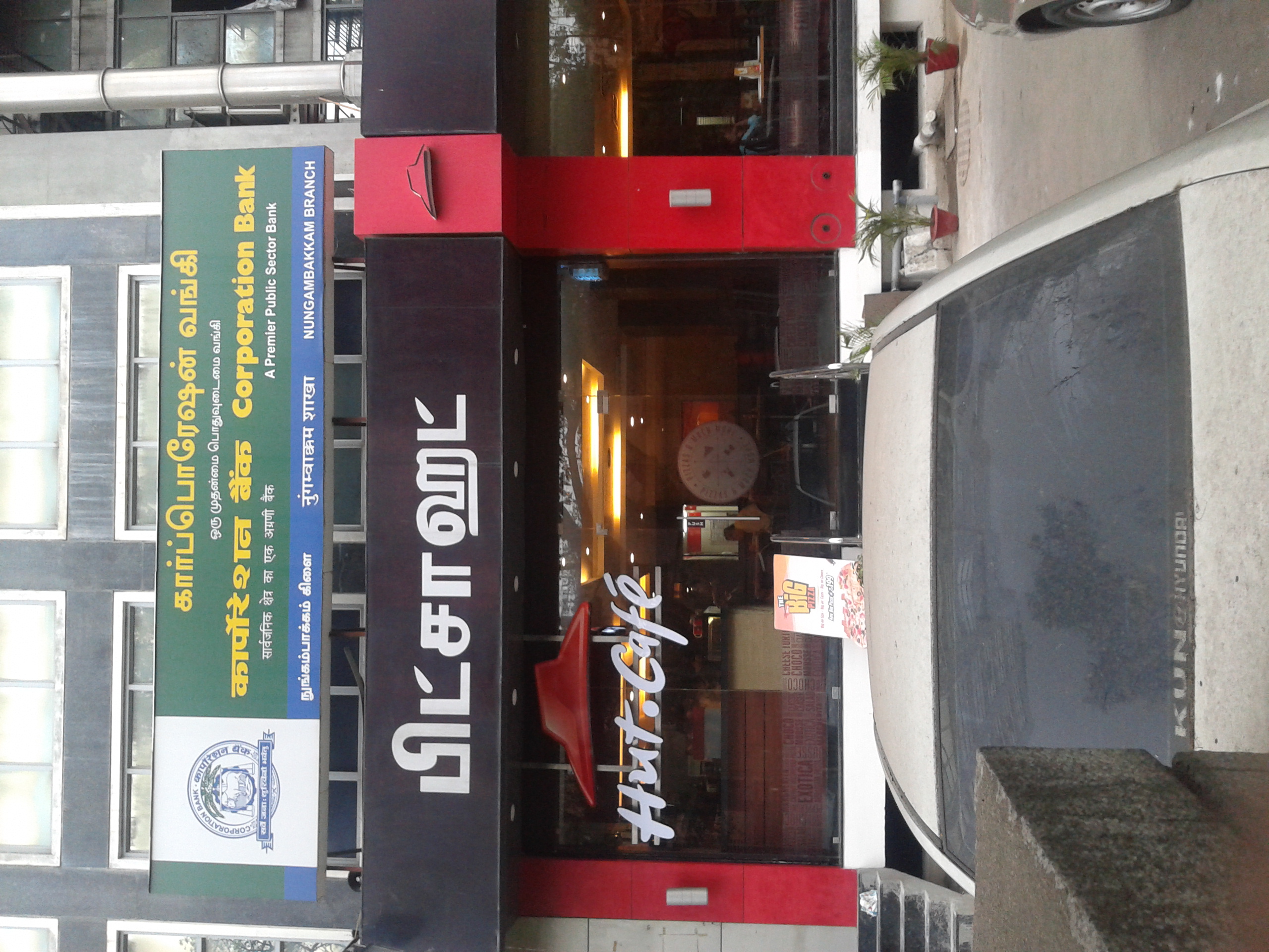
Nungambakkam is a locality in downtown Chennai, India. The neighborhood abounds with multi-national commercial establishments, important government offices, foreign consulates, educational institutions, shopping malls, sporting facilities, tourist spots, star hotels, restaurants, and cultural centers. Nungambakkam is also a prime residential area in Chennai. The adjoining regions of Nungambakkam include Egmore, Chetpet, T. Nagar, Kodambakkam and Choolaimedu. History Nungambakkam is one of the oldest parts of Chennai. It formed the western limits of Madras until the 1960s, and it was part of Madras since the 18th century. According to K.V. Raman's ''The Early History of the Madras Region'', Nungambakkam features in an 11th-century copper plate pertaining to Rajendra Chola. According to the Chennai Corporation's records, Nungambakkam village, which was under a Mughal firman, was handed over to the British along with four other villages (Tiruvatiyoor, Kathiwakam, Vyasarpad ... [...More Info...] [...Related Items...] OR: [Wikipedia] [Google] [Baidu] |
Mount-Poonamallee Road
St. Thomas Mount-Poonamallee Road, popularly known as the Mount-Poonamallee Road (SH-55), is an arterial road in the city of Chennai, India. It runs for 11 kilometres from Kathipara Junction to the NH 4 highway connecting St. Thomas Mount with the suburb of Poonamallee. About 5 kilometres of the Mount-Poonamallee Road is located in the Alandur taluk of Chennai district, part of Maduravoyal Taluk in Chennai district and the remainder in the Poonamallee taluk of Thiruvallur district. Features The road is divided into two sections. The first section from St. Thomas Mount to Nandambakkam covering a distance of one kilometre is more narrow than the rest of the stretch and is known as Butt Road. Places transversed * St. Thomas Mount * Nandambakkam * Ramapuram * Manapakkam * Mugalivakkam * Porur * Iyyappanthangal * Kattupakkam * Karayanchavadi * Kumananchavadi * Poonamallee See also * Transport in Chennai Transport in Chennai includes various modes of a ... [...More Info...] [...Related Items...] OR: [Wikipedia] [Google] [Baidu] |
The Hindu
''The Hindu'' is an Indian English-language daily newspaper owned by The Hindu Group, headquartered in Chennai, Tamil Nadu. It began as a weekly in 1878 and became a daily in 1889. It is one of the Indian newspapers of record and the second most circulated English-language newspaper in India, after '' The Times of India''. , ''The Hindu'' is published from 21 locations across 11 states of India. ''The Hindu'' has been a family-owned newspaper since 1905, when it was purchased by S. Kasturi Ranga Iyengar from the original founders. It is now jointly owned by Iyengar's descendants, referred to as the "Kasturi family", who serve as the directors of the holding company. The current chairperson of the group is Malini Parthasarathy, a great-granddaughter of Iyengar. Except for a period of about two years, when S. Varadarajan held the editorship of the newspaper, the editorial positions of the paper were always held by members of the family or held under their direction. Histo ... [...More Info...] [...Related Items...] OR: [Wikipedia] [Google] [Baidu] |
The Times Of India
''The Times of India'', also known by its abbreviation ''TOI'', is an Indian English-language daily newspaper and digital news media owned and managed by The Times Group. It is the third-largest newspaper in India by circulation and largest selling English-language daily in the world. It is the oldest English-language newspaper in India, and the second-oldest Indian newspaper still in circulation, with its first edition published in 1838. It is nicknamed as "The Old Lady of Bori Bunder", and is an Indian " newspaper of record". Near the beginning of the 20th century, Lord Curzon, the Viceroy of India, called ''TOI'' "the leading paper in Asia". In 1991, the BBC ranked ''TOI'' among the world's six best newspapers. It is owned and published by Bennett, Coleman & Co. Ltd. (B.C.C.L.), which is owned by the Sahu Jain family. In the Brand Trust Report India study 2019, ''TOI'' was rated as the most trusted English newspaper in India. Reuters rated ''TOI'' as India's most trus ... [...More Info...] [...Related Items...] OR: [Wikipedia] [Google] [Baidu] |


