|
Mount-Poonamallee Road
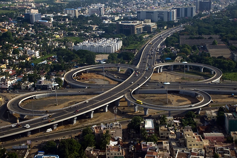
St. Thomas Mount-Poonamallee Road, popularly known as the Mount-Poonamallee Road (SH-55), is an arterial road in the city of Chennai, India. It runs for 11 kilometres from Kathipara Junction to the NH 4 highway connecting St. Thomas Mount with the suburb of Poonamallee. About 5 kilometres of the Mount-Poonamallee Road is located in the Alandur taluk of Chennai district, part of Maduravoyal Taluk in Chennai district and the remainder in the Poonamallee taluk of Thiruvallur district. Features The road is divided into two sections. The first section from St. Thomas Mount to Nandambakkam covering a distance of one kilometre is more narrow than the rest of the stretch and is known as Butt Road. Places transversed * St. Thomas Mount * Nandambakkam * Ramapuram * Manapakkam * Mugalivakkam * Porur * Iyyappanthangal * Kattupakkam * Karayanchavadi * Kumananchavadi * Poonamallee See also * Transport in Chennai Transport in Chennai includes various modes of a ... [...More Info...] [...Related Items...] OR: [Wikipedia] [Google] [Baidu] |
Manapakkam Signal
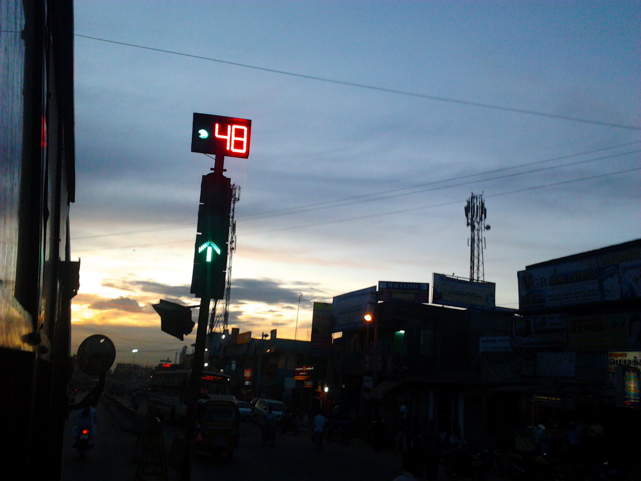
Manapakkam is a suburb of Chennai in the Indian state of Tamil Nadu. A census town, Manapakkam is located along the Mount-Poonamallee Road in Chennai. It is now a home to many IT companies like DLF Cybercity Chennai and Larsen & Toubro. Manappakam has beautiful and scenic Adyar River Bank Trail suitable for morning walkers and joggers, it is a 3-km stretch extended till Chennai Airport's secondary Runway Bridge. Geographic location Manapakkam is located between Ramapuram and Mugalivakkam in the north, Nandambakkam (part) and Parangimalai in the east, Nandambakkam (part) and Meenambakkam in the south and Kolapakkam in the west. Demographics India census, Manapakkam had a population of 8590. Males constitute 52% of the population and females 48%. Manapakkam has an average literacy rate of 73%, higher than the national average of 59.5%: male literacy is 77%, and female literacy is 69%. In Manapakkam, 11% of the population is under 6 years of age. Transport Manapakkam is 5. ... [...More Info...] [...Related Items...] OR: [Wikipedia] [Google] [Baidu] |
Nandambakkam
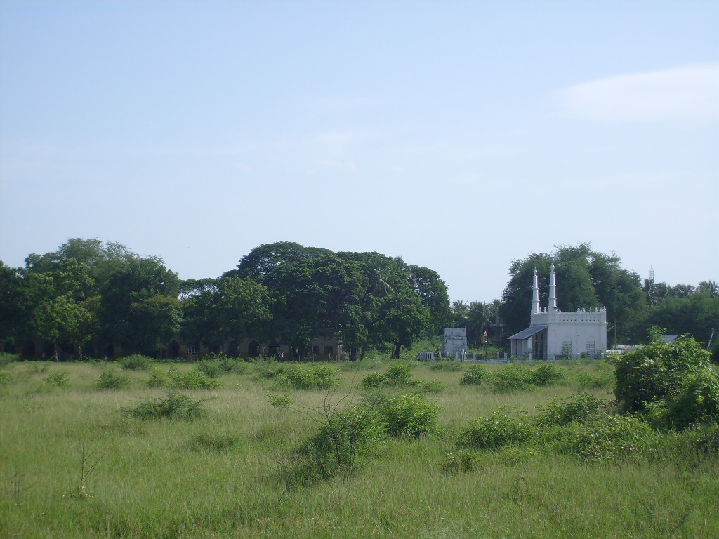
Nandambakkam is a western neighbourhood of Chennai, India. It is known for the Chennai Trade Centre and the Surgical Instruments Factory. In 2011 Nandambakkam was included to Chennai district by the Government of Tamil Nadu. Geography Nandambakkam is situated at a distance of 13 kilometres south-west of Chennai on the Mount-Poonamallee Road. It is bound by Alandur and St Thomas Mount to the east and Manapakkam to the west. It is bound by Ramapuram to the north and north-west and Pallavaram to the south. The township extends from the Madras War Cemetery on the east to the banks of the Adyar River on the west. Demographics India census, Nandambakkam had a population of 9093. Males constitute 51% of the population and females 49%. Nandambakkam has an average literacy rate of 81%, higher than the national average of 59.5%: male literacy is 85%, and female literacy is 77%. In Nandambakkam, 10% of the population is under 6 years of age. History During the Ramayana period a ... [...More Info...] [...Related Items...] OR: [Wikipedia] [Google] [Baidu] |
Transport In Chennai
Transport in Chennai includes various modes of air, sea, road and rail transportation in the city and its suburbs. Chennai's economic development has been closely tied to its port and transport infrastructure, and it is considered one of the best infrastructure systems in India. History The city of Chennai is the birthplace of the railway system in India. In 1831–33, Madras Parliament first came up with the idea. In 1832, the first proposal of railway under the British administration was made in Madras, 21 years before the first operational railway line in India. Later in 1836 A. P. Cotton, a civil engineer in Madras, advocated the construction of a railroad in India. Meanwhile, in 1835, a short railway line intended to carry granite stones was laid at Chintadripet on an experimental basis, which later became to known as Red Hill Railroad line. Construction on this line began in 1836 and the line was opened in 1837. Despite a few troubles, the line became operational in the ... [...More Info...] [...Related Items...] OR: [Wikipedia] [Google] [Baidu] |
Kumananchavadi
Kumananchavadi is a suburb of the city of Chennai in Tamil Nadu, India. It is an upcoming residential suburb located between Iyyapanthangal and Poonamallee on the Mount-Poonamallee Road. Kumananchavadi is situated at a distance of 21 kilometres from Fort St George. The nearest bus stations are at Poonamallee and Iyyapanthangal which are both, two kilometres away while the nearest railway station is at Guindy Guindy is one of the most important neighborhoods of Chennai, Tamil Nadu, and is nicknamed as ''The Gateway to Chennai''. The Kathipara junction where Anna Salai, Mount-Poonamallee Road, Inner Ring Road, 100 Feet Road or Jawaharlal Nehru Roa ... which is nine kilometres from Kumananchavadi. Villages in Tiruvallur district {{Tiruvallur-geo-stub ... [...More Info...] [...Related Items...] OR: [Wikipedia] [Google] [Baidu] |
Kattupakkam
Kattupakkam is a suburb of Chennai, Tamil Nadu, India. It is located in the western side of the city. Location Kattupakkam is located 20 kilometres from Fort St George on the Mount-Poonamallee Road. The nearest bus depot is at Iyyappanthangal, which is one kilometre from Kattupakkam, while the nearest railway station is at Guindy, 8 kilometres away. Kattupakkam is near to the Mangadu Amman temple. Tiruverkadu Karumari Amman Temple is about 5 kilometers from here. The Sri Ramachandra Medical College and Research Institute Sri Ramachandra Institute of Higher Education and Research (SRIHER), formerly Sri Ramachandra University (SRU), formerly Sri Ramachandra Medical College and Research Institute (SRMC & RI), is a private institute located in Porur, Chennai, India. ... is about 2 kilometers. Landmarks Kattupakkam has a number of temples, mosques and churches. The Sri Vada Chendur Murugan Temple at Kattupakkam is one of the oldest Hindu temples built in the city. Pillay ... [...More Info...] [...Related Items...] OR: [Wikipedia] [Google] [Baidu] |
Iyyappanthangal
Iyyappanthangal is a western neighborhood of Chennai, Tamilnadu, India. It comes under Mangadu Municipality of Chennai Metropolitan Area (CMA), governed by CMDA. It is located away from Fort St George on the Mount-Poonamallee Road. The nearest railway stations are at Guindy (Chennai South Line) about away and Avadi (Chennai West Line) about away. The Porur Junction where a much needed road overbridge on the busy Guindy–Poonamallee stretch was built after a very long delay of nearly five years is just about 2 km from Iyyapanthangal and the Poonamallee Junction is just about 6 km from the town. Connectivity The six-acre Iyyappanthangal bus terminus was opened in 1994. It operates 162 buses to places such as Koyambedu, Tambaram, Kundrathur, Sommangalam, Kovalam, Sunguvachattiram, Parrys Corner, Anna Salai, Tambaram, T Nagar and Mint. About 150,000 commuters take buses from here daily. The state highways department undertook renovation of the terminus at a cost of ... [...More Info...] [...Related Items...] OR: [Wikipedia] [Google] [Baidu] |
Porur
Porur () is a neighbourhood of Chennai, India. It is situated in the Maduravoyal taluk of Chennai district in the southern part of the city. Since 2011, it has been a part of the Chennai Corporation and included in zone number 11. The earliest recorded history of Porur goes back to the Chola period when it served as the headquarters of an administrative division (''nadu'') called Perur Nadu. Porur Lake is the major source of fresh water for suburban areas such as Iyyapanthangal, Moulivakkam and Mangadu. Porur is also known for the Ramachandra Medical College. Porur houses Mono-pulse Secondary Surveillance radar, one of the two radars in the city, which aids air-transport communication. Location Porur is located at 13.03° N and 80.16° E, and 52 feet (15 metres) above sea level. It is bounded on the east and south-east by the Pallavaram Hills. History Porur was a little-known village administered as a part of the Saidapet taluk of the then Chengalpattu district in 1961. Du ... [...More Info...] [...Related Items...] OR: [Wikipedia] [Google] [Baidu] |
Mugalivakkam
Mugalivakkam is a neighbourhood of Chennai. It is situated 16 km south-west of Chennai on the Mount-Poonamallee Road. It is bounded by Porur on the North Meenambakkam and Manapakkam on the South and South East, Madhanandhapuram and Gerugambakkam on the South West and Ramapuram on the North East directions. The nearest railway station is at Guindy which is about 6 kilometres away. Porur junction is around 2 km away and Kathipara Junction is around 5 km away. The word, ''Mugalivakkam'', might have evolved during the brief Mughal rule of Poonamallee during the later half of the 17th century CE and the 18th century CE. Recent developments DLF IT City was built and opened next to Mugalivakkam in 2010. Multinational companies such as IBM, CTS, L&T and Infotech have been located in this IT City. L&T ECC, L&T Ship Building and L&T Audco are also vested in this area. Mugalivakkam is included in Chennai city limits from 2011. The availability of small parks, educational ... [...More Info...] [...Related Items...] OR: [Wikipedia] [Google] [Baidu] |
Manapakkam
Manapakkam is a suburb of Chennai in the Indian state of Tamil Nadu. A census town, Manapakkam is located along the Mount-Poonamallee Road in Chennai. It is now a home to many IT companies like DLF Cybercity Chennai and Larsen & Toubro. Manappakam has beautiful and scenic Adyar River Bank Trail suitable for morning walkers and joggers, it is a 3-km stretch extended till Chennai Airport's secondary Runway Bridge. Geographic location Manapakkam is located between Ramapuram and Mugalivakkam in the north, Nandambakkam (part) and Parangimalai in the east, Nandambakkam (part) and Meenambakkam in the south and Kolapakkam in the west. Demographics India census, Manapakkam had a population of 8590. Males constitute 52% of the population and females 48%. Manapakkam has an average literacy rate of 73%, higher than the national average of 59.5%: male literacy is 77%, and female literacy is 69%. In Manapakkam, 11% of the population is under 6 years of age. Transport Manapakkam is 5. ... [...More Info...] [...Related Items...] OR: [Wikipedia] [Google] [Baidu] |
Ramapuram, Chennai
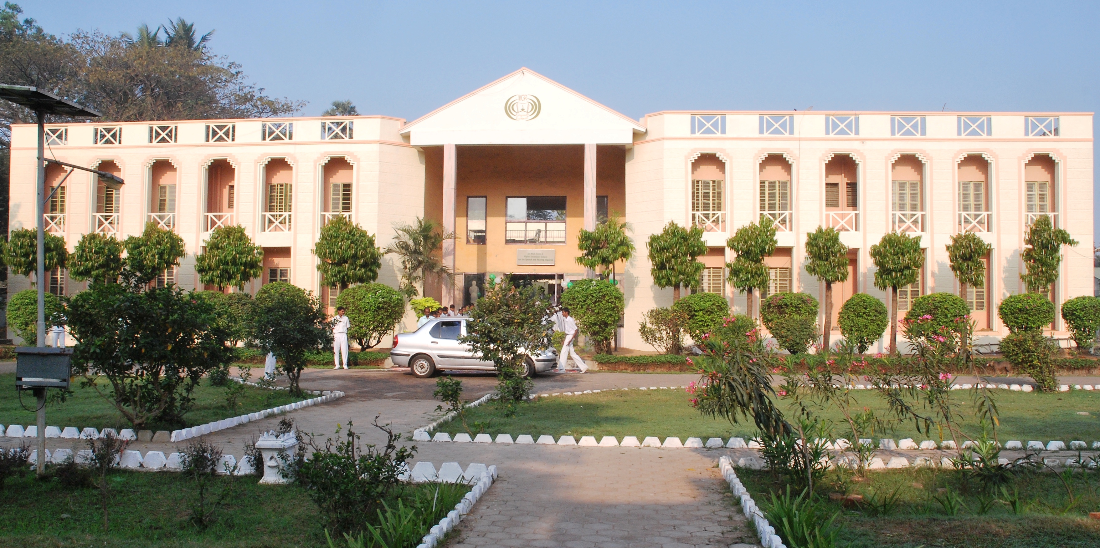
Ramapuram is a neighbourhood in the western part of Chennai, India. It is situated on the Mount-Poonamallee Road at a distance of 3 kilometres from Guindy. Ramapuram forms a part of Maduravoyal taluk, Chennai district. Geography Ramapuram is part of ward number 154 and 155 of the Greater Chennai Corporation. The former Chief Minister of Tamil Nadu, M. G. Ramachandran's residence was in Ramapuram. The place known as "MGR Gardens" now houses the Dr. M. G. R. Home and Higher Secondary School for the Speech and Hearing Impaired. Ramapuram is also famous for Arasamaram Temple which is nearly 100 years old and Lakshmi Narasimha Perumal Temple (Lakshmi Narasimhan idol is approximately 2000 years old). The neighbourhood is surrounded by big hospitals like MIOT Hospital and SRM. Large organizations like L&T InfoTech, IBHYA, and DLF IT Park are also located in Ramapuram. Educational institutes include SRM University and SRM Easwari Engineering college, which is also located in the SRM ... [...More Info...] [...Related Items...] OR: [Wikipedia] [Google] [Baidu] |


