|
State Butchers Shop, Roma
State Butchers Shop is a heritage-listed butcher shop at 75 Arthur Street, Roma, Maranoa Region, Queensland, Australia. It was designed by Government Architect's Office and built in 1919. It is also known as Bushell's Meats, Dore & Donald Butchers, and Ladbrook's Butchery. It was added to the Queensland Heritage Register on 27 April 2001. History This single-storeyed brick shop was erected in 1919 for the Queensland Government as a purpose-designed State Butcher's Shop. From 1915 to 1929, 90 State butcher's shops operated in Queensland for various periods, mostly in leased or purchased premises. The peak number of shops operating at any one time was 72, in 1922–1923. The Roma shop was one of Queensland's few purpose-designed State butcheries, and one of the more substantial of the regional State butcher's shops. In 1915 T. J. Ryan's Labor government won office in wartime Queensland on the strength of promises to improve living standards - principally by addressing the ... [...More Info...] [...Related Items...] OR: [Wikipedia] [Google] [Baidu] |
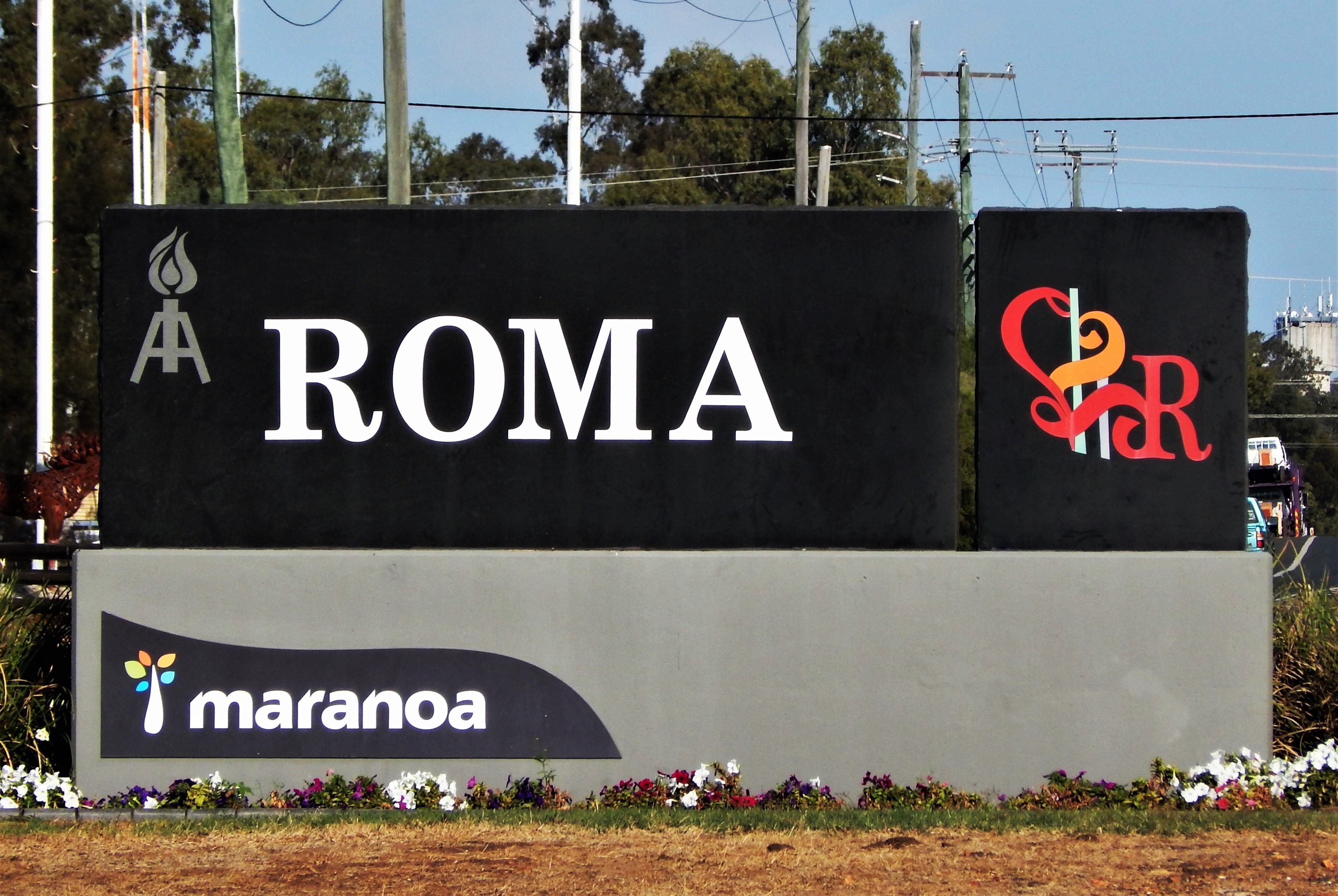
Roma, Queensland
Roma is a rural town and locality in the Maranoa Region, Queensland, Australia. It is the administrative centre of the Maranoa Region. The town was incorporated in 1867 and is named after Lady Diamantina Bowen (née di Roma), the wife of Sir George Bowen, the Governor of Queensland at the time. In the , the locality of Roma had a population of 6,848 people. Geography Roma is in the Maranoa district of South West Queensland, Australia, situated * by rail and road WNW of Brisbane * 355 km (221 mi) W of Toowoomba, * 269 km (167 mi) W of Dalby * 141 km (87.6 mi) W of Miles * 87 km (54 mi) E of Mitchell * 176.6 km (109.7 mi) E of Morven * 266 km (165 mi) E of Charleville It is situated at the junction of the Warrego and Carnarvon highways. It is the centre of a rich pastoral and wheat-growing district. It is also a major town on the Western Railway Line from Toowoomba and Brisbane. History Prior the European settlement the Aboriginal peoples of the Mandandanji Nation o ... [...More Info...] [...Related Items...] OR: [Wikipedia] [Google] [Baidu] |
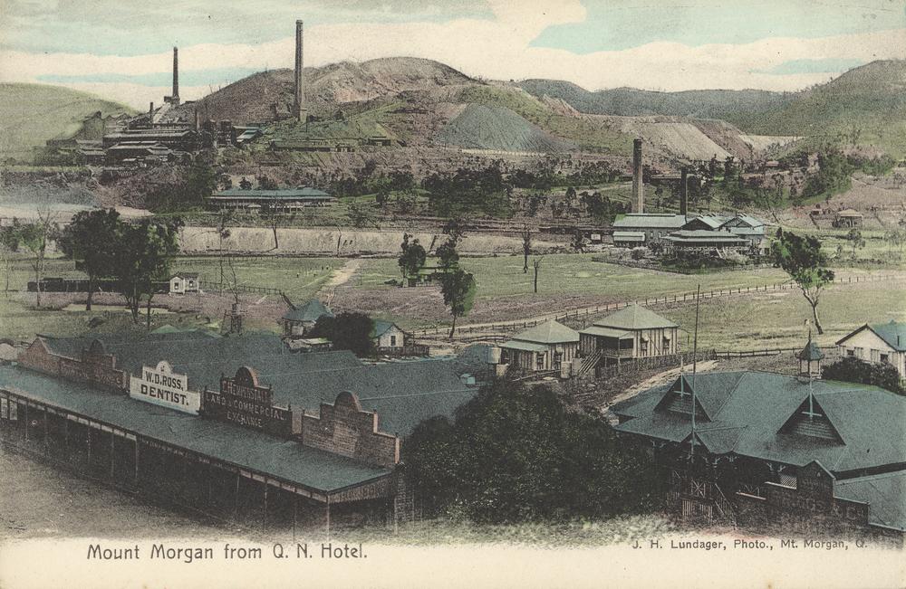
Mount Morgan, Queensland
Mount Morgan is a rural town and locality in the Rockhampton Region, Queensland, Australia. In the the locality of Mount Morgan had a population of 1,963 people. The town was the administrative centre of the Mount Morgan Shire until March 2008, when it was amalgamated with neighbouring local government areas to form the Rockhampton Region. Geography The town of Mount Morgan is situated on the Dee River, south of the city of Rockhampton, and is north of the state capital, Brisbane. The Burnett Highway passes through the town. There are a number of neighbourhoods within the locality: * Gordon Vale () * Kenbula (), located around the former Kenbula railway station * Talban (), located around the former Talban railway station The names ''Kenbula'' and ''Talban'' were both assigned by the Queensland Railway Department on 18 November 1911. Both are Aboriginal names, ''Kenbula'' meaning '' ironbark tree'' and ''Talban'' meaning ''stone curlew''. History Prior to European mi ... [...More Info...] [...Related Items...] OR: [Wikipedia] [Google] [Baidu] |
Country And Progressive National Party
The Country and Progressive National Party was a short-lived conservative political party in the Australian state of Queensland. Formed in 1925, it combined the state's conservative forces in a single party and held office between 1929 and 1932 under the leadership of Arthur Edward Moore. Following repeated election defeat it split into separate rural and urban wings in 1936. History It was created in 1925 as the result of a merger between the state's two conservative parties, the United Party (the Queensland branch of the Nationalist Party) and the Country Party, in an attempt to end a decade of Labor domination in the state. Initially called the Country Progressive Party it was formed in May 1925 by all of the Country MLAs and all but four United MLAs; the outstanding four joined in December when the party took the name Country and Progressive National Party. The party was led throughout the entirety of its existence by Arthur Edward Moore, previously the leader of the Cou ... [...More Info...] [...Related Items...] OR: [Wikipedia] [Google] [Baidu] |
1929 Queensland State Election
Elections were held in the Australian state of Queensland on 11 May 1929 to elect the 72 members of the state's Legislative Assembly. In this electionIrene Longmanbecame the first woman to both stand and be elected into the Queensland Parliament. The Labor government was seeking its sixth continuous term in office since the 1915 election; it would be Premier William McCormack's second election. His main opponent was the Country and Progressive National Party (CPNP), led by Arthur Edward Moore. The term had not gone well for McCormack's government, including a railway lock-out in 1927 which pitted the Labor Party against the union movement, restrictive financial policies and attempts to sell off state-owned enterprises, as well as suggestions of corruption which later came to be known as the Mungana affair. The election resulted in the defeat of the McCormack government, and the first non-Labor ministry since 1915. Key dates Results The election saw the defeat of the Labo ... [...More Info...] [...Related Items...] OR: [Wikipedia] [Google] [Baidu] |
William McCormack
William McCormack (27 April 1879 – 21 November 1947)McCormack, William (1879–1947) – '' Australian Dictionary of Biography''. Retrieved 7 January 2015. was , Australia, from 1925 to 1929. Early life McCormack was born on 27 April 1879 in St Lawrence, Queensland. He was the fourth of six children born to Mary (née Brennan) and Patrick McCormack; his mother was born ...[...More Info...] [...Related Items...] OR: [Wikipedia] [Google] [Baidu] |
Walkerston, Queensland
Walkerston is a town and Suburbs and localities (Australia), locality in Mackay Region, Queensland, Australia. The town is situated on the Peak Downs Highway south-west of Mackay, Queensland, Mackay. In the , Walkerston had a population of 3,403 people. Geography Walkerston is bounded by the Pioneer River to the north. The Peak Downs Highway enters the locality from Alexandra, Queensland, Alexandra in the east, passes through the town (which is in south-west of the locality and then heads south-west exiting the locality to Greenmount, Queensland (Mackay Region), Greenmount. The town is situated on the Peak Downs Highway south-west of Mackay, Queensland, Mackay. Walkerston straddles Bakers Creek for about . Palms is a neighbourhood within Walkerston, located to the east of the town (). History In May 1860, Scots-born John Mackay (Australian pioneer), John Mackay was only 21 years old when he left Armidale, New South Wales in January 1860 with men, horses and provisions in ... [...More Info...] [...Related Items...] OR: [Wikipedia] [Google] [Baidu] |
Mackay, Queensland
} Mackay () is a city in the Mackay Region on the eastern or Coral Sea coast of Queensland, Australia. It is located about north of Brisbane, on the Pioneer River. Mackay is described as being in either Central Queensland or North Queensland, as these regions are not precisely defined. More generally, the area is known as the Mackay–Whitsunday Region. Mackay is nicknamed the sugar capital of Australia because its region produces more than a third of Australia's sugar. Name The city was named after John Mackay. In 1860, he was the leader of an expedition into the Pioneer Valley. Initially Mackay proposed to name the river Mackay River after his father George Mackay. Thomas Henry Fitzgerald surveyed the township and proposed it was called Alexandra after Princess Alexandra of Denmark, who married Prince Edward (later King Edward VII). However, in 1862 the river was renamed to be the Pioneer River, after in which Queensland Governor George Bowen travelled to the area, and t ... [...More Info...] [...Related Items...] OR: [Wikipedia] [Google] [Baidu] |
Ayr, Queensland
Ayr is a rural town and locality in the Shire of Burdekin, Queensland, Australia. It is the centre of a sugarcane-growing region and the administrative centre for the Burdekin Shire Council. In the , the locality of Ayr had a population of 8,738 people. Geography Ayr is located south of Townsville on the Bruce Highway and away from the (smaller) town of Home Hill. It is north of Bowen and north of Mackay. Ayr is located near the delta of the Burdekin River. It is within the Burdekin Shire, which produces the most sugar cane per square kilometre in Australia, accessing underground water supplies and water from the Burdekin Dam to irrigate crops when rains fail. Mirrigan is a neighbourhood within the locality (). It takes its name from the former Mirrigan railway station () which was assigned by the Queensland Railways Department on 10 September 1914. It is an Aboriginal name meaning star. Parkside is a neighbourhood within the south-east of the town (). Ayr railway stati ... [...More Info...] [...Related Items...] OR: [Wikipedia] [Google] [Baidu] |
Booval, Queensland
Booval is a suburb of Ipswich in the City of Ipswich, Queensland, Australia. In the Booval had a population of 2,622 people. Geography Booval contains both residential and commercial areas. Booval straddles Brisbane Road, the main arterial link to the Ipswich Motorway. The Booval Fair shopping centre, located on Brisbane Road, contains a number of major chain stores, including Woolworths and Big W, while a number of smaller businesses line South Station Rd and Brisbane Rd. History The origin of the suburb name is the Ugarapul language word meaning '' frilled lizard''. The first large-scale cotton crops in Queensland were grown at Booval in the 1860s. The settlement of Booval derived from a private estate and its strategic location on the road and railway between Ipswich and Brisbane. In December 1895 the Anglican Diocese's architect John Buckeridge called for tenders to erect the Church of All Saints in Bundanba (as Bundamba was then known) on land donated by Miss Ferret ... [...More Info...] [...Related Items...] OR: [Wikipedia] [Google] [Baidu] |
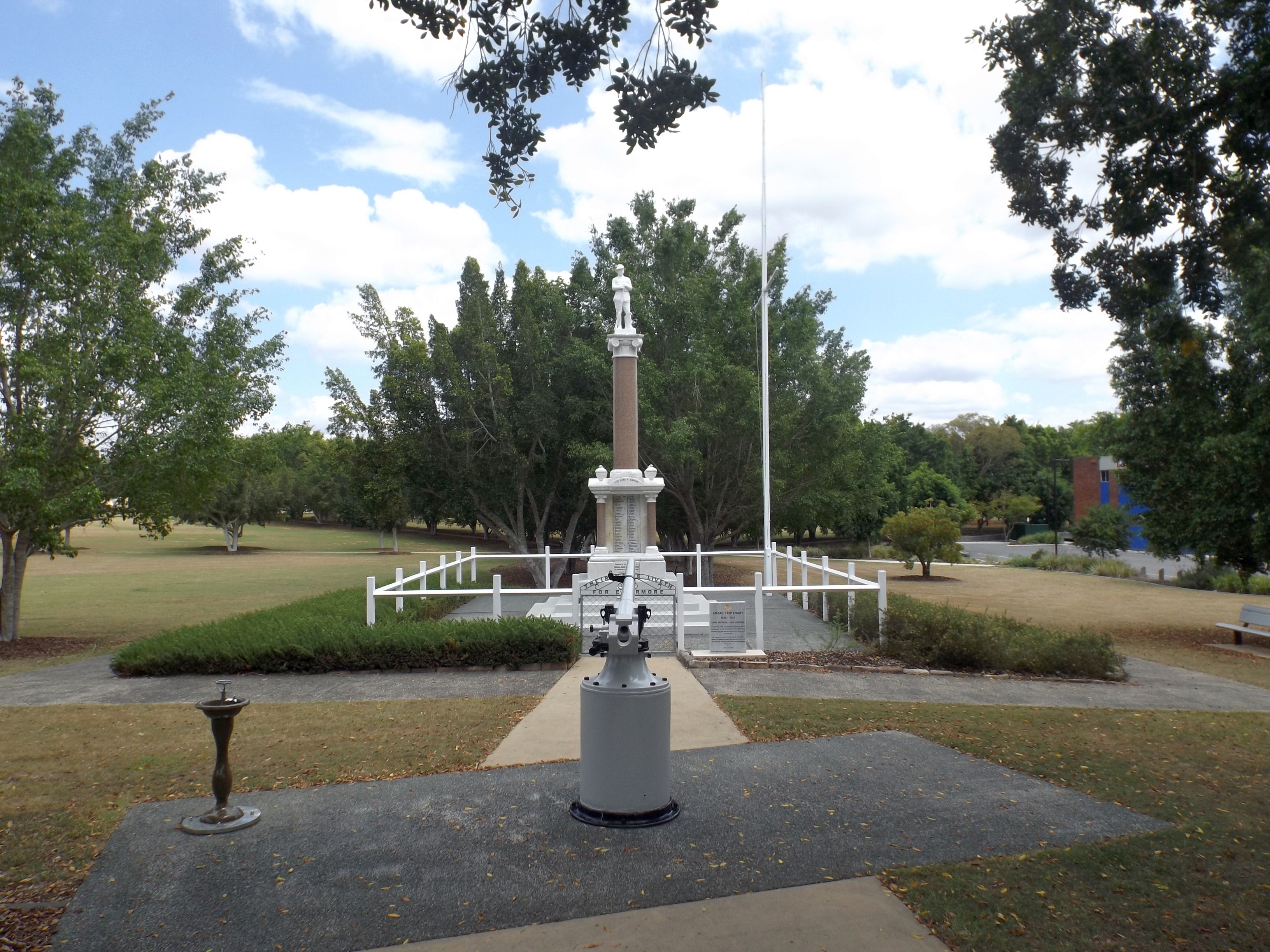
South Brisbane, Queensland
South Brisbane is an inner southern suburb in the City of Brisbane, Queensland, Australia. In the , South Brisbane had a population of 7,196 people. Geography The suburb is on the southern bank of the Brisbane River, bounded to the north-west, north, and east by the median of the river. The river to the east of the suburb is the South Brisbane Reach.(). The suburb is directly connected to the central business district across the river by the following bridges (upstream to downstream): * Go Between Bridge (toll road, ) * William Jolly Bridge (road, ) * Merivale Bridge (rail, ) * Kurilpa Bridge (pedestrian/cycling, ) * Victoria Bridge (road, ) * Goodwill Bridge (pedestrian/cycling, ). Modern public transport services include suburban train stations at South Brisbane and South Bank, and South East Busway stations at Cultural Centre, South Bank, and Mater Hill. CityCat ferry services link South Brisbane to other riverside suburbs. History Pre-colonial times South Brisbane, ... [...More Info...] [...Related Items...] OR: [Wikipedia] [Google] [Baidu] |
Western Star And Roma Advertiser
''The Western Star and Roma Advertiser'', later published as the ''Western Star'', is one of the longest continuously published newspapers in outback Queensland. It was published in Roma from 27 March 1875 to 1948, before continuing as the ''Western Star'' from 1948 to the present day. History ''The Western Star and Roma Advertiser'' was published by Francis Kidner as a weekly newspaper from 1875 to 28 September 1878, a bi-weekly from 1 October 1878 to 1939, and as a weekly from 1940 to 1948. As the ''Western Star'', it was published as a weekly from 1948 to 22 April 1949, before becoming bi-weekly once more. From 11 January 1952, the ''Western Star'' declared itself to be "the largest bi-weekly in Queensland". Along with many other regional Australian newspapers owned by NewsCorp, the newspaper ceased print editions in June 2020 and became an online-only publication from 26 June 2020. Digitisation The paper has been digitised as part of the Australian Newspaper Digitisat ... [...More Info...] [...Related Items...] OR: [Wikipedia] [Google] [Baidu] |
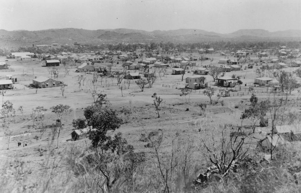
Western Queensland
Western Queensland encompasses the three western regions in the Australian state of Queensland: * North West Queensland, often known as Gulf Country; * Central West Queensland; and * South West Queensland. History Karuwali (also known as ''Garuwali'' or ''Dieri'') is a language of far western Queensland. The Karuwali language region includes the landscape within the local government boundaries of the Diamantina Shire Council, including the localities of Betoota and Haddon Corner. Kuungkari (also known as ''Kungkari'' and ''Koonkerri'') is an Australian Aboriginal language of Western Queensland. The Kuungkari language region includes the landscape within the local government boundaries of Shire of Longreach and Blackall-Tambo Region. Pitta Pitta (also known as ''Bitha Bitha'', ''Pitapita'', and ''Bitta bitta'') is an Australian Aboriginal language of the Western Queensland region. The Pitta Pitta language region includes the landscape within the local government boundarie ... [...More Info...] [...Related Items...] OR: [Wikipedia] [Google] [Baidu] |


