|
St Germans Rural District
St Germans Rural District was a local government division of Cornwall in England, UK, between 1894 and 1974. Established under the Local Government Act 1894, the rural district was enlarged in 1934 by the abolition of Callington Urban District and Calstock Rural District, as well as undergoing a few boundary changes with other adjacent districts. In 1974 the district was abolished under the Local Government Act 1972, forming part of the new Caradon district. Civil parishes The civil parishes within the district were: * Antony * Botusfleming * Callington * Calstock * Deviock * Landrake with St Erney * Landulph * Maker with Rame * Millbrook * Pillaton * Quethiock * Sheviock * St Dominick * St Germans * St John * St Mellion St Mellion ( kw, Sen Melyan) is a village and rural civil parishes in England, civil parish in east Cornwall, England, United Kingdom. The parish is about south of Callington, Cornwall, Callington and is in the St Germans Registration District. ... ... [...More Info...] [...Related Items...] OR: [Wikipedia] [Google] [Baidu] |
Cornwall
Cornwall (; kw, Kernow ) is a historic county and ceremonial county in South West England. It is recognised as one of the Celtic nations, and is the homeland of the Cornish people. Cornwall is bordered to the north and west by the Atlantic Ocean, to the south by the English Channel, and to the east by the county of Devon, with the River Tamar forming the border between them. Cornwall forms the westernmost part of the South West Peninsula of the island of Great Britain. The southwesternmost point is Land's End and the southernmost Lizard Point. Cornwall has a population of and an area of . The county has been administered since 2009 by the unitary authority, Cornwall Council. The ceremonial county of Cornwall also includes the Isles of Scilly, which are administered separately. The administrative centre of Cornwall is Truro, its only city. Cornwall was formerly a Brythonic kingdom and subsequently a royal duchy. It is the cultural and ethnic origin of the Cornish dias ... [...More Info...] [...Related Items...] OR: [Wikipedia] [Google] [Baidu] |
Landulph
Landulph ( kw, Lanndhylyk) is a hamlet and a rural civil parish in south-east Cornwall, England, United Kingdom. It is about 3 miles (5 km) north of Saltash in the St Germans Registration District. The parish lies on the River Tamar (which forms the county boundary between Cornwall and Devon) and the river surrounds Landulph to the north, east and south. Across the river are the Devon parishes of Bere Ferrers and Tamerton Foliot. To the south-east of Landulph is the parish of Botusfleming and to the west the parish of Pillaton. The population in the 2001 census was 485, which increased to 527 at the 2011 census. Settlements in the parish include the hamlet of Landulph and the bigger village of Cargreen which is on the bank of the River Tamar. The manor of Landulph belongs to the Duchy of Cornwall. The parish church of St Leonard & St Dilpe is in Landulph hamlet at . Features of interest in the church include the panelling of the Lower family pew (ca. 1600), some unusual ... [...More Info...] [...Related Items...] OR: [Wikipedia] [Google] [Baidu] |
Rural Districts Of England
In general, a rural area or a countryside is a geographic area that is located outside towns and cities. Typical rural areas have a low population density and small settlements. Agricultural areas and areas with forestry typically are described as rural. Different countries have varying definitions of ''rural'' for statistical and administrative purposes. In rural areas, because of their unique economic and social dynamics, and relationship to land-based industry such as agriculture, forestry and resource extraction, the economics are very different from cities and can be subject to boom and bust cycles and vulnerability to extreme weather or natural disasters, such as droughts. These dynamics alongside larger economic forces encouraging to urbanization have led to significant demographic declines, called rural flight, where economic incentives encourage younger populations to go to cities for education and access to jobs, leaving older, less educated and less wealthy popul ... [...More Info...] [...Related Items...] OR: [Wikipedia] [Google] [Baidu] |
Districts Of England Abolished By The Local Government Act 1972
A district is a type of administrative division that, in some countries, is managed by the local government. Across the world, areas known as "districts" vary greatly in size, spanning regions or counties, several municipalities, subdivisions of municipalities, school district, or political district. By country/region Afghanistan In Afghanistan, a district (Persian ps, ولسوالۍ ) is a subdivision of a province. There are almost 400 districts in the country. Australia Electoral districts are used in state elections. Districts were also used in several states as cadastral units for land titles. Some were used as squatting districts. New South Wales had several different types of districts used in the 21st century. Austria In Austria, the word is used with different meanings in three different contexts: * Some of the tasks of the administrative branch of the national and regional governments are fulfilled by the 95 district administrative offices (). The area a dist ... [...More Info...] [...Related Items...] OR: [Wikipedia] [Google] [Baidu] |
Districts Of England Created By The Local Government Act 1894
A district is a type of administrative division that, in some countries, is managed by the local government. Across the world, areas known as "districts" vary greatly in size, spanning regions or counties, several municipalities, subdivisions of municipalities, school district, or political district. By country/region Afghanistan In Afghanistan, a district (Persian ps, ولسوالۍ ) is a subdivision of a province. There are almost 400 districts in the country. Australia Electoral districts are used in state elections. Districts were also used in several states as cadastral units for land titles. Some were used as squatting districts. New South Wales had several different types of districts used in the 21st century. Austria In Austria, the word is used with different meanings in three different contexts: * Some of the tasks of the administrative branch of the national and regional governments are fulfilled by the 95 district administrative offices (). The area a dist ... [...More Info...] [...Related Items...] OR: [Wikipedia] [Google] [Baidu] |
St Mellion
St Mellion ( kw, Sen Melyan) is a village and rural civil parishes in England, civil parish in east Cornwall, England, United Kingdom. The parish is about south of Callington, Cornwall, Callington and is in the St Germans Registration District. To the north, the parish is bordered by Callington and St Dominick, Cornwall, St Dominick parishes, to the east and south by Pillaton parish, and to the west by St Ive parish. The population in the United Kingdom Census 2001, 2001 Census was 377. The United Kingdom Census 2011, 2011 Census recorded that this had increased to 383. The parish name is taken from Melaine, St Melaine, a 6th-century bishop of Rennes, Brittany. Parish church The Church of England parish church of St Melanus is in the village of St Mellion (the largest settlement in the parish) at . The older part of the church is the south side which was built in the 14th century whereas the north side is of the late 15th century and was built of granite. There is a series of m ... [...More Info...] [...Related Items...] OR: [Wikipedia] [Google] [Baidu] |
St John, Cornwall
St John (parish: kw, Pluwjowan, village: kw, S. Jowan) is a coastal civil parish and a village in south-east Cornwall, England, United Kingdom, south of Saltash and south-west of Torpoint.Ordnance Survey: Landranger map sheet 201 ''Plymouth & Launceston'' Geography The parish is opposite Plymouth, separated from it by St John's Lake, an inlet of The Hamoaze in Plymouth Sound. St John parish is in the St Germans Registration District and the population in the 2001 census was 375, increasing to 391 at the census 2011. To the north, the parish is bordered by St John's Lake and to the south by the sea. To the east, the parish is bordered by Millbrook, to the south-east by Maker-with-Rame and to the west by Antony parish. A few hundred metres north of St John village is an area of high ground called Vanderbands, the site of an Iron Age castle mentioned by John Norden (an English topographer who wrote a series of county histories) in his description of Cornwall published in 1 ... [...More Info...] [...Related Items...] OR: [Wikipedia] [Google] [Baidu] |
St Germans, Cornwall
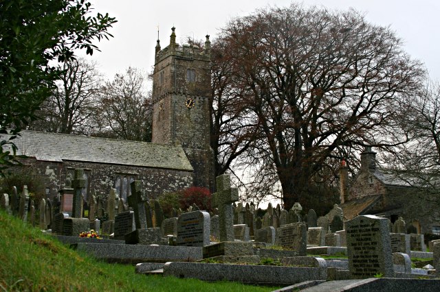
St Germans ( kw, Lannaled) is a village and civil parish in east Cornwall, England. It stands on the River Tiddy, just upstream of where that river joins the River Lynher; the water way from St Germans to the Hamoaze is also known as St Germans River. It takes its name from the St. German's Priory, generally associated with St Germanus, although the church may have been associated initially with a local saint, who was gradually replaced by the 14th century. This Norman church is adjacent to the Port Eliot estate of the present Earl of St Germans. The other villages in the historic parish were Tideford, Hessenford, Narkurs, Polbathic, and Bethany, but new ecclesiastical parishes were established in 1834 ( St Anne's Church, Hessenford) and 1852 (Tideford). In 1997 part of the St Germans parish was made into Deviock parish. The area of the civil parish is , and it has a population of 1,427, increasing to 1,453 at the 2011 census. An electoral ward with the name ''St Germans'' ... [...More Info...] [...Related Items...] OR: [Wikipedia] [Google] [Baidu] |
St Dominick, Cornwall
St Dominic ( kw, Sen Domynek) is a civil parish and village in Cornwall, England, United Kingdom. The village is situated east of Callington and five miles (8 km) north of Saltash.Ordnance Survey: Landranger map sheet 201 ''Plymouth & Launceston'' St Dominick is the historic spelling but this is gradually changing to drop the letter ''K''.GENUKI: St Dominick GENUKI website; St Dominic; retrieved May 2010 It is still spelt with the ''K'' on Ordnance Survey mapping, and in the name of an electoral division, St Dominick, Harrowbarrow and Kelly Bray, but |
Sheviock
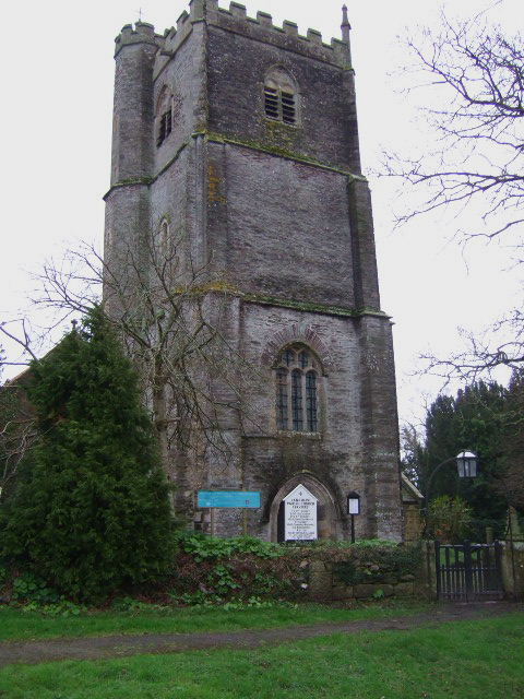
Sheviock ( kw, Seviek, meaning ''strawberry bed'') is a coastal civil parish and a hamlet in south-east Cornwall, England, United Kingdom. The parish is two miles (3 km) south of St Germans and three miles (5 km) south-west of Saltash. Sheviock parish is in the St Germans Registration District and the population in the 2001 census was 683, which had decreased to 646 at the 2011 census. To the north, the parish is bordered by St Germans Creek (the tidal estuary of the River Tiddy, a tributary of the Lynher River) and to the south by the sea. To the east, Sheviock is bordered by Antony parish and to the west by Deviock parish. Landmarks The parish church of St Mary stands in the hamlet of Sheviock at : the building is of the 13th, 14th and 15th centuries. The church one of only a few in Cornwall to have a spire. Two late 14th-century tombs are thought to be of three members of the Courtenay family. There is stained glass by Wailes to the designs of George Edmund Stree ... [...More Info...] [...Related Items...] OR: [Wikipedia] [Google] [Baidu] |
Quethiock
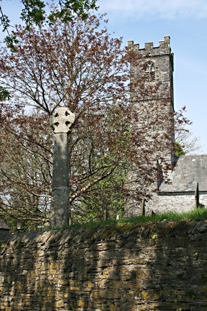
Quethiock ( kw, Koosek, meaning ''forested place'') is a village and civil parish in Cornwall, England, United Kingdom, roughly five miles east of Liskeard. According to the 2001 census the parish had a population of 429, increasing to 443 at the 2011 census. The ancient parish church of St Hugh is one of the most notable in Cornwall. The placename derives from the Old Cornish ''cuidoc'' meaning ''wooded place''. In 1871 the population was 661 and the area . Formerly part of the Pentillie Pentillie Castle is a grade II* listed country house and estate on the bank of the River Tamar in Paynters Cross, near to St Mellion, in Cornwall, England, in the United Kingdom. The secular parts of the nearby village of St Dominick once belo ... Estate and owned by Squire Coryton most of the properties passed into owner occupation after a forced sale to meet Estate Duty in the early 1920s. The village has not had a public house since the closure of the Mason's Arms in the 1920s. There wa ... [...More Info...] [...Related Items...] OR: [Wikipedia] [Google] [Baidu] |
Pillaton
Pillaton ( kw, Trebeulyow) is a village and civil parish in south east Cornwall, England, United Kingdom. The parish extends to approximately 4.6 square miles, (1,177 hectares). It is bounded by the parishes of St Mellion and St Dominic to the north, the River Lynher to the west, Botus Fleming to the south and Landulph to the east. The population is 435 of which 366 are on the electoral register. About 70 per cent of the people live in the village itself. Land use in the parish is dominated by farming, although less than 10 per cent of resident workers are employed in this industry. The population had increased to 473 at the time of the 2011 census. The majority of residents work outside the parish, and Pillaton is effectively a dormitory village for people employed in Plymouth and South East Cornwall. The Pentillie estate lies in the east of the parish, on the banks of the River Tamar. History Pillaton was recorded in Domesday Book (1086) when the manor was held by Reginal ... [...More Info...] [...Related Items...] OR: [Wikipedia] [Google] [Baidu] |


