|
Speewah, Queensland
Speewah is a locality in the Shire of Mareeba, Queensland, Australia. In the , Speewah had a population of 855 people. Geography The Kennedy Highway The Kennedy Highway is a highway in northern Queensland, Australia. It runs as National Route 1 for approximately 243 km from Smithfield, on the northern outskirts of Cairns, to the Gulf Developmental Road in the vicinity of Forty Mile ... is the north-west boundary of the locality. The terrain is mountainous with individual peaks including Yalbogie Hill at , North Peak at and Mount Williams at . The south-eastern part of the locality are in Dinden National Park and Speewah Conservation Park. Education There are no schools in Speewah. Kuranda District State College in neighbouring Kuranda offers both primary and secondary schooling. References {{Shire of Mareeba Shire of Mareeba Localities in Queensland ... [...More Info...] [...Related Items...] OR: [Wikipedia] [Google] [Baidu] |
Electoral District Of Barron River
Barron River is an electoral district of the Legislative Assembly in the Australian state of Queensland. Created at the 1971 redistribution, it currently covers the northern suburbs of Cairns, as well as Kuranda. The Barron River from which the electorate derives its name runs through its centre. It is bordered by the districts of Cook to the north and west, Cairns to the southeast and Mulgrave to the south. Members for Barron River Election results References External links Electorate Profile(Antony Green Antony John Green (born 2 March 1960) is an Australian psephologist and commentator. He is the Australian Broadcasting Corporation's chief election analyst. Early years and background Born in Warrington, Lancashire, in northern England, Gr ..., ABC) {{Electoral districts of Queensland Cairns, Queensland Barron River Far North Queensland ... [...More Info...] [...Related Items...] OR: [Wikipedia] [Google] [Baidu] |
Division Of Leichhardt
The Division of Leichhardt is an Australian Electoral Division in Queensland. Geography Since 1984, federal electoral division boundaries in Australia have been determined at redistributions by a redistribution committee appointed by the Australian Electoral Commission. Redistributions occur for the boundaries of divisions in a particular state, and they occur every seven years, or sooner if a state's representation entitlement changes or when divisions of a state are malapportioned. History The division was first contested in 1949 after the expansion of seats in the Parliament of Australia. It is one of Australia's largest electorates, covering an area stretching from Cairns to Cape York and the Torres Strait, including the Torres Strait Islands. The division is named after Ludwig Leichhardt, an explorer and scientist. The area was first covered by the seat of Herbert from 1901 to 1934 and then by the seat of Kennedy until 1949. Most of the electorate is almost uni ... [...More Info...] [...Related Items...] OR: [Wikipedia] [Google] [Baidu] |
Kuranda, Queensland
Kuranda is a rural town and locality on the Atherton Tableland in the Shire of Mareeba, Queensland, Australia. In the , Kuranda had a population of 3,008 people. It is from Cairns, via the Kuranda Range road. It is surrounded by tropical rainforest and adjacent to the Wet Tropics of Queensland World Heritage listed Barron Gorge National Park. The town of Myola is also located within the locality of Kuranda (). Geography Kuranda is positioned on the eastern edge of the Atherton Tableland where the Barron River begins a steep descent to its coastal floodplain. The area is an important wildlife corridor between the Daintree/ Carbine Tableland area in the north and Lamb Range/Atherton Tableland in the south, two centres of biodiversity. Parts of Kuranda, particularly along its eastern edge, are protected within the Kuranda National Park and Barron Gorge National Park. Both national parks belong to the Wet Tropics World Heritage Area. Barron Gorge Forest Reserve and ... [...More Info...] [...Related Items...] OR: [Wikipedia] [Google] [Baidu] |
Barron Gorge, Queensland
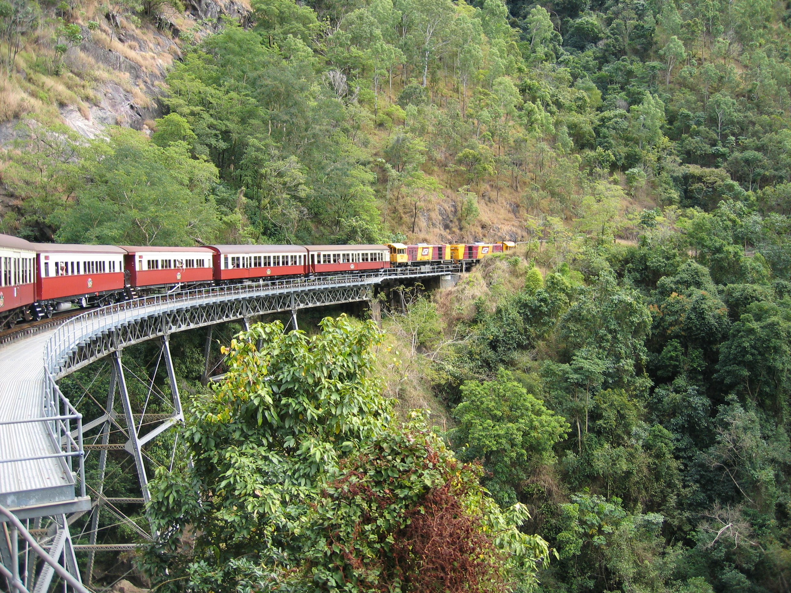
Barron Gorge is a rural locality in the Cairns Region, Queensland, Australia. In the Barron Gorge had a population of 0 people. Springs is a neighbourhood in the narrow centre part of the locality (). Geography Almost the entire area of the locality is undeveloped land within the Barron Gorge National Park which also extends into a number of neighbouring localities. The land rises from approximately 10 metres above sea level to the east of the locality up to a number of named peaks, including: * Red Peak, above sea level in the north of the locality (). * North Peak, in the middle of the locality () * Mount Williams, also known as Tokim Peak, in the south of the locality () * Red Bluff, a cliff () The name of the locality derives from the gorge created by the Barron River through the Macalister Range and the Lamb Range.The Cairns-to-Kuranda railway line provides the north-western boundary of the locality and also part of the south-eastern locality. The railway lin ... [...More Info...] [...Related Items...] OR: [Wikipedia] [Google] [Baidu] |
Lamb Range, Queensland
Lamb Range is a locality in the Cairns Region, Queensland, Australia. In the , Lamb Range had a population of 0. Geography The locality takes its name from the mountain range Lamb Range. The locality that lies to the west of most of the southern suburbs of Cairns. It is undeveloped mountainous land rising from the coastal plains (elevation of less than 50 metres above sea level) up through the Great Dividing Range (with elevations up to 1200 metres) towards the Atherton Tableland. The land use is entirely committed to national parks and reserves. Dinden National Park and Lake Morris Reserve are in the north of the locality with Little Mulgrave National Park in the south. A small area in the west is in the Danbulla National Park. There is only one road through the locality. The Gillies Range Road (also known as the Gillies Highway) passes through the south of the locality connecting Gordonvale in the Cairns Region with Atherton in the Tablelands Region. Lake Morris Road ... [...More Info...] [...Related Items...] OR: [Wikipedia] [Google] [Baidu] |
Koah, Queensland
Koah is a rural locality in the Shire of Mareeba, Queensland, Australia. In the Koah had a population of 602 people. Geography The Tablelands railway line The Tablelands railway line is a railway line in North Queensland, Australia. It was opened in a series of sections between 1887 and 1916. It commences at Cairns and at its maximum extent, reached Ravenshoe at the southern end of th ... enters the locality from the north-west ( Kuranda) and passes through the north of the locality, which is served by Koah railway station (), before exiting to the north-west ( Bibhoora). History In the Koah had a population of 602 people. References Shire of Mareeba Localities in Queensland {{Queensland-geo-stub ... [...More Info...] [...Related Items...] OR: [Wikipedia] [Google] [Baidu] |
Suburbs And Localities (Australia)
Suburbs and localities are the names of geographic subdivisions in Australia, used mainly for address purposes. The term locality is used in rural areas, while the term suburb A suburb (more broadly suburban area) is an area within a metropolitan area, which may include commercial and mixed-use, that is primarily a residential area. A suburb can exist either as part of a larger city/urban area or as a separate ... is used in urban areas. Australian postcodes closely align with the boundaries of localities and suburbs. This Australian usage of the term "suburb" differs from common American and British usage, where it typically means a smaller, frequently separate residential community outside, but close to, a larger city. The Australian usage is closer to the American or British use of "district" or "neighbourhood", and can be used to refer to any portion of a city. Unlike the use in British or American English, this term can include inner-city, outer-metropolitan ... [...More Info...] [...Related Items...] OR: [Wikipedia] [Google] [Baidu] |
Shire Of Mareeba
The Shire of Mareeba is a local government area at the base of Cape York Peninsula in Far North Queensland, inland from Cairns. The shire, administered from the town of Mareeba, covered an area of , and existed as a local government entity from 1879 until 2008, when it amalgamated with several councils in the Atherton Tableland area to become the Tablelands Region. On 20 March 2013, Mareeba residents voted in favour of a proposal to reverse the amalgamation and to re-establish Mareeba Shire. The new Mareeba Shire was re-established on 1 January 2014. History The Woothakata Division, based in the mining town of Thornborough on the Hodgkinson goldfield, was created on 11 November 1879 as one of 74 divisions around Queensland under the ''Divisional Boards Act 1879'' with a population of 1836. Woothakata is a Wakaman and Kuku Djungan Aboriginal word which describes the way (the journey) they travelled to Ngarrabullgan/Mount Mulligan, an important meeting place. The name ... [...More Info...] [...Related Items...] OR: [Wikipedia] [Google] [Baidu] |
Queensland
) , nickname = Sunshine State , image_map = Queensland in Australia.svg , map_caption = Location of Queensland in Australia , subdivision_type = Country , subdivision_name = Australia , established_title = Before federation , established_date = Colony of Queensland , established_title2 = Separation from New South Wales , established_date2 = 6 June 1859 , established_title3 = Federation of Australia, Federation , established_date3 = 1 January 1901 , named_for = Queen Victoria , demonym = , capital = Brisbane , largest_city = capital , coordinates = , admin_center_type = Administration , admin_center = Local government areas of Queensland, 77 local government areas , leader_title1 = Monarchy of Australia, Monarch , leader_name1 = Charles III , leader_title2 = Governor of Queensland, Governor , leader_name2 = Jeannette Young , leader_title3 = Premier of Queensland, Premier , leader_name3 = Annastacia Palaszczuk (Australian Labor Party (Queensland Branch), AL ... [...More Info...] [...Related Items...] OR: [Wikipedia] [Google] [Baidu] |
Kennedy Highway
The Kennedy Highway is a highway in northern Queensland, Australia. It runs as National Route 1 for approximately 243 km from Smithfield, on the northern outskirts of Cairns, to the Gulf Developmental Road in the vicinity of Forty Mile Scrub and Undara Volcanic national parks (at Minnamoolka, about 40 kilometres south of Mount Garnet). South of this junction, the road continues as the Kennedy Developmental Road (State Highway 62) to Boulia about 936 kilometres away, via Hughenden. West of the junction, National Route 1 continues as the Gulf Developmental Road to Normanton. Route description From Smithfield, the highway climbs up into the Atherton Tableland before heading in a general south-westerly direction to the aforementioned junction. The highway is mostly two-lanes. Major towns on, or just off, the Kennedy Highway include Smithfield, Kuranda, Mareeba, Atherton, Ravenshoe and Mount Garnet. Past Mount Garnet, the Kennedy Highway has several long sections ... [...More Info...] [...Related Items...] OR: [Wikipedia] [Google] [Baidu] |


