|
Southwest LRT
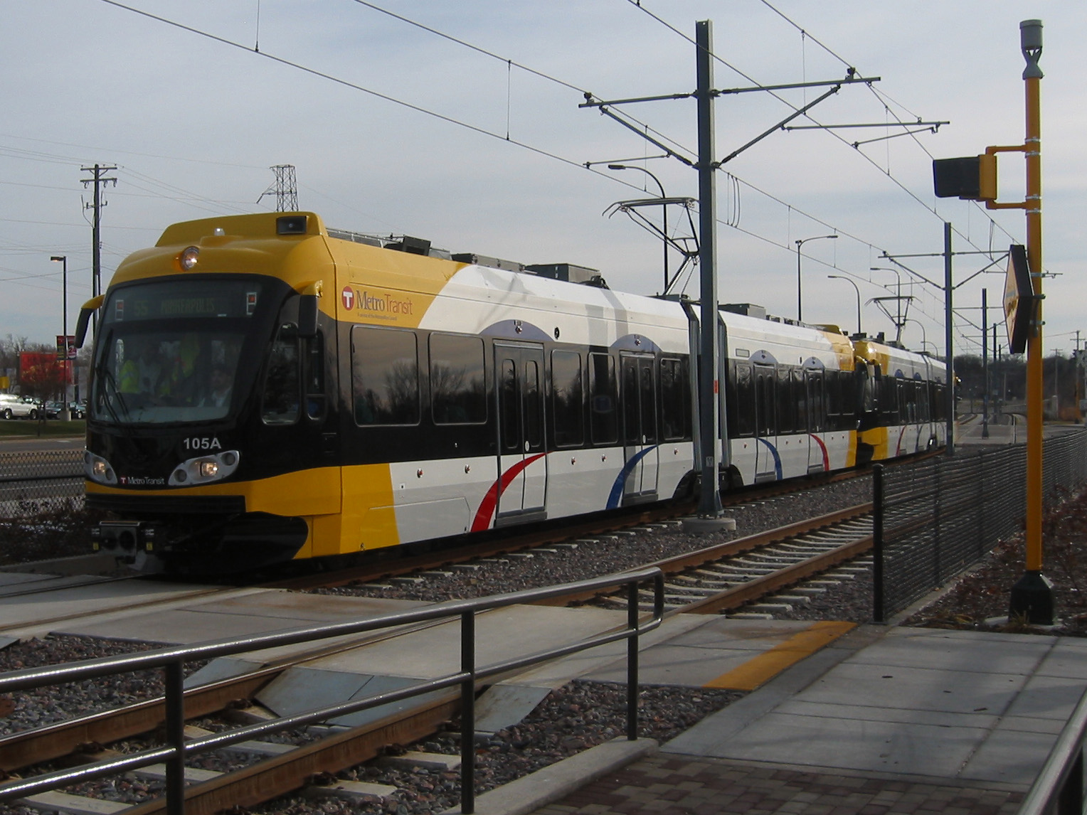
The Southwest LRT (Metro Green Line Extension) is an under–construction light rail transit corridor in Hennepin County, Minnesota, with service between Minneapolis and Eden Prairie. The estimated one-way travel time from Southwest Station in Eden Prairie to Target Field Station in Minneapolis is 32 minutes. The Southwest LRT will extend through St. Louis Park, Hopkins and Minnetonka along the route. Major locations on the line will include Bde Maka Ska, Cedar Lake, the Walker Art Center, the Minneapolis Sculpture Garden and Target Field in downtown Minneapolis. Hennepin County selected the alignment of the route and worked with the Metropolitan Council on environmental impact statements for the project. The Metropolitan Council is managing construction of the route. On November 15, 2018, the council accepted an $800 million construction bid by Lunda Construction and C.S. McCrossan, with early construction starting in December 2018. The project has had unexpected construc ... [...More Info...] [...Related Items...] OR: [Wikipedia] [Google] [Baidu] |
Blue Line (Minnesota)
The Metro Blue Line is a light rail line in Hennepin County, Minnesota, that is part of the Metro network. It travels from downtown Minneapolis to Minneapolis–Saint Paul International Airport and the southern suburb of Bloomington. Formerly the Hiawatha Line (Route 55) prior to May 2013, the line was originally named after the Milwaukee Road's Hiawatha passenger train and Hiawatha Avenue, reusing infrastructure from the former and running parallel to the latter for a portion of the route. The line opened June 26, 2004, and was the first light rail service in Minnesota. An extension, Bottineau LRT, is planned to open in 2028. The Blue Line is operated by Metro Transit, the primary bus and train operator in the Twin Cities. As of December 2022, the service operates from approximately 3:19am to 12:50am with 15minute headways most of the day. The route averaged 32,928 daily riders in 2019, representing 13 percent of Metro Transit's ridership. The line carried 10.6 mil ... [...More Info...] [...Related Items...] OR: [Wikipedia] [Google] [Baidu] |
Nicollet Avenue
Nicollet Avenue is a major street in Minneapolis, Richfield, Bloomington, and Burnsville in the U.S. state of Minnesota. It passes through a number of locally well-known neighborhoods and districts, notably Eat Street in south Minneapolis and the traffic-restricted Nicollet Mall in downtown Minneapolis. History It began as a military road between St. Anthony Falls and Fort Snelling. Nicollet Avenue was named for early 19th-century French explorer and cartographer Joseph Nicollet, who led three expeditions in what is now Minnesota. Nicollet Mall occupies the oldest section of the avenue. Before the mall was constructed in 1968, Nicollet Avenue stretched from the Mississippi River to the Minnesota River. One block of the street between 29th Street and Lake Street was removed in the 1977 to build a K-Mart store (opened in 1978) which covers two city blocks, detouring southbound traffic to Blaisdell Avenue and northbound traffic to First Avenue South. The city of Minneapolis h ... [...More Info...] [...Related Items...] OR: [Wikipedia] [Google] [Baidu] |
Midtown Greenway
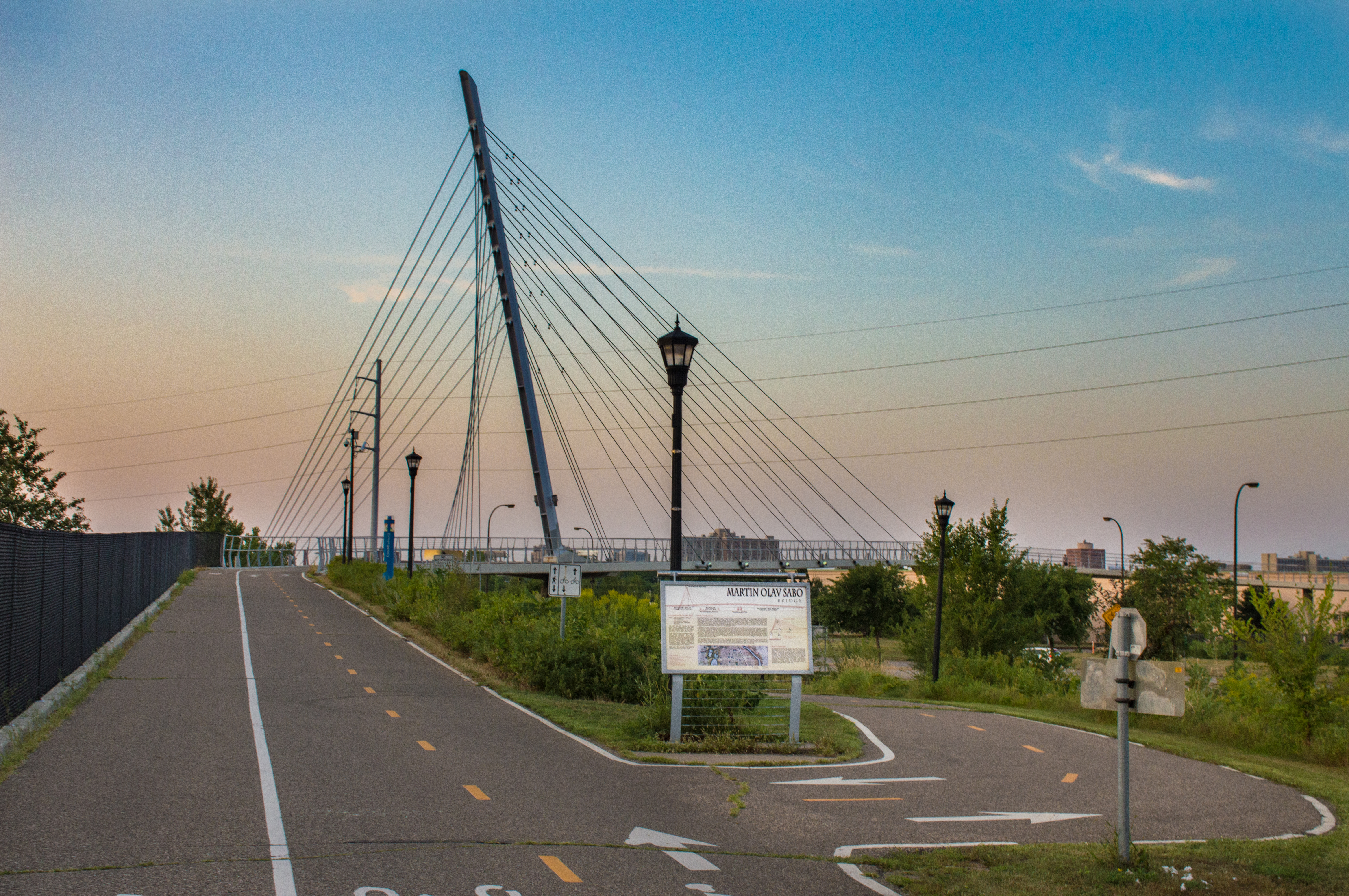
The Midtown Greenway is a rail trail in Minneapolis, Minnesota that follows the path of an abandoned route of the Milwaukee Road railway. It is considered under segregated cycle facilities. Used both recreationally and for commuting, the partially below-grade Greenway runs east–west about one block north of Lake Street. It provides cyclists, inline skaters, runners and pedestrians an almost automobile-free route across the city. History The Greenway lies in a former Milwaukee Road railroad corridor along 29th Street. This corridor had been abandoned west of Hiawatha Avenue but is still active east of Hiawatha as part of the Minnesota Commercial Railway. The rail line was originally built between 1879 and 1881; however, as traffic increased, the city of Minneapolis mandated a trench be built between Hiawatha and Irving avenues in 1910. The trench, bridges and retaining walls were evaluated in 1989 as part of the Reinforced-Concrete Highway Bridges in Minnesota MPS, an ... [...More Info...] [...Related Items...] OR: [Wikipedia] [Google] [Baidu] |
Chain Of Lakes (Minneapolis)
The Grand Rounds National Scenic Byway is a linked series of park areas in Minneapolis, Minnesota, United States, that takes a roughly circular path through the city. The Minneapolis Park and Recreation Board developed the system over many years. The corridors include roads for automobile traffic plus separate paths for pedestrians and bicycles, and extend slightly into neighboring cities. About of roadway and paths are in the system, and much of it was built in the 1930s as part of Civilian Conservation Corps projects. Byway districts There are seven districts along the byway: #Downtown Riverfront lies along the Mississippi River, and includes Saint Anthony Falls and nearby historic milling districts. The byway follows West River Parkway, beginning at Plymouth Avenue, passing Boom Island Park and Nicollet Island Park (both across the river), and Mill Ruins Park, adjacent to the Mill City Museum and the Stone Arch Bridge. #Mississippi River gorge area extends from downtown M ... [...More Info...] [...Related Items...] OR: [Wikipedia] [Google] [Baidu] |
Metropolitan Council
The Metropolitan Council, commonly abbreviated Met Council or Metro Council, is the regional governmental agency and metropolitan planning organization in Minnesota serving the Twin Cities seven-county metropolitan area, accounting for over 55 percent of the state's population. It is one of two multi-county regional governments in the United States, the other being the Portland Metro. The Met Council is granted regional authority powers in state statutes by the Minnesota Legislature. These powers are unique in that unlike the Regional Development Commissions they can supersede decisions and actions of local governments. The legislature created the Metro Council to maintain public services, oversee growth of the state's largest metro area and to act as the regional planning organization. Like the Metro in Portland, Oregon, it also administers an urban growth boundary. The Council's role in the Twin Cities metro area is defined by the necessary regional services it provides and ... [...More Info...] [...Related Items...] OR: [Wikipedia] [Google] [Baidu] |
Bottineau LRT
The Bottineau LRT (Metro Blue Line (Minnesota), Metro Blue Line Extension) is a proposed light rail line extension in the Minneapolis – Saint Paul Metro area, projected to run northwest from Target Field station in downtown Minneapolis along County Road 81 (Hennepin County, Minnesota), County Road 81 to Brooklyn Park, Minnesota, Brooklyn Park. The selected alignment was initially planned to run adjacent to a BNSF freight line, but opposition from the company has forced the project to be redesigned with a new routing. Alignment alternatives The Bottineau Transitway Alternative Analysis Study, released in 2009, outlined several different alternatives for both the northern and southern ends of the corridor. In 2010, the final AA report recommended the A-D1 light rail alignment as the best option, but also suggested B-D1, A-D2 and B-D2 should continue to be studied. A-D1 and B-D1 were also recommended for continued study as possible bus rapid transit alignments. Northern alter ... [...More Info...] [...Related Items...] OR: [Wikipedia] [Google] [Baidu] |
Hennepin County, MN
Hennepin County ( ) is a County (United States), county in the U.S. state of Minnesota. Its county seat is Minneapolis, the state's most populous city. The county is named in honor of the 17th-century explorer Father Louis Hennepin. The county extends from Minneapolis to the suburbs and outlying cities in the western part of the county. The county’s natural areas are covered with extensive woods, hills, and lakes. As of the 2020 United States census, 2020 census, the population was 1,281,565. It is the most populous county in Minnesota, and the List of the most populous counties in the United States, 34th-most populous county in the United States; more than one in five Minnesotans live in Hennepin County. Hennepin County is included in the Minneapolis-St. Paul, Minneapolis-St. Paul-Bloomington Metropolitan Statistical Area. History The Territorial Legislature of Minnesota established Hennepin County on March 6, 1852, and two years later Minneapolis was named the county sea ... [...More Info...] [...Related Items...] OR: [Wikipedia] [Google] [Baidu] |
Hopkins, MN
Hopkins is a small suburban city in Hennepin County, Minnesota, United States, located west of Minneapolis. Hopkins was the headquarters of Minneapolis-Moline, which was a large manufacturer of tractors and agricultural equipment in the United States until the 1960s. The southern end of town sits along the main line of the Twin Cities and Western Railroad. The city is four square miles in size and is surrounded by the larger suburban communities of Minnetonka, Saint Louis Park, and Edina. The population was 19,079 at the 2020 census. U.S. Highway 169 and Minnesota State Highway 7 are two of the main routes in the area. The city's main street was added to the National Register of Historic Places in 2022. Geography According to the United States Census Bureau, the city has a total area of , of which is land and is water. There are several small ponds on the western side of Hopkins, and creeks to the north and south. One of these creeks includes Minnehaha Creek. The north ... [...More Info...] [...Related Items...] OR: [Wikipedia] [Google] [Baidu] |
Interstate 94 In Minnesota
Interstate 94 (I-94) in the US state of Minnesota runs east–west through the central portion of the state. The highway connects the cities of Moorhead, Fergus Falls, Alexandria, St. Cloud, Minneapolis, and Saint Paul. Authorized in 1956, it was mostly constructed in the 1960s. Route description I-94 enters the state from North Dakota at the city of Moorhead and heads southeast after serving Moorhead. Traveling southeast from Moorhead, there are several places where the elevation of I-94 rises slightly; these are "beaches" that formed as the glacial lake rose or fell. Finally, at Rothsay, I-94 climbs the last beach line and enters terrain more typical for Minnesota. From Rothsay to the Twin Cities, the terrain of I-94 is rolling with frequent lakes visible from the highway. I-94 traverses by Fergus Falls, Alexandria, and Sauk Centre on its way to St. Cloud. The "original main street" in Sauk Centre near I-94 commemorates the Sinclair Lewis novel that skewered th ... [...More Info...] [...Related Items...] OR: [Wikipedia] [Google] [Baidu] |
Interstate 394
Interstate 394 (I-394) is a small east–west auxiliary Interstate Highway in Hennepin County in the US state of Minnesota. It is also commonly referred to by its pre-1991 name, Wayzata Boulevard, and by its other designation, US Highway 12 (US 12). It runs for from downtown Minneapolis to I-494 in the Minneapolis suburb of Minnetonka. At its western terminus, the roadway loses its Interstate designation but continues as US 12. I-394 serves as the most direct link for commuters and other drivers who are traveling between downtown Minneapolis and parts of the western Minneapolis–Saint Paul metropolitan area. I-394 maintains at least three lanes in each direction except under the Minnesota State Highway 100 (MN 100) interchange and also between I-94/ US 52 and its eastern terminus downtown. Route description I-394 begins on the western side of the Twin Cities in the suburb of Minnetonka, at its interchange with I-494 (exit 19). From ther ... [...More Info...] [...Related Items...] OR: [Wikipedia] [Google] [Baidu] |


