|
Southern Carpathians
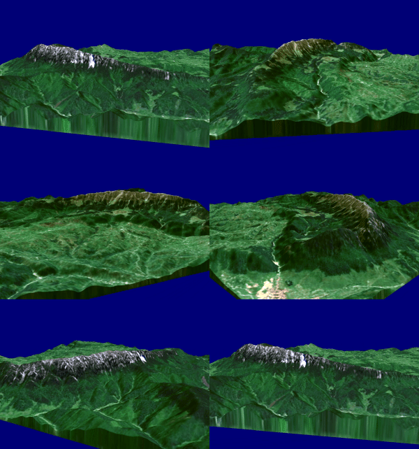
The Southern Carpathians (also known as the Transylvanian Alps; ro, Carpații Meridionali ; hu, Déli-Kárpátok) are a group of mountain ranges located in southern Romania. They cover the part of the Carpathian Mountains located between the Prahova River in the east and the Timiș and Cerna Rivers in the west. To the south they are bounded by the Balkan mountain range in eastern Serbia. Heights The Southern Carpathians are the second highest group of mountains in the Carpathian Mountain range (after Tatra), reaching heights of over 2,500 meters. Although considerably smaller than the Alps, they are classified as having an alpine landscape. Their high mountain character, combined with great accessibility, makes them popular with tourists and scientists. The highest peaks are: * Moldoveanu Peak, 2,544 metres – Făgăraș Mountains * Negoiu, 2,535 metres – Făgăraș Mountains * Parângu Mare, 2,519 metres – Parâng Mountains * Omu Peak 2,514 metres – Buceg ... [...More Info...] [...Related Items...] OR: [Wikipedia] [Google] [Baidu] |
Negoiu
Negoiu Peak ( ro, Vârful Negoiu ; hu, Negoj-csúcs) is a mountain peak in the Făgăraș Mountains of the Southern Carpathians, being located in Sibiu County, Romania, with an elevation of .2017 Romanian Statistical Yearbook p. 11 It is the second highest peak in Romania after Moldoveanu Peak (). References External links * * Mountains of Romania Mountains of the Southern Carpathians {{romania-geo-stub ...[...More Info...] [...Related Items...] OR: [Wikipedia] [Google] [Baidu] |
Bucegi Mountains
The Bucegi Mountains (Romanian: ''Munții Bucegi'' ) are located in central Romania, south of the city of Brașov. They are part of the Southern Carpathians group of the Carpathian Mountains. At , '' Omu'' is its highest point. To the east, the Bucegi Mountains have a very steep slope towards the popular tourist destinations in the Prahova Valley, such as Bușteni and Sinaia. At a higher elevation is the Bucegi Plateau, where wind and rain have turned the rocks into spectacular figures such as the Sphinx and '' Babele''. The Bucegi is believed to be the Dacian holy mountain ''Kogainon'', on which the God Zalmoxis resided in a cave. Name The exact origin of the name "Bucegi" is disputed by philologists. "Buceag" or "bugeac" seems to be the source of the name, a word designating in the language of mountain people both the moss in the forest and the wilderness or the junipers. An archaic version of the name "Bucegi" is "Buceci", name still used today by elders in the mountains, ... [...More Info...] [...Related Items...] OR: [Wikipedia] [Google] [Baidu] |
Făgăraș Mountains Group
The Făgăraș mountain group is a subgroup of mountains in the Southern Carpathians. It is named after the highest of the mountains in the group, the Făgăraș Mountains. Boundaries The Făgăraș group is bounded: *in the west, by the Olt River The Olt ( Romanian and Hungarian; german: Alt; la, Aluta or ', tr, Oltu, grc, Ἄλυτος ''Alytos'') is a river in Romania. It is long, and its basin area is . It is the longest river flowing exclusively through Romania. Its average disch ... *in the east, by the Rucăr-Bran Passage and the river Dâmbovița Mountains * Făgăraș Mountains (''Munții Făgărașului'') * Iezer Mountains (''Munții Iezer''; literally:''Mountains of the Deep Lake'') * Cozia Mountains (''Munții Cozia'') See also * Carpathian Mountains * Parâng Mountains group * Bucegi Mountains External links Pictures and images from the Fagaras Mountains group *http://www.carpati.org/ *http://www.alpinet.org/ {{DEFAULTSORT:Fagaras Mountain ranges of ... [...More Info...] [...Related Items...] OR: [Wikipedia] [Google] [Baidu] |
Leaotă Mountains
The Leaota Mountains are located in central Romania, north of the city Târgovişte. They are part of the Southern Carpathians group of the Carpathian Mountains, and have as neighbours the Bucegi Mountains The Bucegi Mountains (Romanian: ''Munții Bucegi'' ) are located in central Romania, south of the city of Brașov. They are part of the Southern Carpathians group of the Carpathian Mountains. At , '' Omu'' is its highest point. To the east, the ... to the east and Piatra Craiului to the west. The 2,133 meters high pyramidal Leaota peak raises in a superb land of dense fir forests, wild animals, few wanderer shepherds, and almost no tourists. Leaota tourist shelter (Romanian cabana) The shelter was built in the 1940s at an altitude of 1.330 meters above sea level. It is currently abandoned, being used sporadically by passing tourists. In 1962 the chalet had running water, electricity generator, permanent buffet and ski slopes arranged nearby. Until 2004, the chalet of t ... [...More Info...] [...Related Items...] OR: [Wikipedia] [Google] [Baidu] |
Piatra Craiului
The Piatra Craiului Mountains (german: Königstein, hu, Királykő-hegység) are a mountain range in the Southern Carpathians in Romania. Its name is translated as ''Kings' Rock'' or ''The Rock of the Prince''. The mountain range is located in Brașov and Argeș counties; it is included in the Piatra Craiului National Park, which covers an area of . The Piatra Craiului mountains form a narrow and saw-like ridge, which is about long. The highest elevation in the massif is the "Vârful La Om" at . The ridge is regarded as one of the most beautiful sites in the Carpathians. The two-day north–south ridge trail is both challenging and rewarding. Starting at either Plaiul Foii in the north-west or Curmătura in the north-east, walkers climb up to the ridge before following a somewhat precarious path along the narrow spine. The descent at the southern end leads into a karst landscape of deep gorges and pitted slopes where water penetrating the rock has carved a series of cave ... [...More Info...] [...Related Items...] OR: [Wikipedia] [Google] [Baidu] |
Dâmbovița River
Dâmbovița can refer to these places in Romania: * Dâmbovița County * Dâmbovița (river) * Dâmbovița Center, an unfinished Romanian building in Bucharest, near Cotroceni {{DEFAULTSORT:Dambovita ... [...More Info...] [...Related Items...] OR: [Wikipedia] [Google] [Baidu] |
Bucegi Mountains Group
The Bucegi Mountains (Romanian: ''Munții Bucegi'' ) are located in central Romania, south of the city of Brașov. They are part of the Southern Carpathians group of the Carpathian Mountains. At , '' Omu'' is its highest point. To the east, the Bucegi Mountains have a very steep slope towards the popular tourist destinations in the Prahova Valley, such as Bușteni and Sinaia. At a higher elevation is the Bucegi Plateau, where wind and rain have turned the rocks into spectacular figures such as the Sphinx and ''Babele''. The Bucegi is believed to be the Dacian holy mountain ''Kogainon'', on which the God Zalmoxis resided in a cave. Name The exact origin of the name "Bucegi" is disputed by philologists. "Buceag" or "bugeac" seems to be the source of the name, a word designating in the language of mountain people both the moss in the forest and the wilderness or the junipers. An archaic version of the name "Bucegi" is "Buceci", name still used today by elders in the mountains, and ... [...More Info...] [...Related Items...] OR: [Wikipedia] [Google] [Baidu] |
Rumunia 06 147
Romania ( ; ro, România ) is a country located at the crossroads of Central, Eastern, and Southeastern Europe. It borders Bulgaria to the south, Ukraine to the north, Hungary to the west, Serbia to the southwest, Moldova to the east, and the Black Sea to the southeast. It has a predominantly temperate-continental climate, and an area of , with a population of around 19 million. Romania is the twelfth-largest country in Europe and the sixth-most populous member state of the European Union. Its capital and largest city is Bucharest, followed by Iași, Cluj-Napoca, Timișoara, Constanța, Craiova, Brașov, and Galați. The Danube, Europe's second-longest river, rises in Germany's Black Forest and flows in a southeasterly direction for , before emptying into Romania's Danube Delta. The Carpathian Mountains, which cross Romania from the north to the southwest, include Moldoveanu Peak, at an altitude of . Settlement in what is now Romania began in the Lower Paleolithic, with ... [...More Info...] [...Related Items...] OR: [Wikipedia] [Google] [Baidu] |
Mesozoic
The Mesozoic Era ( ), also called the Age of Reptiles, the Age of Conifers, and colloquially as the Age of the Dinosaurs is the second-to-last era of Earth's geological history, lasting from about , comprising the Triassic, Jurassic and Cretaceous Periods. It is characterized by the dominance of archosaurian reptiles, like the dinosaurs; an abundance of conifers and ferns; a hot greenhouse climate; and the tectonic break-up of Pangaea. The Mesozoic is the middle of the three eras since Cambrian explosion, complex life evolved: the Paleozoic, the Mesozoic, and the Cenozoic. The era began in the wake of the Permian–Triassic extinction event, the largest well-documented mass extinction in Earth's history, and ended with the Cretaceous–Paleogene extinction event, another mass extinction whose victims included the non-avian dinosaurs, Pterosaur, pterosaurs, Mosasaur, mosasaurs, and Plesiosaur, plesiosaurs. The Mesozoic was a time of significant tectonic, climatic, and evolut ... [...More Info...] [...Related Items...] OR: [Wikipedia] [Google] [Baidu] |
Palaeozoic
The Paleozoic (or Palaeozoic) Era is the earliest of three geologic eras of the Phanerozoic Eon. The name ''Paleozoic'' ( ;) was coined by the British geologist Adam Sedgwick in 1838 by combining the Greek words ''palaiós'' (, "old") and ''zōḗ'' (), "life", meaning "ancient life" ). It is the longest of the Phanerozoic eras, lasting from , and is subdivided into six geologic periods (from oldest to youngest): # Cambrian # Ordovician # Silurian # Devonian # Carboniferous # Permian The Paleozoic comes after the Neoproterozoic Era of the Proterozoic Eon and is followed by the Mesozoic Era. The Paleozoic was a time of dramatic geological, climatic, and evolutionary change. The Cambrian witnessed the most rapid and widespread diversification of life in Earth's history, known as the Cambrian explosion, in which most modern phyla first appeared. Arthropods, molluscs, fish, amphibians, reptiles, and synapsids all evolved during the Paleozoic. Life began in the ocean ... [...More Info...] [...Related Items...] OR: [Wikipedia] [Google] [Baidu] |
Jiu River
The Jiu (; hu, Zsil ; german: Schil or Schiel; la, Rabon) is a river in southern Romania. It is formed near Petroșani by the confluence of headwaters Jiul de Vest and Jiul de Est. It flows southward through the Romanian counties Hunedoara, Gorj and Dolj before flowing into the Danube near Zăval, a few kilometers upstream from the Bulgarian city of Oryahovo. It is long, including its source river Jiul de Vest. It has a basin of . p. 13 Its average at the i ... [...More Info...] [...Related Items...] OR: [Wikipedia] [Google] [Baidu] |


