|
South Tunbridge Methodist Episcopal Church
The South Tunbridge Methodist Episcopal Church is a historic church on Vermont Route 110, about one-third of a mile north of the Royalton town line in Tunbridge, Vermont. Built in 1833, it is one of the finest examples of late Federal period architecture in Orange County, and was a mainstay of social and civic life in southern Tunbridge for many years. It was listed on the National Register of Historic Places in 2001. Description and history The South Tunbridge Methodist Episcopal Church stands facing east on the west side of Vermont 110, on a rise overlooking the road and the adjacent First Branch White River. It is one of two public buildings in what is now a rural cluster of residences; to its south stands a 1920s community hall. The church is a single-story brick structure, with a gabled roof and stone foundation. The roof is topped by a single-stage clapboarded square tower, which is topped by a corniced flat roof, and has arched louvered openings for the belfry. The ... [...More Info...] [...Related Items...] OR: [Wikipedia] [Google] [Baidu] |
Vermont Route 110
Vermont Route 110 (VT 110) is a state highway in the U.S. state of Vermont. The highway runs from VT 14 in Royalton in northern Windsor County north to U.S. Route 302 (US 302) in the town of Barre in central Washington County. VT 110 follows the valley of the First Branch White River through the Orange County towns of Tunbridge and Chelsea, which contain multiple historic buildings and covered bridges. The highway also follows the Jail Branch River, a tributary of the Winooski River, through Washington and Orange. Route description VT 110 begins at a four-way intersection with VT 14 next to the confluence of the White River and the First Branch White River in the town of Royalton. The south leg of the intersection is Chelsea Street, which crosses the White River into the village of South Royalton, which contains the South Royalton Historic District and the Vermont Law School. VT 110 heads north as a two-lane highway through the valley of the First Br ... [...More Info...] [...Related Items...] OR: [Wikipedia] [Google] [Baidu] |
Royalton, Vermont
Royalton is a town in Windsor County, Vermont, United States. The population was 2,750 at the 2020 census. It includes the villages of Royalton, South Royalton, and North Royalton. Vermont Law School, the state's only accredited law school, is located in South Royalton. History The town was chartered on November 23, 1769 by Cadwallader Colden, Royal Lieutenant Governor of New York. The first permanent settlers were Robert Havens and his family, who arrived in 1771. Royalton was re-chartered by the Independent Republic of Vermont on December 20, 1781. The 1780 Royalton Raid was the last major British raid of the American War of Independence in New England. In 1848, the Vermont Central Railroad opened to South Royalton, which developed as a freight depot. During the Revolutionary War Royalton was visited by Gilbert du Motier, Marquis de Lafayette Although Joseph Smith, founder of Mormonism, was born in the adjacent town of Sharon near the Royalton boundary, the Joseph Smi ... [...More Info...] [...Related Items...] OR: [Wikipedia] [Google] [Baidu] |
Tunbridge, Vermont
Tunbridge is a town in Orange County, Vermont, United States. As of the 2020 United States Census the town population was 1,337. The town consists of three village centers, all situated on Vermont Route 110 in the valley of the first branch of the White River. The three settlements are named North Tunbridge (also known locally as "Blood Village"), Tunbridge Village ("Market") and South Tunbridge ("Jigger"). Historic sites The entire center of Tunbridge Village, including the fairgrounds, was placed on the National Register of Historic Places in 1994. Officially the district listing is ''"Roughly, along VT 110 and adjacent rds. including Town Rd. 45 and Spring and Strafford Rds."'' Tunbridge has five covered bridges (all listed on the National Register) * Cilley Bridge – southwest of Tunbridge Village (off Howe Lane from VT 110) * Flint Bridge – North Tunbridge on Bicknell Hill Road (off VT 110) * Larkin Bridge – North Tunbridge on Larkin Road (off VT 110) * Howe Bri ... [...More Info...] [...Related Items...] OR: [Wikipedia] [Google] [Baidu] |
Orange County, Vermont
Orange County is a county located in the U.S. state of Vermont. As of the 2020 census, the population was 29,277. Its shire town (county seat) is the town of Chelsea. Orange County was organized on February 2, 1781, as an original county within the state. Geography According to the U.S. Census Bureau, the county has an area of , of which is land and (0.8%) is water. Adjacent counties * Caledonia County – northeast * Grafton County, New Hampshire – east * Windsor County – southwest * Addison County – west * Washington County – northwest Demographics 2000 census As of the census of 2000, the county had 28,226 people, 10,936 households, and 7,611 families. The population density was 41 people per square mile (16/km2). There were 13,386 housing units at an average density of 19 per square mile (8/km2). The county's racial makeup was 98.02% White, 0.24% Black or African American, 0.27% Native American, 0.35% Asian, 0.04% Pacific Islander, 0.13% from other ... [...More Info...] [...Related Items...] OR: [Wikipedia] [Google] [Baidu] |
National Register Of Historic Places
The National Register of Historic Places (NRHP) is the United States federal government's official list of districts, sites, buildings, structures and objects deemed worthy of preservation for their historical significance or "great artistic value". A property listed in the National Register, or located within a National Register Historic District, may qualify for tax incentives derived from the total value of expenses incurred in preserving the property. The passage of the National Historic Preservation Act (NHPA) in 1966 established the National Register and the process for adding properties to it. Of the more than one and a half million properties on the National Register, 95,000 are listed individually. The remainder are contributing resources within historic districts. For most of its history, the National Register has been administered by the National Park Service (NPS), an agency within the U.S. Department of the Interior. Its goals are to help property owners and inte ... [...More Info...] [...Related Items...] OR: [Wikipedia] [Google] [Baidu] |
White River (Vermont)
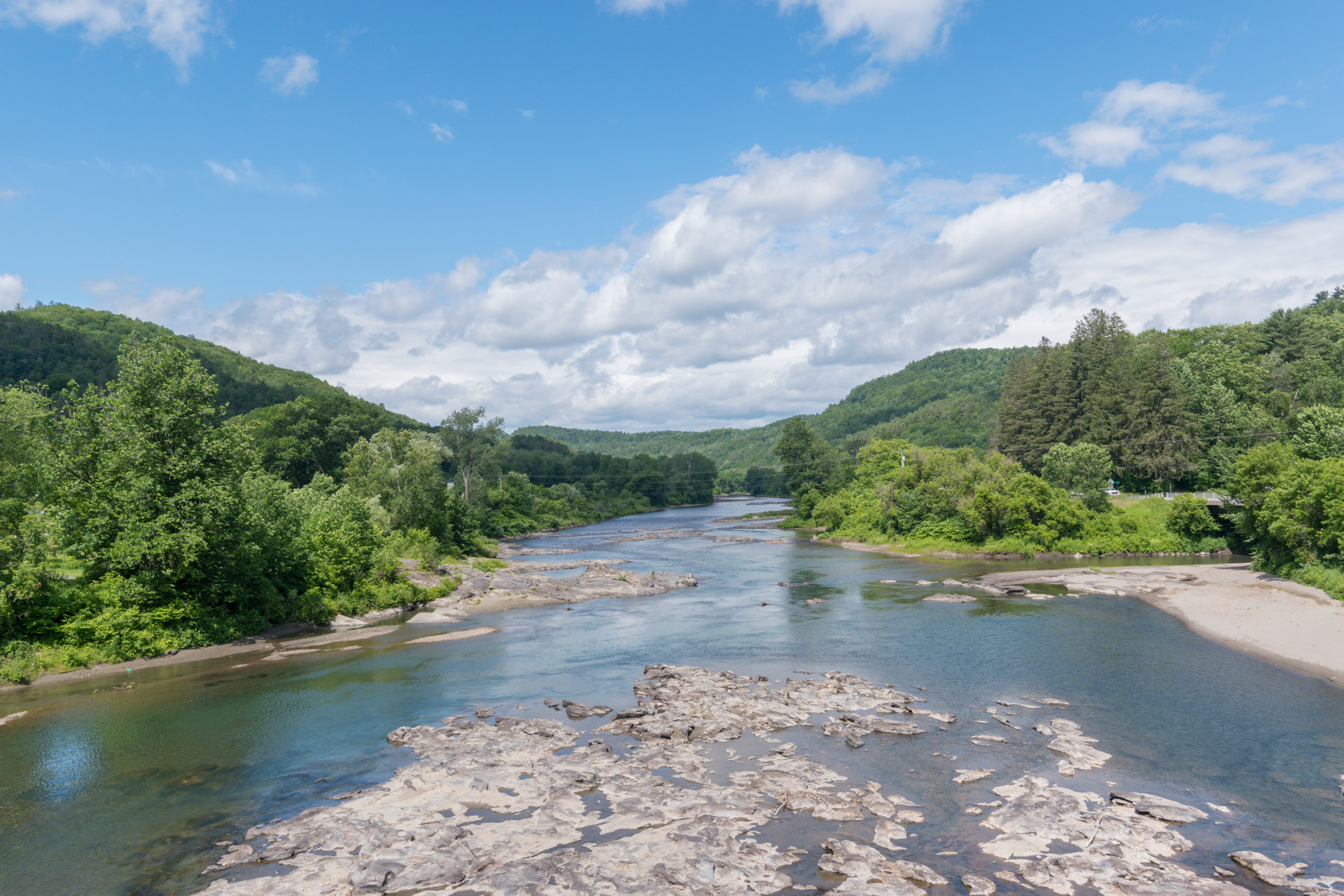
The White River is a U.S. Geological Survey. National Hydrography Dataset high-resolution flowline dataThe National Map accessed April 1, 2011 river in the U.S. state of Vermont. It is a tributary of the Connecticut River, and is the namesake of the White River Valley. The White River rises at Skylight Pond south of Bread Loaf Mountain near the crest of the Green Mountains. The river flows east to the town of Granville, where it receives the outflow from the southern portion of Granville Notch. The river turns south and, followed by Vermont Route 100, flows through the towns of Hancock and Rochester. Entering Stockbridge, the river turns northeast and, followed by Vermont Route 107, flows to the town of Bethel, where the Third Branch of the White River enters from the north. The Second Branch and the First Branch of the White River also enter from the north as the river flows through Royalton. From Royalton to the river's mouth, the valley is occupied by Interstate 89 and ... [...More Info...] [...Related Items...] OR: [Wikipedia] [Google] [Baidu] |
Ogee
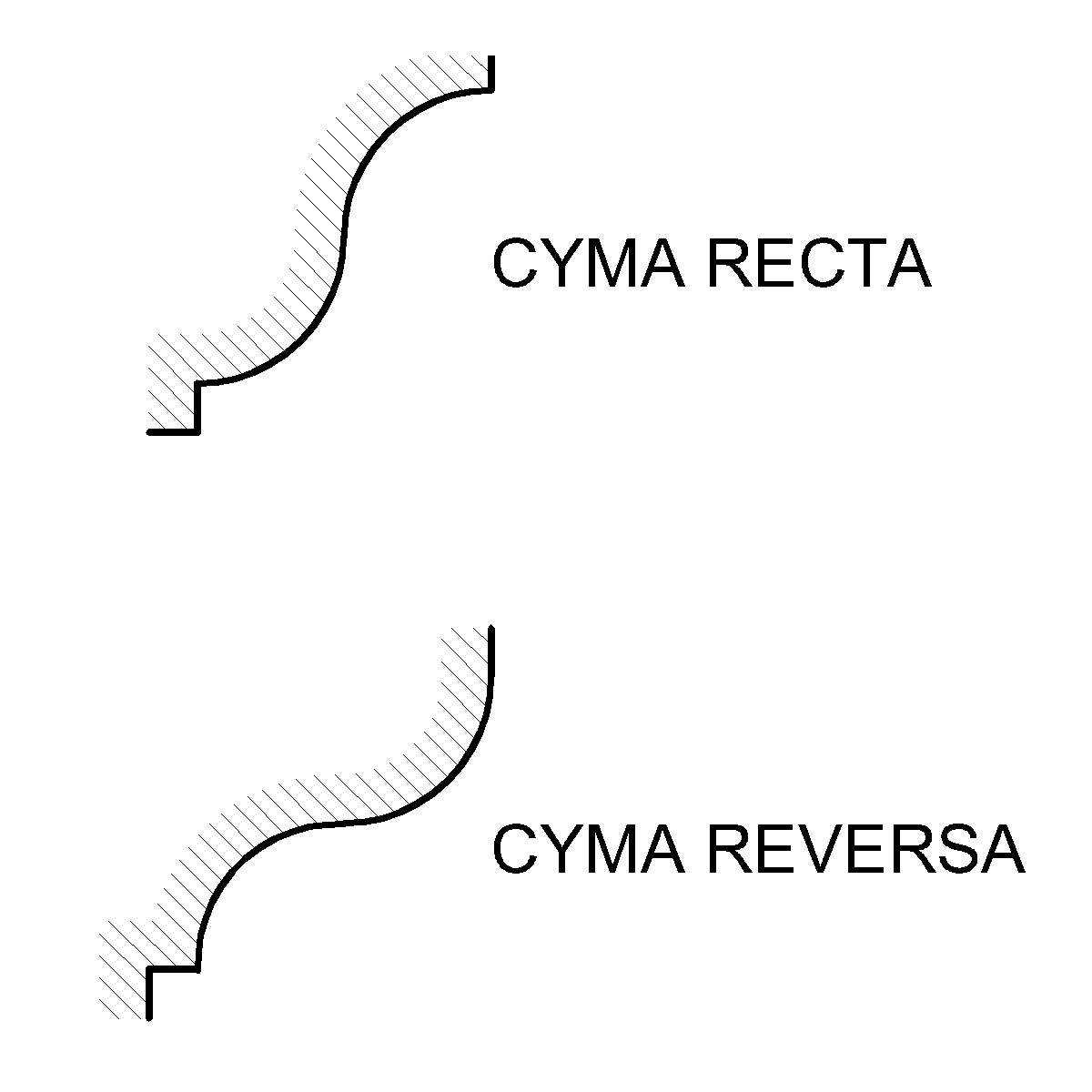
An ogee ( ) is the name given to objects, elements, and curves—often seen in architecture and building trades—that have been variously described as serpentine-, extended S-, or sigmoid-shaped. Ogees consist of a "double curve", the combination of two semicircular curves or arcs that, as a result of a point of inflection from concave to convex or ''vice versa'', have ends of the overall curve that point in opposite directions (and have tangents that are approximately parallel). First seen in textiles in the 12th century, the use of ogee elements—in particular, in the design of arches—has been said to characterise various Gothic and Gothic Revival architectural styles. The shape has many such uses in architecture from those periods to the present day, including in the ogee arch in these architectural styles, where two ogees oriented as mirror images compose the sides of the arch, and in decorative molding designs, where single ogees are common profiles (see opening image) ... [...More Info...] [...Related Items...] OR: [Wikipedia] [Google] [Baidu] |
National Park Service
The National Park Service (NPS) is an agency of the United States federal government within the U.S. Department of the Interior that manages all national parks, most national monuments, and other natural, historical, and recreational properties with various title designations. The U.S. Congress created the agency on August 25, 1916, through the National Park Service Organic Act. It is headquartered in Washington, D.C., within the main headquarters of the Department of the Interior. The NPS employs approximately 20,000 people in 423 individual units covering over 85 million acres in all 50 states, the District of Columbia, and US territories. As of 2019, they had more than 279,000 volunteers. The agency is charged with a dual role of preserving the ecological and historical integrity of the places entrusted to its management while also making them available and accessible for public use and enjoyment. History Yellowstone National Park was created as the first national par ... [...More Info...] [...Related Items...] OR: [Wikipedia] [Google] [Baidu] |
National Register Of Historic Places Listings In Orange County, Vermont
__NOTOC__ This is a list of the National Register of Historic Places listings in Orange County, Vermont. This is intended to be a complete list of the properties and districts on the National Register of Historic Places in Orange County, Vermont, United States. Latitude and longitude coordinates are provided for many National Register properties and districts; these locations may be seen together in a map. There are 63 properties and districts listed on the National Register in the county, including 1 National Historic Landmark. Current listings See also * List of National Historic Landmarks in Vermont * National Register of Historic Places listings in Vermont References {{Orange County, Vermont Orange Orange most often refers to: *Orange (fruit), the fruit of the tree species '' Citrus'' × ''sinensis'' ** Orange blossom, its fragrant flower *Orange (colour), from the color of an orange, occurs betwe ... [...More Info...] [...Related Items...] OR: [Wikipedia] [Google] [Baidu] |
Methodist Churches In Vermont
Methodism, also called the Methodist movement, is a group of historically related denominations of Protestant Christianity whose origins, doctrine and practice derive from the life and teachings of John Wesley. George Whitefield and John's brother Charles Wesley were also significant early leaders in the movement. They were named ''Methodists'' for "the methodical way in which they carried out their Christian faith". Methodism originated as a revival movement within the 18th-century Church of England and became a separate denomination after Wesley's death. The movement spread throughout the British Empire, the United States, and beyond because of vigorous missionary work, today claiming approximately 80 million adherents worldwide. Wesleyan theology, which is upheld by the Methodist churches, focuses on sanctification and the transforming effect of faith on the character of a Christian. Distinguishing doctrines include the new birth, assurance, imparted righte ... [...More Info...] [...Related Items...] OR: [Wikipedia] [Google] [Baidu] |


.jpg)