|
Somersetshire (1810 Ship)
''Somersetshire'', was launched in 1810 on the River Thames as a West Indiaman. She made two voyages to Australia transporting convicts, and one in between with passengers. On the second convict transport voyage some convicts and guards planned a mutiny that her captain was able to foil. ''Somersetshire'' is last listed in 1844. In between convict transport contracts, she made numerous other voyages, including a diarised (by "BJ" Barker Joseph Benson) voyage to Bombay (Mumbai) and back in 1838. Career ''Somersetshire'' first appeared in ''Lloyd's Register'' (''LR'') in the volume for 1810. Captain Robert Haly (or Haley, or Hayley) received a letter of marque for ''Somersetshire'' on 9 March 1811."Register of Letters of Marque against France 1793-1815"; p.87 On Mo ... [...More Info...] [...Related Items...] OR: [Wikipedia] [Google] [Baidu] |
Rotherhithe
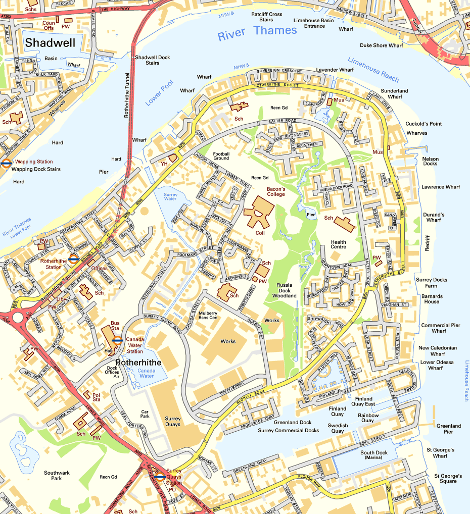
Rotherhithe () is a district of south-east London, England, and part of the London Borough of Southwark. It is on a peninsula on the south bank of the Thames, facing Wapping, Shadwell and Limehouse on the north bank, as well as the Isle of Dogs to the east of the Thames and is a part of the London Docklands, Docklands area. It borders Bermondsey to the west and Deptford to the south east. Rotherhithe has a long history as a port, with Elizabethan era, Elizabethan shipyards and working docks until the 1970s. In the 1980s, the area along the river was redeveloped as housing through a mix of warehouse conversions and new-build developments. Following the arrival of the Jubilee line in 1999 (giving quick connections to the West End of London, West End and to Canary Wharf) and the London Overground in 2010 (providing a quick route to the City of London), the rest of Rotherhithe is now a gentrification, gentrifying residential and commuter area, with urban regeneration progressing arou ... [...More Info...] [...Related Items...] OR: [Wikipedia] [Google] [Baidu] |
Canary Islands
The Canary Islands (; es, Canarias, ), also known informally as the Canaries, are a Spanish autonomous community and archipelago in the Atlantic Ocean, in Macaronesia. At their closest point to the African mainland, they are west of Morocco. They are the southernmost of the autonomous communities of Spain. The islands have a population of 2.2 million people and they are the most populous special territory of the European Union. The seven main islands are (from largest to smallest in area) Tenerife, Fuerteventura, Gran Canaria, Lanzarote, La Palma, La Gomera, and El Hierro. The archipelago includes many smaller islands and islets, including La Graciosa, Alegranza, Isla de Lobos, Montaña Clara, Roque del Oeste, and Roque del Este. It also includes a number of rocks, including those of Salmor, Fasnia, Bonanza, Garachico, and Anaga. In ancient times, the island chain was often referred to as "the Fortunate Isles". The Canary Islands are the southernmost region of Spain, and ... [...More Info...] [...Related Items...] OR: [Wikipedia] [Google] [Baidu] |
Plymouth
Plymouth () is a port city and unitary authority in South West England. It is located on the south coast of Devon, approximately south-west of Exeter and south-west of London. It is bordered by Cornwall to the west and south-west. Plymouth's early history extends to the Bronze Age when a first settlement emerged at Mount Batten. This settlement continued as a trading post for the Roman Empire, until it was surpassed by the more prosperous village of Sutton founded in the ninth century, now called Plymouth. In 1588, an English fleet based in Plymouth intercepted and defeated the Spanish Armada. In 1620, the Pilgrim Fathers departed Plymouth for the New World and established Plymouth Colony, the second English settlement in what is now the United States of America. During the English Civil War, the town was held by the Roundhead, Parliamentarians and was besieged between 1642 and 1646. Throughout the Industrial Revolution, Plymouth grew as a commercial shipping port, handling ... [...More Info...] [...Related Items...] OR: [Wikipedia] [Google] [Baidu] |
Thomas Boutflower Bennett
Thomas Boutflower Bennett (1808–14 September 1894) was an early colonist of South Australia, remembered as a schoolmaster at J. L. Young's Adelaide Educational Institution and at Saint Peter's College. He married Elizabeth (14 January 1811–11 February 1899) and with two children arrived at Holdfast Bay on the ''Somersetshire'' on 24 August 1839.Death of Mrs A. W. Bennett ''South Australian Register'' 21 February 1899 p.5 accessed 26 September 2011 perhaps misprint for E. W. (Elizabeth Wiggins?) He started a distillery on the banks of the at Klemzig, but was closed down by the ... [...More Info...] [...Related Items...] OR: [Wikipedia] [Google] [Baidu] |
Seychelles
Seychelles (, ; ), officially the Republic of Seychelles (french: link=no, République des Seychelles; Creole: ''La Repiblik Sesel''), is an archipelagic state consisting of 115 islands in the Indian Ocean. Its capital and largest city, Victoria, is east of mainland Africa. Nearby island countries and territories include the Comoros, Madagascar, Mauritius, and the French overseas departments of Mayotte and Réunion to the south; and Maldives and the Chagos Archipelago (administered by the United Kingdom as the British Indian Ocean Territory) to the east. It is the least populated sovereign African country, with an estimated 2020 population of 98,462. Seychelles was uninhabited prior to being encountered by Europeans in the 16th century. It faced competing French and British interests until coming under full British control in the late 18th century. Since proclaiming independence from the United Kingdom in 1976, it has developed from a largely agricultural society to ... [...More Info...] [...Related Items...] OR: [Wikipedia] [Google] [Baidu] |
Sperm Oil
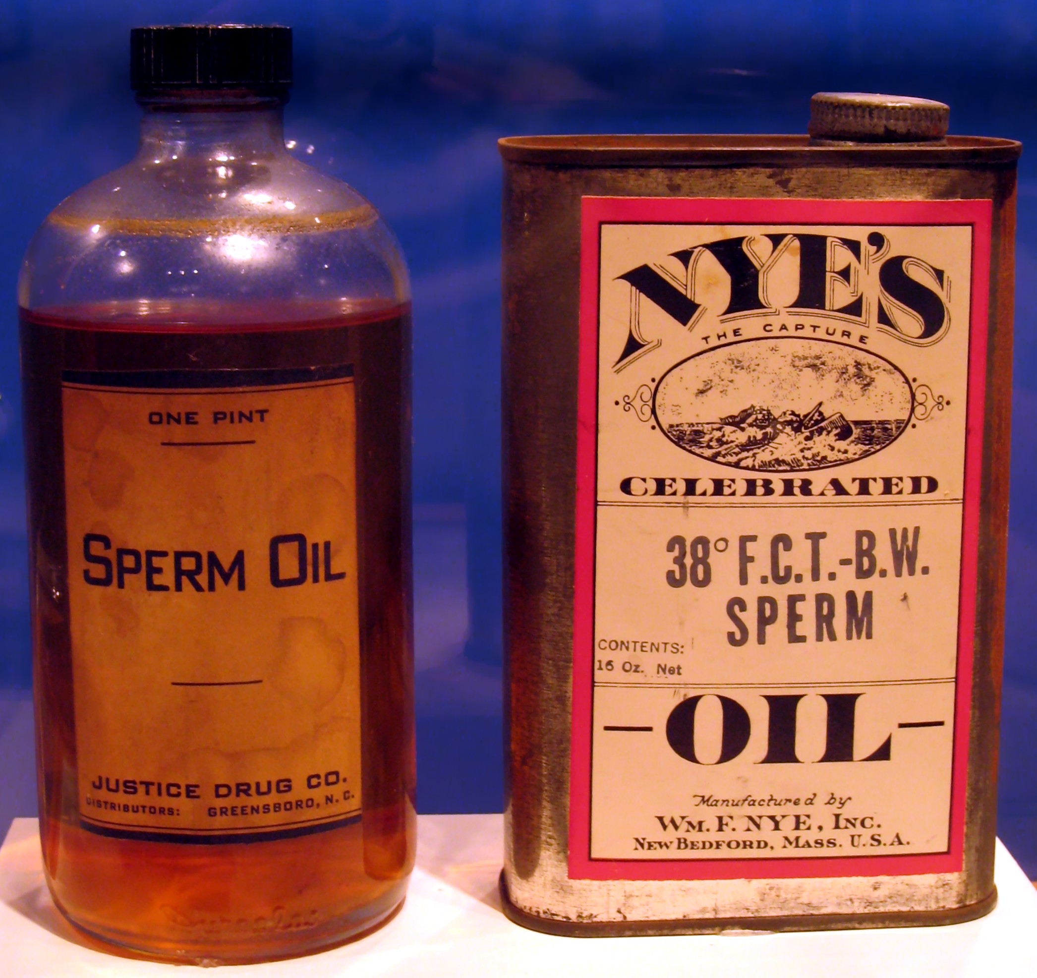
Sperm oil is a waxy liquid obtained from sperm whales. It is a clear, yellowish liquid with a very faint odor. Sperm oil has a different composition from common whale oil, obtained from rendered blubber. Although it is traditionally called an "oil", it is technically a liquid wax. It is composed of wax esters with a small proportion of triglycerides, an ester of an unsaturated fatty acid, and a branched-chain fatty alcohol. ransmission Digest, Volume 26, No. 2, October 2006, "The Science of Synthetic Sperm Whale Oil"/ref> It is a natural antioxidant and heat-transfer agent. In the late-18th and early-19th centuries, sperm oil was prized as an illuminant for its bright, odorless flame and as a lubricant for its low viscosity and stability. It was supplanted in the late 19th century by less expensive alternatives such as kerosene and petroleum-based lubricants. With the 1987 international ban on whaling, sperm oil is no longer legally sold. The oil from bottlenose whales was som ... [...More Info...] [...Related Items...] OR: [Wikipedia] [Google] [Baidu] |
Mauritius
Mauritius ( ; french: Maurice, link=no ; mfe, label=Mauritian Creole, Moris ), officially the Republic of Mauritius, is an island nation in the Indian Ocean about off the southeast coast of the African continent, east of Madagascar. It includes the main island (also called Mauritius), as well as Rodrigues, Agaléga and St. Brandon. The islands of Mauritius and Rodrigues, along with nearby Réunion (a French overseas department), are part of the Mascarene Islands. The main island of Mauritius, where most of the population is concentrated, hosts the capital and largest city, Port Louis. The country spans and has an exclusive economic zone covering . Arab sailors were the first to discover the uninhabited island, around 975, and they called it ''Dina Arobi''. The earliest discovery was in 1507 by Portuguese sailors, who otherwise took little interest in the islands. The Dutch took possession in 1598, establishing a succession of short-lived settlements over a period of about ... [...More Info...] [...Related Items...] OR: [Wikipedia] [Google] [Baidu] |
Madagascar
Madagascar (; mg, Madagasikara, ), officially the Republic of Madagascar ( mg, Repoblikan'i Madagasikara, links=no, ; french: République de Madagascar), is an island country in the Indian Ocean, approximately off the coast of East Africa across the Mozambique Channel. At Madagascar is the world's List of island countries, second-largest island country, after Indonesia. The nation is home to around 30 million inhabitants and consists of the island of Geography of Madagascar, Madagascar (the List of islands by area, fourth-largest island in the world), along with numerous smaller peripheral islands. Following the prehistoric breakup of the supercontinent Gondwana, Madagascar split from the Indian subcontinent around 90 million years ago, allowing native plants and animals to evolve in relative isolation. Consequently, Madagascar is a biodiversity hotspot; over 90% of wildlife of Madagascar, its wildlife is endemic. Human settlement of Madagascar occurred during or befo ... [...More Info...] [...Related Items...] OR: [Wikipedia] [Google] [Baidu] |
Cape Sainte Marie
Cape Sainte Marie ( mg, Tanjona Vohimena; french: cap Sainte-Marie), formerly known as Cape Romain and Cape St. Mary, is the southernmost point of Madagascar. It is situated in the Androy region from Tsiombe Tsihombe (or: Tsiombe) is a municipality in Androy Region, Madagascar. It is situated at the Manambovo River and the Route nationale 10 Route nationale 10, or RN 10, is a trunk (route nationale) in France between Paris and the border with Spain .... It is the location of the Cap Sainte-Marie Special Reserve, a nature reserve which occupies most of the cape and was created in 1962. References Landforms of Madagascar[...More Info...] [...Related Items...] OR: [Wikipedia] [Google] [Baidu] |
Cape Of Good Hope
The Cape of Good Hope ( af, Kaap die Goeie Hoop ) ;''Kaap'' in isolation: pt, Cabo da Boa Esperança is a rocky headland on the Atlantic coast of the Cape Peninsula in South Africa. A common misconception is that the Cape of Good Hope is the southern tip of Africa, based on the misbelief that the Cape was the dividing point between the Atlantic and Indian oceans, and have nothing to do with north or south. In fact, by looking at a map, the southernmost point of Africa is Cape Agulhas about to the east-southeast. The currents of the two oceans meet at the point where the warm-water Agulhas current meets the cold-water Benguela current and turns back on itself. That oceanic meeting point fluctuates between Cape Agulhas and Cape Point (about east of the Cape of Good Hope). When following the western side of the African coastline from the equator, however, the Cape of Good Hope marks the point where a ship begins to travel more eastward than southward. Thus, the first mode ... [...More Info...] [...Related Items...] OR: [Wikipedia] [Google] [Baidu] |
New South Wales
) , nickname = , image_map = New South Wales in Australia.svg , map_caption = Location of New South Wales in AustraliaCoordinates: , subdivision_type = Country , subdivision_name = Australia , established_title = Before federation , established_date = Colony of New South Wales , established_title2 = Establishment , established_date2 = 26 January 1788 , established_title3 = Responsible government , established_date3 = 6 June 1856 , established_title4 = Federation , established_date4 = 1 January 1901 , named_for = Wales , demonym = , capital = Sydney , largest_city = capital , coordinates = , admin_center = 128 local government areas , admin_center_type = Administration , leader_title1 = Monarch , leader_name1 = Charles III , leader_title2 = Governor , leader_name2 = Margaret Beazley , leader_title3 = Premier , leader_name3 = Dominic Perrottet (Liberal) , national_representation = Parliament of Australia , national_representation_type1 = Senat ... [...More Info...] [...Related Items...] OR: [Wikipedia] [Google] [Baidu] |
São Nicolau, Cape Verde
São Nicolau (Portuguese for ''Saint Nicholas'') is one of the Barlavento (Windward) islands of Cape Verde. It is located between the islands of Santa Luzia and Sal. Its population is 12,424 (2015),Cabo Verde, Statistical Yearbook 2015 Instituto Nacional de Estatística with an area of . The main towns are Ribeira Brava and |


