|
Siorarsuk Peninsula
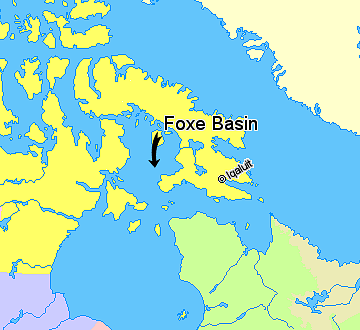
Siuraarjuk (Inuktitut syllabics: ''ᓯᐅᕌᕐᔪᒃ'') formerly Siorarsuk Peninsula is a finger-shaped peninsula in northern Baffin Island in the Qikiqtaaluk Region of Nunavut, Canada. It juts into the Foxe Basin north of the Melville Peninsula. The island of Kapuiviit is southeast of it, separated by the South Passage. Bowhead whales are known to congregate in the area until western Igloolik Igloolik ( Inuktitut syllabics: , ''Iglulik'', ) is an Inuit hamlet in Foxe Basin, Qikiqtaaluk Region in Nunavut, northern Canada. Because its location on Igloolik Island is close to Melville Peninsula, it is often mistakenly thought to be on th ... is ice-free, at which time they travel to that region. References Peninsulas of Baffin Island Foxe Basin {{QikiqtaalukNU-geo-stub ... [...More Info...] [...Related Items...] OR: [Wikipedia] [Google] [Baidu] |
Qikiqtaaluk Region
The Qikiqtaaluk Region, Qikiqtani Region (Inuktitut syllabics: ᕿᑭᖅᑖᓗᒃ ) or Baffin Region is the easternmost, northernmost, and southernmost administrative region of Nunavut, Canada. Qikiqtaaluk is the traditional Inuktitut name for Baffin Island. Although the Qikiqtaaluk Region is the most commonly used name in official contexts, several notable public organizations, including Statistics Canada prefer the older term Baffin Region. With a population of 18,988 and an area of , it is the largest and most populated of the three regions. The region consists of Baffin Island, the Belcher Islands, Akimiski Island, Mansel Island, Prince Charles Island, Bylot Island, Devon Island, Baillie-Hamilton Island, Cornwallis Island, Bathurst Island, Amund Ringnes Island, Ellef Ringnes Island, Axel Heiberg Island, Ellesmere Island, the Melville Peninsula, the eastern part of Melville Island, and the northern parts of both Prince of Wales Island and Somerset Island, plus s ... [...More Info...] [...Related Items...] OR: [Wikipedia] [Google] [Baidu] |
Nunavut
Nunavut ( , ; iu, ᓄᓇᕗᑦ , ; ) is the largest and northernmost Provinces and territories of Canada#Territories, territory of Canada. It was separated officially from the Northwest Territories on April 1, 1999, via the ''Nunavut Act'' and the ''Nunavut Land Claims Agreement, Nunavut Land Claims Agreement Act'', which provided this territory to the Inuit for independent government. The boundaries had been drawn in 1993. The creation of Nunavut resulted in the territorial evolution of Canada, first major change to Canada's political map in half a century since the province of Newfoundland and Labrador, Newfoundland was admitted in 1949. Nunavut comprises a major portion of Northern Canada and most of the Arctic Archipelago. Its vast territory makes it the list of the largest country subdivisions by area, fifth-largest country subdivision in the world, as well as North America's second-largest (after Greenland). The capital Iqaluit (formerly Frobisher Bay), on Baffin Islan ... [...More Info...] [...Related Items...] OR: [Wikipedia] [Google] [Baidu] |
Inuktitut Syllabics
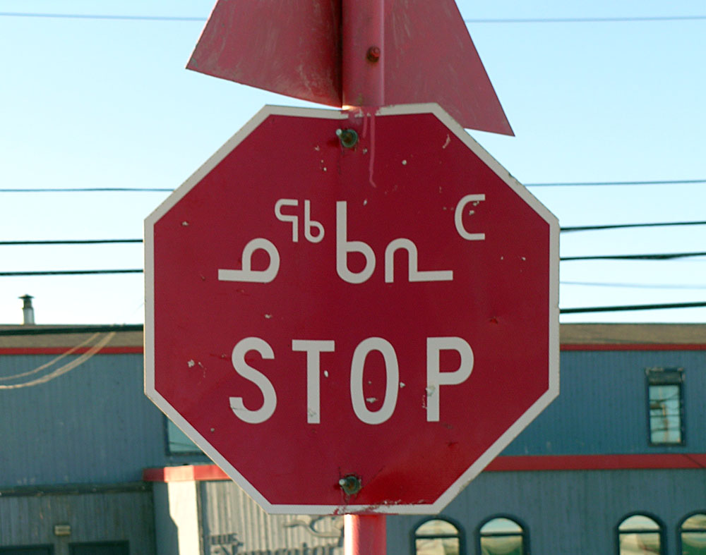
Inuktitut syllabics ( iu, ᖃᓂᐅᔮᖅᐸᐃᑦ, qaniujaaqpait, or , ) is an abugida-type writing system used in Canada by the Inuktitut-speaking Inuit of the territory of Nunavut and the Nunavik and Nunatsiavut regions of Quebec and Labrador, respectively. In 1976, the Language Commission of the Inuit Cultural Institute made it the co-official script for the Inuit languages, along with the Latin script. The name derives from the root , meaning "mouth". The alternative, Latin-based writing system is named (), and it derives from , a word describing the markings or the grain in rocks. meaning "new writing system" is to be seen in contrast to (), the "old syllabics" used before the reforms of 1976. History The first efforts to write Inuktitut came from Moravian missionaries in Greenland and Labrador in the mid-19th century using Latin script. The first book printed in Inuktitut using Cree script was an 8-page pamphlet known as ''Selections from the Gospels in the di ... [...More Info...] [...Related Items...] OR: [Wikipedia] [Google] [Baidu] |
Peninsula
A peninsula (; ) is a landform that extends from a mainland and is surrounded by water on most, but not all of its borders. A peninsula is also sometimes defined as a piece of land bordered by water on three of its sides. Peninsulas exist on all continents. The size of a peninsula can range from tiny to very large. The largest peninsula in the world is the Arabian Peninsula. Peninsulas form due to a variety of causes. Etymology Peninsula derives , which is translated as 'peninsula'. itself was derived , or together, 'almost an island'. The word entered English in the 16th century. Definitions A peninsula is usually defined as a piece of land surrounded on most, but not all sides, but is sometimes instead defined as a piece of land bordered by water on three of its sides. A peninsula may be bordered by more than one body of water, and the body of water does not have to be an ocean or a sea. A piece of land on a very tight river bend or one between two rivers is sometimes s ... [...More Info...] [...Related Items...] OR: [Wikipedia] [Google] [Baidu] |
Baffin Island
Baffin Island (formerly Baffin Land), in the Canadian territory of Nunavut, is the largest island in Canada and the fifth-largest island in the world. Its area is , slightly larger than Spain; its population was 13,039 as of the 2021 Canadian census; and it is located at . It also contains the city of Iqaluit, the capital of Nunavut. Name The Inuktitut name for the island is , which means "very big island" ( "island" + "very big") and in Inuktitut syllabics is written as . This name is used for the administrative region the island is part of ( Qikiqtaaluk Region), as well as in multiple places in Nunavut and the Northwest Territories, such as some smaller islands: Qikiqtaaluk in Baffin Bay and Qikiqtaaluk in Foxe Basin. Norse explorers referred to it as ("stone land"). In 1576, English seaman Martin Frobisher made landfall on the island, naming it "Queen Elizabeth's Foreland" and Frobisher Bay is named after him. The island is named after English explorer William Baff ... [...More Info...] [...Related Items...] OR: [Wikipedia] [Google] [Baidu] |
Foxe Basin
Foxe Basin is a shallow oceanic basin north of Hudson Bay, in Nunavut, Canada, located between Baffin Island and the Melville Peninsula. For most of the year, it is blocked by sea ice (fast ice) and drift ice made up of multiple ice floes. The nutrient-rich cold waters found in the basin are known to be especially favourable to phytoplankton and the numerous islands within it are important bird habitats, including Sabine's gulls and many types of shorebirds. Bowhead whales migrate to the northern part of the basin each summer. The basin takes its name from the English explorer Luke Foxe who entered the lower part in 1631. Waterway Foxe Basin is a broad, predominantly shallow depression, generally less than in depth, while to the south, depths of up to occur. The tidal range decreases from in the southeast to less than in the northwest. During much of the year, landfast ice dominates in the north, while pack ice prevails towards the south. Foxe Basin itself is rarely ice ... [...More Info...] [...Related Items...] OR: [Wikipedia] [Google] [Baidu] |
Melville Peninsula
Melville Peninsula is a large peninsula in the Canadian Arctic north of Hudson Bay. To the east is Foxe Basin and to the west the Gulf of Boothia. To the north the Fury and Hecla Strait separates it from Baffin Island. To the south Repulse Bay and Frozen Strait separate it from Southampton Island at the north end of Hudson Bay. On the southwest it is connected to the mainland by the Rae Isthmus, named after the Arctic explorer John Rae. Between 1821 and 1823 its east side was mapped by William Edward Parry, who named the peninsula (along with Melville Island) after Robert Dundas, 2nd Viscount Melville First Sea Lord of the Admirality. Since 1999, it has been part of Nunavut. Before that, it was part of the District of Franklin. Most of the peninsula lies in Nunavut's Qikiqtaaluk Region, while its southwesternmost section, around Repulse Bay, lies in the Kivalliq Region. Communities on the peninsula include the hamlets of Naujaat and Sanirajak. The hamlet of Igloolik is loca ... [...More Info...] [...Related Items...] OR: [Wikipedia] [Google] [Baidu] |
Kapuiviit
Kapuiviit (Inuktitut syllabics: ''ᑲᐳᐃᕖᑦ'') formerly Jens Munk Island, for Dano-Norwegian explorer Jens Munk, is one of the Canadian arctic islands in the Qikiqtaaluk Region, Nunavut, Canada. It is an uninhabited Baffin Island offshore island with an area of . The island presently has no permanent resident population (since displacements driven by colonialism took place in the 1950s and 1960s) but it remains an important outpost camp in the Igloolik Island area. Historically, however, it was the location of Kapuivik, a hunting camp which is now an important archaeological site for the research of pre-Inuit peoples including the Dorset (Tuniit), Pre-Dorset and Paleo-Inuit. Kapuivik was also the birthplace of noted film director Zacharias Kunuk. [...More Info...] [...Related Items...] OR: [Wikipedia] [Google] [Baidu] |
Bowhead Whale
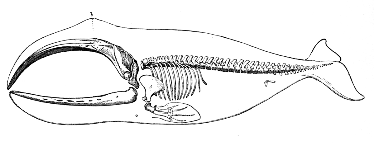
The bowhead whale (''Balaena mysticetus'') is a species of baleen whale belonging to the family Balaenidae and the only living representative of the genus ''Balaena''. They are the only baleen whale endemic to the Arctic and subarctic waters, and are named after their characteristic massive triangular skull, which they use to break through Arctic ice. Other common names of the species are the Greenland right whale, Arctic whale, and Arviq in aboriginal languages ( Inuktitut). American whalemen called them the steeple-top, polar whale, or Russian whale. Bowheads have the largest mouth of any animal representing almost one-third of the length of the body, the longest baleen plates with a maximum length of and may be the longest-lived mammals, with the ability to reach an age of more than 200 years. The bowhead was an early whaling target. Their population was severely reduced before a 1966 moratorium was passed to protect the species. Of the five stocks of bowhead population ... [...More Info...] [...Related Items...] OR: [Wikipedia] [Google] [Baidu] |
Igloolik
Igloolik ( Inuktitut syllabics: , ''Iglulik'', ) is an Inuit hamlet in Foxe Basin, Qikiqtaaluk Region in Nunavut, northern Canada. Because its location on Igloolik Island is close to Melville Peninsula, it is often mistakenly thought to be on the peninsula. The name "Igloolik" means "there is a house here". It derives from meaning house or building, and refers to the sod houses that were originally in the area, not to snow igloos. In Inuktitut the residents are called Iglulingmiut (the suffix ''miut'' means "people of"). History Information about the area’s earliest inhabitants comes mainly from numerous archaeological sites on the island; some dating back more than 4,000 years. First contact with Europeans came when British Navy ships HMS ''Fury'' and HMS ''Hecla'', under the command of Captain William Edward Parry, wintered in Igloolik in 1822. The island was visited in 1867 and 1868 by the American explorer Charles Francis Hall in his search for survivors of the lost ... [...More Info...] [...Related Items...] OR: [Wikipedia] [Google] [Baidu] |
Peninsulas Of Baffin Island
A peninsula (; ) is a landform that extends from a mainland and is surrounded by water on most, but not all of its borders. A peninsula is also sometimes defined as a piece of land bordered by water on three of its sides. Peninsulas exist on all continents. The size of a peninsula can range from tiny to very large. The largest peninsula in the world is the Arabian Peninsula. Peninsulas form due to a variety of causes. Etymology Peninsula derives , which is translated as 'peninsula'. itself was derived , or together, 'almost an island'. The word entered English in the 16th century. Definitions A peninsula is usually defined as a piece of land surrounded on most, but not all sides, but is sometimes instead defined as a piece of land bordered by water on three of its sides. A peninsula may be bordered by more than one body of water, and the body of water does not have to be an ocean or a sea. A piece of land on a very tight river bend or one between two rivers is sometimes s ... [...More Info...] [...Related Items...] OR: [Wikipedia] [Google] [Baidu] |


