|
Sinopah
Sinopah (Ap'-ah-ki) (c. 1796-c. 1880) was a Blackfeet Confederacy woman married to interpreter Hugh Monroe. She was also the daughter of Blackfeet Confederacy Chief Lone Walker. Sinopah Mountain, located in Glacier National Park in the U.S. state of Montana, in named after her. Sinopah means "kit fox" in Blackfeet. Life Sinopah was born in the Montana Territory and was part of the Blackfeet Confederacy. Her father was Pikuni Chief Lone Walker (Ni-to-wa-wa-ka). In 1820 she married Hugh "Rising Wolf" Monroe, a white trapper and interpreter who became part of the Blackfeet tribe. During their marriage they were trappers and hunters in multiple places including the Canadian province of Saskatchewan, Fort Benton, Montana, and the area around Glacier National Park. Differing accounts list the couple as having between seven and ten children. Family members reported that she died before 1880 but the exact date and place are unknown. Mountains named for her father (Lone Walker M ... [...More Info...] [...Related Items...] OR: [Wikipedia] [Google] [Baidu] |
Sinopah Mountain
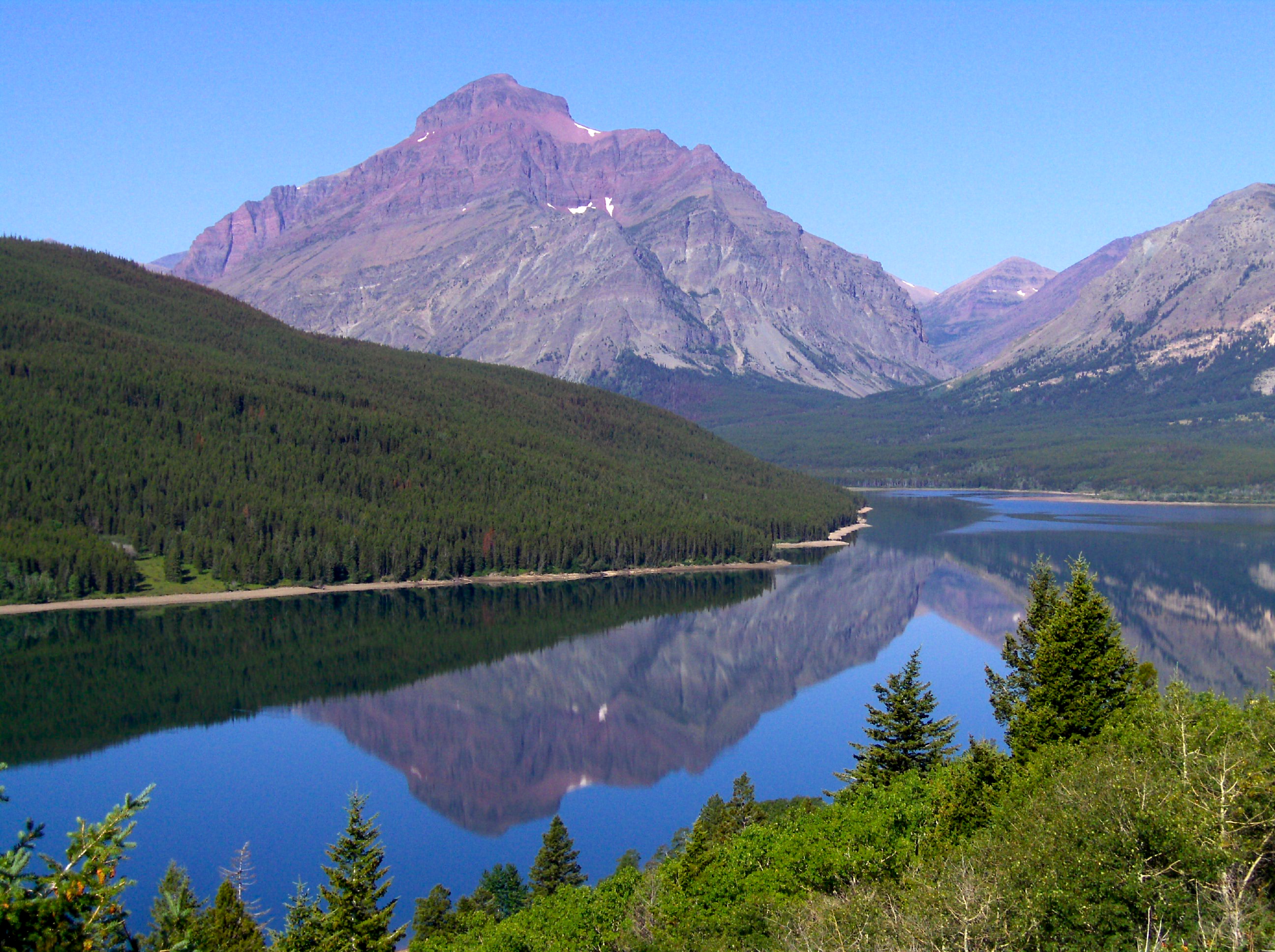
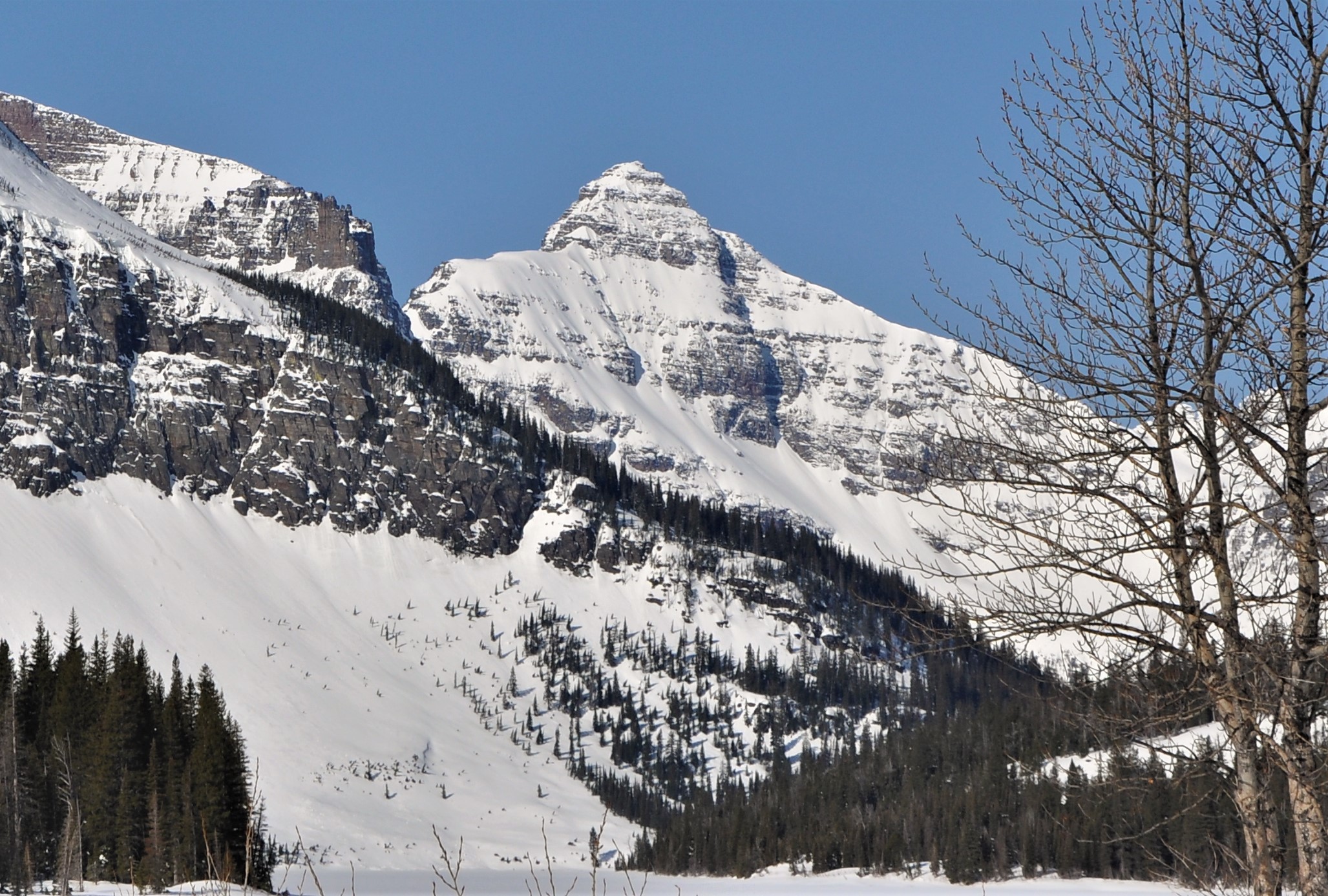
Sinopah Mountain () is located in the Lewis Range, Glacier National Park in the U.S. state of Montana. Sinopah Mountain rises prominently to the west of Two Medicine Lake. Sinopah means, ""kit fox" in Blackfeet, (who) was the Indian wife of Hugh Monroe (Rising Wolf) and daughter of Lone Walker, a powerful Blackfeet chief." Geology Like other mountains in Glacier National Park, the peak is composed of sedimentary rock laid down during the Precambrian to Jurassic periods. Formed in shallow seas, this sedimentary rock was initially uplifted beginning 170 million years ago when the Lewis Overthrust fault pushed an enormous slab of precambrian rocks thick, wide and long over younger rock of the cretaceous period. Climate Based on the Köppen climate classification, the peak is located in an alpine subarctic climate The subarctic climate (also called subpolar climate, or boreal climate) is a climate with long, cold (often very cold) winters, and short, warm to cool summers ... [...More Info...] [...Related Items...] OR: [Wikipedia] [Google] [Baidu] |
Hugh Monroe
Hugh Monroe (1798-1892) was a Canadian trapper, guide, and interpreter. He worked for Hudson's Bay Company, American Fur Company, and independently throughout his life. He traveled with the Piikani Nation and was known as "Rising Wolf," with Rising Wolf Mountain later named after him. Biography Monroe was born on July 9, 1798 in Trois-Rivières, Quebec. His fatherHugh Monroe(spelled Munro at the time), was a captain in the British Army and his grandfather was Capt. John Munro, a prominent loyalist. His mother, Angelique de la Roche, née Leroux, was the daughter of a royal family who was part of the French Emigration. He attended English school in Montreal before moving on to a priest's college for four years, learning to speak both English and French. He began hunting at an early age and later and developed an interest for the outdoors. He later worked for Hudson's Bay Company where he worked as an apprentice-clerk in uncharted areas of modern-day Alberta. During a trip to ... [...More Info...] [...Related Items...] OR: [Wikipedia] [Google] [Baidu] |
Lone Walker
Lone Walker (Ni-to-wa-wa-ka) was a Blackfoot Confederacy chief. Lone Walker Mountain is named after Lone Walker. He was the father of Sinopah who married interpreter Hugh Monroe Hugh Monroe (1798-1892) was a Canadian trapper, guide, and interpreter. He worked for Hudson's Bay Company, American Fur Company, and independently throughout his life. He traveled with the Piikani Nation and was known as "Rising Wolf," with Rising .... References {{NorthAm-native-stub Blackfoot people ... [...More Info...] [...Related Items...] OR: [Wikipedia] [Google] [Baidu] |
Glacier National Park (US)
Glacier National Park is an American national park located in northwestern Montana, on the Canada–United States border, adjacent to the Canadian provinces of Alberta and British Columbia. The park encompasses more than and includes parts of two mountain ranges (sub-ranges of the Rocky Mountains), more than 130 named lakes, more than 1,000 different species of plants, and hundreds of species of animals. This vast pristine ecosystem is the centerpiece of what has been referred to as the "Crown of the Continent Ecosystem," a region of protected land encompassing . The region that became Glacier National Park was first inhabited by Native Americans. Upon the arrival of European explorers, it was dominated by the Blackfeet in the east and the Flathead in the western regions. Under pressure, the Blackfeet ceded the mountainous parts of their treaty lands in 1895 to the federal government; it later became part of the park. Soon after the establishment of the park on May 11, 1910, a ... [...More Info...] [...Related Items...] OR: [Wikipedia] [Google] [Baidu] |
Montana Territory
The Territory of Montana was an organized incorporated territory of the United States that existed from May 26, 1864, until November 8, 1889, when it was admitted as the 41st state in the Union as the state of Montana. Original boundaries The Montana Territory was organized out of the existing Idaho Territory by Act of Congress and signed into law by President Abraham Lincoln on May 26, 1864. The areas east of the Continental Divide had been previously part of the Nebraska Territory and Dakota Territory and had been acquired by the United States in the Louisiana Purchase. The territory also included a portion of the Idaho Territory west of the continental divide and east of the Bitterroot Range, which had been acquired by the United States in the Oregon Treaty, and originally included in the Oregon Territory. The part of the Oregon Territory that became part of Montana had been split off as part of the Washington Territory. The boundary between the Washington Territory and ... [...More Info...] [...Related Items...] OR: [Wikipedia] [Google] [Baidu] |
Blackfeet Confederacy
The Blackfoot Confederacy, ''Niitsitapi'' or ''Siksikaitsitapi'' (ᖹᐟᒧᐧᒣᑯ, meaning "the people" or " Blackfoot-speaking real people"), is a historic collective name for linguistically related groups that make up the Blackfoot or Blackfeet people: the '' Siksika'' ("Blackfoot"), the '' Kainai or Blood'' ("Many Chiefs"), and two sections of the Peigan or Piikani ("Splotchy Robe") – the Northern Piikani (''Aapátohsipikáni'') and the Southern Piikani (''Amskapi Piikani'' or ''Pikuni''). Broader definitions include groups such as the ''Tsúùtínà'' ( Sarcee) and ''A'aninin'' ( Gros Ventre) who spoke quite different languages but allied with or joined the Blackfoot Confederacy. Historically, the member peoples of the Confederacy were nomadic bison hunters and trout fishermen, who ranged across large areas of the northern Great Plains of western North America, specifically the semi-arid shortgrass prairie ecological region. They followed the bison herds as they ... [...More Info...] [...Related Items...] OR: [Wikipedia] [Google] [Baidu] |
Montana
Montana () is a state in the Mountain West division of the Western United States. It is bordered by Idaho to the west, North Dakota and South Dakota to the east, Wyoming to the south, and the Canadian provinces of Alberta, British Columbia, and Saskatchewan to the north. It is the fourth-largest state by area, the eighth-least populous state, and the third-least densely populated state. Its state capital is Helena. The western half of Montana contains numerous mountain ranges, while the eastern half is characterized by western prairie terrain and badlands, with smaller mountain ranges found throughout the state. Montana has no official nickname but several unofficial ones, most notably "Big Sky Country", "The Treasure State", "Land of the Shining Mountains", and " The Last Best Place". The economy is primarily based on agriculture, including ranching and cereal grain farming. Other significant economic resources include oil, gas, coal, mining, and lumber. The health ca ... [...More Info...] [...Related Items...] OR: [Wikipedia] [Google] [Baidu] |
Canadian Province
Within the geographical areas of Canada, the ten provinces and three territories are sub-national administrative divisions under the jurisdiction of the Canadian Constitution. In the 1867 Canadian Confederation, three provinces of British North America—New Brunswick, Nova Scotia, and the Province of Canada (which upon Confederation was divided into Ontario and Quebec)—united to form a federation, becoming a fully independent country over the next century. Over its history, Canada's international borders have changed several times as it has added territories and provinces, making it the world's second-largest country by area. The major difference between a Canadian province and a territory is that provinces receive their power and authority from the ''Constitution Act, 1867'' (formerly called the ''British North America Act, 1867''), whereas territorial governments are creatures of statute with powers delegated to them by the Parliament of Canada. The powers flowing from th ... [...More Info...] [...Related Items...] OR: [Wikipedia] [Google] [Baidu] |
Saskatchewan
Saskatchewan ( ; ) is a Provinces and territories of Canada, province in Western Canada, western Canada, bordered on the west by Alberta, on the north by the Northwest Territories, on the east by Manitoba, to the northeast by Nunavut, and on the south by the United States, U.S. states of Montana and North Dakota. Saskatchewan and Alberta are the only landlocked provinces of Canada. In 2022, Saskatchewan's population was estimated at 1,205,119. Nearly 10% of Saskatchewan’s total area of is fresh water, mostly rivers, reservoirs and List of lakes in Saskatchewan, lakes. Residents primarily live in the southern prairie half of the province, while the northern half is mostly forested and sparsely populated. Roughly half live in the province's largest city Saskatoon or the provincial capital Regina, Saskatchewan, Regina. Other notable cities include Prince Albert, Saskatchewan, Prince Albert, Moose Jaw, Yorkton, Swift Current, North Battleford, Melfort, Saskatchewan, Melfort, and ... [...More Info...] [...Related Items...] OR: [Wikipedia] [Google] [Baidu] |
Fort Benton, Montana
Fort Benton is a city in and the county seat of Chouteau County, Montana, United States. Established in 1846, Fort Benton is the oldest continuously occupied settlement in Montana. The city's waterfront area, the most important aspect of its 19th century growth, was designated the Fort Benton Historic District, a National Historic Landmark, in 1961. The population was 1,449 at the 2020 census. History Established in 1846 by Alexander Culbertson, who worked for Auguste Chouteau and Pierre Chouteau, Jr. of St. Louis, the original fort was the last fur trading post on the Upper Missouri River, Chouteau County Courthouse, 2009 the fort became an important economic center. For 30 years, the port attracted steamboats carrying goods, merchants, gold miners and settlers, coming from New Orleans, Memphis, St. Louis, Hannibal, Bismarck, Kansas City, etc. As the terminus for the 642-mile-long Mullan Road, completed by the United States Army in 1860, and at the head of navigation of ... [...More Info...] [...Related Items...] OR: [Wikipedia] [Google] [Baidu] |
Lone Walker Mountain
Lone Walker Mountain () is located in the Lewis Range, Glacier National Park in the U.S. state of Montana. Lone Walker Mountain is situated immediately southwest of Upper Two Medicine Lake along the Continental Divide. Climate Based on the Köppen climate classification, it is located in an alpine subarctic climate zone with long, cold, snowy winters, and cool to warm summers. Temperatures can drop below −10 °F with wind chill factors below −30 °F. Geology Like other mountains in Glacier National Park, it is composed of sedimentary rock laid down during the Precambrian to Jurassic periods. Formed in shallow seas, this sedimentary rock was initially uplifted beginning 170 million years ago when the Lewis Overthrust fault pushed an enormous slab of precambrian rocks thick, wide and long over younger rock of the cretaceous The Cretaceous ( ) is a geological period that lasted from about 145 to 66 million years ago (Mya). It is the third and final period o ... [...More Info...] [...Related Items...] OR: [Wikipedia] [Google] [Baidu] |


