|
Shippingport, Kentucky
Shippingport, Kentucky is an industrial site and one of the six formerly independent settlements at the Falls of the Ohio in what is now Louisville, Kentucky. It was located on a peninsula on the south bank of the Ohio River, and incorporated without a name on October 10, 1785. It was later named Campbell Town after Revolutionary War soldier and settler John Campbell. He had been granted the land for his earlier service in the French & Indian War. In 1803 the settlement was sold to a Philadelphia-based partnership and renamed Shippingport. Two Tarascon brothers became leaders of the French business community at the Falls, building a large warehouse, a 1200-foot rope walk, and a six-story water-powered flour mill at the site by 1819. Numerous French families settled in the area, making it a center of French culture for a time. Some of the French settlers came from Kaskaskia, Illinois, and other areas of French settlement along the Mississippi River after the United States complet ... [...More Info...] [...Related Items...] OR: [Wikipedia] [Google] [Baidu] |
Shippingport
Shippingport is a borough in western Beaver County, Pennsylvania, United States, located along the Ohio River. The population was 159 at the 2020 census. It is part of the Pittsburgh metropolitan area. Shippingport is home to the Beaver Valley Nuclear Power Station, and formerly the Bruce Mansfield Power Plant and Shippingport Atomic Power Station, the world's first full-scale atomic electric power plant devoted exclusively to peacetime uses. Nuclear energy Shippingport is the site of the United States' first commercial nuclear power plant, the Shippingport Atomic Power Station, which began operation in 1957. Although the original Shippingport reactor was decommissioned in 1982, the Beaver Valley Nuclear Power Station Units 1 and 2 from the same site have been in operation since 1976 and 1987, respectively. Geography Shippingport is located in west-central Beaver County at (40.623594, -80.424691), on the south side of the Ohio River. It is bordered to the southwest by Gre ... [...More Info...] [...Related Items...] OR: [Wikipedia] [Google] [Baidu] |
Paris, Kentucky
Paris is a home rule-class city in Bourbon County, Kentucky. It lies northeast of Lexington on the Stoner Fork of the Licking River. Paris is the seat of its county and forms part of the Lexington–Fayette Metropolitan Statistical Area. As of 2020 it has a population of 9,846. History Joseph Houston settled a station in the area in 1776, but was forced to relocate due to prior land grants. In 1786, Lawrence Protzman purchased the area of present-day Paris from its owners, platted for a town, and offered land for public buildings in exchange for the Virginia legislature making the settlement the seat of the newly formed Bourbon County. In 1789, the town was formally established as Hopewell after Hopewell, New Jersey, his hometown. The next year it was renamed Paris after the French capital to match its county and honor the French assistance during the American Revolution. Among the early settlers in the late 18th and early 19th centuries were French refugees who had fl ... [...More Info...] [...Related Items...] OR: [Wikipedia] [Google] [Baidu] |
History Of The French In Louisville
The influence of those of French ancestry on Louisville, Kentucky, USA and the surrounding area, especially New Albany, Indiana, is immense. Louisville was even named for a French king, Louis XVI. Before Louisville a French outpost existed called La Belle. 18th century Louisville was almost completely settled by French immigrants from the Rhine. Early French immigrants came in three phases; the first group of about 15,000 settled mostly on the coastal states. The first French settlers of Louisville were second- and third-generation American-born Huguenots. The first generation arrived in North America in 1685 after the Edict of Nantes was repealed. These were represented by such people as Thomas Bullitt, a surveyor who started Bullitt's Lick, Kentucky's oldest industry. The second significant immigration was mainly of culture value during the American Revolution as most of the French that came overseas during this time returned after the war. The third migration during the French R ... [...More Info...] [...Related Items...] OR: [Wikipedia] [Google] [Baidu] |
History Of Louisville, Kentucky
The geology of the Ohio River, with but a single series of rapids halfway in its length from the confluence of the Monongahela and Allegheny rivers to its union with the Mississippi, made it inevitable that a town would grow on the site. Louisville, Kentucky was chartered in the late 18th century. From its early days on the frontier, it quickly grew to be a major trading and distribution center in the mid 19th century, important industrial city in the early 20th, declined in the mid 20th century, before revitalizing in the late 20th century as a culturally-focused mid-sized American city. The history of Louisville, Kentucky spans a bit over two centuries since the latter part of the 18th century. Prior to arrival of Europeans, the region was depopulated from the Beaver Wars of the 17th century, and no permanent Native American settlements existed in the area. It was used as hunting grounds by northern Shawnee and southern Cherokee. The area's geography and location on the Ohio ... [...More Info...] [...Related Items...] OR: [Wikipedia] [Google] [Baidu] |
Geography Of Louisville, Kentucky
Louisville is a city in Jefferson County, in the U.S. state of Kentucky. It is located at the Falls of the Ohio River. Louisville is located at . According to the U.S. Census Bureau, Louisville Metro (in 2015 measurements for Jefferson County) has a total area of , of which is land and (4.33%) is covered by water. Topography and geomorphology Although the soils and underlying rocks officially put Louisville in the outer Bluegrass region, the city's landscape is better described as being in a very wide part of the Ohio River flood plain. Louisville's part of the valley is located between two plateaus, the karst plateau of Southern Indiana and the Bluegrass plateau of Kentucky, both with an elevation of around 900 feet. Elevations drop off the Indiana plateau very sharply via the Muldraugh Escarpment, whereas the rise in elevation up to the Bluegrass plateau is more gradual. The flood plain is much longer north to south than it is east to west. For example, within severa ... [...More Info...] [...Related Items...] OR: [Wikipedia] [Google] [Baidu] |
Fort Nelson (Kentucky)
Fort Nelson, built in 1781 by troops under George Rogers Clark including Captain Richard Chenoweth, was the second on-shore fort on the Ohio River in the area of what is now downtown Louisville, Kentucky. Fort-on-Shore, the downriver and first on-shore fort, had proved to be insufficient barely three years after it was established. In response to continuing attacks from Native Americans and the threat of British attacks during the Revolutionary War, Fort Nelson was constructed between what is currently Main Street and the river, with its main gate near Seventh Street. It was named after Thomas Nelson, Jr., then the governor of Virginia. (Kentucky was part of Virginia at the time.) The fort was used as a courthouse and jail until one was built. The fort was garrisoned until the building of Fort Finney across the river at the site of what is today Jeffersonville, Indiana about 1784. In the fort's place today stands Fort Nelson Park, a shady plaza or 'pocket park' housing a grani ... [...More Info...] [...Related Items...] OR: [Wikipedia] [Google] [Baidu] |
Fort-on-Shore
Fort-on-Shore, built in 1778 by William Linn, was the first on-shore fort on the Ohio River in the area of what is now downtown Louisville, Kentucky. George Rogers Clark had directed Linn to move the militia post to the mainland from its original off-shore location at Corn Island. The fort was located near the current intersection of Twelfth and Rowan Streets. By 1781, the new fort would already prove insufficient, and thus Fort Nelson was constructed upriver. See also *History of Louisville, Kentucky The geology of the Ohio River, with but a single series of rapids halfway in its length from the confluence of the Monongahela and Allegheny rivers to its union with the Mississippi, made it inevitable that a town would grow on the site. Louisvi ... References * Former buildings and structures in Louisville, Kentucky Forts in Kentucky History of Louisville, Kentucky Kentucky in the American Revolution Pre-statehood history of Kentucky {{Louisville-struct-stub ... [...More Info...] [...Related Items...] OR: [Wikipedia] [Google] [Baidu] |
Ohio River Flood Of 1937
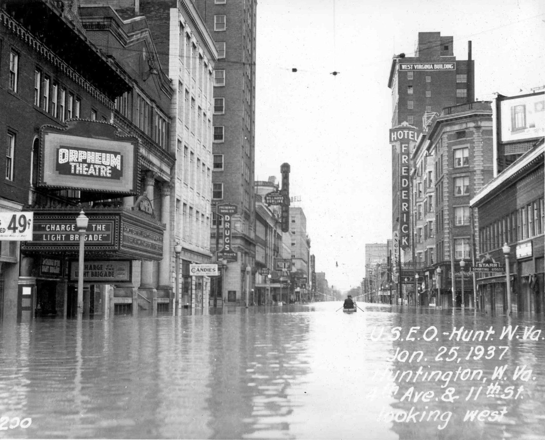
The Ohio River flood of 1937 took place in late January and February 1937. With damage stretching from Pittsburgh to Cairo, Illinois, 385 people died, one million people were left homeless and property losses reached $500 million ($10.2 billion when adjusted for inflation as of September 2022). Federal and state resources were strained to aid recovery as the disaster occurred during the depths of the Great Depression and a few years after the beginning of the Dust Bowl. Event timeline * January 5: Water levels began to rise. * January 10–18: Numerous flood warnings were issued across much of the region. * January 13–24: Near record rainfalls were recorded. * January 18: Numerous homes were flooded as the Ohio River started to overflow its banks due to the heavy rains. * January 23–24: Martial law was declared in Evansville, Indiana, where the water level was at . [...More Info...] [...Related Items...] OR: [Wikipedia] [Google] [Baidu] |
Portland, Louisville
Portland is a neighborhood and former independent town northwest of downtown Louisville, Kentucky. It is situated along a bend of the Ohio River just below the Falls of the Ohio, where the river curves to the north and then to the south, thus placing Portland at the northern tip of urban Louisville. In its early days it was the largest of the six major settlements at the falls, the others being Shippingport and Louisville in Kentucky and New Albany, Clarksville, and Jeffersonville on the Indiana side. Its modern boundaries are the Ohio River along the northwest, north, and northeast, 10th Street at the far east, Market Street on the south, and the Shawnee Golf Course at the far west. History Gen. William Lytle II, the founder of Cincinnati, Ohio, owned a large amount of land just below the Falls of the Ohio and in 1811 laid out the settlement of Portland. He planned to sell the lots to finance his plan to build a canal around the Falls. Lytle authorized Joshua Barclay and Ale ... [...More Info...] [...Related Items...] OR: [Wikipedia] [Google] [Baidu] |
Louisville And Portland Canal
The Louisville and Portland Canal was a canal bypassing the Falls of the Ohio River at Louisville, Kentucky. The Falls form the only barrier to navigation between the origin of the Ohio at Pittsburgh and the port of New Orleans on the Gulf of Mexico; circumventing them was long a goal for Pennsylvanian and Cincinnatian merchants.Yater, George. ''The Encyclopedia of Louisville''p. 531 "Louisville and Portland Canal". University Press of Kentucky (Lexington), 2001. Accessed 9 October 2013. The canal opened in 1830 as the private Louisville and Portland Canal Company but was gradually bought out during the 19th century by the federal government, which had invested heavily in its construction, maintenance, and improvement. The Louisville and Portland Canal was renamed as the McAlpine Locks and Dam in 1962 after extensive modernization. The name "Louisville and Portland Canal" (or simply "Portland Canal") is still used to refer to the canal itself, which runs between the Kentucky bank ... [...More Info...] [...Related Items...] OR: [Wikipedia] [Google] [Baidu] |
Calcutta
Kolkata (, or , ; also known as Calcutta , List of renamed places in India#West Bengal, the official name until 2001) is the Capital city, capital of the Indian States and union territories of India, state of West Bengal, on the eastern bank of the Hooghly River west of the border with Bangladesh. It is the primary business, commercial, and financial hub of East India, Eastern India and the main port of communication for North-East India. According to the 2011 Indian census, Kolkata is the List of cities in India by population, seventh-most populous city in India, with a population of 45 lakh (4.5 million) residents within the city limits, and a population of over 1.41 crore (14.1 million) residents in the Kolkata metropolitan area, Kolkata Metropolitan Area. It is the List of metropolitan areas in India, third-most populous metropolitan area in India. In 2021, the Kolkata metropolitan area crossed 1.5 crore (15 million) registered voters. The ... [...More Info...] [...Related Items...] OR: [Wikipedia] [Google] [Baidu] |
Falls Of The Ohio
The Falls of the Ohio National Wildlife Conservation Area is a national, bi-state area on the Ohio River near Louisville, Kentucky in the United States, administered by the U.S. Army Corps of Engineers. Federal status was awarded in 1981. The falls were designated a National Natural Landmark in 1966. Overview The area is located at the Falls of the Ohio, which was the only navigational barrier on the river in earlier times. The falls were a series of rapids formed by the relatively recent erosion of the Ohio River operating on 386-million-year-old Devonian hard limestone rock shelves. Louisville, Kentucky, and the associated Indiana communities— Jeffersonville, Clarksville, and New Albany—all owe their existence as communities to the falls, as the navigational obstacles the falls presented meant that late-18th-century and early- to late-19th-century river traffic could benefit from local expertise in navigating the drop made by the river over a distance of two miles (3& ... [...More Info...] [...Related Items...] OR: [Wikipedia] [Google] [Baidu] |


