|
Sherwood, Oregon
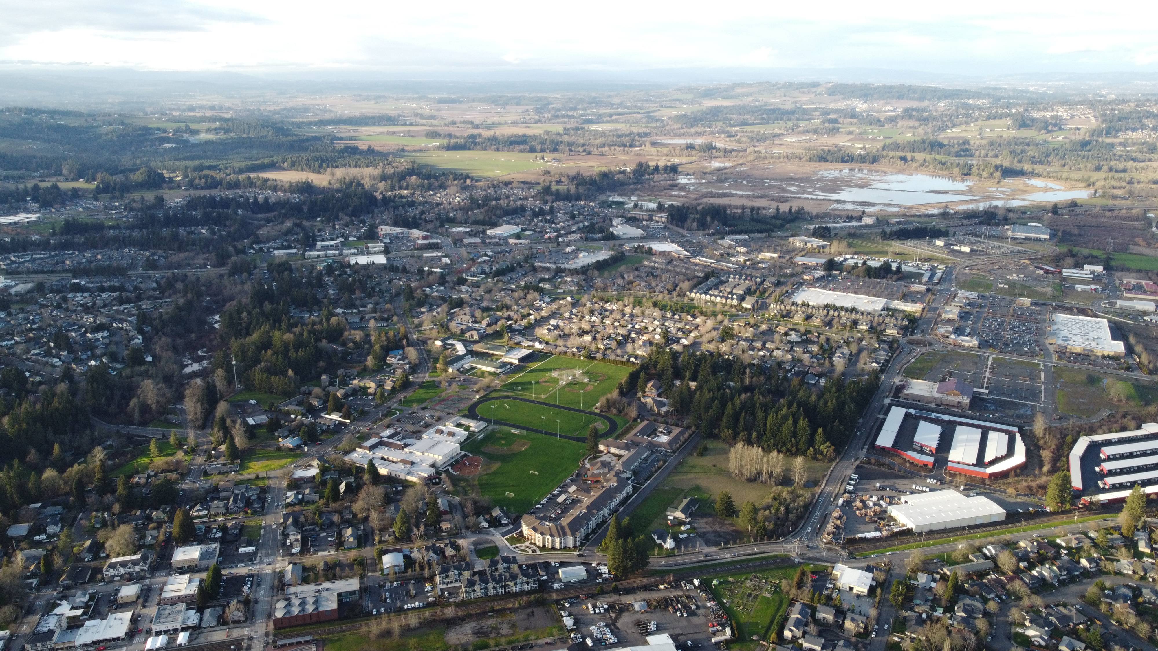
Sherwood is a city in Washington County, Oregon, United States. Located in the southeast corner of the county, it is a residential community in the Tualatin Valley, southwest of Portland. As of the 2010 census, Sherwood had a population of 18,194 residents. The city's population for 2019 was estimated to be 19,879 by the U.S. Census. Sherwood was first incorporated in 1893 as a town. Originally named Smockville after its founder, James Christopher Smock, the town was given its current name by local businessman Robert Alexander in 1891. The name "Sherwood" may have come from Sherwood, Michigan or the Sherwood Forest in England. History What is now the Sherwood area was originally inhabited by the Atfalati band of the Kalapuya nation. Native Americans were relocated to reservations after the Donation Land Claim Act of 1850–55 gave American citizens exclusive ownership of these lands. The relocation process took place under the guidance of a series of federal employees, most not ... [...More Info...] [...Related Items...] OR: [Wikipedia] [Google] [Baidu] |
City
A city is a human settlement of notable size.Goodall, B. (1987) ''The Penguin Dictionary of Human Geography''. London: Penguin.Kuper, A. and Kuper, J., eds (1996) ''The Social Science Encyclopedia''. 2nd edition. London: Routledge. It can be defined as a permanent and densely settled place with administratively defined boundaries whose members work primarily on non-agricultural tasks. Cities generally have extensive systems for housing, transportation, sanitation, utilities, land use, production of goods, and communication. Their density facilitates interaction between people, government organisations and businesses, sometimes benefiting different parties in the process, such as improving efficiency of goods and service distribution. Historically, city-dwellers have been a small proportion of humanity overall, but following two centuries of unprecedented and rapid urbanization, more than half of the world population now lives in cities, which has had profound consequences for g ... [...More Info...] [...Related Items...] OR: [Wikipedia] [Google] [Baidu] |
Tualatin Valley
The Tualatin Valley is a farming and suburban region southwest of Portland, Oregon in the United States. The valley is formed by the meandering Tualatin River, a tributary of the Willamette River at the northwest corner of the Willamette Valley, east of the Northern Oregon Coast Range. Most of the valley is located within Washington County, separated from Portland by the Tualatin Mountains. Communities in the Tualatin Valley include Banks, Forest Grove, Cornelius, Hillsboro, Aloha, Beaverton, Sherwood, Tigard, and Tualatin. History In the early 19th century, the valley was inhabited by the Atfalati, a hunter-gatherer Kalapuyan band that spoke a dialect of Northern Kalapuyan. In the middle 19th century, the Atfalati lived in several villages in the valley, including Chakeipi ("Place of the Beaver", translated by early white settlers as "Beaver Dam"). Early Euro-American settlers called the valley the "Twality Plains", a corruption of the name of the Atfalati tribe. Ot ... [...More Info...] [...Related Items...] OR: [Wikipedia] [Google] [Baidu] |
Willamette River
The Willamette River ( ) is a major tributary of the Columbia River, accounting for 12 to 15 percent of the Columbia's flow. The Willamette's main stem is long, lying entirely in northwestern Oregon in the United States. Flowing northward between the Oregon Coast Range and the Cascade Range, the river and its tributaries form the Willamette Valley, a basin that contains two-thirds of Oregon's population, including the state capital, Salem, and the state's largest city, Portland, which surrounds the Willamette's mouth at the Columbia. Originally created by plate tectonics about 35 million years ago and subsequently altered by volcanism and erosion, the river's drainage basin was significantly modified by the Missoula Floods at the end of the most recent ice age. Humans began living in the watershed over 10,000 years ago. There were once many tribal villages along the lower river and in the area around its mouth on the Columbia. Indigenous peoples lived throughout ... [...More Info...] [...Related Items...] OR: [Wikipedia] [Google] [Baidu] |
Oregon City, Oregon
) , image_skyline = McLoughlin House.jpg , imagesize = , image_caption = The McLoughlin House, est. 1845 , image_flag = , image_seal = Oregon City seal.png , image_map = Clackamas_County_Oregon_Incorporated_and_Unincorporated_areas_Oregon_City_Highlighted.svg , mapsize = 250px , map_caption = Location in Oregon , image_map1 = , mapsize1 = , map_caption1 = , pushpin_map = Oregon#USA , pushpin_map_alt = , pushpin_map_caption = , pushpin_label = Oregon City , subdivision_type = Country , subdivision_type1 = State , subdivision_type2 = County , subdivision_name = United States , subdivision_name1 = Oregon , subdivision_name2 = Clackamas , government_type = , leader_title = Mayor , leader_name ... [...More Info...] [...Related Items...] OR: [Wikipedia] [Google] [Baidu] |
California Gold Rush
The California Gold Rush (1848–1855) was a gold rush that began on January 24, 1848, when gold was found by James W. Marshall at Sutter's Mill in Coloma, California. The news of gold brought approximately 300,000 people to California from the rest of the United States and abroad. The sudden influx of gold into the money supply reinvigorated the American economy; the sudden population increase allowed California to go rapidly to statehood, in the Compromise of 1850. The Gold Rush had severe effects on Native Californians and accelerated the Native American population's decline from disease, starvation and the California genocide. The effects of the Gold Rush were substantial. Whole indigenous societies were attacked and pushed off their lands by the gold-seekers, called "forty-niners" (referring to 1849, the peak year for Gold Rush immigration). Outside of California, the first to arrive were from Oregon, the Sandwich Islands (Hawaii) and Latin America in late 1848. Of th ... [...More Info...] [...Related Items...] OR: [Wikipedia] [Google] [Baidu] |
Oregon Historical Society
The Oregon Historical Society (OHS) is an organization that encourages and promotes the study and understanding of the history of the Oregon Country, within the broader context of U.S. history. Incorporated in 1898, the Society collects, preserves, and makes available materials of historical character and interest, and collaborates with other groups and individuals with similar aims. The society operates the Oregon History Center that includes the Oregon Historical Society Museum in downtown Portland. History The Society was organized on December 17, 1898, in Portland at the Portland Library Building.Corning, Howard M. ''Dictionary of Oregon History''. Binfords & Mort Publishing, 1956. Its mission, as expressed in the first volume of its ''Oregon Historical Quarterly'', was to "bring together in the most complete measure possible the data for the history of the commonwealth, and to stimulate the widest and highest use of them." The first president was Harvey W. Scott, with memb ... [...More Info...] [...Related Items...] OR: [Wikipedia] [Google] [Baidu] |
Oregon History Project
Oregon () is a state in the Pacific Northwest region of the Western United States. The Columbia River delineates much of Oregon's northern boundary with Washington, while the Snake River delineates much of its eastern boundary with Idaho. The 42° north parallel delineates the southern boundary with California and Nevada. Oregon has been home to many indigenous nations for thousands of years. The first European traders, explorers, and settlers began exploring what is now Oregon's Pacific coast in the early-mid 16th century. As early as 1564, the Spanish began sending vessels northeast from the Philippines, riding the Kuroshio Current in a sweeping circular route across the northern part of the Pacific. In 1592, Juan de Fuca undertook detailed mapping and studies of ocean currents in the Pacific Northwest, including the Oregon coast as well as the strait now bearing his name. Spanish ships – 250 in as many years – would typically not land before reaching Cape Mendocin ... [...More Info...] [...Related Items...] OR: [Wikipedia] [Google] [Baidu] |
Joel Palmer
General Joel Palmer (October 4, 1810 – June 9, 1881) was an American pioneer of the Oregon Territory in the Pacific Northwest region of North America. He was born in Canada, and spent his early years in New York and Pennsylvania before serving as a member of the Indiana House of Representatives. Palmer traveled to the Oregon Country in 1845. He played a central role in blazing the last leg of the Oregon Trail, the Barlow Road, with Sam Barlow and others. Specifically, Palmer is noted for having climbed high on Mount Hood to observe the surrounding area when the party ran into difficulty. He wrote a popular immigrant guidebook, co-founded Dayton, Oregon, and served as a controversial Indian Affairs administrator. After Oregon became a state, Palmer served in both branches of the Oregon Legislative Assembly. He was selected as Speaker of the Oregon House of Representatives for one session in 1862, and in 1870 lost a bid to become Governor of Oregon. The Palmer House, his former ... [...More Info...] [...Related Items...] OR: [Wikipedia] [Google] [Baidu] |
Donation Land Claim Act
The Donation Land Claim Act of 1850, sometimes known as the Donation Land Act, was a statute enacted by the United States Congress in late 1850, intended to promote homestead settlements in the Oregon Territory. It followed the Distribution-Preemption Act 1841. The law, a forerunner of the later Homestead Act, brought thousands of settlers into the new territory, swelling their ranks along the Oregon Trail. 7,437 land patents were issued under the law, which expired in late 1855. The Donation Land Claim Act allowed white men or partial Native Americans (mixed with white) who had arrived in Oregon before 1850 to work on a piece of land for four years and legally claim the land for themselves. Along with other US land grant legislation, the Donation Land Claim Act discriminated against nonwhite settlers and had the effect of dispossessing land from Native Americans. History The passage of the law was largely due to the efforts of Samuel R. Thurston, the Oregon territorial deleg ... [...More Info...] [...Related Items...] OR: [Wikipedia] [Google] [Baidu] |
Kalapuya People
The Kalapuya are a Native Americans in the United States, Native American ethnic group, people, which had eight independent groups speaking three mutually intelligible dialects. The Kalapuya tribes' traditional homelands were the Willamette Valley of present-day western Oregon in the United States, an area bounded by the Cascade Range to the east, the Oregon Coast Range at the west, the Columbia River at the north, to the Calapooya Mountains of the Umpqua River at the south. Today, most Kalapuya people are enrolled in the federally recognized Confederated Tribes of the Grand Ronde Community of Oregon; in addition, some are members of the Confederated Tribes of the Siletz. In both cases descendants have often intermarried with people of other tribes in the confederated tribes, and are counted in overall tribal numbers, rather than separately. Most of the Kalapuya descendants live at the Grand Ronde Community, Grand Ronde reservation, located in Yamhill and Polk counties. Name T ... [...More Info...] [...Related Items...] OR: [Wikipedia] [Google] [Baidu] |
Atfalati
The Atfalati , also known as the Tualatin or Wapato Lake IndiansRobert H. Ruby, John A. Brown & Cary C. Collins, Atfalati, in ''A Guide to the Indian Tribes of the Pacific Northwest'' (3d ed. 2010, University of Oklahoma Press) are a tribe of the Kalapuya Native Americans who originally inhabited and continue to steward some 24 villages on the Tualatin Plains in the northwest part of the U.S. state of Oregon; the Atfalati also live in the hills around Forest Grove, along Wapato Lake and the north fork of the Yamhill River, and into areas of Southern Portland. The Atfalati speak the Tualatin-Yamhill (Northern Kalapuya) language, which is one of the three Kalapuyan languages. History and culture Atfalati people ranged around the valley, engaged in a hunter-gatherer lifestyle. Primary food stuffs included deer, camas root, fish, berries, elk, and various nuts. To encourage the growth of the camas plant and maintain habitat beneficial to deer and elk, the group burned the valley ... [...More Info...] [...Related Items...] OR: [Wikipedia] [Google] [Baidu] |
Sherwood Forest
Sherwood Forest is a royal forest in Nottinghamshire, England, famous because of its historic association with the legend of Robin Hood. The area has been wooded since the end of the Last Glacial Period (as attested by pollen sampling cores). Today Sherwood Forest National Nature Reserve encompasses , surrounding the village of Edwinstowe, the site of Thoresby Hall. It is a remnant of an older and much larger royal hunting forest, which derived its name from its status as the ''shire (or sher) wood'' of Nottinghamshire, which extended into several neighbouring counties (shires), bordered on the west by the River Erewash and the Forest of East Derbyshire. When Domesday Book was compiled in 1086 the forest covered perhaps a quarter of Nottinghamshire (approximately 19,000 acres or 7,800 hectares) in woodland and heath subject to the forest laws. The forest gives its name to the Sherwood Parliamentary constituency. Geology Sherwood Forest is established over an area under ... [...More Info...] [...Related Items...] OR: [Wikipedia] [Google] [Baidu] |


.jpg)

.jpg)

