|
Shergarh Fort
Shergarh Fort (also known as Qila Shergarh, Bhurkuda Fort) is a ruined fort in Malhipur, Chenari block of Sasaram, it is well connected from Kudra and as well from Sasaram, Bihar. It is a hill fort on a Kaimur plateau about 800 feet in height and was fortified by Emperor Sher Shah Suri. The fort is in dense forest, making access difficult from the bottom of the plateau. The fort lies on the banks of the Durgavati River. History The fort was built between 1540 to 1545 by Emperor Sher Shah Suri. In the 16th century the fort was known as Bhurkuda Qila. It is also claimed that the fort was built by Kharwar Kharwar is a community found in the Indian states of Uttar Pradesh, Bihar, Jharkhand, Chhattisgarh, Orissa and West Bengal. Etymology The ''Khar'' grass is totem of the Kharwar. They don't cut or injure it while growing. Kharwar tribe of pres ... rulers and subsequently captured by Sher Shah Suri in 1530. Architecture The area of the fort is nearly 16 km2. Its main ... [...More Info...] [...Related Items...] OR: [Wikipedia] [Google] [Baidu] |
Sasaram
Sasaram ()sometimes also spelled as Sahasram, is an ancient historical city and a municipal corporation region in the Rohtas district of the Bihar state in eastern India, with a history that goes to thousands of years. During the prehistoric age, Buddha walked through this way and lived for some days and then travelled to Gaya to be enlightened with verity and wisdom under the Mahabodhi tree, the city is also known as gateway of "Vihar" to visit rest "Bihar" including Gaya, Rajgriha, and Nalanda. It has also served as the capital of the Sur dynasty during Shershah Suri ruled over India in 16th Century, and was residence place sub capital of epic monarch Sahstrabahu ( Kartivirya Arjuna's ). The Rohtasgarh fort, one of the world's oldest forts, has served as the capital for several dynasties, Britishers and other rulers, including Shershah Suri and Akbar Governor King Man Singh, as well as the Shashanka and Kharvar empires. The historical fort has been linked to both pol ... [...More Info...] [...Related Items...] OR: [Wikipedia] [Google] [Baidu] |
India
India, officially the Republic of India (Hindi: ), is a country in South Asia. It is the seventh-largest country by area, the second-most populous country, and the most populous democracy in the world. Bounded by the Indian Ocean on the south, the Arabian Sea on the southwest, and the Bay of Bengal on the southeast, it shares land borders with Pakistan to the west; China, Nepal, and Bhutan to the north; and Bangladesh and Myanmar to the east. In the Indian Ocean, India is in the vicinity of Sri Lanka and the Maldives; its Andaman and Nicobar Islands share a maritime border with Thailand, Myanmar, and Indonesia. Modern humans arrived on the Indian subcontinent from Africa no later than 55,000 years ago., "Y-Chromosome and Mt-DNA data support the colonization of South Asia by modern humans originating in Africa. ... Coalescence dates for most non-European populations average to between 73–55 ka.", "Modern human beings—''Homo sapiens''—originated in Africa. Then, int ... [...More Info...] [...Related Items...] OR: [Wikipedia] [Google] [Baidu] |
Indo-Islamic Architecture
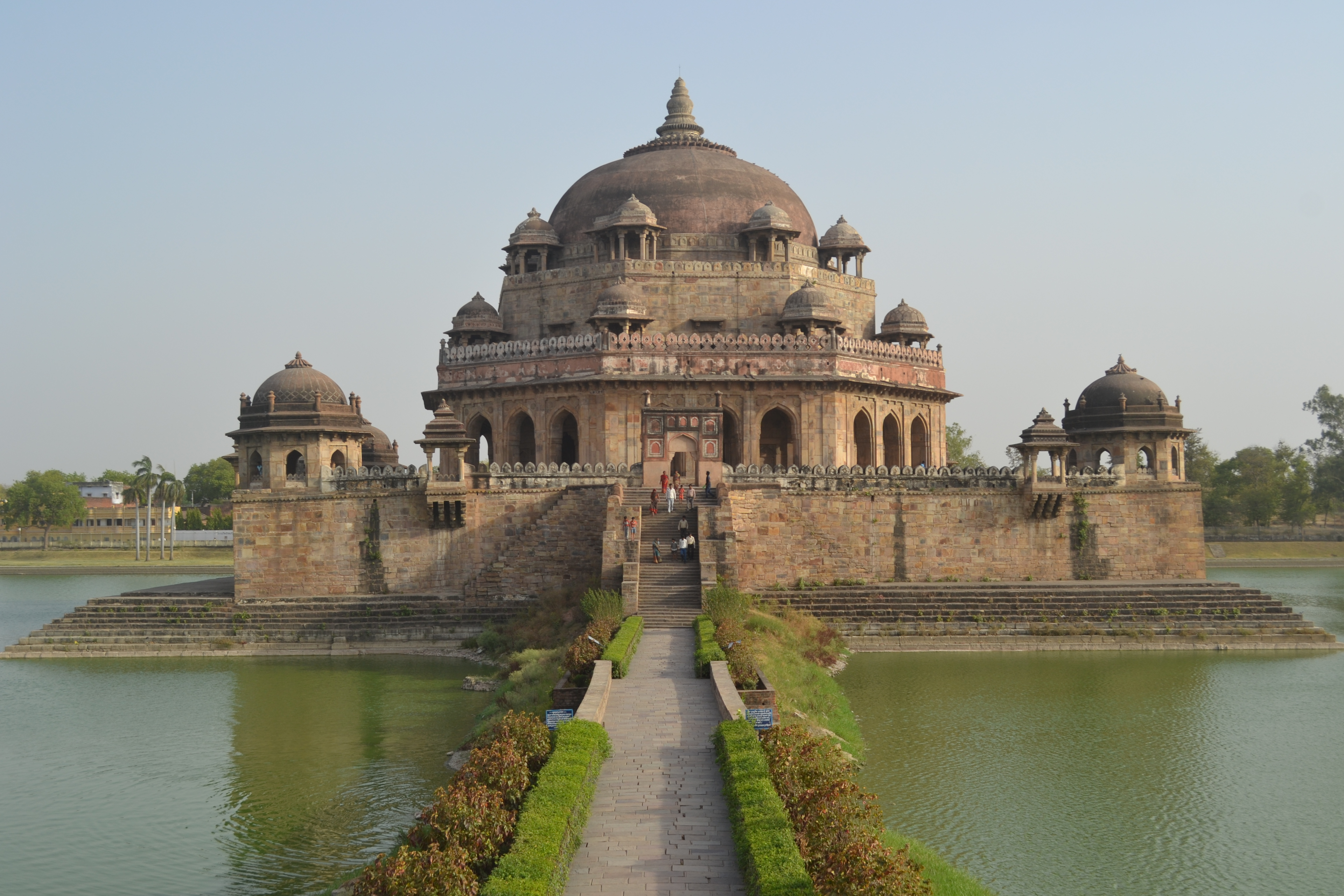
Indo-Islamic architecture is the architecture of the Indian subcontinent produced by and for Islamic patrons and purposes. Despite an initial Arab presence in Sindh, the development of Indo-Islamic architecture began in earnest with the establishment of Delhi as the capital of the Ghurid dynasty in 1193. Succeeding the Ghurids was the Delhi Sultanate, a series of Central Asian dynasties that consolidated much of North India, and later the Mughal Empire by the 15th century. Both of these dynasties introduced Persianate architecture and art styles from Western Eurasia into the Indian subcontinent. The types and forms of large buildings required by Muslim elites, with mosques and tombs much the most common, were very different from those previously built in India. The exteriors of both were very often topped by large domes, and made extensive use of arches. Both of these features were hardly used in Hindu temple architecture and other indigenous Indian styles. Both types of ... [...More Info...] [...Related Items...] OR: [Wikipedia] [Google] [Baidu] |
Sur Empire
The Sur Empire ( ps, د سرو امپراتورۍ, dë sru amparāturəi; fa, امپراطوری سور, emperâturi sur) was an Afghan dynasty which ruled a large territory in the northern part of the Indian subcontinent for nearly 16 years, between 1540 and 1556, with Sasaram, in modern-day Bihar, serving as its capital. The Sur dynasty held control of nearly all the Mughal territories, from eastern Balochistan, Pakistan in the west to modern-day Rakhine, Myanmar in the east. History Sher Shah, an ethnic Pashtun of the tribal house of Sur, first served as a private before rising to become a commander in the Mughal army under Babur and then the governor of Bihar. In 1537, when Babur's son Humayun was elsewhere on an expedition, Sher Shah overran the state of Bengal and established the Suri dynasty. The Sur supplanted the Mughal dynasty as rulers of North India during the reign of the relatively ineffectual second Mughal Humayun. Sher Shah defeated ''badshah-i-Hind'' ... [...More Info...] [...Related Items...] OR: [Wikipedia] [Google] [Baidu] |
Rohtas District
Rohtas District is one of the thirty-eight districts of Bihar state, India. It came into existence when Shahabad District was bifurcated into Bhojpur & Rohtas in 1972. Administrative headquarter of the district is Sasaram. Rohtas district has the highest literacy in Bihar. The literacy rate of Rohtas district which is 73.37% as per 2011 census is highest among all 38 districts of Bihar. Rohtas district also has one of the highest forest cover among all 38 districts of Bihar. The Rohtas district is a part of Patna Division, and it has an area of 3850 km², a population of 2,959,918 (2011 census), and a population density of 763 persons per km². Languages spoken here are Bhojpuri, Hindi and English. History Rohtas district was created in 1972, when the former Shahabad district was divided in two. It corresponded to the former district's sub-divisions of Sasaram and Bhabua. In 1991, Bhabua was split off as a separate district, which was renamed Kaimur district in 1994. Th ... [...More Info...] [...Related Items...] OR: [Wikipedia] [Google] [Baidu] |
Bihar
Bihar (; ) is a state in eastern India. It is the 2nd largest state by population in 2019, 12th largest by area of , and 14th largest by GDP in 2021. Bihar borders Uttar Pradesh to its west, Nepal to the north, the northern part of West Bengal to the east, and with Jharkhand to the south. The Bihar plain is split by the river Ganges, which flows from west to east. On 15 November 2000, southern Bihar was ceded to form the new state of Jharkhand. Only 20% of the population of Bihar lives in urban areas as of 2021. Additionally, almost 58% of Biharis are below the age of 25, giving Bihar the highest proportion of young people of any Indian state. The official languages are Hindi and Urdu, although other languages are common, including Maithili, Magahi, Bhojpuri and other Languages of Bihar. In Ancient and Classical India, the area that is now Bihar was considered the centre of political and cultural power and as a haven of learning. From Magadha arose India's first empire, ... [...More Info...] [...Related Items...] OR: [Wikipedia] [Google] [Baidu] |
Fortification
A fortification is a military construction or building designed for the defense of territories in warfare, and is also used to establish rule in a region during peacetime. The term is derived from Latin ''fortis'' ("strong") and ''facere'' ("to make"). From very early history to modern times, defensive walls have often been necessary for cities to survive in an ever-changing world of invasion and conquest. Some settlements in the Indus Valley civilization were the first small cities to be fortified. In ancient Greece, large stone walls had been built in Mycenaean Greece, such as the ancient site of Mycenae (famous for the huge stone blocks of its 'cyclopean' walls). A Greek '' phrourion'' was a fortified collection of buildings used as a military garrison, and is the equivalent of the Roman castellum or English fortress. These constructions mainly served the purpose of a watch tower, to guard certain roads, passes, and borders. Though smaller than a real fortress, they act ... [...More Info...] [...Related Items...] OR: [Wikipedia] [Google] [Baidu] |
Plateau
In geology and physical geography, a plateau (; ; ), also called a high plain or a tableland, is an area of a highland consisting of flat terrain that is raised sharply above the surrounding area on at least one side. Often one or more sides have deep hills or escarpments. Plateaus can be formed by a number of processes, including upwelling of volcanic magma, extrusion of lava, and erosion by water and glaciers. Plateaus are classified according to their surrounding environment as intermontane, piedmont, or continental. A few plateaus may have a small flat top while others have wide ones. Formation Plateaus can be formed by a number of processes, including upwelling of volcanic magma, extrusion of lava, Plate tectonics movements and erosion by water and glaciers. Volcanic Volcanic plateaus are produced by volcanic activity. The Columbia Plateau in the north-western United States is an example. They may be formed by upwelling of volcanic magma or extrusion of lava. The un ... [...More Info...] [...Related Items...] OR: [Wikipedia] [Google] [Baidu] |
Emperor
An emperor (from la, imperator, via fro, empereor) is a monarch, and usually the sovereignty, sovereign ruler of an empire or another type of imperial realm. Empress, the female equivalent, may indicate an emperor's wife (empress consort), mother (empress dowager), or a woman who rules in her own right and name (empress regnant). Emperors are generally recognized to be of the highest monarchic honour, honor and royal and noble ranks, rank, surpassing kings. In Europe, the title of Emperor has been used since the Middle Ages, considered in those times equal or almost equal in dignity to that of Pope due to the latter's position as visible head of the Church and spiritual leader of the Catholic part of Western Europe. The Emperor of Japan is the only currently List of current sovereign monarchs, reigning monarch whose title is translated into English as "Emperor". Both emperors and kings are monarchs or sovereigns, but both emperor and empress are considered the higher monarch ... [...More Info...] [...Related Items...] OR: [Wikipedia] [Google] [Baidu] |
Sher Shah Suri
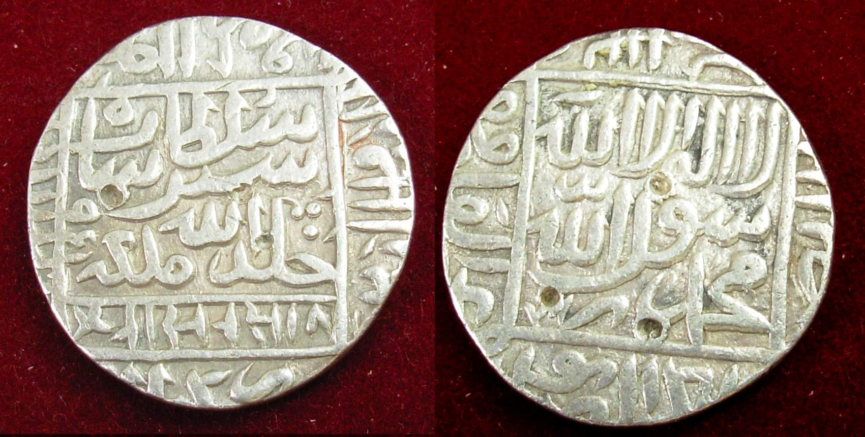
Sher Shah Suri ( ps, شیرشاه سوری) (1472, or 1486 – 22 May 1545), born Farīd Khān ( ps, فرید خان) , was the founder of the Sur Empire in India, with its capital in Sasaram in modern-day Bihar. He standardized the silver coin to the weight of 178 grams and named the currency as rupee based on the ancient Sanskrit term for silver. An ethnic Pashtun ruler, Sher Shah took control of the Mughal Empire in 1540 CE. After his accidental death in 1545 CE, his son Islam Shah became his successor. He first served as a private before rising to become a commander in the Mughal army under Babur and then the governor of Bihar. In 1537, when Babur's son Humayun was elsewhere on an expedition, Sher Shah overran the state of Bengal and established the Suri dynasty. A brilliant strategist, Sher Shah proved himself as a gifted administrator as well as a capable general. His reorganization of the empire laid the foundations for the later Mughal emperors, notably Akbar, son of Hu ... [...More Info...] [...Related Items...] OR: [Wikipedia] [Google] [Baidu] |
Durgavati River
The Durgavati River, ( 𑂠𑂳𑂩𑂹𑂏𑂰𑂫𑂞𑂲 𑂢𑂠𑂹𑂠𑂲 ) (also called Durgaoti or Durgauti and spelt as Durgawati) which flows through Kaimur district in the Indian state of Bihar, is a tributary of the Karmanasa. Course The source of the Durgavati is about east of that of the Karmanasa. In its upper reaches it is a rocky channel wide. It runs nearly north for about when it plunges down the rocky boundary of the table land in to the head of deep glen named Kadhar Kho. There it is joined by three other torrents that like itself rise on the table land of the Turkan Kharawars and fall down the rocks at the head of the same glen. These three torrents are the Lohara, Hatiyadub and Kothas. The Durgavati joins the Karmanasa as a right bank tributary. Waterfalls The Durgavati Falls, high, on the Durgavati River is at the edge of the Rohtas Plateau. Durgavati Reservoir The Durgavati Reservoir, also known as Karamchat Dam is a water storage Dam located ne ... [...More Info...] [...Related Items...] OR: [Wikipedia] [Google] [Baidu] |
Kharwar
Kharwar is a community found in the Indian states of Uttar Pradesh, Bihar, Jharkhand, Chhattisgarh, Orissa and West Bengal. Etymology The ''Khar'' grass is totem of the Kharwar. They don't cut or injure it while growing. Kharwar tribe of present day may be enlarge totem sept which broke off from some larger group and in course of time developed a separate organisation. History The Kharwar have various putative origins. Some may be traced to Palamu region, now in the state of Jharkhand, while others may have lived in the Sone Valley. Those of Uttar Pradesh claim to have come from Rohtas and to be descended from the mythological Suryavansha dynasty. According to a inscription dated 1169 AD found at Phulwari in Rohtas district, which refers to road construction by Nayak Pratapdhavala, the chief of Japila(modern Japla). Pratapdhavala is also known for his inscription of Tarachandi temple in Sasaram and Tutla Bhawani in Tilothu. According to a inscription dated to 1223 AD ... [...More Info...] [...Related Items...] OR: [Wikipedia] [Google] [Baidu] |


_1_by_N._A._Naseer.jpg)


