|
Shariatpur
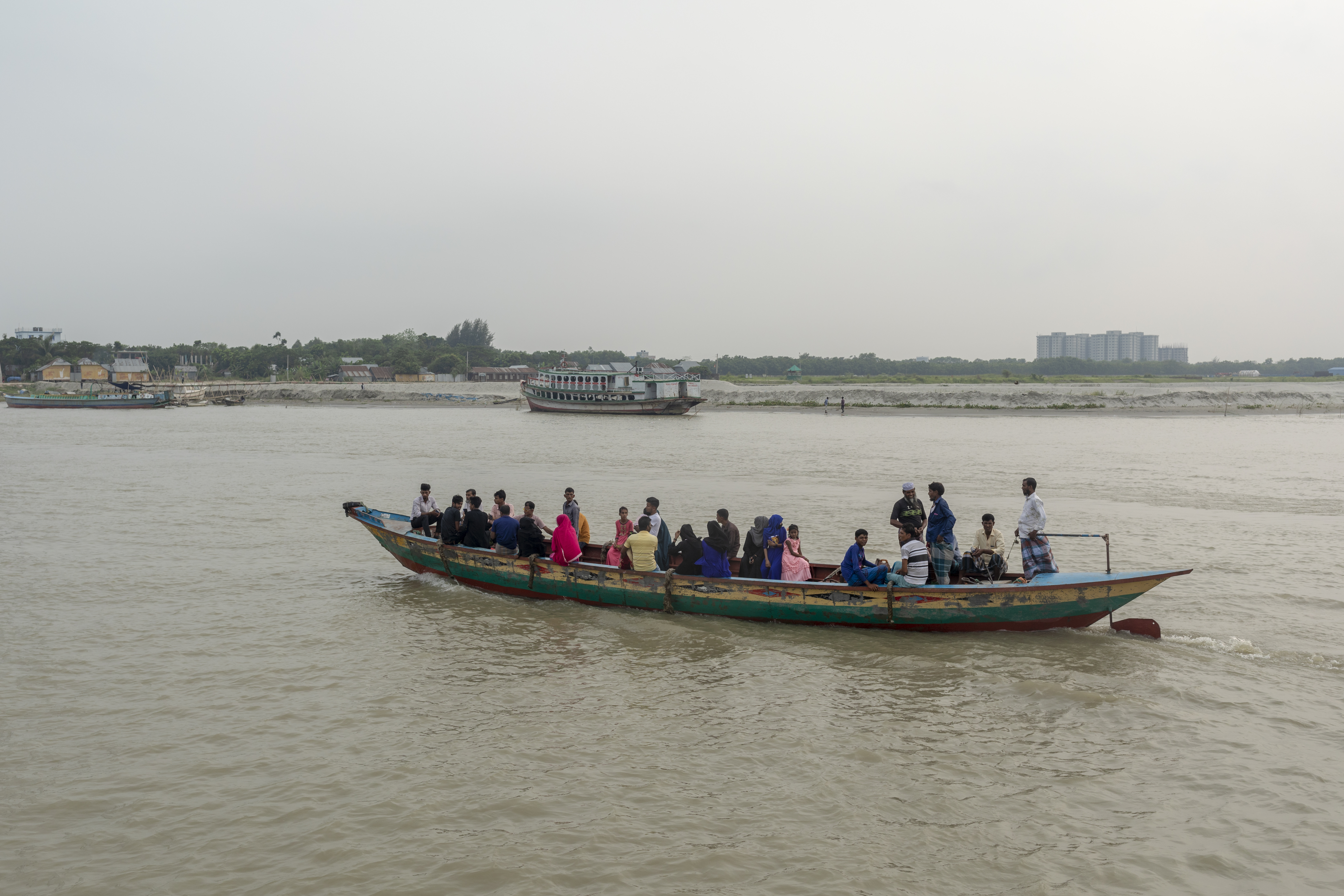
Shariatpur ( bn, শরিয়তপুর জেলা, ''Shariatpur Jela'' also ''Shariatpur Zila'') is a district in the Dhaka Division of central Bangladesh. It is bounded by Munshiganj district on the north, Barisal district on the south, Chandpur district on the east, Madaripur district on the west. Water bodies Main rivers: Padma, Meghna, Palong (Kirtinasha) and Jayanti. Of the six upazilas of the district Bhedarganj Upazila is the largest () and Damudya Upazila is the smallest (). History Shariatpur was named after Haji Shariatullah (1781–1840), who was the founder of Faraizi Movement and an eminent Islamic reformer/revivalist during British Raj. It was established as a district on 1 March 1984. In 1971 the Pak army in collaboration with their local agents conducted mass killing and plundering; they also set many houses of the district on fire. During Bangladesh Liberation War a number of encounters were held in Shariatpur Sadar Upazila between the freedom fighters and ... [...More Info...] [...Related Items...] OR: [Wikipedia] [Google] [Baidu] |
Shariatpur Sadar Upazila
Shariatpur Sadar ( bn, শরিয়তপুর সদর) is an upazila of Shariatpur District in the Division of Dhaka, Bangladesh. Shariatpur Thana was converted into an upazila in 1984. The upazila takes its name from the district and the Bengali word ''sadar'' (headquarters). It is the subdistrict where the district headquarters, Shariatpur town, is located. Geography Shariatpur Sadar Upazila has a total area of . It borders Zajira Upazila to the north, Naria and Bhedarganj upazilas to the east, Damudya Upazila to the southeast, and Madaripur District to the south and west. Demographics According to the 2011 Bangladesh census, Shariatpur Sadar Upazila had 45,883 households and a population of 210,259, 23.6% of whom lived in urban areas. 10.5% of the population was under the age of 5. The literacy rate (age 7 and over) was 51.2%, compared to the national average of 51.8%. Administration Shariatpur Sadar Upazila is divided into Shariatpur Municipality and 11 union par ... [...More Info...] [...Related Items...] OR: [Wikipedia] [Google] [Baidu] |
Zanjira Upazila
Zajira ( bn, জাজিরা) is an upazila of Shariatpur District in the Division of Dhaka, Bangladesh. Zajira Thana was established in 1973 and was converted into an upazila in 1984. It is named after its administrative center, the town of Zajira. Geography Zajira Upazila has a total area of . About two-thirds is land and one-third is water, chiefly the Padma River, which flows through the northern part of the upazila. It borders Munshiganj District to the north, Naria Upazila to the east and south, Shariatpur Sadar Upazila to the south, and Madaripur District to the west. Demographics According to the 2011 Bangladesh census, Zajira Upazila had 14,715 households and a population of 194,019, 11.0% of whom lived in urban areas. 11.2% of the population was under the age of 5. The literacy rate (age 7 and over) was 44.4%, compared to the national average of 51.8%. Administration Zajira Upazila is divided into Zajira Municipality and 12 union parishads: Bara Gopalpur, Bara Kri ... [...More Info...] [...Related Items...] OR: [Wikipedia] [Google] [Baidu] |
Gosairhat Upazila
Gosairhat ( bn, গোসাইরহাট) is an upazila of Shariatpur District in the Division of Dhaka, in south central Bangladesh. Geography Gosairhat Upazila has a total area of . It is the southernmost upazila of Shariatpur District. Located on the western bank of the Meghna River, it borders Damudya and Bhedargan upazilas to the north, Haimchar Upazila of Chandpur District to the east, Muladi and Hizla upazilas of Barisal District to the south, and Kalkini Upazila of Madaripur District to the west. The upazila headquarters is spread over the only two urban areas of the upazila, Dhipur and Daser Jangal mauzas. Together they have a total area of . Demographics According to the 2011 Bangladesh census, Gosairhat Upazila had 33,169 households and a population of 157,665, 7.0% of whom lived in urban areas. 12.7% of the population was under the age of 5. The literacy rate (age 7 and over) was 42.1%, compared to the national average of 51.8%. The boundaries of the upazila ... [...More Info...] [...Related Items...] OR: [Wikipedia] [Google] [Baidu] |
Bhedarganj Upazila
Bhedarganj ( bn, ভেদরগঞ্জ, Bhedorgonj) is an upazila (sub-district) of Shariatpur District in central Bangladesh, located in the Dhaka Division. It is a part of the Greater Faridpur region and is named after its administrative centre, the town of Bhedarganj. Geography Bhedarganj Upazila has a total area of . About seven-tenths is land and three-tenths is water, chiefly the Padma River, which cuts through the northern part of the upazila. It borders Naria Upazila to the west and north, Munshiganj District to the north, Chandpur District to the north and east, Gosairhat and Damudya upazilas to the south, and Shariatpur Sadar Upazila to the west. The Meghna River also flows through this upazila as well as the Banglabazar Canal. History In 1924, the Zamindar of Bikrampur Syed Bhedar Uddin Shah established the Bhedarganj Thana in his name. During the Bangladesh Liberation War of 1971, two brawls and a battle took place in Bhedarganj resulting in the deaths of many Ben ... [...More Info...] [...Related Items...] OR: [Wikipedia] [Google] [Baidu] |
Damudya Upazila
Damudya ( bn, ডামুড্যা) is an upazila of Shariatpur District in the Division of Dhaka, Bangladesh. Damudya Thana was established in 1975 and was converted into an upazila in 1982. It is named after its administrative center, the town of Damudya. Geography Damudya Upazila has a total area of . It borders Bhedarganj Upazila to the north, Gosairhat Upazila to the east and south, Madaripur District to the west, and Shariatpur Sadar Upazila to the northwest. Demographics According to the 2011 Bangladesh census, Damudya Upazila had 24,193 households and a population of 109,003, 15.9% of whom lived in urban areas. 11.1% of the population was under the age of 5. The literacy rate (age 7 and over) was 52.5%, compared to the national average of 51.8%. Administration Damudya Upazila is divided into Damudya Municipality and seven union parishads: Darul Aman, Dhanokathi, Islampur, Koneshwar, Purbo Damudya, Shidul Kura, and Sidda. The union parishads are subdivided into 60 m ... [...More Info...] [...Related Items...] OR: [Wikipedia] [Google] [Baidu] |
Padma Bridge
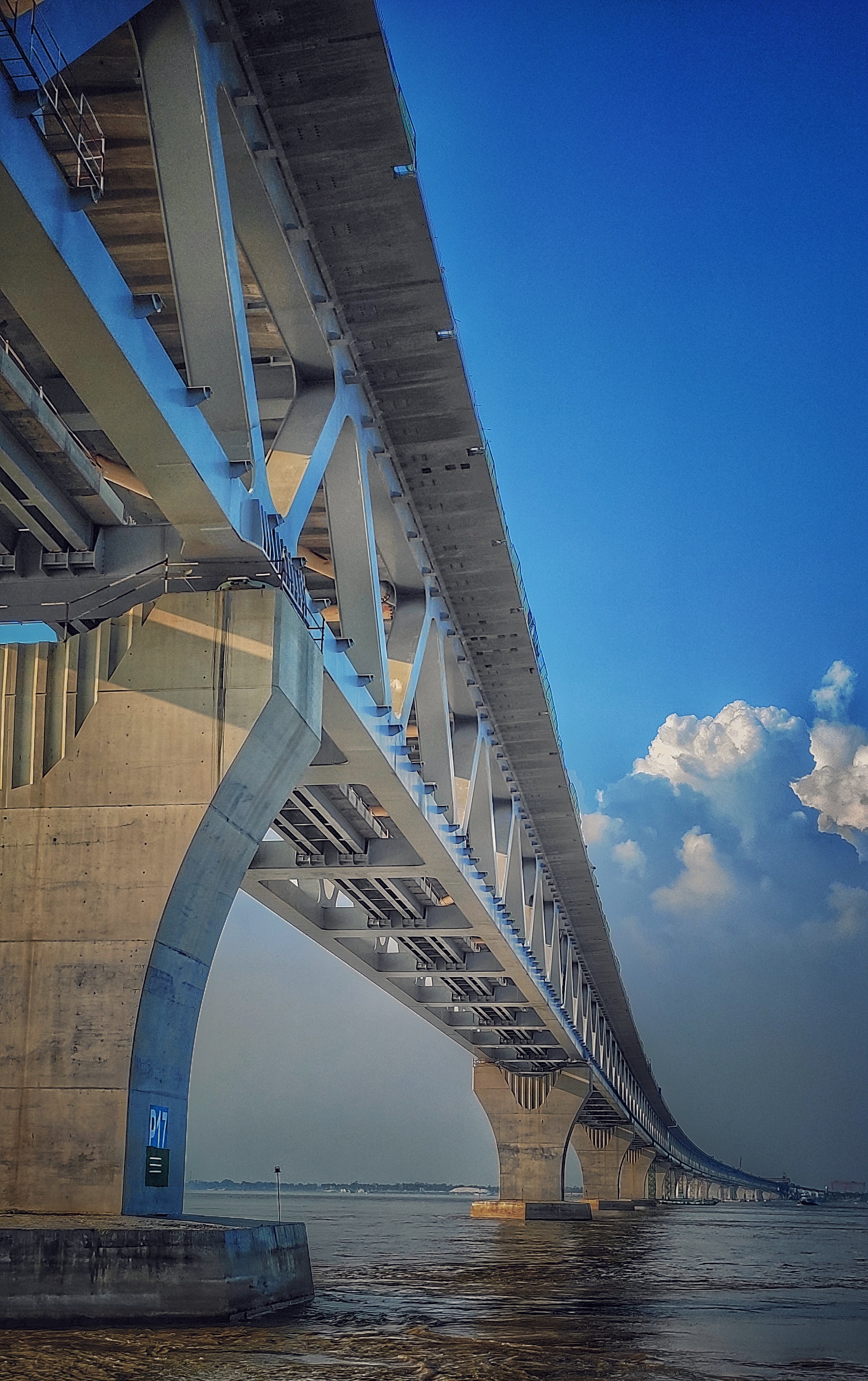
The Padma Multipurpose Bridge ( bn, পদ্মা বহুমুখী সেতু, Pôdma Bôhumukhī Setu), commonly known as the Padma Bridge ( bn, পদ্মা সেতু, Pôdma Setu), is a two-level road-rail bridge across the Padma River, the main distributary of the Ganges in Bangladesh. It connects Louhajang Upazila of Munshiganj and Zazira Upazila of Shariatpur and a small part of Shibchar Upazila of Madaripur, linking the less developed southwest of the country to the northern and eastern regions. The bridge was inaugurated on 25 June 2022 by the Prime Minister Sheikh Hasina. The bridge is considered to be the most challenging construction project in the history of Bangladesh, the steel truss bridge carries a four-lane highway on the upper level and a single track railway on the lower level. The bridge consists of 41 sections, each long and wide, with a total length of . It is the longest bridge in Bangladesh, the longest bridge over the river Ganges ( ... [...More Info...] [...Related Items...] OR: [Wikipedia] [Google] [Baidu] |
Padma
The Padma ( bn, পদ্মা ''Pôdma'') is a major river in Bangladesh. It is the main distributary of the Ganges, flowing generally southeast for to its confluence with the Meghna River near the Bay of Bengal. The city of Rajshahi is situated on the banks of the river.Hossain ML, Mahmud J, Islam J, Khokon ZH and Islam S (eds.) (2005) Padma, Tatthyakosh Vol. 1 and 2, Dhaka, Bangladesh, p. 182 . Since 1966, over of land has been lost due to erosion of the Padma. History Etymology The Padma, Sanskrit for lotus flower, is a mentioned in Hindu mythology as a byname for the Goddess Lakshmi. The name ''Padma'' is given to the lower part of the course of the Ganges (Ganga) below the point of the off-take of the Bhagirathi River (India), another Ganges River distributary also known as the Hooghly River. Padma had, most probably, flowed through a number of channels at different times. Some authors contend that each distributary of the Ganges in its deltaic part is a remnant ... [...More Info...] [...Related Items...] OR: [Wikipedia] [Google] [Baidu] |
Haji Shariatullah
Haji Shariatullah ( bn, হাজী শরীয়তুল্লাহ; 17811840) was a prominent religious leader and Islamic scholar from Bengal in the eastern subcontinent, who is best known as the founder of the Faraizi movement. In 1884, the Shariatpur District was formed and named after him. Early life Shariatullah is generally acknowledged to have been born into a Bengali Muslim family of Taluqdars in Char Shamail, a village in present-day Shibchar, Madaripur. The exact date or time of his birth and the name of his mother has not been mentioned by any peer-reviewed historical text, but some have estimated it to be circa 1781 CE. Coming from a family with no high educational background, his father was Abd al-Jalil Taluqdar, a landowner who had farming as his primary source of income. At around eight years old, Shariatullah lost his father and was then taken care of by his uncle, Azim ad-Din, who nurtured him in a very loving manner and made Shariatullah's youth "carefre ... [...More Info...] [...Related Items...] OR: [Wikipedia] [Google] [Baidu] |
Padma River
The Padma ( bn, পদ্মা ''Pôdma'') is a major river in Bangladesh. It is the main distributary of the Ganges, flowing generally southeast for to its confluence with the Meghna River near the Bay of Bengal. The city of Rajshahi is situated on the banks of the river.Hossain ML, Mahmud J, Islam J, Khokon ZH and Islam S (eds.) (2005) Padma, Tatthyakosh Vol. 1 and 2, Dhaka, Bangladesh, p. 182 . Since 1966, over of land has been lost due to erosion of the Padma. History Etymology The Padma, Sanskrit for lotus flower, is a mentioned in Hindu mythology as a byname for the Goddess Lakshmi. The name ''Padma'' is given to the lower part of the course of the Ganges (Ganga) below the point of the off-take of the Bhagirathi River (India), another Ganges River distributary also known as the Hooghly River. Padma had, most probably, flowed through a number of channels at different times. Some authors contend that each distributary of the Ganges in its deltaic part is a remnan ... [...More Info...] [...Related Items...] OR: [Wikipedia] [Google] [Baidu] |
List Of Regions Of Bangladesh By Human Development Index ...
This is a list of regions of Bangladesh by Human Development Index as of 2019. By Division References {{Subnational entities by Human Development Index Bangladesh Human Development Index Regions by Human Development Index Bangladesh Bangladesh (}, ), officially the People's Republic of Bangladesh, is a country in South Asia. It is the eighth-most populous country in the world, with a population exceeding 165 million people in an area of . Bangladesh is among the mos ... [...More Info...] [...Related Items...] OR: [Wikipedia] [Google] [Baidu] |
Barisal
Barisal ( or ; bn, বরিশাল, ), officially known as Barishal, is a major city that lies on the banks of the Kirtankhola river in south-central Bangladesh. It is the largest city and the administrative headquarter of both Barisal District and Barisal Division. It is one of the oldest municipalities and river ports of the country. Barisal municipality was established in the year 1876 during the British rule in India and upgraded to City Corporation on 25 July 2002. Barisal is Bangladesh's third largest information technology and financial hub. The city consists of 30 wards and 50 mahallas with a population of 328,278 according to the 2011 national census and with the voter of about 2.48 lakhs according to the 2018 voter list of city election. The area of the city is 58 km2. The city was once called the Venice of the East or the Venice of Bengal. History Barisal was conquered by Muhammad bin Bakhtiyar Khalji and was later a significant territory of the Delhi Sul ... [...More Info...] [...Related Items...] OR: [Wikipedia] [Google] [Baidu] |
Bangladesh Liberation War
The Bangladesh Liberation War ( bn, মুক্তিযুদ্ধ, , also known as the Bangladesh War of Independence, or simply the Liberation War in Bangladesh) was a revolution and War, armed conflict sparked by the rise of the Bengali nationalism, Bengali nationalist and self-determination movement in East Pakistan, which resulted in the independence of Bangladesh. The war began when the Pakistani Military dictatorship, military junta based in West Pakistan—under the orders of Yahya Khan—launched Operation Searchlight against the people of East Pakistan on the night of 25 March 1971, initiating the 1971 Bangladesh genocide, Bangladesh genocide. In response to the violence, members of the Mukti Bahini—a guerrilla resistance movement formed by Bengali military, paramilitary and civilians—launched a mass Guerrilla warfare, guerrilla war against the Pakistani military, liberating numerous towns and cities in the initial months of the conflict. At first, the Pakis ... [...More Info...] [...Related Items...] OR: [Wikipedia] [Google] [Baidu] |


