|
Serra Dourada State Park
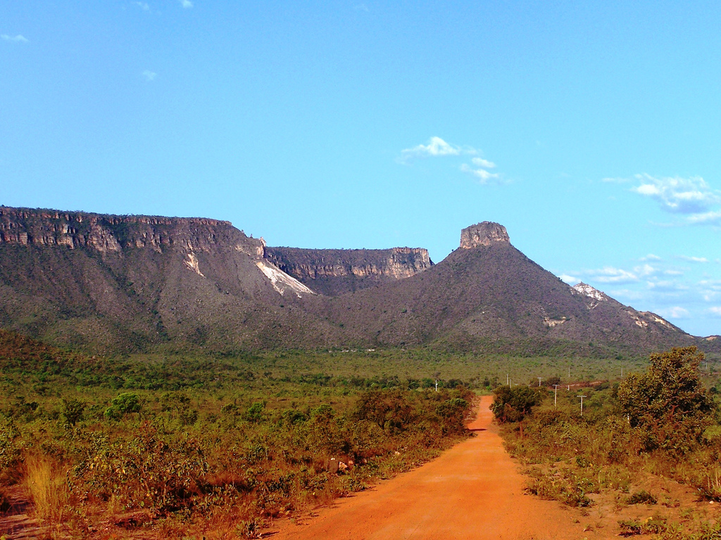
The Serra Dourada State Park ( pt, Parque Estadual da Serra Dourada) is a State park (Brazil), state park in the state of Goiás, Brazil. Location The Serra Dourada State Park is in the northwest of Goiás, divided between the municipalities of Buriti de Goiás, Mossâmedes and the Goiás, Goiás, city of Goiás. As of 2014 it had an area of . The park is about from the city of Mossâmedes. It is on top of a mountain range, and can be reached with a four-wheel drive car. Within the park the trails are level and lead to interesting rock formations called "stone cities" surrounded by typical cerrado vegetation. History The Serra Dourada State Park was established in 2003. It included 188 properties. A 2008 thesis on sustainable ecotourism in the park found that nothing had been done following the decree creating the park. Although there was large potential, there was no management plan and no environmental education for visitors. In June 2014 it was reported that the State Secre ... [...More Info...] [...Related Items...] OR: [Wikipedia] [Google] [Baidu] |
State Park (Brazil)
A state park ( pt, Parque Estadual) in Brazil is a legally defined type of protected area operated by one of the states. Their goal is to preserve important or beautiful natural ecosystems. Public access is allowed subject to regulations defined by the responsible agency. Definition State parks fall under the same regulations as national parks, defined by law 9.985 of July 2000. The park's basic objective is preservation of natural ecosystems of great ecological relevance and scenic beauty. This enables the conduct of scientific research and the development of educational activities and environmental interpretation, recreation in contact with nature and eco tourism. The park is publicly owned, and private areas included in its limits will be expropriated when it is established. Public visitation is subject to the rules and restrictions set out in Unit Management Plan, rules established by the body responsible for its administration, and those provided for by regulation. Scientific ... [...More Info...] [...Related Items...] OR: [Wikipedia] [Google] [Baidu] |
Goiás
Goiás () is a Brazilian state located in the Center-West region. Goiás borders the Federal District and the states of (from north clockwise) Tocantins, Bahia, Minas Gerais, Mato Grosso do Sul and Mato Grosso. The state capital is Goiânia. With 7.2 million inhabitants, Goiás is the most populous state in the Center-West and the 11th most populous in the country. It has the ninth largest economy among Brazilian federative units. In Brazil's geoeconomic division, Goiás belongs to the Centro-Sul (Center-South), being the northernmost state of the southern portion of Brazil. The state has 3.3% of the Brazilian population and is responsible for 2.7% of the Brazilian GDP. The history of Goiás dates back to the beginning of the 18th century, with the arrival of pioneers from São Paulo. The Rio Vermelho region was the first to be occupied, where Vila Boa (later renamed Goiás) was founded. The development and settlement of the state took place, in a more intensified way, start ... [...More Info...] [...Related Items...] OR: [Wikipedia] [Google] [Baidu] |
Buriti De Goiás
Buriti de Goiás is a municipality in eastern Goiás state, Brazil. Location and Communications *Distance to regional center (São Luís de Montes Belos): 58 km. Highway connections are made by state highway BR-069 west from Goiânia, through Trindade, Santa Bárbara de Goiás, São Luís de Montes Belos, and then 58 kilometers northeast to Buriti de Goiás. Neighboring municipalities are Córrego do Ouro, Fazenda Nova, Novo Brasil, Goiás, Mossâmedes, and Sanclerlândia. The municipality contains part of the Serra Dourada State Park, created in 2003. Demographics *Population density in 2007: 11.23 inhabitants/km2 *Population growth rate 2000-2007: -2.43.% *Urban population in 2007: 1,487 *Rural population in 2007: 751 *Eligible voters in 2007: 2638 *City government in 2007: mayor (Altamiro Antônio da Silva), vice-mayor (José Sérgio Magno), and 09 councilpersons *Income distribution: In 823 households, 407 earned less than one minimum salary in 2000. Economy The econ ... [...More Info...] [...Related Items...] OR: [Wikipedia] [Google] [Baidu] |
Mossâmedes
Mossâmedes is a municipality in western Goiás state, Brazil. Location Mossâmedes is located northwest of the state capital, Goiânia in the Anicuns Microregion. It is connected by paved roads with Itaberaí to the north and Anicuns to the south. The distance to the state capital is 142 kilometers. Road connections from Goiânia are made by GO-060 / Trindade / GO-326 / Anicuns / GO-222 / Chopana / GO-326 / Sanclerlândia / GO-164. Municipal boundaries are with Goiás, Sanclerlândia, Adelândia, Americano do Brasil, Anicuns, Itaberaí and Buriti de Goiás The municipality contains the Professor José Ângelo Rizzo Biological Reserve, a strictly protected conservation unit created in 1969 and administered by the Federal University of Goiás (UFG). It also contains part of the Serra Dourada State Park, created in 2003. Demographics The population has decreased by more than 50% since 1980, when it was 12,208. At that time most of the population was rural and did not tran ... [...More Info...] [...Related Items...] OR: [Wikipedia] [Google] [Baidu] |
Goiás, Goiás
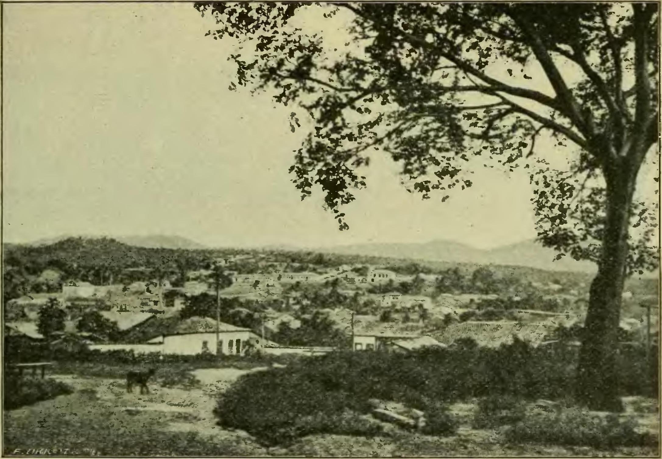
Goiás (also known as Goiás Velho, Old Goiás) is a municipality in the state of Goiás in Brazil. Its population was 22,381 (2020 est.) and its area is 3,108 km2. It is the former capital of the state and preserves much of its colonial heritage. In 2002, it became a UNESCO World Heritage Site. World Heritage Site It used to be the old state capital of Goiás up until 1937 when the government seat was transferred to the then-recently built Goiânia. It was founded by the famed Bandeirante explorer Bartolomeu Bueno da Silva, nicknamed the ''Anhangüera'', and was called in colonial times Vila Boa de Goyaz ("Good Village of Goyaz" in archaic Portuguese). Given its historical importance, the historical center of Goiás was included on the UNESCO's World Heritage list in 2001. Location Municipal boundaries: *North: Faina *South: Mossâmedes *East: Itaberaí *West: Itapirapuã and Matrinchã *Districts: Calcilândia, Buenolândia, Davidópolis, São João e Uvá. *Povoado (vill ... [...More Info...] [...Related Items...] OR: [Wikipedia] [Google] [Baidu] |
Cerrado
The ''Cerrado'' (, ) is a vast ecoregion of tropical savanna in eastern Brazil, particularly in the states of Goiás, Mato Grosso do Sul, Mato Grosso, Tocantins, Minas Gerais, and the Federal District. The core areas of the Cerrado biome are the Brazilian highlands – the ''Planalto''. The main habitat types of the Cerrado consist of forest savanna, wooded savanna, park savanna and gramineous-woody savanna. The ''Cerrado'' also includes savanna wetlands and gallery forests. The second largest of Brazil's major habitat types, after the Amazonian rainforest, the Cerrado accounts for a full 21 percent of the country's land area (extending marginally into Paraguay and Bolivia). The first detailed European account of the Brazilian cerrados was provided by Danish botanist Eugenius Warming (1892) in the book ''Lagoa Santa'', : The above is the original. There are other, later French and Portuguese translations not listed here. in which he describes the main features of the c ... [...More Info...] [...Related Items...] OR: [Wikipedia] [Google] [Baidu] |
State Parks Of Brazil
State may refer to: Arts, entertainment, and media Literature * ''State Magazine'', a monthly magazine published by the U.S. Department of State * ''The State'' (newspaper), a daily newspaper in Columbia, South Carolina, United States * ''Our State'', a monthly magazine published in North Carolina and formerly called ''The State'' * The State (Larry Niven), a fictional future government in three novels by Larry Niven Music Groups and labels * States Records, an American record label * The State (band), Australian band previously known as the Cutters Albums * ''State'' (album), a 2013 album by Todd Rundgren * ''States'' (album), a 2013 album by the Paper Kites * ''States'', a 1991 album by Klinik * ''The State'' (album), a 1999 album by Nickelback Television * ''The State'' (American TV series), 1993 * ''The State'' (British TV series), 2017 Other * The State (comedy troupe), an American comedy troupe Law and politics * State (polity), a centralized political organizatio ... [...More Info...] [...Related Items...] OR: [Wikipedia] [Google] [Baidu] |
Protected Areas Established In 2003
Protection is any measure taken to guard a thing against damage caused by outside forces. Protection can be provided to physical objects, including organisms, to systems, and to intangible things like civil and political rights. Although the mechanisms for providing protection vary widely, the basic meaning of the term remains the same. This is illustrated by an explanation found in a manual on electrical wiring: Some kind of protection is a characteristic of all life, as living things have evolved at least some protective mechanisms to counter damaging environmental phenomena, such as ultraviolet light. Biological membranes such as bark on trees and skin on animals offer protection from various threats, with skin playing a key role in protecting organisms against pathogens and excessive water loss. Additional structures like scales and hair offer further protection from the elements and from predators, with some animals having features such as spines or camouflage servin ... [...More Info...] [...Related Items...] OR: [Wikipedia] [Google] [Baidu] |
2003 Establishments In Brazil
3 (three) is a number, numeral and digit. It is the natural number following 2 and preceding 4, and is the smallest odd prime number and the only prime preceding a square number. It has religious or cultural significance in many societies. Evolution of the Arabic digit The use of three lines to denote the number 3 occurred in many writing systems, including some (like Roman and Chinese numerals) that are still in use. That was also the original representation of 3 in the Brahmic (Indian) numerical notation, its earliest forms aligned vertically. However, during the Gupta Empire the sign was modified by the addition of a curve on each line. The Nāgarī script rotated the lines clockwise, so they appeared horizontally, and ended each line with a short downward stroke on the right. In cursive script, the three strokes were eventually connected to form a glyph resembling a with an additional stroke at the bottom: ३. The Indian digits spread to the Caliphate in the 9th ... [...More Info...] [...Related Items...] OR: [Wikipedia] [Google] [Baidu] |


