|
Sermersut Island
Sermersuut Island (old spelling: ''Sermersût'', da, Hamborgerland) is an uninhabited island in the Qeqqata municipality in western Greenland.''Maniitsoq'', Saga Map, Tage Schjøtt, 1992 Geography The island is located on the shores of Davis Strait, separated from Maniitsoq Island in the south by the Ammarqoq Sound, and from the mainland in the east by the Ikamiut Kangerluarsuat Ikamiut is a settlement in the Qeqertalik municipality in western Greenland, located on a small island in the Aasiaat Archipelago on the southern shores of Disko Bay. Its population was 86 in 2020. Transport Air Greenland serves the village as ... fjord. The island is very mountainous and glaciated in the north, with several distinct mountain peaks. The highest point on the island is . References External links * Davis Strait Uninhabited islands of Greenland {{Greenland-geo-stub ... [...More Info...] [...Related Items...] OR: [Wikipedia] [Google] [Baidu] |
Davis Strait
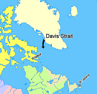
Davis Strait is a northern arm of the Atlantic Ocean that lies north of the Labrador Sea. It lies between mid-western Greenland and Baffin Island in Nunavut, Canada. To the north is Baffin Bay. The strait was named for the English explorer John Davis (1550–1605), who explored the area while seeking a Northwest Passage. By the 1650s it was used for whale hunting. Extent The International Hydrographic Organization defines the limits of the Davis Strait as follows: ''On the North.'' The Southern limit of Baffin Bay 70° North between Greenland and Baffin Island">Baffin Land]. ''On the East.'' The Southwest coast of Greenland. ''On the South.'' The parallel of 60th parallel north, 60° North between Greenland and Labrador. ''On the West.'' The Eastern limit of the Northwestern Passages South of 70° North he East coast of Baffin Island to East Bluff, its Southeastern extremityand of Hudson Strait line from East Bluff, the Southeast extreme of Baffin Island (), to Point ... [...More Info...] [...Related Items...] OR: [Wikipedia] [Google] [Baidu] |
Qeqqata
Qeqqata (, da, Centrum, lit=Centre) is a municipality in western Greenland, operational from 1 January 2009. The municipality was named after its location in the central-western part of the country. Its population is 9,378 as of January 2020. The administrative center of the municipality is in Sisimiut (formerly called Holsteinsborg). Creation It consists of the previously unincorporated area of Kangerlussuaq, as well as two former municipalities of western Greenland, Maniitsoq and Sisimiut. Geography In the south and east, the municipality is flanked by the Sermersooq municipality, although settlements and associated trade is concentrated mainly alongside the coast. In the north, it is bordered by the Qeqertalik municipality. The waters of the western coast are that of the Davis Strait, separating Greenland from Baffin Island. With an area of it is the second-smallest municipality of Greenland after Kujalleq. Politics Qeqqata's municipal council consists of 15 members, ele ... [...More Info...] [...Related Items...] OR: [Wikipedia] [Google] [Baidu] |
Greenland
Greenland ( kl, Kalaallit Nunaat, ; da, Grønland, ) is an island country in North America that is part of the Kingdom of Denmark. It is located between the Arctic and Atlantic oceans, east of the Canadian Arctic Archipelago. Greenland is the world's largest island. It is one of three constituent countries that form the Kingdom of Denmark, along with Denmark and the Faroe Islands; the citizens of these countries are all citizens of Denmark and the European Union. Greenland's capital is Nuuk. Though a part of the continent of North America, Greenland has been politically and culturally associated with Europe (specifically Norway and Denmark, the colonial powers) for more than a millennium, beginning in 986.The Fate of Greenland's Vikings , by Dale Mackenzie Brown, ''Archaeological Institute of America'', ... [...More Info...] [...Related Items...] OR: [Wikipedia] [Google] [Baidu] |
Maniitsoq Island
Maniitsoq Island is an island in the Qeqqata municipality in western Greenland.''Maniitsoq'', Saga Map, Tage Schjøtt, 1992 Geography The island is located on the shores of Davis Strait, separated from Sermersuut Island in the north by the Ammarqoq Sound. The island is roughly triangular in shape and many little islets and rocks dot its eastern and southwestern coastline. Located at the southern end of the island, Maniitsoq Maniitsoq (), formerly Sukkertoppen, is a town in Maniitsoq Island, western Greenland located in the Qeqqata municipality. With 2,534 inhabitants , it is the sixth-largest town in Greenland. History Archaeological finds indicate that the area ... was formerly known as Sukkertoppen.Ross, James. Narrative of a Second Voyage in Search of a North-west Passage, and of a Residence in the Arctic Regions During the Years 1829, 1830, 1831, 1832, 1833'. A.W. Webster, 1835. It is the only settlement in the area and is served by the Maniitsoq Airport. See a ... [...More Info...] [...Related Items...] OR: [Wikipedia] [Google] [Baidu] |
Ikamiut Kangerluarsuat
Ikamiut is a settlement in the Qeqertalik municipality in western Greenland, located on a small island in the Aasiaat Archipelago on the southern shores of Disko Bay. Its population was 86 in 2020. Transport Air Greenland serves the village as part of government contract, with winter-only helicopter flights from Ikamiut Heliport to Aasiaat Airport and Qasigiannguit Heliport. Settlement flights in the Disko Bay region are unique in that they are operated only during winter and spring. During summer and autumn, when the waters of the bay are navigable, communication between settlements is by sea only, serviced by Diskoline. The ferry links Ikamiut with Qasigiannguit, [...More Info...] [...Related Items...] OR: [Wikipedia] [Google] [Baidu] |
