|
Seodaemun
Seodaemun District (, "Great West Gate") is one of the 25 districts of Seoul, South Korea. Seodaemun has a population of 313,814 (2010) and has a geographic area of 17.61 km2 (6.8 sq mi), and is divided into 14 '' dong'' (administrative neighborhoods). Seodaemun is located in northwestern Seoul, bordering the city districts of Eunpyeong to the northwest, Mapo to the southwest, Jung to the southeast, and Jongno to the east. Seodaemun is part of the '' Seongjeosimni'' (Outer old Seoul) area and is named after Donuimun, one of the Eight Gates of Seoul which was formerly located within the district. Seodaemun is home to Seodaemun Independence Park, which contains several historic monuments and buildings such as the Seodaemun Prison museum and the Independence Gate. Moon Seok-Jin (문석진) of the Democratic Party has been the mayor of Seodaemun since July 2010. Administrative divisions Seodaemun District consists of 14 "administrative dong"s (''haengjeong-dong'' 행정동). ... [...More Info...] [...Related Items...] OR: [Wikipedia] [Google] [Baidu] |
Seodaemun District Council
Seodaemun District (, "Great West Gate") is one of the 25 districts of Seoul, South Korea. Seodaemun has a population of 313,814 (2010) and has a geographic area of 17.61 km2 (6.8 sq mi), and is divided into 14 '' dong'' (administrative neighborhoods). Seodaemun is located in northwestern Seoul, bordering the city districts of Eunpyeong to the northwest, Mapo to the southwest, Jung to the southeast, and Jongno to the east. Seodaemun is part of the '' Seongjeosimni'' (Outer old Seoul) area and is named after Donuimun, one of the Eight Gates of Seoul which was formerly located within the district. Seodaemun is home to Seodaemun Independence Park, which contains several historic monuments and buildings such as the Seodaemun Prison museum and the Independence Gate. Moon Seok-Jin (문석진) of the Democratic Party has been the mayor of Seodaemun since July 2010. Administrative divisions Seodaemun District consists of 14 "administrative dong"s (''haengjeong-dong'' 행정동). ... [...More Info...] [...Related Items...] OR: [Wikipedia] [Google] [Baidu] |
Seodaemun Prison
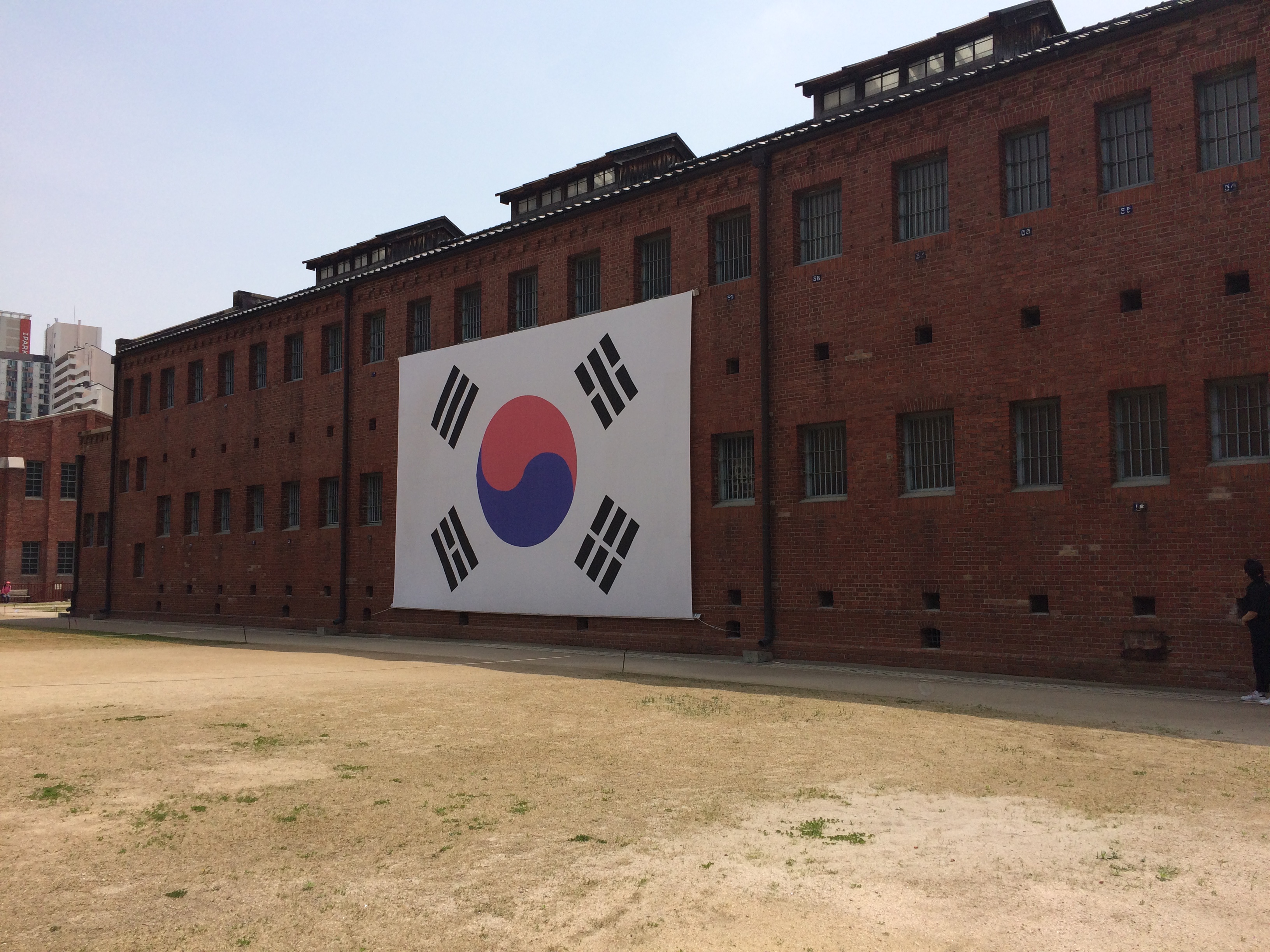
Seodaemun Prison History Hall is a museum and former prison in Seodaemun-gu, Seoul, South Korea. It was constructed beginning in 1907. The prison was opened on October 21, 1908, under the name Gyeongseong Gamok. During the early part of the Japanese colonial period it was known as Keijo Prison (, the Japanese pronunciation of Gyeongseong Gamok). Its name was changed to Seodaemun Prison in 1923, and it later had several other names. History The prison was used during the Japanese colonial period to imprison Korean liberation activists, and could originally hold around 500 inmates. It had a separate facility for women and young girls. In 1911, Kim Koo was imprisoned. He was one of the more important figures in the Korean liberation movement. In 1919, shortly after the March 1st Movement, the number of imprisoned increased drastically. About three thousand liberation activists were imprisoned, and shortly before the colonization ended in 1945, the number of prisoners was at 2980. ... [...More Info...] [...Related Items...] OR: [Wikipedia] [Google] [Baidu] |
Seodaemun Independence Park
Seodaemun Independence Park ( ko, 서대문독립공원) is an educational and cultural park located in Hyunjeo-dong, Seodaemun-gu, Seoul, South Korea. The park contains various monuments and buildings, most notably the Seodaemun Prison Museum. The park receives nearly half a million visitors annually. Overview The name Seodaemun means literally "West Great Gate." This refers to Donuimun, one of the former Eight Gates of Seoul, which was torn down in 1915. Even though the gate no longer survives, this area of Seoul still carries the name Seodaemun. Seodaemun Independence Park contains: #Seodaemun Prison, originally built in 1907, currently a museum #Independence Gate (독립문), completed in 1897, modeled after the Arc de Triomphe in Paris #Plinths of Yeongeunmun Gate, Seoul, which is remnants of intentionally destroyed Yeongeunmun in 1895 #Patriotic Martyr Monument #Independence Hall (독립관), rebuilding of a structure originally built in 1407 #Statue of Seo Jae-pil, Kor ... [...More Info...] [...Related Items...] OR: [Wikipedia] [Google] [Baidu] |
Seoul Metropolitan Council
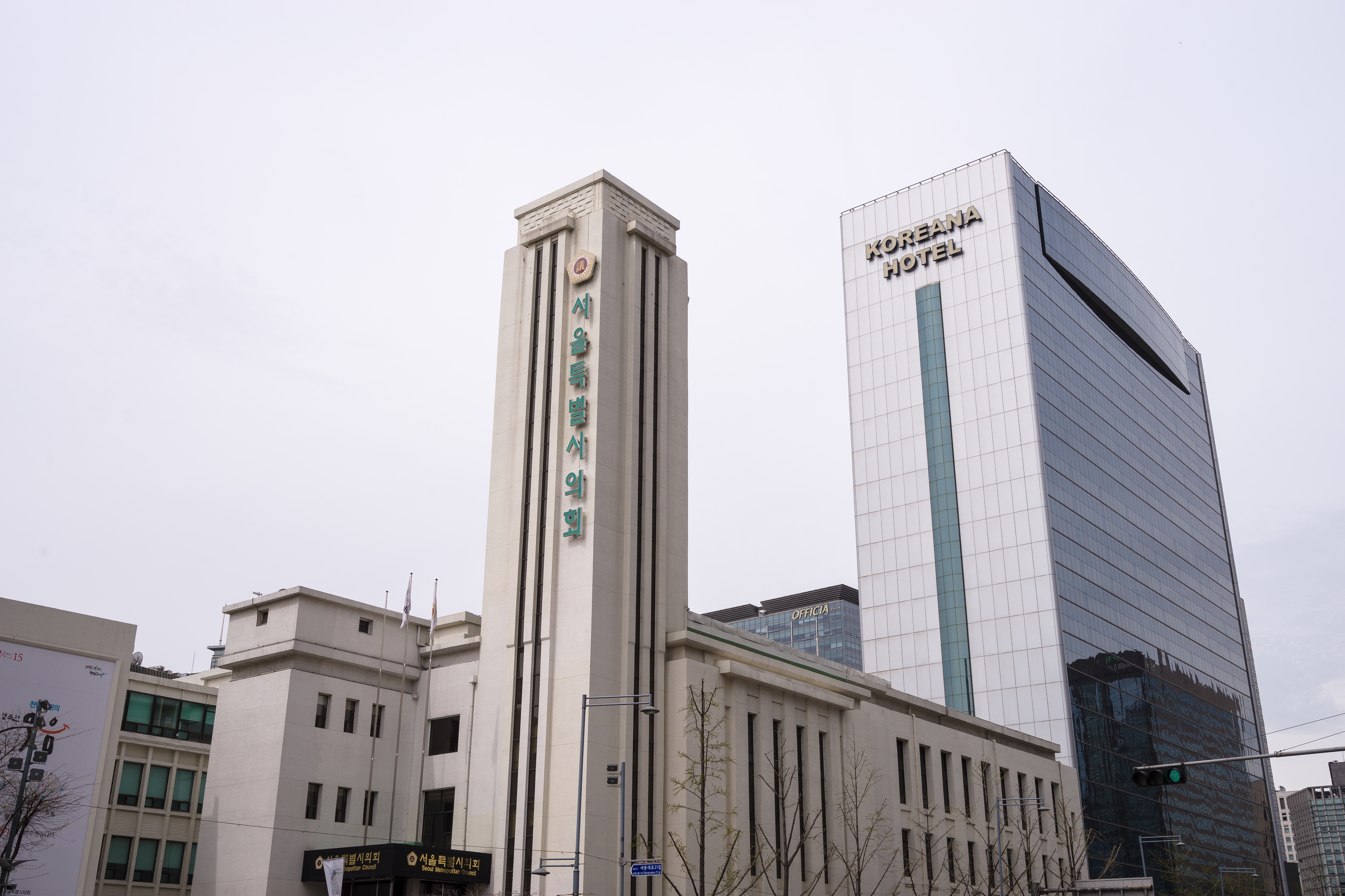
The Seoul Metropolitan Council () is the local council of Seoul. There are a total of 110 members, with 100 members elected in the First-past-the-post voting system and 10 members elected in Party-list proportional representation. Current composition Negotiation groups can be formed by 10 or more members. List of council members Organization The structure of Council consists of: *Chairman *Two Vice Chairmen *Standing Committees **Council Steering Committee **Administration & Autonomy Committee **Planning & Economy Committee **Environment & Water Resources Committee **Culture, Sports & Tourism Committee **Health & Social Affairs Committee **Public Safety & Construction Committee **City Planning & Management Committee **Transportation Committee **Education Committee *Special Committees **Special Committees on Budget & Accounts **Special Committees on Ethics Recent election results 2018 , - style="text-align:center;" ! rowspan="2" colspan="3" width="200" , Party ! ... [...More Info...] [...Related Items...] OR: [Wikipedia] [Google] [Baidu] |
List Of Districts Of Seoul
The districts of Seoul are the twenty-five ''Administrative divisions of South Korea#Gu (District), gu'' ("districts"; hangeul: 구; hanja: 區) comprising Seoul, South Korea. The ''gu'' vary greatly in area (from 10 to 47 km2) and population (from less than 140,000 to 630,000). Songpa-gu is the most populated, while Seocho-gu has the largest area. Gu are similar to London's or New York City, New York's boroughs or Tokyo's Special Wards of Tokyo, 23 special wards. Each gu's government handles many of the functions that are handled by city governments in other jurisdictions. This city-like standing is underscored by the fact that each gu has its own legislative council, mayor and sister cities. Each ''gu'' is further divided into ''Dong (administrative division), dong'' or neighborhoods. Some ''gu'' have only a few ''dong'' while others (like Jongno-gu) have a very large number of distinct neighborhoods. List by population and area ''2014 estimate by Seoul Statistics''. ... [...More Info...] [...Related Items...] OR: [Wikipedia] [Google] [Baidu] |
Independence Gate
Dongnimmun () or Independence Gate is a memorial gate at Seoul, built by Soh Jaipil in late 19th century, as a symbol of Korea's commitment to independence around the world. It is designated as Historic Sites of South Korea in 1963, and relocated to 70m northwest from original location in 1979 for preservation. History Background In 1895, the Government of Joseon abandoned its long continued diplomatic policy of ''Sadae'' (flunkeyism). Under this policy, Joseon was respecting political influence of China. To celebrate it, the Government of Joseon demolished Yeongeunmun in February 1895, which was a traditional symbol of flunkeyism built in 16th century as a symbolic gate only for welcoming Chinese diplomats to Joseon. In March 1895, this movement of the Joseon Government got recognized by the Treaty of Shimonoseki following the First Sino-Japanese War. Yet it was also important to promote the Joseon's public to discard spirit of excessive reliance on China. To achieve this, Kor ... [...More Info...] [...Related Items...] OR: [Wikipedia] [Google] [Baidu] |
Mapo District
Mapo District () is one of the 25 districts of Seoul, South Korea. Mapo has a population of 381,330 (2015) and has a geographic area of 23.87 km2 (9.22 sq mi), and is divided into 24 '' dong'' (administrative neighborhoods). Mapo is located in western Seoul on the northern bank of the Han River, bordering the Gyeonggi Province city of Goyang to the northwest, and the Seoul city districts of Gangseo to the west, Yeongdeungpo to the south, Yongsan to the southeast, Jung to the east, and Seodaemun and Eunpyeong to the north. Mapo is home to several universities and government buildings, and is well known for the Hongdae club district around Hongik University. Mapo is connected to the Seoul Metropolitan Subway's Line 2, Line 5, and Line 6, as well as the Airport Railroad, and the Korail Gyeongui-Jungang Line, which all pass through this district. The Seoul World Cup Stadium, a famous landmark in Seoul, is located in Sangam in northwest Mapo. Mapo District Office Location ... [...More Info...] [...Related Items...] OR: [Wikipedia] [Google] [Baidu] |
Sinchon-dong, Seoul
Sinchon-dong is a neighbourhood and a judicial (as opposed to administrative) ''dong'' () in Seodaemun-gu in Seoul, South Korea. Sinchon's main attraction is its nightlife, with numerous bars of both western style and traditional Korean hofs, restaurants, and other activities aimed at the area's student population. Transport Sinchon Station is located on Seoul Subway Line 2 between Ewha Womans University Station and Hongik University Station. Sinchon Station is also the name of a station on the Gyeongui Line which connects Seoul and Dorasan. Sinchon is the line's second station, located between Seoul Station and Gajwa Station. The main bus station/terminal is located near the police station about 100m south (towards Yeouido) from Sinchon Rotary. Bus number 110A goes to Itaewon and can be caught near Hyundai dept. store. The first transit mall in Seoul and only second in the nation following one in Daegu, opened on Sinchon-ro in January 2014. The vehicle street has shrunk fr ... [...More Info...] [...Related Items...] OR: [Wikipedia] [Google] [Baidu] |
Seoul
Seoul (; ; ), officially known as the Seoul Special City, is the capital and largest metropolis of South Korea.Before 1972, Seoul was the ''de jure'' capital of the Democratic People's Republic of Korea (North Korea) as stated iArticle 103 of the 1948 constitution. According to the 2020 census, Seoul has a population of 9.9 million people, and forms the heart of the Seoul Capital Area with the surrounding Incheon metropolis and Gyeonggi province. Considered to be a global city and rated as an Alpha – City by Globalization and World Cities Research Network (GaWC), Seoul was the world's fourth largest metropolitan economy in 2014, following Tokyo, New York City and Los Angeles. Seoul was rated Asia's most livable city with the second highest quality of life globally by Arcadis in 2015, with a GDP per capita (PPP) of around $40,000. With major technology hubs centered in Gangnam and Digital Media City, the Seoul Capital Area is home to the headquarters of 15 ''Fo ... [...More Info...] [...Related Items...] OR: [Wikipedia] [Google] [Baidu] |
Eunpyeong District
Eunpyeong District (은평구, ''Eunpyeong-gu'') is one of the 25 districts of Seoul, South Korea. Eunpyeong has a population of 450,583 (2010) and has a geographic area of 29.7 km2 (11.5 sq mi), and is divided into 16 '' dong'' (administrative neighborhoods). Eunpyeong is located in northwestern Seoul, bordering the Gyeonggi Province city of Goyang to the west, and the Seoul city districts of Mapo to the southwest, Seodaemun to the south, and Jongno to the east. Kim Mi-kyung of the Democratic Party has been the mayor of Eunpyeong since July 2018. Administrative divisions *Bulgwang-dong (불광동, 佛光洞) *Daejo-dong (대조동, 大棗洞) *Eungam-dong (응암동, 鷹岩洞) *Galhyeon-dong (갈현동, 葛峴洞) *Gusan-dong (구산동, 龜山洞) *Jeungsan-dong (증산동, 繒山洞) *Jingwan-dong (진관동, 津寬洞) *Nokbeon-dong (녹번동, 碌磻洞) * Sinsa-dong (신사동, 新寺洞) *Susaek-dong (수색동, 水色洞) *Yeokchon-dong (역촌동, 驛村洞) Transpor ... [...More Info...] [...Related Items...] OR: [Wikipedia] [Google] [Baidu] |
The Eight Gates Of Seoul
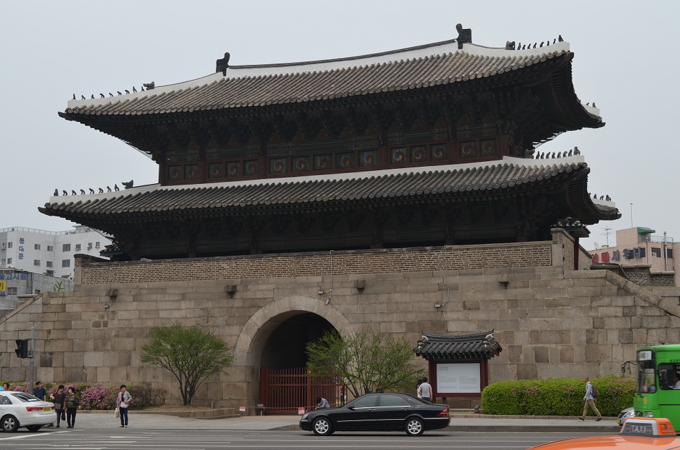
The Eight Gates of Seoul are eight historical gates that were located in the Fortress Wall of Seoul, South Korea, which surrounded the city in the Joseon Dynasty. Six of these gates exist today (2018). All eight gates were originally built between 1396 and 1398. Introduction The Eight Gates were based roughly in the four cardinal and four intermediate directions of the compass. Of the eight gates, the North, South, East, and West were known as the “Four Great Gates” (사대문), while the Northwest, Northeast, Southeast, and Southwest gates were known as the “Four Small Gates” (사소문). Of the eight gates, two (West and Southwest) no longer exist. Memorials are currently placed roughly where the West and Southwest gates once stood (July 2012). There has been discussion and announcements about rebuilding the West Gate, but no construction has yet been undertaken (as of July 2012) for this gate. On February 10, 2008, the South Gate was severely damaged in a fire set ... [...More Info...] [...Related Items...] OR: [Wikipedia] [Google] [Baidu] |
Outer Old Seoul
Outer old Seoul or ''Seongjeosimni'' (Hangul: 성저십리, Hanja: 城底十里) was the area of Seoul located outside of the Fortress Wall but within the city limits during the Joseon period. Outer old Seoul corresponds to the island of Yeouido and present-day Seoul city districts of Eunpyeong, Mapo, Seodaemun, Yongsan, Dongdaemun, Seongbuk, Gangbuk, and Seongdong. History Outer old Seoul was official territory of ''Hanseong-bu'' (한성부), the capital city of Joseon, meaning it did not belong to the two surrounding counties around old Seoul - Goyang and Yangju - but surrounded the urbanized Inner old Seoul, often referred as "the inside area of the Eight Gates of Seoul" or ''Sadaemun-an'' (사대문안). Unlike Inner old Seoul, the number of residents was relatively smaller and predominantly rural in character, with city authorities maintaining the region as a green belt by making deforestation and funeral burials within the area highly regulated or prohibited. Outer old S ... [...More Info...] [...Related Items...] OR: [Wikipedia] [Google] [Baidu] |


