|
Seebensee 7
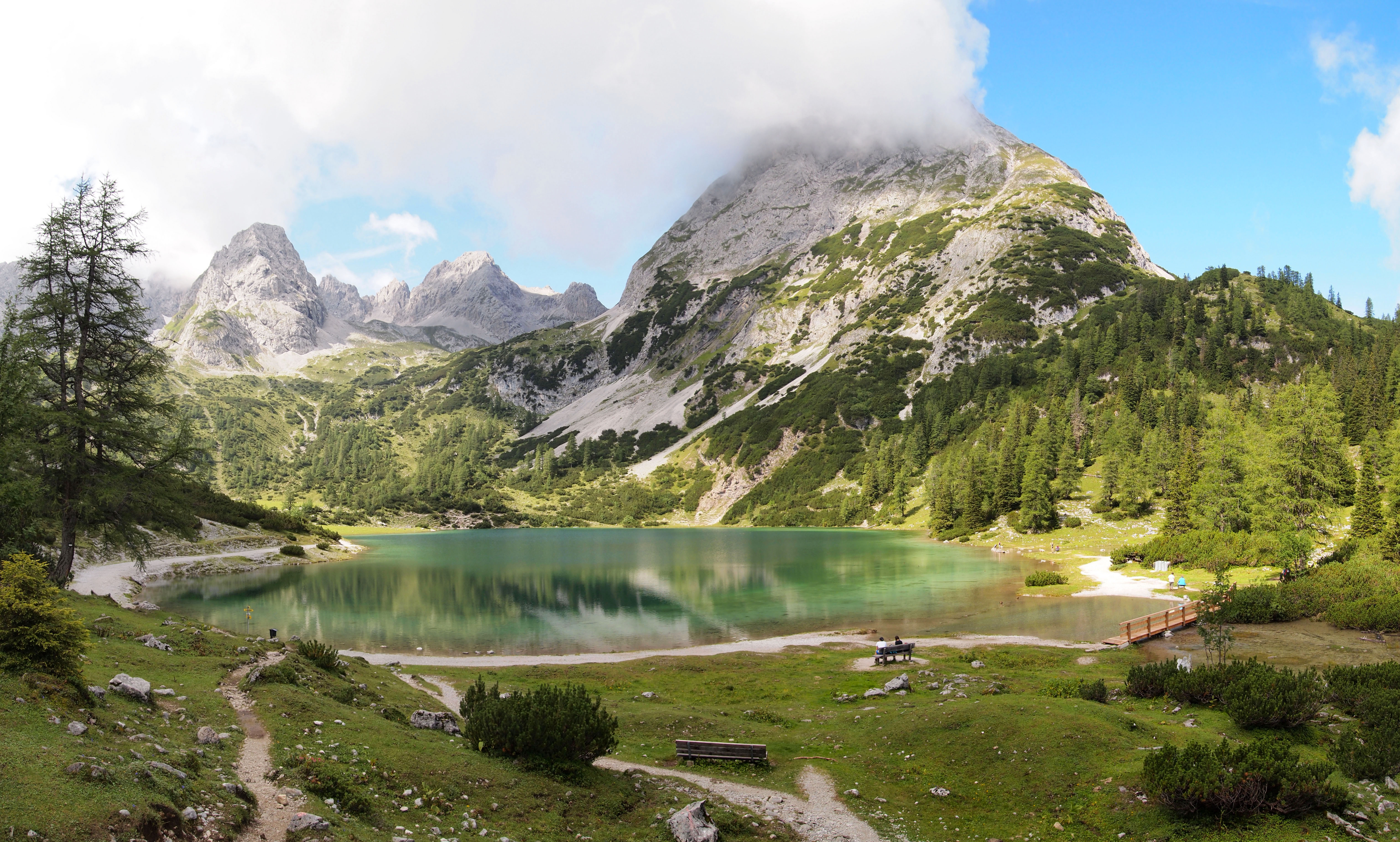
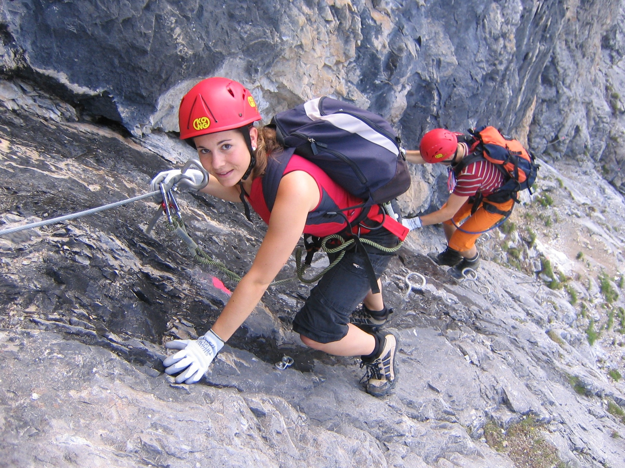
The Seebensee is a natural high mountain lake (an ice-age affected, rock basin lake) at a height of 1,657 metres, south of Ehrwald in the Mieming Range. It is surrounded by the Vorderer Tajakopf in the east, the Vorderer Drachenkopf in the south and the Ehrwalder Sonnenspitze in the west. The Seebensee has no significant above-ground inflows and one outflow via the Seebenbach Falls and the Geißbach into the Loisach river. The lake may be reached from Ehrwald on a forest track via the Ehrwalder Alm, via the Seeben Klettersteig, a difficult klettersteig, or via one of the two protected mountain trails '' Hoher Gang'' or '' Immensteig''. From Biberwier, the lake may be reached via the arête of the Biberwierer Scharte, and from Leutasch through the Gaistal valley. Near the lake (to the northeast) lies the managed alpine pasture of Seebenalm. To the south on a rock terrace above the lake is the Coburger Hut owned by the German Alpine Club. The surface of the lake covers around 6 ... [...More Info...] [...Related Items...] OR: [Wikipedia] [Google] [Baidu] |
Mieming Range
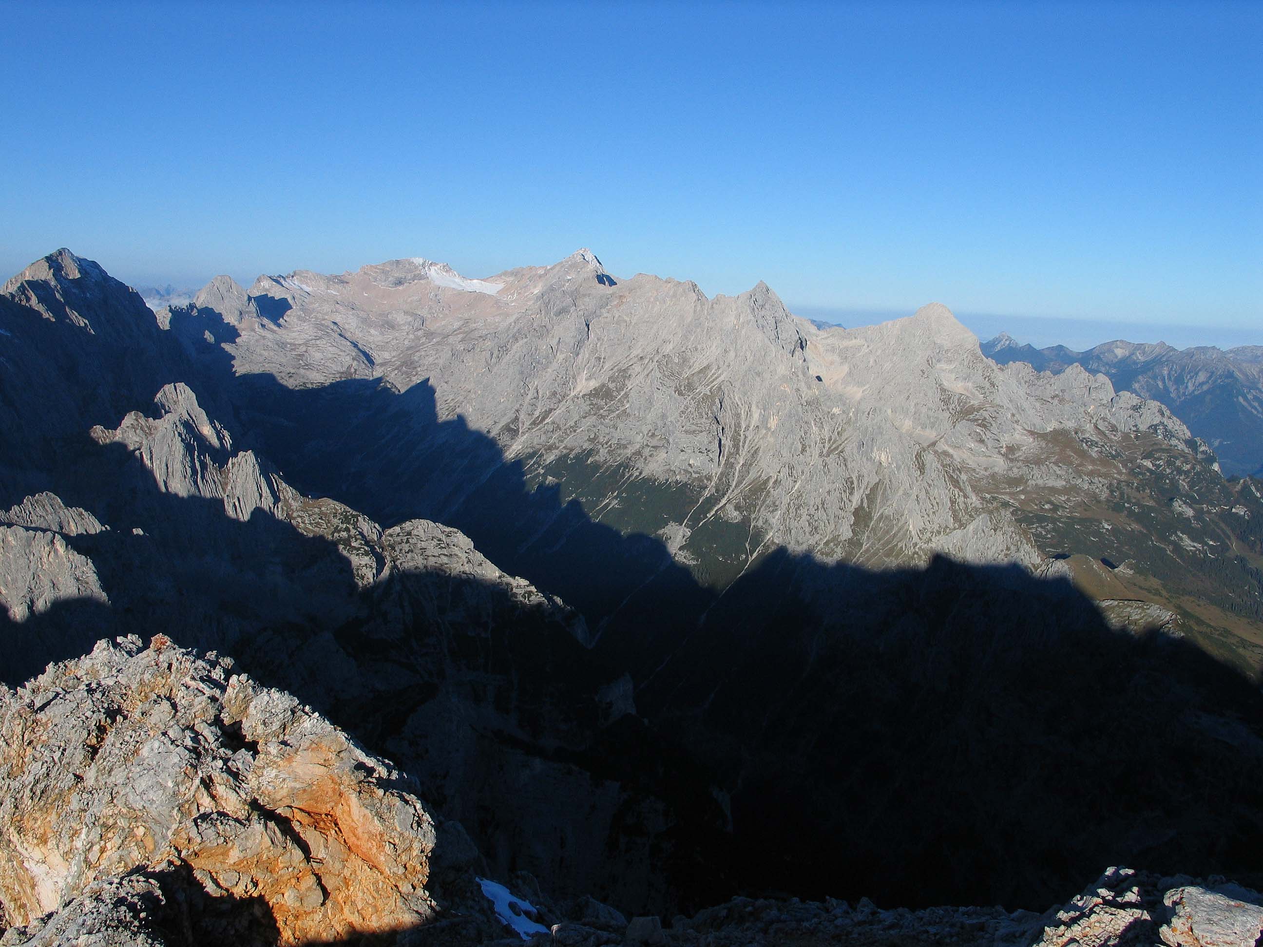
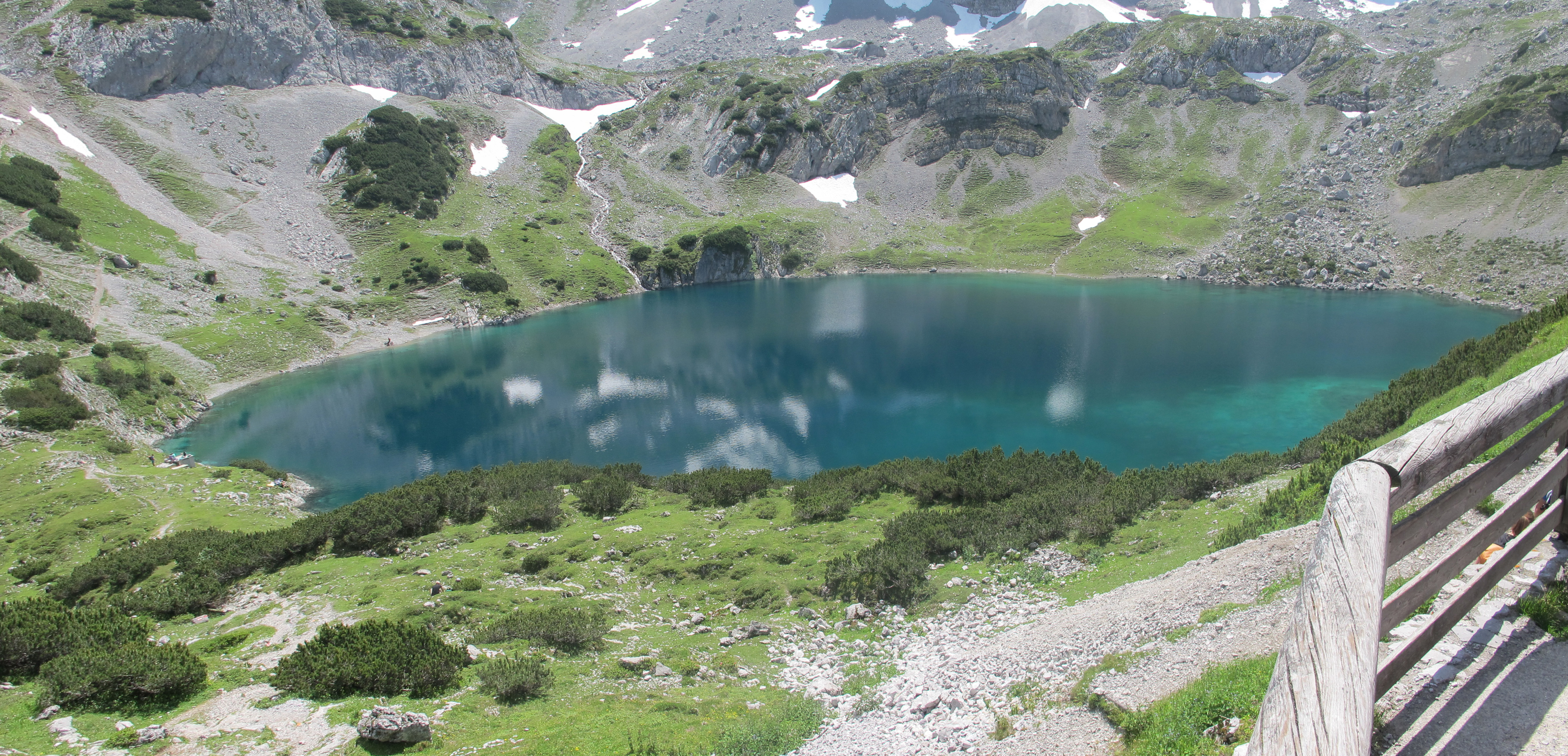
The Mieming(er) Range, Mieminger Chain (german: Mieminger Kette) or Mieminger Mountains (''Mieminger Gebirge''), is a mountain range of the Northern Limestone Alps in the Eastern Alps. It is located entirely in Austria within the state of Tyrol (Bundesland), Tyrol. This sub-group is somewhat in the shadows of its more famous neighbour, the Wetterstein Mountains, Wetterstein to the north. Whilst the region around the Coburger Hut and the lakes of Seebensee and Drachensee in the west (Ehrwalder Sonnenspitze and Vorderer Tajakopf with its new ''klettersteig'' over the Tajakante) and the Hohe Munde in the extreme east receive large numbers of visitors, the less developed central area remains very quiet. The Hohe Munde is also a popular and challenging ski touring destination. Public transport links: The Außerfern Railway stops at Ehrwald on the western side of the range. Busses run from Leutasch on the southern side of the mountains to Mittenwald and Seefeld in Tirol. Geology ... [...More Info...] [...Related Items...] OR: [Wikipedia] [Google] [Baidu] |
Biberwier
Biberwier is a municipality with 612 inhabitants (as of 1 January 2019) in the district of Reutte (district), Reutte in the Austrian state of state of Tyrol, Tyrol. The municipality is located in the district court Reutte. Geography The village is located on the southern edge of the Ehrwald, Lermooser Moos, between a mountain slope and the landslide landscape of the Fern Pass in the Tyrolean Alps. The municipality is crossed by the Loisach, which springs west of the village. The community is located near the border with Germany on the edge of the Wetterstein, Wetterstein Mountains and is visible from the Zugspitze. History The name derives from beavers, who have demonstrably lived in the municipality until 1800 and arrived back in recent years. Corpus of finds from the Roman period bear witness to the early importance of the place on the Via Claudia Augusta. The track grooves at the northern entrance, though referred to as Roman, are from Medieval times. From the Middle Ages ... [...More Info...] [...Related Items...] OR: [Wikipedia] [Google] [Baidu] |
Loisach Basin
The Loisach is a river that flows through Tyrol (state), Tyrol, Austria and Bavaria, Germany. Its name might be Celts, Celtic in origin, from Proto-Celtic ''*lawo'' and ''*iskā'', both of which mean "water". The Loisach goes through the great swamp . The Loisach is a left tributary to the Isar. The source of the Loisach is near Ehrwald in Austria. The Loisach flows past Garmisch-Partenkirchen and into the Kochelsee. At the Kochelsee the water that was diverted from the upper river Isar for the Walchensee Hydroelectric Power Station joins the Loisach. The Loisach then flows out of Kochelsee and joins the Isar at Wolfratshausen. A canal joins the Isar and the Loisach returning the water diverted for power generation to the Isar before Wolfratshausen to reduce the risk of flooding in the town. The most important tributaries of the Loisach entering from the right-hand side are the Hammersbach, the Partnach near Garmisch-Partenkirchen, the streams Kuhflucht near Farchant, Röhrlbach ... [...More Info...] [...Related Items...] OR: [Wikipedia] [Google] [Baidu] |
Alpine Club Guide
The ''Alpine Club Guides'' (german: Alpenvereinsführer, commonly shortened to ''AV Führer'' or ''AVF'') are the standard series of Alpine guides that cover all the important mountain groups in the Eastern Alps. They are produced jointly by the German (DAV), Austrian (ÖAV) and South Tyrol Alpine Clubs (AVS). They have been published since 1950 by the firm of Bergverlag Rother in Munich, Germany. The AV guides contain all the routes – hiking trails, mountain hut approaches and summit climbs as well as ice and high mountain routes and ''klettersteigs'' in each mountain range. The descriptions are factual and dry, with few illustrations - rather unlike mountain books by e.g. Walter Pause – and despite introductory sections require general Alpine knowledge and experience. Examples are the ''AVF Allgäuer Alpen'' and the ''AVF Verwallgruppe''.The AV guides are often used as the basis for other publications and complement the Alpine Club maps or other map series. Available guid ... [...More Info...] [...Related Items...] OR: [Wikipedia] [Google] [Baidu] |
Alpine Club Map
Alpine Club maps (german: Alpenvereinskarten, often abbreviated to ''AV-Karten'' i.e. AV maps) are specially detailed maps for summer and winter mountain climbers (mountaineers, hikers and ski tourers). They are predominantly published at a scale of 1:25.000, although some individual sheets have scales of 1:50.000 and 1:100.000. The cartographic library of the German (DAV) and Austrian Alpine Clubs (OeAV) currently has about 70 different high mountain maps. Also, individual map sheets of the Alpine region or other interesting mountain areas in the world are continually being published. The publication of its maps has been a function of the Alpine Club since 1865. The reason the two clubs still issue their maps is to complement the range of more or less good official maps of the high mountains with special large-scale maps. This is especially true for the Austrian Alpine region, which is the classical field for Alpine Club branches (sections). Here, there are no official maps at a s ... [...More Info...] [...Related Items...] OR: [Wikipedia] [Google] [Baidu] |
Wetterstein Mountains
The Wetterstein mountains (german: Wettersteingebirge), colloquially called Wetterstein, is a mountain group in the Northern Limestone Alps within the Eastern Alps. It is a comparatively compact range located between Garmisch-Partenkirchen, Mittenwald, Seefeld in Tirol and Ehrwald along the border between Germany (Bavaria) and Austria (Tyrol). Zugspitze, the highest peak is at the same time the highest mountain in Germany. The Wetterstein mountains are an ideal region for mountaineers and climbers. Mountain walkers sometimes need to allow for significant differences in elevation. The proximity of the range to the south German centres of population, the scenic landscape and its good network of cable cars and lifts mean that the mountains are heavily frequented by tourists for most of the year. There are, however, places in the Wetterstein that are rarely or never visited by people. Neighbouring ranges The Wetterstein borders on the following other mountain ranges of t ... [...More Info...] [...Related Items...] OR: [Wikipedia] [Google] [Baidu] |
Hectares
The hectare (; SI symbol: ha) is a non-SI metric unit of area equal to a square with 100-metre sides (1 hm2), or 10,000 m2, and is primarily used in the measurement of land. There are 100 hectares in one square kilometre. An acre is about and one hectare contains about . In 1795, when the metric system was introduced, the ''are'' was defined as 100 square metres, or one square decametre, and the hectare ("hecto-" + "are") was thus 100 ''ares'' or km2 (10,000 square metres). When the metric system was further rationalised in 1960, resulting in the International System of Units (), the ''are'' was not included as a recognised unit. The hectare, however, remains as a non-SI unit accepted for use with the SI and whose use is "expected to continue indefinitely". Though the dekare/decare daa (1,000 m2) and are (100 m2) are not officially "accepted for use", they are still used in some contexts. Description The hectare (), although not a unit of SI, is ... [...More Info...] [...Related Items...] OR: [Wikipedia] [Google] [Baidu] |
German Alpine Club
The German Alpine Club (german: links=no, Deutscher Alpenverein, DAV for short) is the world's largest climbing association and the eighth-largest sporting association in Germany. It is a member of the German Olympic Sports Confederation and the competent body for sport and competition climbing, hiking, mountaineering, hill walking, ice climbing, mountain expeditions, as well as ski mountaineering. It is an association made up of local branches known as 'sections'. History The German Alpine Club was founded as on 9 May 1869 in Munich by 36 former members of the Austrian Alpine Club around the Ötztal curate Franz Senn. It was founded in order to promote the development of tourism in the Eastern Alps through the building of mountain huts, and establishment of hiking trails, and via ferratas. The association had a large membership from the beginning, attracting 1,070 members in the first ten months. The German and the Austrian societies merged in 1873 to form the German and A ... [...More Info...] [...Related Items...] OR: [Wikipedia] [Google] [Baidu] |
Leutasch
Leutasch is a municipality in the northern part of the district Innsbruck-Land in the Austrian state of Tyrol about 30 km northwest of Innsbruck and 10 km northwest of Seefeld in Tirol Geography The village lies in the Leutaschtal, a high valley that extends for over 16 kilometres from the Hohe Munde to the northeast along the Wetterstein Mountains and ends at the Leutasch Gorge, which forms the border with Germany at Mittenwald. The valley is framed by other prominent peaks such as the Hochwanner, the Dreitorspitze and the Arnspitze. The valley is a large rock basin formed by glaciers of the Ice Age and filled with gravel and lake sediments. The Leutascher Ache river flows through it. The Gaistal valley leads between the Wetterstein and Mieming Chain to the west to the Ehrwald Alm. Leutasch is protected to the south from the warm föhn and to the north from the cold by the Wetterstein. From the west, snow clouds have easy access through the Gaistal valley. ... [...More Info...] [...Related Items...] OR: [Wikipedia] [Google] [Baidu] |
Coburger Hütte
The Coburger Hut (german: Coburger Hütte) is an Alpine hut owned by the Coburg Branch of the German Alpine Club. It is located in the Mieming Range in the Austrian state of Tyrol and lies only a few metres in height above the lake of Drachensee. The accommodation is generally open from June to early October and there is a winter room. History The construction of the hut goes back to a proposal by the Munich alpinist, Ferdinand Kilger, in 1890. This was taken up in 1895 by the Coburg branch of the German Alpine Club, a branch which had been founded in 1879. In 1901 the first hut was finished and, in the years that followed, it was given a water connexion (the "drinking quality water" was drawn from the Grünsteinsee, a lake which has now dried out), an electrical generator and, in 1908, a telephone line. After the First World War the building was extended for the first time and, in 1962, the material ropeway was built. For the 75th anniversary of the hut a new toilet block w ... [...More Info...] [...Related Items...] OR: [Wikipedia] [Google] [Baidu] |
Tyrol (state)
Tyrol (; german: Tirol ; it, Tirolo) is a States of Austria, state (''Land'') in western Austria. It comprises the Austrian part of the historical County of Tyrol, Princely County of Tyrol. It is a constituent part of the present-day Euroregion Tyrol–South Tyrol–Trentino (together with South Tyrol and Trentino in Italy). The capital of Tyrol is Innsbruck. Geography The state of Tyrol is separated into two parts, divided by a strip. The larger territory is called North Tyrol (''Nordtirol'') and the smaller area is called East Tyrol (''Osttirol''). The neighbouring Austrian state of Salzburg (state), Salzburg stands to the east, while on the south Tyrol has a border with the Italy, Italian province of South Tyrol (Trentino-Alto Adige/Südtirol) which was part of the Austro-Hungarian Empire before the First World War. With a land area of , Tyrol is the third-largest state in Austria. Tyrol shares its borders with the federal state of Salzburg in the east and Vorarlberg in th ... [...More Info...] [...Related Items...] OR: [Wikipedia] [Google] [Baidu] |
Klettersteig
A via ferrata (Italian language, Italian for "iron path", plural ''vie ferrate'' or in English ''via ferratas'') is a protected climbing route found in the Alps and certain other locations. The term "via ferrata" is used in most countries and languages except notably in German-speaking regions, which use ''Klettersteig''—"climbing path" (plural ''Klettersteige''). Infrastructure A via ferrata is a climbing route that employs steel cables, rungs or ladders, fixed to the rock to which the climbers affix #Safety and equipment, a harness with two leashes, which allows the climbers to secure themselves to the metal fixture and limit any fall. The cable and other fixtures, such as iron rungs (stemples), pegs, carved steps, and ladders and bridges, provide both footings and handholds, as well. This allows climbing on otherwise dangerous routes without the risks of unprotected scrambling and climbing or the need for technical climbing equipment. They expand the opportunities for acce ... [...More Info...] [...Related Items...] OR: [Wikipedia] [Google] [Baidu] |
