|
Sedbergh
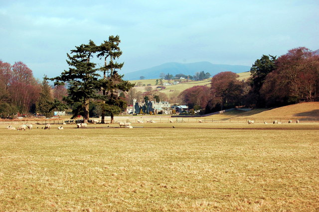
Sedbergh ( or ) is a town and civil parish in Cumbria, England. The 2001 census gave the parish a population of 2,705, increasing at the 2011 census to 2,765. Historically in the West Riding of Yorkshire, it lies about east of Kendal, north of Lancaster and about north of Kirkby Lonsdale, just within the Yorkshire Dales National Park. It stands at the foot of Howgill Fells, on the north bank of the River Rawthey, which joins the River Lune below the town. Situation Sedbergh has a narrow main street lined with shops. From all angles, the hills rising behind the houses can be seen. Until the coming of the Ingleton Branch Line in 1861, these remote places were reachable only by walking over some steep hills. The line to Sedbergh railway station ran from 1861 to 1954. The civil parish covers a large area, including the hamlets of Millthrop, Catholes, Marthwaite, Brigflatts, High Oaks, Howgill, Lowgill and Cautley, the southern part of the Howgill Fells and the wes ... [...More Info...] [...Related Items...] OR: [Wikipedia] [Google] [Baidu] |
Sedbergh School
Sedbergh School is a public school (English independent day and boarding school) in the town of Sedbergh in Cumbria, in North West England. It comprises a junior school for children aged 4 to 13 and the main school for 13 to 18 year olds. It was established in 1525. History Roger Lupton was born at Cautley in the parish of Sedbergh, Yorkshire, in 1456 and he provided for a Chantry School in Sedbergh in 1525 while he was Provost of Eton.History of the school By 1528, land had been bought, a school built, probably on the site of the present school library, and the foundation deed had been signed. Lupton's subsequent donations to the school's ''Sedbergh scholars'' of numerous scholarships and fellowships to |
St Andrew's Church, Sedbergh
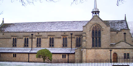
St Andrew's Church is in Main Street, Sedbergh, Cumbria, England. It is an active Anglican parish church in the deanery of Kendal, and the diocese of Carlisle. Its benefice is united with those of St Mark, Cautley, and St John the Baptist, Garsdale, to form the benefice of Sedbergh, Cautley and Garsdale. The church is recorded in the National Heritage List for England as a designated Grade I listed building. History The present church dates mainly from about 1500, but fabric from earlier churches has been incorporated. A major restoration was carried out in 1885–86 by the Lancaster architects Paley and Austin. This included rebuilding the south aisle, its arcade and parts of the walling, lowering the floor, and removing the gallery. A new pulpit, altar and altar rails were added, which were made by Gillow. The restoration and the additions cost £4,200. Architecture Exterior St Andrew's is constructed in rubble stone with sandstone quoins and dressings; it h ... [...More Info...] [...Related Items...] OR: [Wikipedia] [Google] [Baidu] |
Sedbergh Railway Station
Sedbergh railway station was located in the West Riding of Yorkshire, serving the town and locale of Sedbergh on the Ingleton Branch Line. The town now lies in Cumbria following boundary changes in 1974. History The Lancaster and Carlisle Railway built the Ingleton Branch Line from the existing Ingleton Station to Low Gill. By the time the branch was completed in 1861, the L&CR was operated by the London and North Western Railway The London and North Western Railway (LNWR, L&NWR) was a British railway company between 1846 and 1922. In the late 19th century, the L&NWR was the largest joint stock company in the United Kingdom. In 1923, it became a constituent of the ... (L&NWR). After formal closure to passenger traffic in February 1954, the line was still on occasions used for weekend excursions and to transport pupils to and from local boarding schools (including one in the town here). Goods traffic continued until 1 October 1964. The line was maintained as a pos ... [...More Info...] [...Related Items...] OR: [Wikipedia] [Google] [Baidu] |
Cumbria
Cumbria ( ) is a ceremonial and non-metropolitan county in North West England, bordering Scotland. The county and Cumbria County Council, its local government, came into existence in 1974 after the passage of the Local Government Act 1972. Cumbria's county town is Carlisle, in the north of the county. Other major settlements include Barrow-in-Furness, Kendal, Whitehaven and Workington. The administrative county of Cumbria consists of six districts (Allerdale, Barrow-in-Furness, Carlisle, Copeland, Eden and South Lakeland) and, in 2019, had a population of 500,012. Cumbria is one of the most sparsely populated counties in England, with 73.4 people per km2 (190/sq mi). On 1 April 2023, the administrative county of Cumbria will be abolished and replaced with two new unitary authorities: Westmorland and Furness (Barrow-in-Furness, Eden, South Lakeland) and Cumberland (Allerdale, Carlisle, Copeland). Cumbria is the third largest ceremonial county in England by area. It is ... [...More Info...] [...Related Items...] OR: [Wikipedia] [Google] [Baidu] |
Millthrop
Millthrop is a hamlet in the South Lakeland district of Cumbria, Northern England and the Yorkshire Dales. Millthrop lies on the south bank of the River Rawthey close to the town of Sedbergh Sedbergh ( or ) is a town and civil parish in Cumbria, England. The 2001 census gave the parish a population of 2,705, increasing at the 2011 census to 2,765. Historically in the West Riding of Yorkshire, it lies about east of Kendal, no .... See also * Listed buildings in Sedbergh References Hamlets in Cumbria South Lakeland District {{Cumbria-geo-stub ... [...More Info...] [...Related Items...] OR: [Wikipedia] [Google] [Baidu] |
Howgill Fells
The Howgill Fells are uplands in Northern England between the Lake District and the Yorkshire Dales, lying roughly within a triangle formed by the towns of Sedbergh and Kirkby Stephen and the village of Tebay.The Howgill Fells in Cumbria ''www.visitcumbria.com'' The name Howgill derives from the word ''haugr'' meaning a hill or barrow, plus ''gil'' meaning a narrow valley. Geography The Howgill Fells are bounded by the (and the |
South Lakeland
South Lakeland is a local government district in Cumbria, England. The population of the non-metropolitan district was 102,301 according to the 2001 census, increasing to 103,658 at the 2011 Census. Its council is based in Kendal. It includes much of the Lake District as well as northwestern parts of the Yorkshire Dales. The district was created on 1 April 1974 under the Local Government Act 1972. It was formed from the Kendal borough, Windermere urban district, most of Lakes urban district, South Westmorland Rural District, from Westmorland, Grange and Ulverston urban districts and North Lonsdale Rural District from Lancashire, and Sedbergh Rural District from the West Riding of Yorkshire. In July 2021 the Ministry of Housing, Communities and Local Government announced that in April 2023, Cumbria will be reorganised into two unitary authorities. South Lakeland District Council is to be abolished and its functions transferred to a new authority, to be known as ... [...More Info...] [...Related Items...] OR: [Wikipedia] [Google] [Baidu] |
Yorkshire Dales National Park
The Yorkshire Dales National Park is a national park in England covering most of the Yorkshire Dales. Most of the park is in North Yorkshire, with a sizeable area in Westmorland (Cumbria) and a small part in Lancashire. The park was designated in 1954, and extended in 2016. Over 95% of the land in the Park is under private ownership; there are over 1,000 farms in this area. In late 2020, the park was named as an International Dark Sky Reserve. This honour confirms that the area has "low levels of light pollution with good conditions for astronomy". Some 23,500 residents live in the park (as of 2017); a 2018 report estimated that the Park attracted over four million visitors per year. The economy consists primarily of tourism and agriculture. Location The park is north-east of Manchester; Otley, Ilkley, Leeds and Bradford lie to the south, while Kendal is to the west, Darlington to the north-east and Harrogate to the south-east. The national park does not include ... [...More Info...] [...Related Items...] OR: [Wikipedia] [Google] [Baidu] |
Briggflatts Meeting House
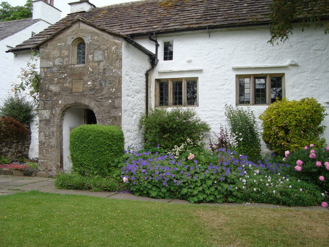
Brigflatts Meeting House or Briggflatts Meeting House is a Friends Meeting House of the Religious Society of Friends (Quakers), near Sedbergh, Cumbria, in north-western England. Built in 1675, it is the second oldest Friends Meeting House in England. It has been listed Grade I on the National Heritage List for England since March 1954. It is the subject of a twelve-line poem titled "At Briggflatts meetinghouse" by British modernist poet Basil Bunting. Bunting's poem was written in 1975 for the 300th anniversary of the meeting house's construction. Cites the poem as ''Odes II:11, 1975''. Throughout its history, the spelling has varied from ''Brigflatts'', ''Brigflats'', ''Briggflats'', or ''Briggflatts'', for both the village and the Quaker Meeting. Currently, the Quaker Meeting uses the spelling "Brigflatts".SeeBrigflatts Quaker Meeting Retrieved 13 May 2015. The variant spelling with two g's and two t's was used by Bunting for his two poems, "At Briggflatts Meetinghouse" (1975) ... [...More Info...] [...Related Items...] OR: [Wikipedia] [Google] [Baidu] |
River Rawthey
The River Rawthey is a river in Cumbria in northwest England. The headwaters of the Rawthey are at Rawthey Gill Foot, where Rawthey Gill meets Haskhaw Gill. The source of Rawthey Gill is unclear, but is either on Knoutberry Haw or near to the East Tarns of Baugh Fell. Moving initially northwards, the Rawthey picks up Whin Stone Gill in Uldale before skirting round Bluecaster, after which the river runs south-southwest through Cautley. The Rawthey is joined by the Clough River, coming from Garsdale, near Dowbiggin, and, having run past Castleshaw Tower, the River Dee close to Sedbergh. The Rawthey joins the Lune at Stangerthwaite soon afterwards. Most of the country through which the Rawthey runs is part of the historic West Riding of Yorkshire The West Riding of Yorkshire is one of three historic subdivisions of Yorkshire, England. From 1889 to 1974 the administrative county County of York, West Riding (the area under the control of West Riding County Council), abbrevi ... [...More Info...] [...Related Items...] OR: [Wikipedia] [Google] [Baidu] |
Firbank Fell
Firbank Fell is a hill in Cumbria between the towns of Kendal and Sedbergh that is renowned as a place where George Fox, the founder of the Religious Society of Friends (Quakers), preached. Fox described what happened there on 13 June 1652 in this way: While others were gone to dinner, I went to a brook, got a little water, and then came and sat down on the top of a rock hard by the chapel. In the afternoon the people gathered about me, with several of their preachers. It was judged there were above a thousand people; to whom I declared God's everlasting truth and Word of life freely and largely for about the space of three hours. Because of Fox's preaching there, the site is sometimes called "Fox's Pulpit." A plaque on the rock there commemorates the event, which is sometimes considered the beginning of the Friends movement. Firbank Fell is now immortalised as a place of Quaker history in one of the four houses at the Quaker school Bootham School Bootham School is an ... [...More Info...] [...Related Items...] OR: [Wikipedia] [Google] [Baidu] |
Kirkby Lonsdale
Kirkby Lonsdale () is a town and civil parish in the South Lakeland district of Cumbria, England, on the River Lune. Historically in Westmorland, it lies south-east of Kendal on the A65. The parish recorded a population of 1,771 in the 2001 census, increasing to 1,843 at the 2011 Census. Notable buildings include St Mary's Church, a Norman building with fine carved columns. The view of the River Lune from the churchyard is known as Ruskin's View after John Ruskin, who called it one of the loveliest in England. It was painted by J. M. W. Turner. Governance Kirkby Lonsdale is in the Westmorland and Lonsdale parliamentary constituency; Tim Farron of the Liberal Democrats is the current member. In local government it is in the Kirkby Lonsdale ward of South Lakeland District Council and the Sedbergh & Kirkby Lonsdale Division of Cumbria County Council. It has a parish council: Kirkby Lonsdale Town Council. Early history Early signs of occupation include a Neolithic ston ... [...More Info...] [...Related Items...] OR: [Wikipedia] [Google] [Baidu] |


