|
Seamill
Seamill is a village in North Ayrshire on the west coast of Scotland, about 5 miles north of Ardrossan and 8 miles south of Largs, on the east coast of the Firth of Clyde. It is sometimes considered part of West Kilbride, and sometimes considered as a village in its own right. The local authority has sought to consolidate it with West Kilbride by signposting it as "West Kilbride incorporating Seamill", however its location on the major A78 trunk road (West Kilbride proper is bypassed) means that it is still locally identified as an entity in its own right. It is named after one of its oldest buildings, the Sea Mill, a grain watermill that appears in Johannes Blaeu's Atlas of Scotland published in Amsterdam in 1654. Seamill village has a golf club A golf club is a club used to hit a golf ball in a game of golf. Each club is composed of a shaft with a grip and a club head. Woods are mainly used for long-distance fairway or tee shots; irons, the most versatile class, are use ... [...More Info...] [...Related Items...] OR: [Wikipedia] [Google] [Baidu] |
West Kilbride
West Kilbride ( gd, Cille Bhrìghde an Iar) is a village and historic parish in North Ayrshire, Scotland, on the west coast by the Firth of Clyde, looking across the Firth of Clyde to Goat Fell and the Isle of Arran. West Kilbride and adjoining districts of Seamill and Portencross are generally considered to be a small town, having a combined population of 4,393 at the 2001 census. History Early history A Neolithic cup and ring marked stone is located on Blackshaw Hill, near West Kilbride. This stone is unusual, in that it is carved with three spirals. Although the purpose of such stones is not known, it is considered that they may have had religious importance. Traces of an Iron Age fortification were uncovered when the house named "The Fort" was constructed in Ardrossan Road, Seamill. Celtic West Kilbride is generally believed to be named after the ancient Celtic Saint Brigid of Kildare, often known as St Bride. The name suggests there was once a cell or ''kil'' to Bri ... [...More Info...] [...Related Items...] OR: [Wikipedia] [Google] [Baidu] |
Firth Of Clyde
The Firth of Clyde is the mouth of the River Clyde. It is located on the west coast of Scotland and constitutes the deepest coastal waters in the British Isles (it is 164 metres deep at its deepest). The firth is sheltered from the Atlantic Ocean by the Kintyre peninsula, which encloses the outer firth in Argyll and Ayrshire. The Kilbrannan Sound is a large arm of the Firth of Clyde, separating the Kintyre Peninsula from the Isle of Arran. Within the Firth of Clyde is another major island – the Isle of Bute. Given its strategic location at the entrance to the middle and upper Clyde, Bute played a vital naval military role during World War II. Geography At its entrance, the firth is about wide. At one area in its upper reaches, it is joined by Loch Long and the Gare Loch. This area includes the large anchorage off of Greenock that is known as the Tail of the Bank. (The “Bank” is a reference to the sandbank and shoal that separates the firth from the estuary of the Ri ... [...More Info...] [...Related Items...] OR: [Wikipedia] [Google] [Baidu] |
Portencross
Portencross ( gd, Port na Crois) is a hamlet near Farland Head in North Ayrshire, Scotland. Situated about west of Seamill and about south of Hunterston B nuclear power station, it is noted for Portencross Castle. It has two harbours and a pier. The "Old Harbour" is actually a small tidal inlet next to the castle, and is part of the castle property. The larger harbour, "North Harbour", owned by the Portencross Harbour Trust, lies about north of the castle and was the main access point for fishing activity.WKAS, p.75 The Portencross Pier was built in the era of Clyde steamer cruising but was never used as much as other locations such as Largs, Fairlie or Wemyss Bay. Natural History In 2014 the North Ayrshire Ranger Service carried out a survey of the plants growing on the rocky shore, whinstone dyke, saltmarsh and "machair-like" seaside vegetation. Species recorded included sea arrowgrass (''Triglochin maritima''); sea sandwort (''Honkenya peploides''); scurvy-grass (''Coc ... [...More Info...] [...Related Items...] OR: [Wikipedia] [Google] [Baidu] |
North Ayrshire
North Ayrshire ( gd, Siorrachd Àir a Tuath, ) is one of 32 council areas in Scotland. The council area borders Inverclyde to the north, Renfrewshire and East Renfrewshire to the northeast, and East Ayrshire and South Ayrshire to the east and south respectively. The local authority is North Ayrshire Council, formed in 1997 and following similar boundaries to the district of Cunninghame. Located in the west central Lowlands with the Firth of Clyde to its west, the council area covers the northern portion of the historic county of Ayrshire, in addition to the islands forming Buteshire. It has a population of roughly people. with its largest settlements at Irvine and Kilwinning. History and formation The area was created in 1996 as a successor to the district of Cunninghame. The council headquarters are located in Irvine, which is the largest town. The area also contains the towns of Ardrossan, Beith, Dalry, Kilbirnie, Kilwinning, Largs, Saltcoats, Skelmorlie, Stevenston, W ... [...More Info...] [...Related Items...] OR: [Wikipedia] [Google] [Baidu] |
Ardrossan
Ardrossan (; ) is a town on the North Ayrshire coast in southwestern Scotland. The town has a population of 10,670 and forms part of a conurbation with Saltcoats and Stevenston known as the 'Three Towns'. Ardrossan is located on the east shore of the Firth of Clyde. History Ardrossan's roots can be traced to the construction of its castle 'Cannon Hill', thought to be in around 1140, by Simon de Morville. The castle and estate passed to the Barclay family (also known as Craig) and through successive heirs until the 14th century when it passed to the Eglinton family on the death of Godfrey Barclay de Ardrossan, who died without an heir. Sir Fergus Barclay, Baron of Ardrossan, was said to be in league with the Devil and in one of his dealings, set the task for the Devil to make ropes from sand; on failing to do so, the Devil kicked the castle with his hoof in frustration and left a petrosomatoglyph hoofprint.Ardrossan & Neighbourhood. Guide. 1920s. pp. 29–30. The castle sto ... [...More Info...] [...Related Items...] OR: [Wikipedia] [Google] [Baidu] |
Largs
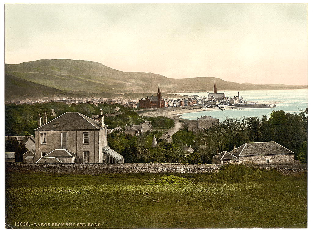
Largs ( gd, An Leargaidh Ghallda) is a town on the Firth of Clyde in North Ayrshire, Scotland, about from Glasgow. The original name means "the slopes" (''An Leargaidh'') in Scottish Gaelic. A popular seaside resort with a pier, the town markets itself on its historic links with the Vikings and an annual festival is held each year in early September. In 1263 it was the site of the Battle of Largs between the Norwegian and the Scottish armies. The National Mòd has also been held here in the past. History There is evidence of human activity in the vicinity of Largs which can be dated to the Neolithic era. The Haylie Chambered Tomb in Douglas Park dates from c. 3000 BC. Largs evolved from the estates of North Cunninghame over which the Montgomeries of Skelmorlie became temporal lords in the seventeenth century. Sir Robert Montgomerie built Skelmorlie Aisle in the ancient kirk of Largs in 1636 as a family mausoleum. Today the monument is all that remains of the old kirk. ... [...More Info...] [...Related Items...] OR: [Wikipedia] [Google] [Baidu] |
A78 Road
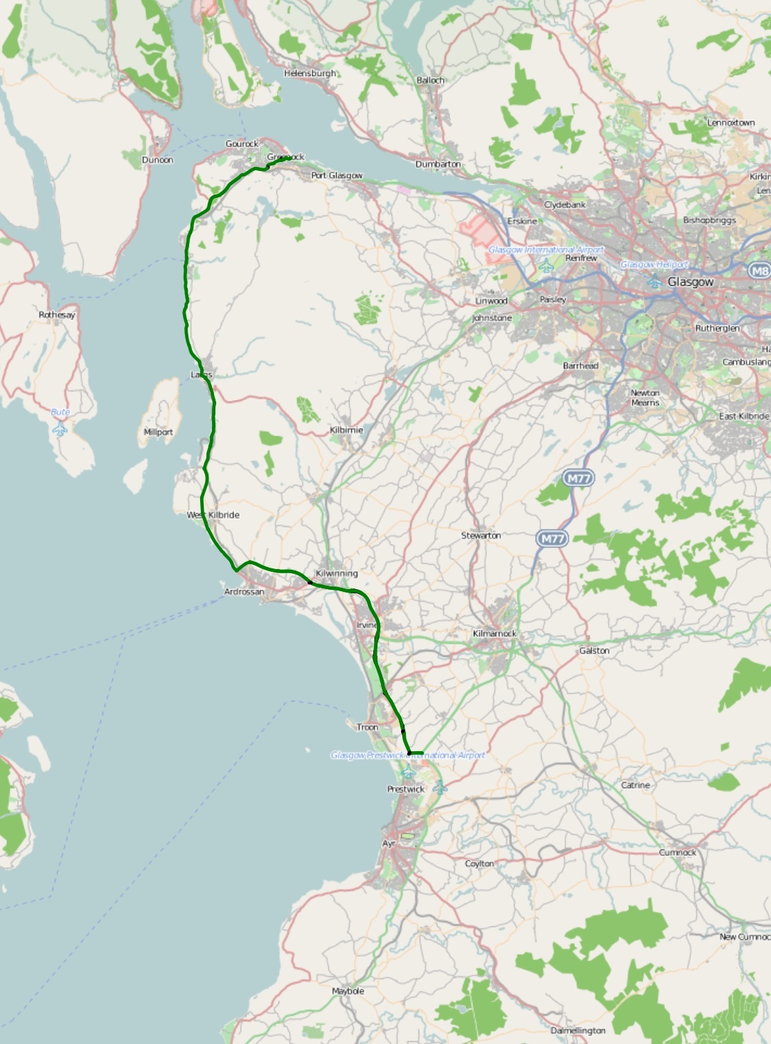
The A78 is an A road in Scotland. It connects Greenock and Prestwick on a route which follows the northern section of the Ayrshire coast. Route The A78 begins in Greenock, Renfrewshire as a continuation of the A8 road at the Bull Ring roundabout, and runs in a southerly direction through the Spango Valley, Inverkip, Wemyss Bay, Largs, Seamill and then bypasses the major towns of Ardrossan, Irvine and Troon amongst others before terminating near Prestwick, Ayrshire, where it forms a junction with the A77. Infrastructure Much of the road is single carriageway – both for a short distance through Greenock and a 21-mile stretch between Inverkip and Ardrossan. The rest is dual carriageway – between the Eglinton and Warrix interchanges there are in fact 3 lanes in each direction, and the road is constructed to motorway standard (with full grade separation at junctions) save for a lack of hard shoulders. The road very rarely appears busy on this stretch – the adjacent New ... [...More Info...] [...Related Items...] OR: [Wikipedia] [Google] [Baidu] |
Hydrotherapy
Hydrotherapy, formerly called hydropathy and also called water cure, is a branch of alternative medicine (particularly naturopathy), occupational therapy, and physiotherapy, that involves the use of water for pain relief and treatment. The term encompasses a broad range of approaches and therapeutic methods that take advantage of the physical properties of water, such as temperature and pressure, to stimulate blood circulation, and treat the symptoms of certain diseases. Various therapies used in the present-day hydrotherapy employ water jets, underwater massage and mineral baths (e.g. balneotherapy, Iodine-Grine therapy, Kneipp treatments, Scotch hose, Swiss shower, thalassotherapy) or whirlpool bath, hot Roman bath, hot tub, Jacuzzi, and cold plunge. Uses Water therapy may be restricted to use as aquatic therapy, a form of physical therapy, and as a cleansing agent. However, it is also used as a medium for delivery of heat and cold to the body, which has long been the b ... [...More Info...] [...Related Items...] OR: [Wikipedia] [Google] [Baidu] |
Scotland
Scotland (, ) is a country that is part of the United Kingdom. Covering the northern third of the island of Great Britain, mainland Scotland has a border with England to the southeast and is otherwise surrounded by the Atlantic Ocean to the north and west, the North Sea to the northeast and east, and the Irish Sea to the south. It also contains more than 790 islands, principally in the archipelagos of the Hebrides and the Northern Isles. Most of the population, including the capital Edinburgh, is concentrated in the Central Belt—the plain between the Scottish Highlands and the Southern Uplands—in the Scottish Lowlands. Scotland is divided into 32 administrative subdivisions or local authorities, known as council areas. Glasgow City is the largest council area in terms of population, with Highland being the largest in terms of area. Limited self-governing power, covering matters such as education, social services and roads and transportation, is devolved from the Scott ... [...More Info...] [...Related Items...] OR: [Wikipedia] [Google] [Baidu] |
Johannes Blaeu
Joan Blaeu (; 23 September 1596 – 21 December 1673) was a Dutch cartographer born in Alkmaar, the son of cartographer Willem Blaeu. Life In 1620, Blaeu became a doctor of law but he joined the work of his father. In 1635, they published the ''Atlas Novus'' (full title: ''Theatrum orbis terrarum, sive, Atlas novus'') in two volumes. Joan and his brother Cornelius took over the studio after their father died in 1638. Blaeu became the official cartographer of the Dutch East India Company like his father before him. Blaeu died in Amsterdam on 21 December 1673. He is buried in the Westerkerk there. Maps Blaeu's world map, ''Nova et Accuratissima Terrarum Orbis Tabula,'' incorporating the discoveries of Abel Tasman, was published in 1648. This map was revolutionary in that it "depicts the solar system according to the heliocentric theories of Nicolaus Copernicus, which show the earth revolving around the sun.... Although Copernicus's groundbreaking book ''On the Revolu ... [...More Info...] [...Related Items...] OR: [Wikipedia] [Google] [Baidu] |
Country Club
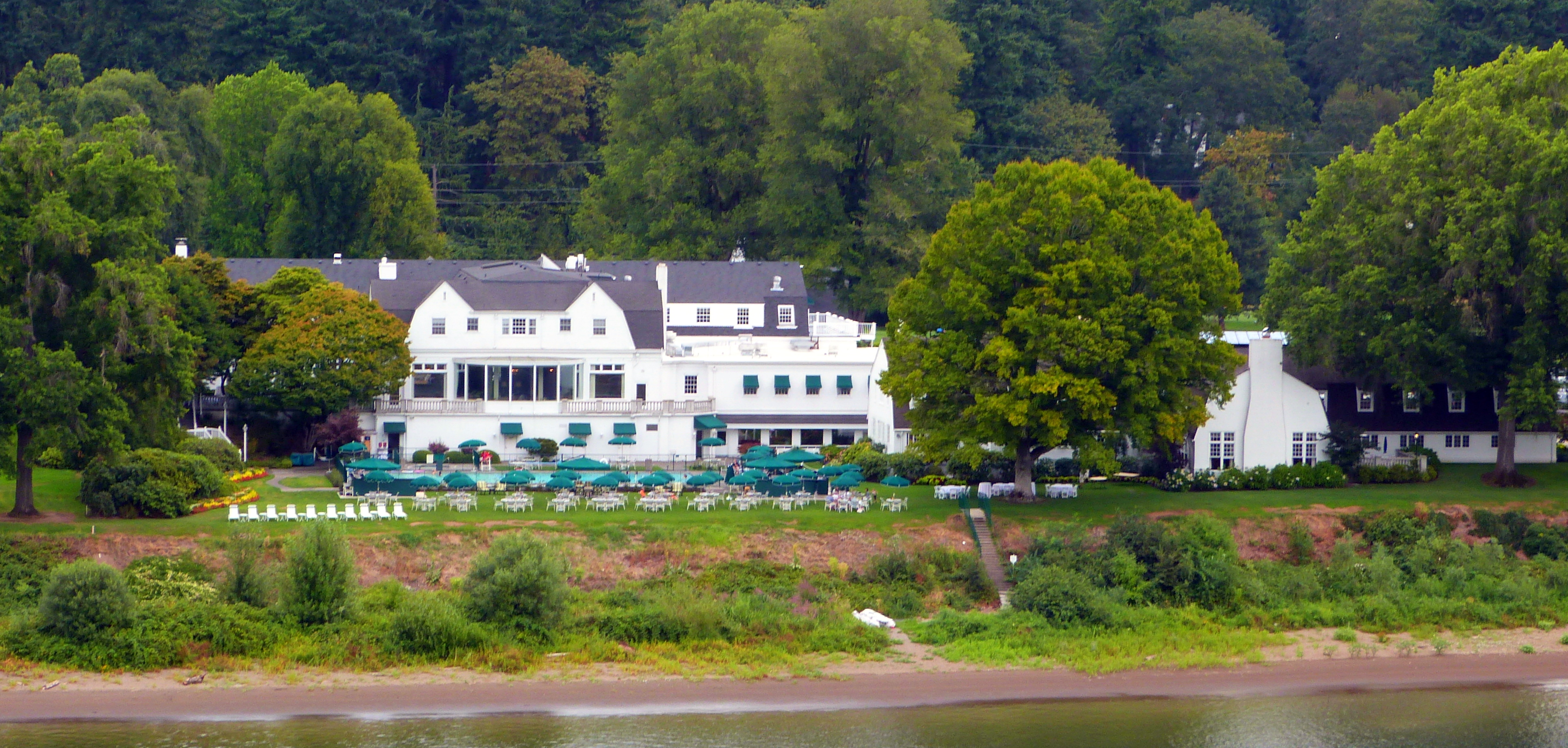
A country club is a privately owned club, often with a membership quota and admittance by invitation or sponsorship, that generally offers both a variety of recreational sports and facilities for dining and entertaining. Typical athletic offerings are golf, tennis, and swimming. Where golf is the principal or sole sporting activity, and especially outside of the United States and Canada, it is common for a country club to be referred to simply as a golf club. Country clubs are most commonly located in city outskirts or suburbs, due to the requirement of having substantial grounds for outdoor activities, which distinguishes them from an urban athletic club. Country clubs originated in Scotland and first appeared in the US in the early 1880s.Simon, Roger D. “Country Clubs.” In The Encyclopedia of American Urban History, edited by David R. Goldfield, 193-94. Thousand Oaks, CA: SAGE Publications, Inc., 2007. doi: 10.4135/9781412952620.n110. Country clubs had a profound effect ... [...More Info...] [...Related Items...] OR: [Wikipedia] [Google] [Baidu] |


.jpg)


.jpg)
