|
Seacliff, South Australia
Seacliff is a coastal suburb located in the capital city of South Australia; Adelaide. Overseen by the council, City of Holdfast Bay, this suburb is adjacent to South Brighton, Seacliff Park, Marino and Kingston Park. Seacliff Post Office opened on 1 July 1915 and closed in 1978. History Heritage listings The suburb of Seacliff has an extensive list of heritage listed locations all deemed to have historical value. The Seacliff Hotel built in 1927, originally named the Hotel Australia and renamed in 1935, was proposed to be heritage listed in 1998. It received great publicity for being the headquarters for the English Test Cricketers during the Adelaide Test in the 1935 and 1936 tour. The Brighton and Seacliff Yacht Club formed in 1919, and later had its clubrooms built in 1927 after land was purchased by Tom Mayfield Hardy. It became home club to nationally and internationally renowned yachtsmen Sir James Hardy, and in 1966 hosted the 505 World Championships. Eur ... [...More Info...] [...Related Items...] OR: [Wikipedia] [Google] [Baidu] |
Electoral District Of Black
Black is a single-member electoral district for the South Australian House of Assembly. It was created by the redistribution conducted in 2016, and was contested for the first time at the 2018 state election. Black is named after Dorrit Black (Dorothea Foster Black, 1891–1951), a South Australian modern artist, best known for linocuts, oil and watercolour paintings. Black lies south-west of the Adelaide city centre and includes the suburbs of Darlington, Hallett Cove, Kingston Park, Marino, O'Halloran Hill, Seacliff, Seacliff Park, Seacombe Heights, Seaview Downs, Sheidow Park and Trott Park. At its creation, Black was projected to be notionally held by the Liberal Party with a swing of 2.6% required to lose it. The 2018 creation of Black replaced the electorate of Mitchell that was disestablished at the 2018 state election. Black does not extend as far north or south as Mitchell did, but extends west to the coast through part of what used to be Bright. Members for Blac ... [...More Info...] [...Related Items...] OR: [Wikipedia] [Google] [Baidu] |
Encounter Bay
Encounter Bay is a bay in the Australian state of South Australia located on the state's south central coast about south of the state capital of Adelaide. It was named by Matthew Flinders after his encounter on 8 April 1802 with Nicolas Baudin, the commander of the Baudin expedition of 1800–03. It is the site of both the mouth of the River Murray and the regional city of Victor Harbor. It is one of four "historic bays" located on the South Australian coast. Extent There are at least two definitions of the bay’s extent: *Firstly, the US National Geospatial-Intelligence Agency states that Newland Head is its westerly extremity while the mouth of the River Murray is the easterly extremity. *Secondly, Australian authorities consider the bay’s extent consists of all of the sea north of a line running east from the southern tip of Rosetta Head to the Younghusband Peninsula. Encounter Bay is one of four bays on the South Australian coast considered by the Australian go ... [...More Info...] [...Related Items...] OR: [Wikipedia] [Google] [Baidu] |
Snorkelling
Snorkeling ( British and Commonwealth English spelling: snorkelling) is the practice of swimming on or through a body of water while equipped with a diving mask, a shaped breathing tube called a snorkel, and usually swimfins. In cooler waters, a wetsuit may also be worn. Use of this equipment allows the snorkeler to observe underwater attractions for extended periods with relatively little effort and to breathe while face-down at the surface. Snorkeling is a popular recreational activity, particularly at tropical resort locations. It provides the opportunity to observe underwater life in a natural setting without the complicated equipment and training required for scuba diving. It appeals to all ages because of how little effort is involved and is the basis of the two surface disciplines of the underwater sport of finswimming. Snorkeling is also used by scuba divers when on the surface, in underwater sports such as underwater hockey and underwater rugby, and as part of water-ba ... [...More Info...] [...Related Items...] OR: [Wikipedia] [Google] [Baidu] |
Swamp
A swamp is a forested wetland.Keddy, P.A. 2010. Wetland Ecology: Principles and Conservation (2nd edition). Cambridge University Press, Cambridge, UK. 497 p. Swamps are considered to be transition zones because both land and water play a role in creating this environment. Swamps vary in size and are located all around the world. The water of a swamp may be fresh water, brackish water, or seawater. Freshwater swamps form along large rivers or lakes where they are critically dependent upon rainwater and seasonal flooding to maintain natural water level fluctuations.Hughes, F.M.R. (ed.). 2003. The Flooded Forest: Guidance for policy makers and river managers in Europe on the restoration of floodplain forests. FLOBAR2, Department of Geography, University of Cambridge, Cambridge, UK. 96 p. Saltwater swamps are found along tropical and subtropical coastlines. Some swamps have hammock (ecology), hammocks, or dry-land protrusions, covered by aquatic vegetation, or vegetation that tolerates ... [...More Info...] [...Related Items...] OR: [Wikipedia] [Google] [Baidu] |
Kaurna Language
Kaurna ( or ) is a Pama-Nyungan language historically spoken by the Kaurna peoples of the Adelaide Plains of South Australia. The Kaurna peoples are made up of various tribal clan groups, each with their own ''parnkarra'' district of land and local dialect. These dialects were historically spoken in the area bounded by Crystal Brook and Clare in the north, Cape Jervis in the south, and just over the Mount Lofty Ranges. Kaurna ceased to be spoken on an everyday basis in the 19th century and the last known native speaker, Ivaritji, died in 1929. Language revival efforts began in the 1980s, with the language now frequently used for ceremonial purposes, such as dual naming and welcome to country ceremonies. Classification R. M. W. Dixon (2002) classified Kaurna as a dialect of the Kadli language, along with Ngadjuri, Narungga, and Nukunu, and "Nantuwara", with ''kadli'' meaning "dog" in these varieties. However this name has not gained wide acceptance and is not recorded as a la ... [...More Info...] [...Related Items...] OR: [Wikipedia] [Google] [Baidu] |
University Of Adelaide
The University of Adelaide (informally Adelaide University) is a public research university located in Adelaide, South Australia. Established in 1874, it is the third-oldest university in Australia. The university's main campus is located on North Terrace in the Adelaide city centre, adjacent to the Art Gallery of South Australia, the South Australian Museum, and the State Library of South Australia. The university has four campuses, three in South Australia: North Terrace campus in the city, Roseworthy campus at Roseworthy and Waite campus at Urrbrae, and one in Melbourne, Victoria. The university also operates out of other areas such as Thebarton, the National Wine Centre in the Adelaide Park Lands, and in Singapore through the Ngee Ann-Adelaide Education Centre. The University of Adelaide is composed of three faculties, with each containing constituent schools. These include the Faculty of Sciences, Engineering and Technology (SET), the Faculty of Health and Medical S ... [...More Info...] [...Related Items...] OR: [Wikipedia] [Google] [Baidu] |
Adelaide Plains
The Adelaide Plains (Kaurna name Tarndanya) is a plain in South Australia lying between the coast (Gulf St Vincent) on the west and the Mount Lofty Ranges on the east. The southernmost tip of the plain is in the southern seaside suburbs of Adelaide around Brighton at the foot of the O'Halloran Hill escarpment with the south Hummocks Range and Wakefield River roughly approximating the northern boundary. Traditionally entirely occupied by the Kaurna (indigenous) people, the Adelaide Plains are crossed by a number of rivers and creeks, but several dry up during summer. The rivers (from south to north) include: the Onkaparinga/Ngangki, Sturt/Warri Torrens/Karra Wirra, Little Para, Gawler, Light/Yarralinka and Wakefield/Undalya. The plains are generally fertile with annual rainfall of about per year. The plain can be roughly divided into three parts. The southern area is now covered by the city of Adelaide, the capital of South Australia. The central area is considered the ... [...More Info...] [...Related Items...] OR: [Wikipedia] [Google] [Baidu] |
Kaurna
The Kaurna people (, ; also Coorna, Kaura, Gaurna and other variations) are a group of Aboriginal people whose traditional lands include the Adelaide Plains of South Australia. They were known as the Adelaide tribe by the early settlers. Kaurna culture and language were almost completely destroyed within a few decades of the British colonisation of South Australia in 1836. However, extensive documentation by early missionaries and other researchers has enabled a modern revival of both language and culture. The phrase ''Kaurna meyunna'' means "Kaurna people". Etymology The early settlers of South Australia referred to the various indigenous tribes of the Adelaide Plains and Fleurieu Peninsula as "Rapid Bay tribe", "the Encounter Bay tribe", "the Adelaide tribe", the Kouwandilla tribe, "the Wirra tribe", "the Noarlunga tribe" (the Ngurlonnga band) and the Willunga tribe (the Willangga band). The extended family groups of the Adelaide Plains, who spoke dialects of a common lang ... [...More Info...] [...Related Items...] OR: [Wikipedia] [Google] [Baidu] |
Groyne
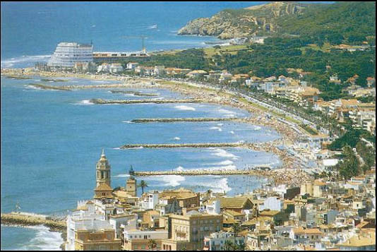
A groyne (in the U.S. groin) is a rigid hydraulic structure built perpendicularly from an ocean shore (in coastal engineering) or a river bank, interrupting water flow and limiting the movement of sediment. It is usually made out of wood, concrete, or stone. In the ocean, groynes create beaches, prevent beach erosion caused by longshore drift where this is the dominant process and facilitate beach nourishment. There is also often cross-shore movement which if longer than the groyne will limit its effectiveness. In a river, groynes slow down the process of erosion and prevent ice-jamming, which in turn aids navigation. Groynes run generally perpendicular to the shore, extending from the upper foreshore or beach into the water. All of a groyne may be underwater, in which case it is a ''submerged groyne''. They are often used in tandem with seawalls and other coastal engineering features. Groynes, however, may cause a shoreline to be perceived as unnatural. Groynes are generally ... [...More Info...] [...Related Items...] OR: [Wikipedia] [Google] [Baidu] |
Breakwater (structure)
A breakwater is a permanent structure constructed at a coastal area to protect against tides, currents, waves, and storm surges. Part of a coastal management system, breakwaters are installed to minimize erosion, and to protect anchorages, helping isolate vessels within them from marine hazards such as prop washes and wind-driven waves. A breakwater, also known in some contexts as a jetty, may be connected to land or freestanding, and may contain a walkway or road for vehicle access. On beaches where longshore drift threatens the erosion of beach material, smaller structures on the beach, usually perpendicular to the water's edge, may be installed. Their action on waves and current is intended to slow the longshore drift and discourage mobilisation of beach material. In this usage they are more usually referred to as groynes. Purposes Breakwaters reduce the intensity of wave action in inshore waters and thereby provide safe harbourage. Breakwaters may also be small structu ... [...More Info...] [...Related Items...] OR: [Wikipedia] [Google] [Baidu] |
Sand Dune
A dune is a landform composed of wind- or water-driven sand. It typically takes the form of a mound, ridge, or hill. An area with dunes is called a dune system or a dune complex. A large dune complex is called a dune field, while broad, flat regions covered with wind-swept sand or dunes with little or no vegetation are called ''ergs'' or ''sand seas''. Dunes occur in different shapes and sizes, but most kinds of dunes are longer on the stoss (upflow) side, where the sand is pushed up the dune, and have a shorter ''slip face'' in the lee side. The valley or trough between dunes is called a ''dune slack''. Dunes are most common in desert environments, where the lack of moisture hinders the growth of vegetation that would otherwise interfere with the development of dunes. However, sand deposits are not restricted to deserts, and dunes are also found along sea shores, along streams in semiarid climates, in areas of glacial outwash, and in other areas where poorly cemented san ... [...More Info...] [...Related Items...] OR: [Wikipedia] [Google] [Baidu] |
Port River Estuary
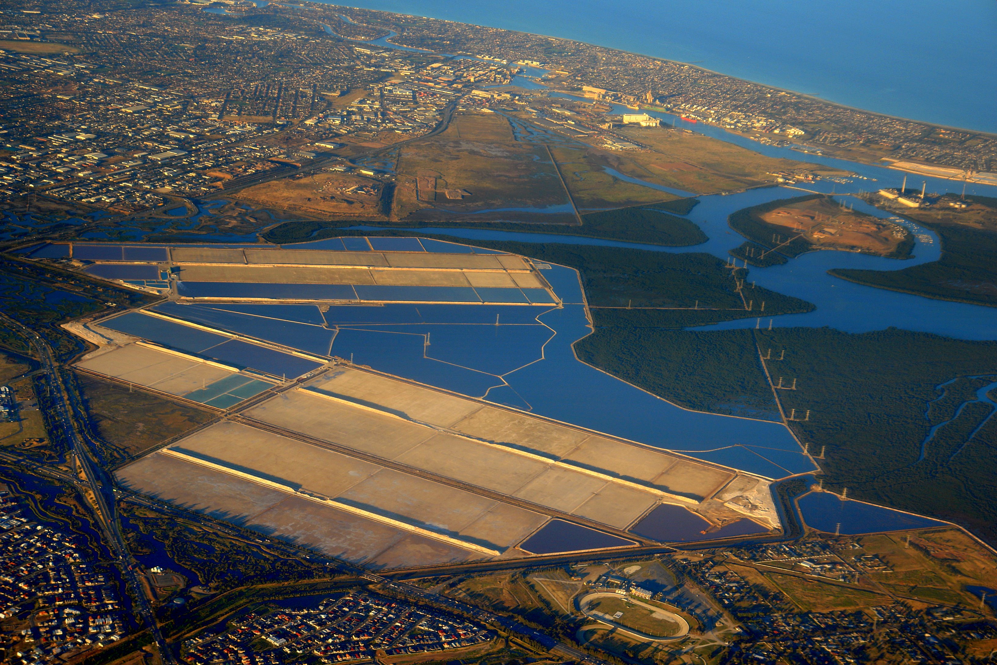
The Port River (officially known as the Port Adelaide River) is part of a tidal estuary located north of the Adelaide city centre in the Australian state of South Australia. It has been used as a shipping channel since the beginning of European settlement of South Australia in 1836, when Colonel Light selected the site to use as a port. Before colonisation, the Port River region and the estuary area were known as Yerta Bulti (or Yertabulti) by the Kaurna people, and used extensively as a source of food and plant materials to fashion artefacts used in daily life. The Port River dolphins are a popular tourist attraction. Geography The Port River is the western branch of the largest tidal estuary on the eastern side of Gulf St Vincent. The whole estuarine area, sometimes called the Port River estuary, includes Barker Inlet, Torrens Island, Garden Island, and to a greater or lesser extent touches the suburbs of St Kilda, Bolivar, Dry Creek, Port Adelaide, New Port, and (up ... [...More Info...] [...Related Items...] OR: [Wikipedia] [Google] [Baidu] |


