|
Schwäbisch Hall (district)
Schwäbisch Hall () is a ''Landkreis'' (district) in the northeast of Baden-Württemberg, Germany. Neighboring districts are (from north clockwise) Main-Tauber, the Bavarian district Ansbach, Ostalbkreis, Rems-Murr, and Hohenlohe. History The district dates back to the ''Oberamt Schwäbisch Hall'', which was created in 1803, when the previously free imperial city Schwäbisch Hall became part of Württemberg. After several minor changes, it was converted into a district in 1938. In 1973, it was merged with the district Crailsheim and the area around Gaildorf, which was part of the also dissolved district Backnang. Geography The two rivers Jagst and Kocher, tributaries to the Neckar, flow through the district. The landscapes covered by the district are the Hohenlohe plain (''Hohenloher Ebene''), the Swabian-Franconian Forest (''Schwäbisch-Fränkischen Waldberge''), which includes part of the Mainhardt Forest, and the ''Frankenhöhe''. Partnerships The district maintains partnersh ... [...More Info...] [...Related Items...] OR: [Wikipedia] [Google] [Baidu] |
Schwäbisch Hall
Schwäbisch Hall (; "Swabian Hall"; from 1802 until 1934 and colloquially: ''Hall'' ) is a city in the German state of Baden-Württemberg located in the valley of the Kocher river, the longest tributary (together with its headwater Lein) of the Neckar river. The closest larger city is Heilbronn, and Schwäbisch Hall lies north-east of the state capital of Stuttgart. It is the seat of the district (''Landkreis'') of Schwäbisch Hall. Unlike its name might suggest, and unlike Schwäbisch Gmünd, Schwäbisch Hall lies in the region of Heilbronn-Franconia, the East Franconian-speaking northeasternmost part of Baden-Württemberg, which is culturally and linguistically more closely related to the adjoining region of Franconia in neighbouring Bavaria than to the Alemannic-speaking regions of Württemberg, Baden, Switzerland, Bavarian Swabia, Vorarlberg, Alsace and Liechtenstein. The city's main landmarks are the market square with St Michael's Church ( St. Michaelskirche), Comburg Ca ... [...More Info...] [...Related Items...] OR: [Wikipedia] [Google] [Baidu] |
Delitzsch (district)
Delitzsch () is a former district in Saxony, Germany. It was bounded by (from the east and clockwise) the districts of Torgau-Oschatz and Muldentalkreis, the city of Leipzig, the district of Leipziger Land and the state of Saxony-Anhalt (districts Saalekreis, Anhalt-Bitterfeld and Wittenberg). History After the 1815 Congress of Vienna Saxony had to cede large amounts of its territory to Prussia. The Prussian government established districts in the newly acquired lands, among them the district of Delitzsch. The state of Prussia was dissolved after the end of the Nazi era, and the new state of Saxony-Anhalt was established, with Delitzsch being a part of it. In 1953 the East German government dissolved the states. They were reestablished after the German reunification in 1990, but Delitzsch and Eilenburg (two districts made up of the former Delitzsch district) were initially given to Saxony instead of Saxony-Anhalt. The two districts again merged in 1994 and formed the present bor ... [...More Info...] [...Related Items...] OR: [Wikipedia] [Google] [Baidu] |
Schrozberg
Schrozberg is a town in the district of Schwäbisch Hall, in Baden-Württemberg, Germany. It is located west of Rothenburg ob der Tauber, and northeast of Schwäbisch Hall. Schrozburg Castle of the Lords of Schrozberg was built in the 12th century and destroyed in 1441 by the city of Rothenburg. Schrozberg was then possessed by the lords of Schrozberg, later jointly by the noble families Seldeneck, Adelsheim, the city of Rothenburg, the House of Hohenlohe und the barons of Berlichingen. A new castle outside the town was built in the early 16th century. By 1455, Albrecht of Hohenlohe had acquired the castle and lordship of Bartenstein near Schrozberg. The castle is still today the residence of the Prince of Hohenlohe-Bartenstein. Schloss_Schrozberg_17.jpg, Schrozberg Castle Luftbild Bartenstein.jpg, Bartenstein 11.4.2019. Frühling an Schloss Bartenstein. 04.jpg, Bartenstein Castle Evangelische Kirche Ettenhausen.jpg, Protestant church Ettenhausen Mayors * 1835-1867: Geo ... [...More Info...] [...Related Items...] OR: [Wikipedia] [Google] [Baidu] |
Langenburg
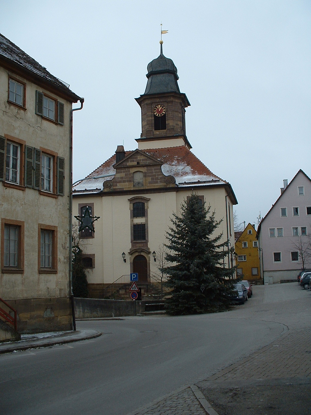
Langenburg () is a town in the district of Schwäbisch Hall, in Baden-Württemberg, Germany. It is located on a hill above the river Jagst, 18 km northeast of Schwäbisch Hall. It is also the place where Wibele - small, sweet, biscuit-like pastries - were invented and are still baked today. History The history of Langenburg begins with the building of a castle on the western hill crag. Prehistoric settling is likely, but not proven. Langenburg is first documented in 1226. The free Lords of Langenburg, which stepped into history in 1201, were closely related to the Lords of Hohenlohe. Maybe they even held family bonds. After the Langenburgs had died out, the Hohenlohe family inherited the possessions. Langenburg thus came under the rule of Hohenlohe and remained part of the Principality for the next centuries. Since 1568 Langenburg was the residency of the county and latter principality Hohenlohe-Langenburg. In the 17th Century, Langenburg was the site of witch trials. Th ... [...More Info...] [...Related Items...] OR: [Wikipedia] [Google] [Baidu] |
Kirchberg An Der Jagst
Kirchberg an der Jagst is a town in the district of Schwäbisch Hall, in Baden-Württemberg, Germany. It is located on the river Jagst, 11 km northwest of Crailsheim. The Second World War resistance member Friedrich Gustav Jaeger Friedrich Gustav Jaeger (25 September 1895 – 21 August 1944) was a resistance fighter in Nazi Germany and a member of the 20 July Plot. Resistance activities In 1938, after the Sudeten Crisis, Jaeger took part in the German invasion of Czecho ... was born here. Politics Elections for the local council (''Gemeinderat'') in 2014: * Unabhängige Wählervereinigung (Independent voters association): 7 seats * Aktive Bürger (active citizens) 8 seats * Unabhängige Grüne Liste (Independent green list) 5 seats References Schwäbisch Hall (district) Württemberg {{SchwäbischHall-geo-stub ... [...More Info...] [...Related Items...] OR: [Wikipedia] [Google] [Baidu] |
Ilshofen
Ilshofen () is a town in the district of Schwäbisch Hall, in Baden-Württemberg, Germany. It is located 15 km northeast of Schwäbisch Hall Schwäbisch Hall (; "Swabian Hall"; from 1802 until 1934 and colloquially: ''Hall'' ) is a city in the German state of Baden-Württemberg located in the valley of the Kocher river, the longest tributary (together with its headwater Lein) of the .... References Towns in Baden-Württemberg Schwäbisch Hall (district) Württemberg {{SchwäbischHall-geo-stub ... [...More Info...] [...Related Items...] OR: [Wikipedia] [Google] [Baidu] |
Gerabronn
Gerabronn () is a small town in the county of Schwäbisch Hall, Baden-Württemberg, Germany. In 2006 it had a population of about 4,547 and covered an area of 40.38 km2. Gerabronn is the home town of the two leading German politicians of the Green Party: Joschka Fischer and Rezzo Schlauch. History Gerabronn developed from a village, which was supposedly founded in the 10th century. Originally named ''Gerhiltebrunnen'' (well of Gerhilt), it was also called Gerolzbrunn, Geroldbrunn, Gerltbrunn or Gerhartsbrunn, until in the 17th century the current name became common. The village was first mentioned in a 1226 feud letter, when the area came under the control of the Bishop of Würzburg. Until the 19th century Gerabronn was only a village; thereafter it became a town (''Oberamtsstadt'') in 1811 it was responsible for the administration of the surrounding area. Industrialization and a connection to the railway further helped the growth of the town. In 1938 the ''Amt'' was d ... [...More Info...] [...Related Items...] OR: [Wikipedia] [Google] [Baidu] |
Crailsheim
Crailsheim is a town in the German state of Baden-Württemberg. Incorporated in 1338, it lies east of Schwäbisch Hall and southwest of Ansbach in the Schwäbisch Hall district. The city's main attractions include two Evangelical churches, a Catholic church, and the 67 metre tower of its town hall. History Crailsheim is famed for withstanding a siege by forces of three imperial cities - Schwäbisch Hall, Dinkelsbühl, and Rothenburg ob der Tauber - lasting from 1379 until 1380, a feat which it celebrates annually. Crailsheim became a possession of the Burgrave of Nuremberg following the siege. In 1791 it became part of the Prussian administrative region, before returning to Bavaria in 1806 and becoming a part of Württemberg in 1810. Crailsheim's railroad and airfield were heavily defended by the Waffen-SS during World War II. Following an American assault in mid-April 1945, the town was occupied briefly by US forces before being lost to a German counter-offensive. Intense U ... [...More Info...] [...Related Items...] OR: [Wikipedia] [Google] [Baidu] |
Hohenzollern
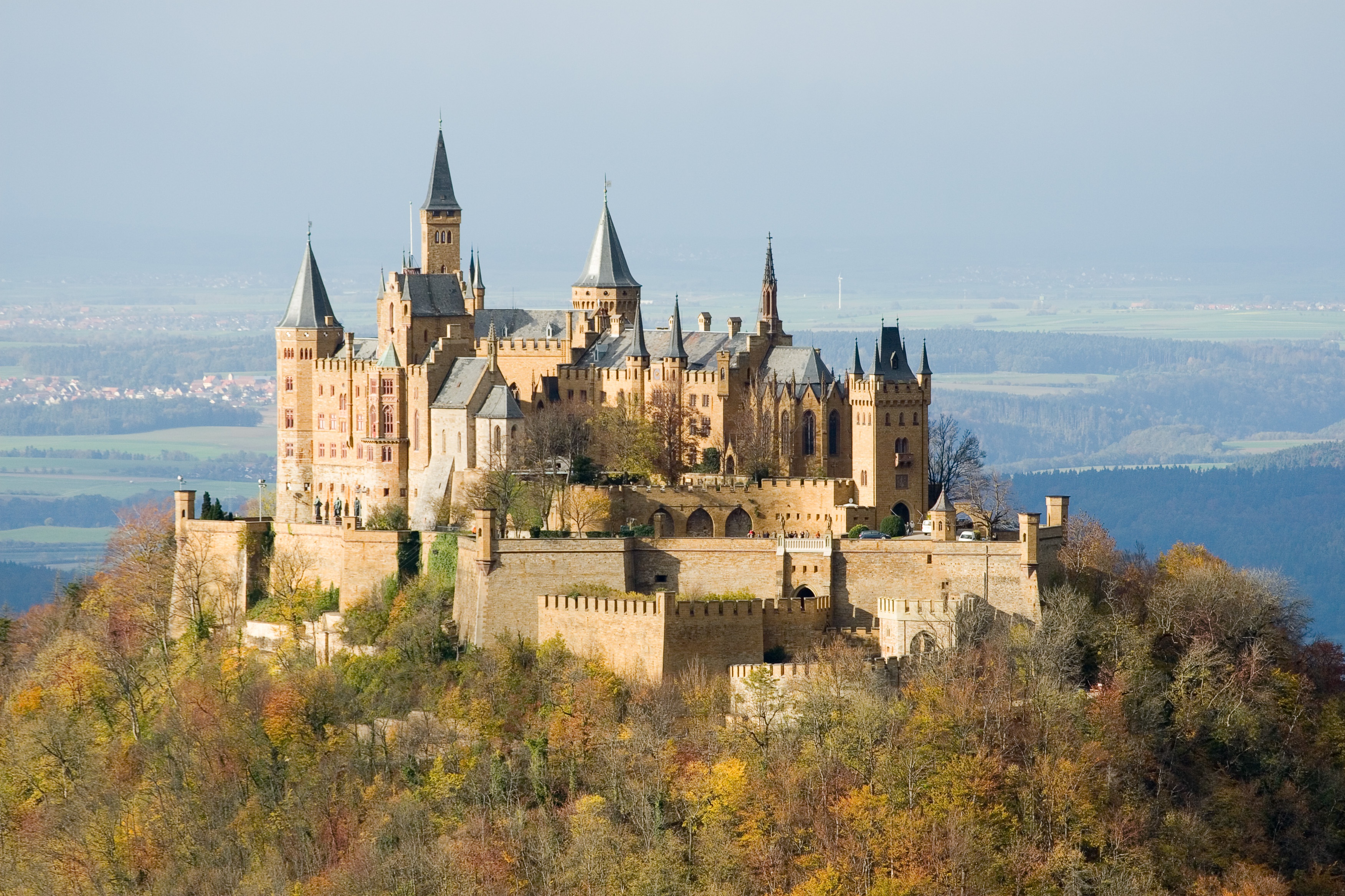
The House of Hohenzollern (, also , german: Haus Hohenzollern, , ro, Casa de Hohenzollern) is a German royal (and from 1871 to 1918, imperial) dynasty whose members were variously princes, electors, kings and emperors of Hohenzollern, Brandenburg, Prussia, the German Empire, and Romania. The family came from the area around the town of Hechingen in Swabia during the late 11th century and took their name from Hohenzollern Castle. The first ancestors of the Hohenzollerns were mentioned in 1061. The Hohenzollern family split into two branches, the Catholic Swabian branch and the Protestant Franconian branch,''Genealogisches Handbuch des Adels, Fürstliche Häuser'' XIX. "Haus Hohenzollern". C.A. Starke Verlag, 2011, pp. 30–33. . which ruled the Burgraviate of Nuremberg and later became the Brandenburg-Prussian branch. The Swabian branch ruled the principalities of Hohenzollern-Hechingen and Hohenzollern-Sigmaringen until 1849, and also ruled Romania from 1866 to 1947. Members ... [...More Info...] [...Related Items...] OR: [Wikipedia] [Google] [Baidu] |
Gaildorf
Gaildorf is a town in the district of Schwäbisch Hall, in Baden-Württemberg, Germany. It is located on the river Kocher, 13 km south of Schwäbisch Hall. Gaildorf is the approximate center of the Limpurger Land district, formerly a county of the Holy Roman Empire ruled by the counts Schenk von Limpurg until their extinction in 1713, thereafter inherited by a number of female heirs, and mediatized to the Kingdom of Württemberg in 1806. Notable people * (1806–1883), member of Landtag * (1700-1783), organ-maker * (1807–1857), Württembergian city councilman * (1817–1907), doctor and poet (son of Justinus Kerner) * (1824–1895), merchant and member of landtag * (1835–1914), prime minister of Württemberg * (1839–1892), Schultheiß and politician * (1847–1928), pharmacist and fossil-collector in Crailsheim * (born 1926), agriculturalist * (1936–2009), writer * (born 1959), composer * (born 1969), politician (CDU) *Hermann Frasch Herman Frasch r Hermann Fras ... [...More Info...] [...Related Items...] OR: [Wikipedia] [Google] [Baidu] |
Heller (money)
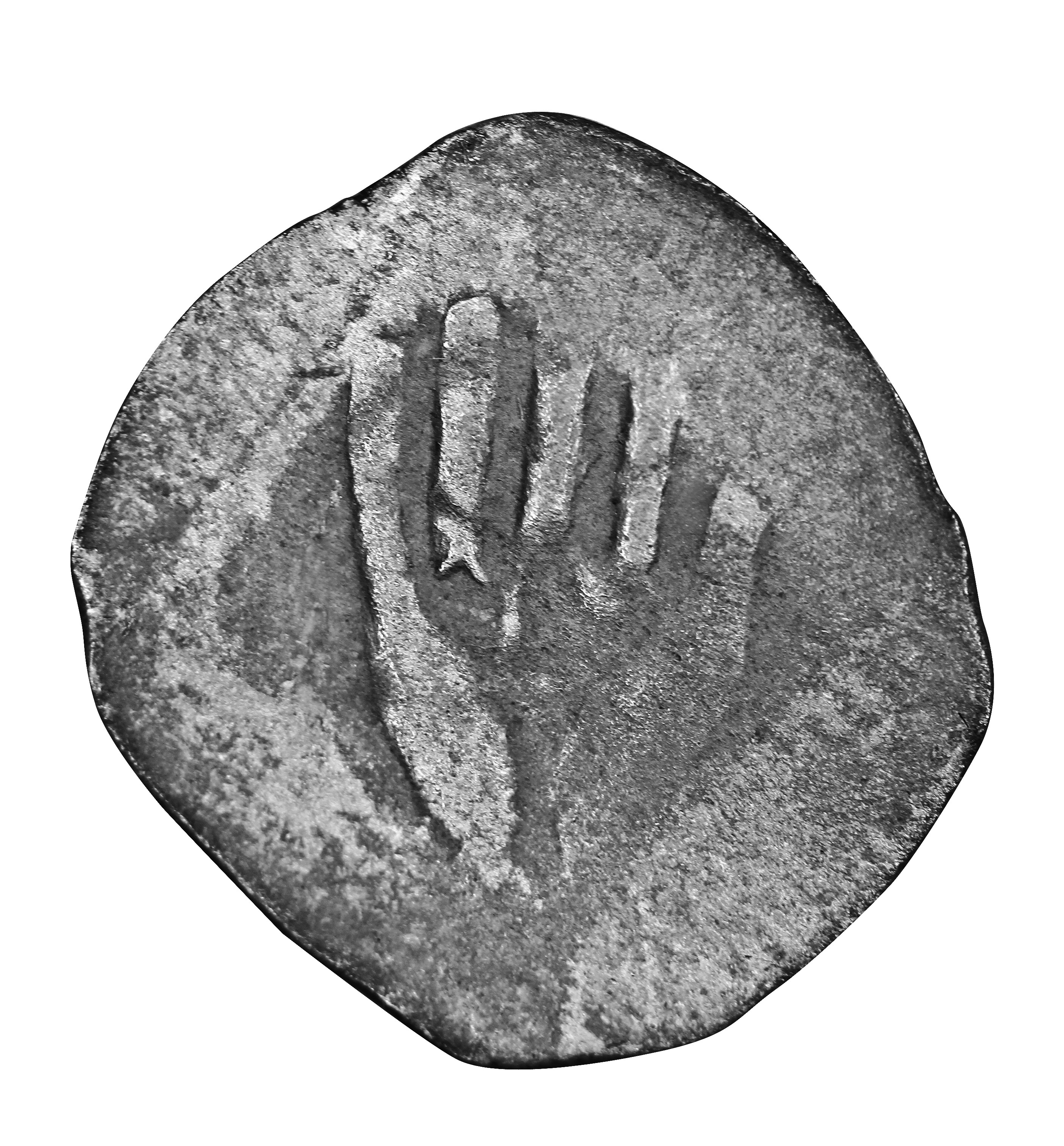
The ''Heller'', abbreviation ''hlr'', was a coin, originally valued at half a pfennig, that was issued in Switzerland and states of the Holy Roman Empire, surviving in some European countries until the 20th century. It was first recorded in 1200 or 1208 or, according to Reiner Hausherr as early as 1189. The ''hellers'' were gradually so debased that they were no long silver coins. There were 576 ''hellers'' in a ''Reichsthaler'' ("imperial ''thaler''"). After the Second World War, ''hellers'' only survived in Czechoslovakia and Hungary. The ''heller'' also existed as a silver unit of weight equal to of a ''Mark''. Name The ''Heller'', also called the Haller or Häller (), in Latin sources: ''denarius hallensis'' or ''hallensis denarius'', took its name from the city of Hall am Kocher (today Schwäbisch Hall). Silver coins stamped on both sides (''Häller Pfennige'') were called ''Händelheller'' because they usually depicted a hand. A distinction was made between white, red ... [...More Info...] [...Related Items...] OR: [Wikipedia] [Google] [Baidu] |
Zamość
Zamość (; yi, זאמאשטש, Zamoshtsh; la, Zamoscia) is a historical city in southeastern Poland. It is situated in the southern part of Lublin Voivodeship, about from Lublin, from Warsaw. In 2021, the population of Zamość was 62,021. Zamość was founded in 1580 by Jan Zamoyski, Grand Chancellor of Poland, who envisioned an ideal city. The historical centre of Zamość was added to the World Heritage List in 1992, following a decision of the sixteenth ordinary session of the World Heritage Committee, held between 7 and 14 December 1992 in Santa Fe, New Mexico, United States; it was recognized for being "a unique example of a Renaissance town in Central Europe". Zamość is about from the Roztocze National Park. History Zamość was founded in 1580 by the Chancellor and Hetman (head of the army of the Polish–Lithuanian Commonwealth), Jan Zamoyski, on the trade route linking western and northern Europe with the Black Sea. Modelled on Italian trading cities, and b ... [...More Info...] [...Related Items...] OR: [Wikipedia] [Google] [Baidu] |


