|
School Of The Air
School of the Air is a generic term for correspondence schools catering for the primary and early secondary education of children in remote and outback Australia where some or all classes were historically conducted by radio, although this is now replaced by telephone and internet technology. In these areas, the school-age population is too small for a conventional school to be viable. History The invention of the pedal radio by Alfred Traeger around 1929, and particularly the involvement of educator Adelaide Miethke in formulating and developing the idea of using the existing Royal Flying Doctor Service of radio communications, were pivotal in the establishment of the School of the Air. The first School of the Air lessons were officially sent from the Royal Flying Doctor Service in Alice Springs on 8 June 1951. The service celebrated its 50th jubilee on 9 May 2001, ahead of the real jubilee on 8 June; and its 70th year on 8 June 2021. Each state of Australia that utilises this ... [...More Info...] [...Related Items...] OR: [Wikipedia] [Google] [Baidu] |
Homework
Homework is a set of tasks assigned to students by their teachers to be completed outside the classroom. Common homework assignments may include required reading, a writing or typing project, Exercise (mathematics), mathematical exercises to be completed, information to be reviewed before a Test (assessment), test, or other skills to be practiced. The effects of homework are debated. Generally speaking, homework does not improve academic performance among young children. Homework may improve academic skills among older students, especially lower-achieving students. However, homework also creates stress for students and parents, and reduces the amount of time that students can spend in other activities. Purposes The basic objectives of assigning homework to students often align with schooling in general. However, teachers have many purposes for assigning homework, including: * reinforcing skills taught in class * extending skills to new situations * preparing for future clas ... [...More Info...] [...Related Items...] OR: [Wikipedia] [Google] [Baidu] |
Mount Isa
Mount Isa ( ) is a city in the Gulf Country region of Queensland, Australia. It came into existence because of the vast mineral deposits found in the area. Mount Isa Mines (MIM) is one of the most productive single mines in world history, based on combined production of lead, silver, copper and zinc. With an urban population of 18,727 in 2021 census, Mount Isa is the administrative, commercial and industrial centre for the state's vast north-western region. Although situated in an arid area, the artificial Lake Moondarra north of the city on the Leichhardt River provides both drinking water and an area for watersports, birdwatching and recreation. Locals often refer to Mount Isa as "The Isa". Due to the lead production in the city, Mount Isa has one of the most intensive air quality monitoring systems in Australia. Concerns have been raised over childhood lead contamination and air pollution within the city. The Mount Isa Mines (MIM) in particular are a source of significan ... [...More Info...] [...Related Items...] OR: [Wikipedia] [Google] [Baidu] |
Longreach
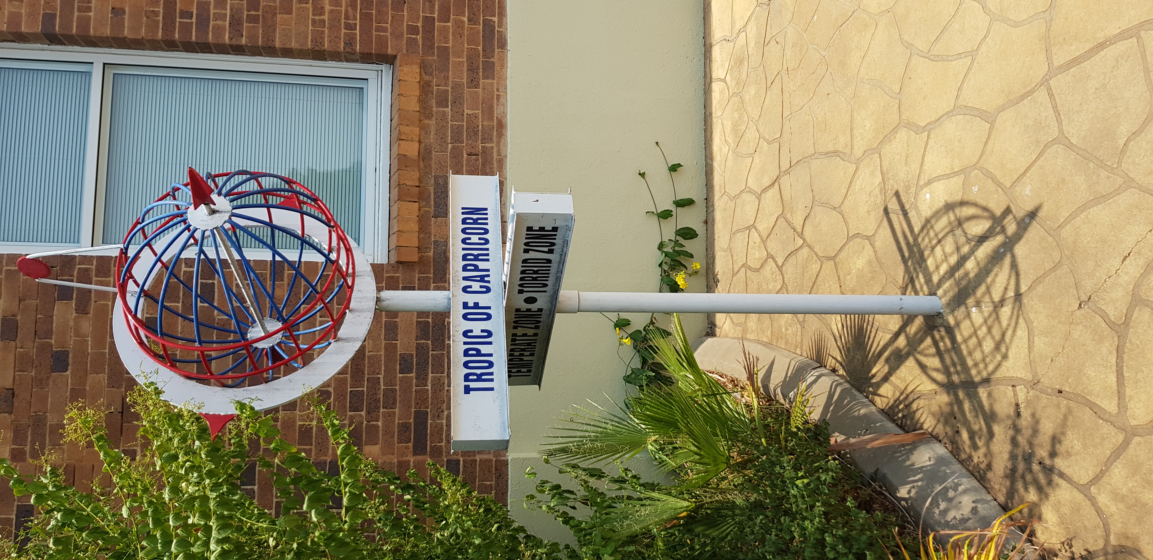
Longreach is a town and a locality in the Longreach Region, Queensland, Australia. It is the administrative centre of the Longreach Regional Council, which was established in 2008 as a merger of the former Longreach, Ilfracombe, and Isisford shires. Longreach is a well known tourist destination due to its aviation history and importance. In the , the locality of Longreach had a population of 3,124 people. Geography Longreach is in Central West Queensland, approximately from the coast, west of Rockhampton. The town is on the Tropic of Capricorn in the south-east of the locality. The town is named after the ‘long reach’ of the Thomson River on which it is situated. Lochern National Park is in the south-western part of the locality (formerly in Vergemont). The main industries of the area are cattle, sheep, and, more recently, tourism. The Landsborough Highway enters the locality from the south-east (Ilfracombe), passes through the town and then exits to the north-west ... [...More Info...] [...Related Items...] OR: [Wikipedia] [Google] [Baidu] |
Charters Towers
Charters Towers is a rural town in the Charters Towers Region, Queensland, Australia. It is by road south-west from Townsville on the Flinders Highway. During the last quarter of the 19th century, the town boomed as the rich gold deposits under the city were developed. After becoming uneconomical in the 20th century, profitable mining operations have commenced once again. In the , Charters Towers had a population of 8,120 people. Geography and climate The urban area of the town of Charters Towers includes its suburbs: Charters Towers City (the centre of the city); Richmond Hill, Toll, and Columbia to the north, Queenton to the east, Grand Secret and Alabama Hill to the west, and Towers Hill, Mosman Park, and Millchester to the south. Charters Towers township is only mildly elevated at above sea-level, but this has a noticeable effect, with lower humidity and wider temperature variations compared to nearby Townsville. Charters Towers obtains its water supply from the n ... [...More Info...] [...Related Items...] OR: [Wikipedia] [Google] [Baidu] |
Charleville, Queensland
Charleville () is a rural town and locality in the Shire of Murweh, Queensland, Australia. In the , the locality of Charleville had a population of 3,335 people. Geography Located in southwestern Queensland, Australia, Charleville is west of Brisbane (the Queensland capital), 616 kilometres (384 mi) west of Toowoomba, 535 kilometres (333 mi) west of Dalby, 393 kilometres (244 mi) west of Miles and 254 kilometres (158 mi) west of Roma. It is the largest town and administrative centre of the Shire of Murweh, which covers an area of 43,905 square kilometres. Charleville is situated on the banks of the Warrego River. Charleville is the terminus for the Warrego Highway which stretches 683 kilometres (424 mi) from Brisbane. The Mitchell Highway also connects Charleville with: * Augathella - 84 kilometres (53 mi) north * Wyandra - 124 kilometres (77 mi) south * Cunnamulla - 198 kilometres (123 mi) south * Bourke - 454 kilometres (282&nb ... [...More Info...] [...Related Items...] OR: [Wikipedia] [Google] [Baidu] |
The Guardian
''The Guardian'' is a British daily newspaper. It was founded in 1821 as ''The Manchester Guardian'', and changed its name in 1959. Along with its sister papers ''The Observer'' and ''The Guardian Weekly'', ''The Guardian'' is part of the Guardian Media Group, owned by the Scott Trust. The trust was created in 1936 to "secure the financial and editorial independence of ''The Guardian'' in perpetuity and to safeguard the journalistic freedom and liberal values of ''The Guardian'' free from commercial or political interference". The trust was converted into a limited company in 2008, with a constitution written so as to maintain for ''The Guardian'' the same protections as were built into the structure of the Scott Trust by its creators. Profits are reinvested in journalism rather than distributed to owners or shareholders. It is considered a newspaper of record in the UK. The editor-in-chief Katharine Viner succeeded Alan Rusbridger in 2015. Since 2018, the paper's main news ... [...More Info...] [...Related Items...] OR: [Wikipedia] [Google] [Baidu] |
Cairns
Cairns (, ) is a city in Queensland, Australia, on the tropical north east coast of Far North Queensland. The population in June 2019 was 153,952, having grown on average 1.02% annually over the preceding five years. The city is the 5th-most-populous in Queensland, and 15th in Australia. The city was founded in 1876 and named after Sir William Wellington Cairns, following the discovery of gold in the Hodgkinson river. Throughout the late 19th century, Cairns prospered from the settlement of Chinese immigrants who helped develop the region's agriculture. Cairns also served as a port for blackbirding ships, bringing slaves and indentured labourers to the sugar plantations of Innisfail. During World War II, the city became a staging ground for the Allied Forces in the Battle of the Coral Sea. By the late 20th century the city had become a centre of international tourism, and in the early 21st century has developed into a major metropolitan city. Cairns is a popular tourist ... [...More Info...] [...Related Items...] OR: [Wikipedia] [Google] [Baidu] |
Katherine, Northern Territory
Katherine is a town in the Northern Territory of Australia. It is situated on the Katherine River, after which it is named, southeast of Darwin. It is the fourth largest settlement in the Territory and is known as the place where "The outback meets the tropics". Katherine had an urban population of approximately 6,300 at the 2016 Census. Katherine is also the closest major town to RAAF Base Tindal, located southeast, and provides education, health, local government services and employment opportunities for the families of Defence personnel stationed there. In the , the base had a residential population of 857, with only around 20% of the workforce engaged in employment outside of defence, the majority commuting to work in Katherine. Katherine is also the central hub of the great "Savannah Way" which stretches from Cairns in north Queensland to Broome in the Kimberley region of Western Australia. Beginning as an outpost established with the Australian Overland Telegraph ... [...More Info...] [...Related Items...] OR: [Wikipedia] [Google] [Baidu] |
Tibooburra
Tibooburra (pronounced or ) is a town in the far northwest of New South Wales, Australia, located from the state capital, Sydney. It is most frequently visited by tourists on their way to Sturt National Park or on the way to or from Innamincka in South Australia and Birdsville in Queensland. At the , Tibooburra had a population of 134. Although facilities in Tibooburra are quite limited, fuel, meals, and a range of accommodation options are available. All significant support services (medical, dental, hospital, retail, mechanical, commercial) are based in Broken Hill. The New South Wales National Parks and Wildlife Service has a tourist information centre in the township. There is also a police station. There is an airstrip about 6 km east of the village. The road from Broken Hill was finally completely sealed in 2020 and officially opened in July 2020. History Tibooburra is in the traditional lands of the Karenggapa Aboriginal peoples. Explorer Charles Stur ... [...More Info...] [...Related Items...] OR: [Wikipedia] [Google] [Baidu] |
Queensland Government
The Queensland Government is the democratic administrative authority of the Australian state of Queensland. The Government of Queensland, a parliamentary constitutional monarchy was formed in 1859 as prescribed in its Constitution, as amended from time to time. Since the Federation of Australia in 1901, Queensland has been a State of Australia, with the Constitution of Australia regulating the relationships between all state and territory governments and the Australian Government. Under the Australian Constitution, all states and territories (including Queensland) ceded powers relating to certain matters to the federal government. The government is influenced by the Westminster system and Australia's federal system of government. The Governor of Queensland, as the representative of Charles III, King of Australia, holds nominal executive power, although in practice only performs ceremonial duties. In practice executive power lies with the Premier and Cabinet. The Cabinet of ... [...More Info...] [...Related Items...] OR: [Wikipedia] [Google] [Baidu] |


