|
Scar End
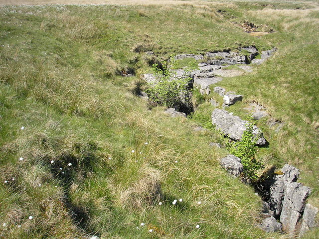
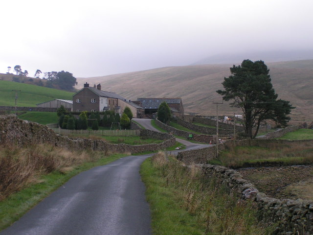
Scar End is a settlement on the side of Twisleton Scar in the English county of North Yorkshire. This Scar itself is the end of a spur running westwards from Whernside, one of the Three Peaks, towards Ingleton, North Yorkshire, and the beds of limestone project to a height of above sea level. Looking out towards the west from Twisleton Scar is Ingleton, to the South, is Ingleborough, and to the north is the view up the Kingsdale valley. The settlement consists of a handful of buildings, one of which is Twisleton Hall. The road into the settlement leaves the old Roman Road from Ingleton (Oddies Lane) into Chapel-le-Dale. Visitors walking the Ingleton Waterfalls Trail Ingleton Waterfalls Trail is a well-known circular trail beginning and ending in the village of Ingleton in the English county of North Yorkshire, now maintained by the Ingleton Scenery Company. It is claimed that the trail, some long, and wi ... will approach Scar End by walking along Twisleton Lane. Twisl ... [...More Info...] [...Related Items...] OR: [Wikipedia] [Google] [Baidu] |
England
England is a country that is part of the United Kingdom. It shares land borders with Wales to its west and Scotland to its north. The Irish Sea lies northwest and the Celtic Sea to the southwest. It is separated from continental Europe by the North Sea to the east and the English Channel to the south. The country covers five-eighths of the island of Great Britain, which lies in the North Atlantic, and includes over 100 smaller islands, such as the Isles of Scilly and the Isle of Wight. The area now called England was first inhabited by modern humans during the Upper Paleolithic period, but takes its name from the Angles, a Germanic tribe deriving its name from the Anglia peninsula, who settled during the 5th and 6th centuries. England became a unified state in the 10th century and has had a significant cultural and legal impact on the wider world since the Age of Discovery, which began during the 15th century. The English language, the Anglican Church, and Engli ... [...More Info...] [...Related Items...] OR: [Wikipedia] [Google] [Baidu] |
North Yorkshire
North Yorkshire is the largest ceremonial counties of England, ceremonial county (lieutenancy area) in England, covering an area of . Around 40% of the county is covered by National parks of the United Kingdom, national parks, including most of the Yorkshire Dales and the North York Moors. It is one of four counties in England to hold the name Yorkshire; the three other counties are the East Riding of Yorkshire, South Yorkshire and West Yorkshire. North Yorkshire may also refer to a non-metropolitan county, which covers most of the ceremonial county's area () and population (a mid-2016 estimate by the Office for National Statistics, ONS of 602,300), and is administered by North Yorkshire County Council. The non-metropolitan county does not include four areas of the ceremonial county: the City of York, Middlesbrough, Redcar and Cleveland and the southern part of the Borough of Stockton-on-Tees, which are all administered by Unitary authorities of England, unitary authorities. ... [...More Info...] [...Related Items...] OR: [Wikipedia] [Google] [Baidu] |
Whernside
Whernside is a mountain in the Yorkshire Dales in Northern England. It is the highest of the Yorkshire Three Peaks, the other two being Ingleborough and Pen-y-ghent. It is the highest point in the ceremonial county of North YorkshireMickle Fell in southern Teesdale is the highest point within the boundaries of the historic county of Yorkshire. and the historic West Riding of Yorkshire with the summit lying on the county boundary with Cumbria. It is the fifteenth most prominent hill in England. In shape Whernside forms a long ridge, running roughly north-north-east to south-south-west. The mountain is north west of Ingleton and north of Horton-in-Ribblesdale. Name The name, first recorded in 1208 as ''Querneside'', is of Old English origin. It is derived from ''cweorn'' 'quern' or 'millstone' and ''sīde'' 'hillside', so means "hillside where millstones are found". The name is of the same origin as Great Whernside, to the east, with which it is sometimes confused. Ro ... [...More Info...] [...Related Items...] OR: [Wikipedia] [Google] [Baidu] |
Ingleton, North Yorkshire
Ingleton is a village and civil parish in the Craven district of North Yorkshire, England. The village is from Kendal and from Lancaster on the western side of the Pennines. It is from Settle. The River Doe and the River Twiss meet to form the source of the River Greta, a tributary of the River Lune. The village is on the A65 road and at the head of the A687. The B6255 takes the south bank of the River Doe to Ribblehead and Hawes. All that remains of the railway in the village is the landmark Ingleton Viaduct.OS map 98, Wensleydale and Upper Wharfdale. Arthur Conan Doyle was a regular visitor to the area and was married locally, as his mother lived at Masongill from 1882 to 1917 (see notable people). It has been claimed that there is evidence that the inspiration for the name Sherlock Holmes came from here. Whernside, north-north-east of the village, one of the Yorkshire Three Peaks, is the highest point in the parish at . There are major quarries within the paris ... [...More Info...] [...Related Items...] OR: [Wikipedia] [Google] [Baidu] |
Ingleborough
Ingleborough () is the second-highest mountain in the Yorkshire Dales, England. It is one of the Yorkshire Three Peaks (the other two being Whernside and Pen-y-ghent), and is frequently climbed as part of the Three Peaks walk. A large part of Ingleborough is designated as a Site of Special Scientific Interest and National Nature Reserve and is the home of a new joint project, Wild Ingleborough, with aims to improve the landscape for wildlife and people. Name The first element of the name "Ingleborough" has been variably explained as a Scots term for 'beacon, fire', an Old Danish term meaning 'English' or a derivative of Old English ''ing'', 'peak'. The second element is derived from the Old English word ''burh'', meaning "a fortified place"; in this case, a hill fort. The summit plateau of Ingleborough is encircled by the remains of a massive stone rampart, containing the foundations of Iron Age huts. Geography Ingleborough is in the south-western corner of the Yorkshi ... [...More Info...] [...Related Items...] OR: [Wikipedia] [Google] [Baidu] |
Kingsdale
Kingsdale is a valley on the western edge of the Yorkshire Dales National Park in northern England. The name Kingsdale derives from a combination of Old Norse and Old English (''Kyen'' and ''Dael'') which means ''The valley where the cows were kept''. Humans were active in Kingsdale from 6,700 BC onwards. Evidence of fire-pits used by hunter-gatherers have been found in the dale. The larger part of the valley lies within the county of North Yorkshire but its highest reaches fall just within Cumbria. It is defined by the hills of Whernside to its east and Gragareth to its west. Kingsdale is drained by the south-westward flowing Kingsdale Beck which assumes the name River Twiss before joining the River Doe at Ingleton to become the River Greta. The single minor public road which serves the valley is followed by the Yorkshire Dales Cycle Way. There are several nationally important caves within the valley (such as Rowten Pot and Yordas Cave) and the impressive resurgence of K ... [...More Info...] [...Related Items...] OR: [Wikipedia] [Google] [Baidu] |
Ingleton Waterfalls Trail
Ingleton Waterfalls Trail is a well-known circular trail beginning and ending in the village of Ingleton in the English county of North Yorkshire, now maintained by the Ingleton Scenery Company. It is claimed that the trail, some long, and with a vertical rise of 169 m (554 feet) has some of the most spectacular waterfall and woodland scenery in the north of England. It is on private land and an entrance fee is charged. Beginnings Following a number of articles in the ''Lancaster Guardian'' and other newspapers about the scenery in and around Ingleton, public interest led to the creation of the trail in an area which was previously hidden from view. Paths and bridges were built and the trail opened on Good Friday, 11 April 1885. The presence of Ingleton railway station played a major role in the early success of the trail, attracting visitors from Bradford, Manchester and Leeds. Geology Ingleton lies on the North and South Craven fault, exposing Carboniferous ... [...More Info...] [...Related Items...] OR: [Wikipedia] [Google] [Baidu] |


