|
Sattel
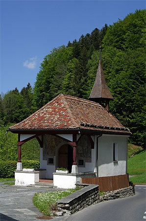
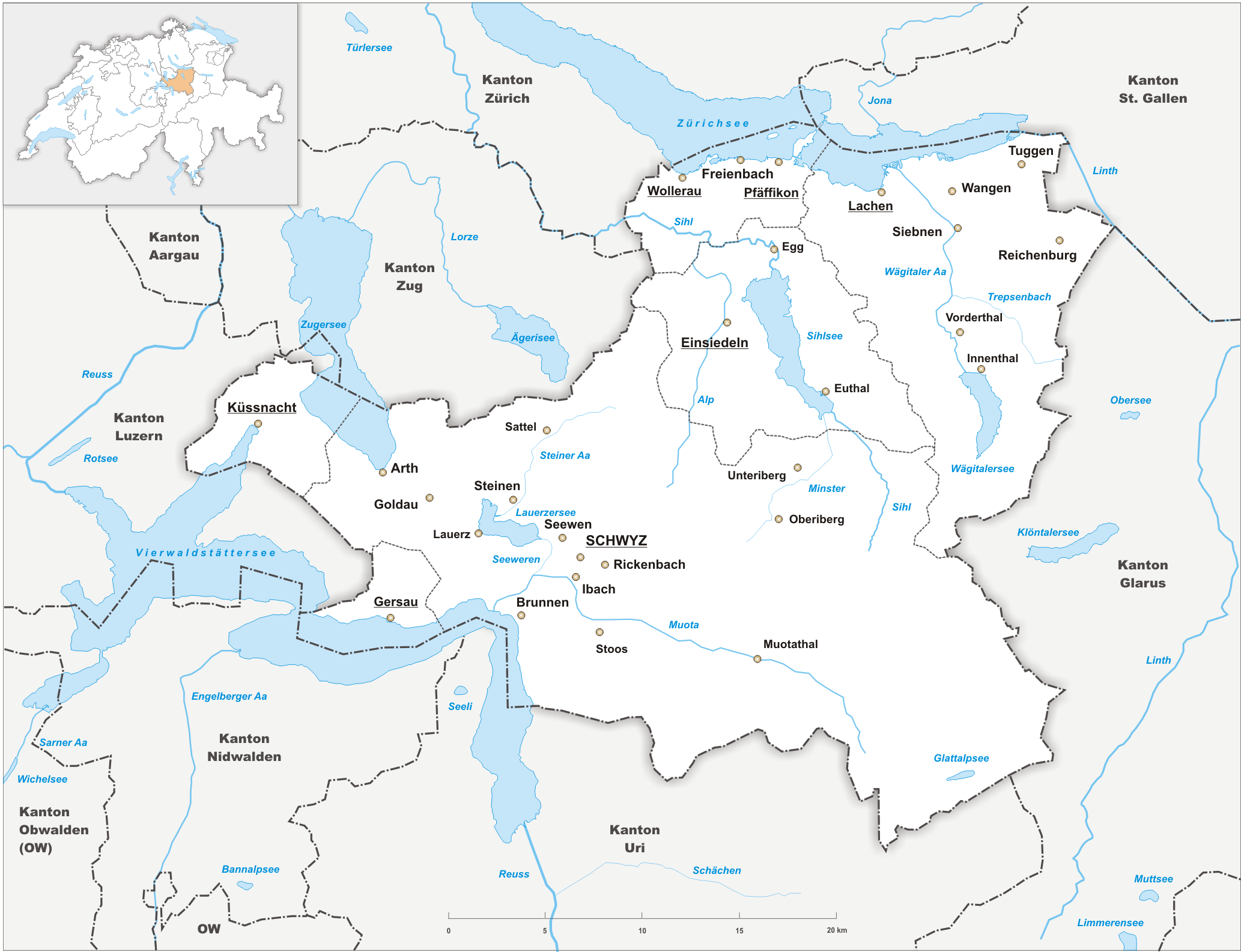
Sattel is a municipality in Schwyz District in the canton of Schwyz in Switzerland. Its name is the German word for "saddle". History The Battle of Morgarten occurred on 15 November 1315 near Sattel, at Morgarten (now part of Oberägeri). It began when a Swiss Confederation force of 1,500 infantry archers ambushed a group of Austrian soldiers of the Holy Roman Empire near the Morgarten Pass. The Swiss, led by Werner Stauffacher, thoroughly defeated the Austrians, who were under the command of Duke Leopold I of Austria. The Confederates prepared a road-block and an ambush at a point between Lake Aegeri and Morgarten pass where the small path led between the steep slope and a swamp. When about 1500 men attacked from above with rocks, logs and halberds, the knights had no room to defend themselves and suffered a crushing defeat, while the foot soldiers in the rear fled back to the city of Zug. A chronicler described the Confederates, unfamiliar with the customs of battles bet ... [...More Info...] [...Related Items...] OR: [Wikipedia] [Google] [Baidu] |
Mostelberg
Mostelberg (also known simply as ''Mostel'') is a resort in the Swiss Alps, located in the canton of Schwyz. The village is situated in the region between Lake Ägeri and Lake Lauerz, above Sattel, at a height of 1,191 metres above sea level. It belongs to the municipality of Sattel. Mostelberg can be reached via a gondola lift from Sattel. In winter the resort includes a ski area culminating near the Hochstuckli. Near the gondola station is located a 374-metre-long foot suspension bridge. The bridge crosses the Lauitobel valley. References *Swisstopo Swisstopo is the official name for the Swiss Federal Office of Topography (in German language, German: ''Bundesamt für Landestopografie''; French language, French: ''Office fédéral de topographie''; Italian language, Italian: ''Ufficio fed ... topographic maps External linksSattel-hochstuckli.ch (official website) Villages in the canton of Schwyz Ski areas and resorts in Switzerland Car-free villages in Switzerland ... [...More Info...] [...Related Items...] OR: [Wikipedia] [Google] [Baidu] |
Canton Of Schwyz
The canton of Schwyz (german: Kanton Schwyz rm, Chantun Sviz; french: Canton de Schwytz; it, Canton Svitto) is a canton in central Switzerland between the Alps in the south, Lake Lucerne to the west and Lake Zürich in the north, centred on and named after the town of Schwyz. It is one of the founding cantons of Switzerland; Switzerland's name is derived from the name of the canton, and the flag of Switzerland from its coat of arms. For the history of the name, see Schwyz. The Swiss Federal Charter is on display in Schwyz. Northeast of the town of Schwyz is Einsiedeln Abbey. History Prehistory to the Roman era The earliest traces of humans in Schwyz are from the Upper Paleolithic and Early Mesolithic, or about 12,500 BC. An excavation of the karst caves in the valley of the Muota river (''Muotatal'') revealed numerous sites, some dating to the Younger Dryas period (c. 10,000 BC). The alpine meadows at Bödmeren, Twärenen and Silberen were Stone Age hunter-gatherer camps. ... [...More Info...] [...Related Items...] OR: [Wikipedia] [Google] [Baidu] |
Schwyz District
Schwyz District is a district of the canton of Schwyz, Switzerland ). Swiss law does not designate a ''capital'' as such, but the federal parliament and government are installed in Bern, while other federal institutions, such as the federal courts, are in other cities (Bellinzona, Lausanne, Luzern, Neuchâtel .... It is both the largest and most populous of the six districts of the canton of Schwyz, accounting for around half its surface area, and 40% of the population. It has a population of (as of ). The district contains a total of 15 municipalities, of which the town of Schwyz is the capital. References {{Authority control Districts of the canton of Schwyz ... [...More Info...] [...Related Items...] OR: [Wikipedia] [Google] [Baidu] |
Rothenthurm
Rothenthurm is a municipality in Schwyz District in the canton of Schwyz in Switzerland. History The French invasion of Switzerland in 1798 brought about a swift end of the Ancien Régime. The French victories against the larger cities of the swiss plateau led to the creation of the French supported Helvetic Republic on 12 April 1798. Following the declaration of the Republic, the Cantons of Uri, Schwyz and Nidwalden rejected it and raised an army to fight the French. Under Alois von Reding they were able to raise about 10,000 men. This army was deployed along the defensive line from Napf to Rapperswil. General Reding besieged French controlled Lucerne and marched across the Brünig pass into the Berner Oberland to support the armies of Berne. At the same time, the French General Balthazar Alexis Henri Schauenburg marched out of occupied Zürich to attack Zug, Lucerne and the Sattel pass. Even though the Reding's army won victories at Rothenthurm and Morgarten, Schauenbu ... [...More Info...] [...Related Items...] OR: [Wikipedia] [Google] [Baidu] |
Helvetic Republic
The Helvetic Republic (, , ) was a sister republic of France that existed between 1798 and 1803, during the French Revolutionary Wars. It was created following the French invasion and the consequent dissolution of the Old Swiss Confederacy, marking the end of the ''ancien régime'' in Switzerland. Throughout its existence, the republic incorporated most of the territory of modern Switzerland, excluding the cantons of Geneva and Neuchâtel and the old Prince-Bishopric of Basel. The Swiss Confederacy, which until then had consisted of self-governing cantons united by a loose military alliance (and ruling over subject territories such as Vaud), was invaded by the French Revolutionary Army and turned into an ally known as the "Helvetic Republic". The interference with localism and traditional liberties was deeply resented, although some modernizing reforms took place. Resistance was strongest in the more traditional Catholic cantons, with armed uprisings breaking out in spring 1 ... [...More Info...] [...Related Items...] OR: [Wikipedia] [Google] [Baidu] |
Oberägeri
Oberägeri, until 1798 simply known as Ägeri, is a municipality in the canton of Zug in Switzerland. History Oberägeri first appears in historical documents in 1150 as ''Agregia''. In 1538 it was mentioned as ''Ober Egere''. The first church in the valley was built in 876. After 1100, the land belonged to the monastery of Einsiedeln, and was influenced by the Battle of Morgarten. The Battle of Morgarten occurred on 15 November 1315 at Morgarten (now part of Oberägeri) and near neighboring Sattel. It began when a Swiss Confederation force of 1,500 infantry archers, led by Werner Stauffacher, ambushed a group of Austrian soldiers of the Holy Roman Empire under the command of Duke Leopold I of Austria near the Morgarten Pass. The Swiss thoroughly defeated the Austrians. The Confederates prepared a road-block and an ambush at a point between Lake Aegeri and Morgarten Pass where a small path led between the steep slope and a swamp. When about 1500 men attacked from above wit ... [...More Info...] [...Related Items...] OR: [Wikipedia] [Google] [Baidu] |
Steinen, Switzerland
Steinen is a municipality in Schwyz District in the canton of Schwyz in Switzerland. Geography Steinen has an area, , of . Of this area, 52.7% is used for agricultural purposes, while 22.1% is forested. Of the rest of the land, 10.5% is settled (buildings or roads) and the remainder (14.6%) is non-productive (rivers, glaciers or mountains). It is located between Rossberg and Lake Lauerz. Demographics Steinen has a population (as of ) of . , 7.6% of the population was made up of foreign nationals. Over the last 10 years the population has grown at a rate of 11.8%. Most of the population () speaks German (94.6%), with Italian being second most common ( 1.7%) and Serbo-Croatian being third ( 1.1%).Swiss Federal Statistical Office accessed 31-Aug-2009 the gender distribution of the population ... [...More Info...] [...Related Items...] OR: [Wikipedia] [Google] [Baidu] |
Schwyz
The town of Schwyz (; french: Schwytz; it, Svitto) is the capital of the canton of Schwyz in Switzerland. The Federal Charter of 1291 or ''Bundesbrief'', the charter that eventually led to the foundation of Switzerland, can be seen at the ''Bundesbriefmuseum''. The official language of Schwyz is (the Swiss variety of) German, but the main spoken language is the local variant of the Alemannic Swiss German dialect. Name The earliest certain record of the name dates to 972, recorded in Medieval Latin as '. There are a number of uncertain records dated between 924 and 960, in the form ''Swites'' (''Suuites'') and ''Switz''. The name is recorded as ''Schwitz'' in the 13th century, and in the 17th to 18th century often as ''Schweitz''. The name's etymology is uncertain. It was long presented as derived from the name of an eponymous founder in Swiss legend, one ''Suito'' or ''Switer'', an explanation found in Swiss school textbooks until the first half of the 20th century. T ... [...More Info...] [...Related Items...] OR: [Wikipedia] [Google] [Baidu] |
Unterägeri
Unterägeri is a municipality in the canton of Zug in Switzerland. History Oberägeri is first mentioned in 1150 as ''Agregia''. In 1538 it was mentioned as ''Ober Egere''. The first church in the valley was built in 876. After 1100, the land belonged to the monastery on Einsiedeln, and was influenced by the Battle of Morgarten. The municipality came into existence in the 15th century. Around 1500, several chapels and the first government building were built in Oberägeri. In 1669 the municipality gained the right to elect its own priest. In 1726 the church was burgled. In 1766 the governments of Oberägeri and Unterägeri (at the time known as Wilägeri) became involved in an open fight during local parliamentary sessions, and the two municipalities split in 1798. Geography Unterägeri has an area, , of . Of this area, 37.1% is used for agricultural purposes, while 54.3% is forested. Of the rest of the land, 6.7% is settled (buildings or roads) and the remainder (1.8%) is ... [...More Info...] [...Related Items...] OR: [Wikipedia] [Google] [Baidu] |
Steinerberg
Steinerberg is a municipality in Schwyz District in the canton of Schwyz in Switzerland. Geography Steinerberg has an area, , of . Of this area, 62.7% is used for agricultural purposes, while 31.8% is forested. Of the rest of the land, 5.2% is settled (buildings or roads) and the remainder (0.3%) is non-productive (rivers, glaciers or mountains). Demographics Steinerberg has a population (as of ) of . , 6.3% of the population was made up of foreign nationals. Over the last 10 years the population has decreased at a rate of -3.5%. Most of the population () speaks German (95.1%), with Serbo-Croatian being second most common ( 1.3%) and Albanian being third ( 0.9%).Swiss Federal Statistical Office accessed 31-Aug-2009 the gender distribution of the population was 51.3% male and 48.7% female. The age d ... [...More Info...] [...Related Items...] OR: [Wikipedia] [Google] [Baidu] |
Leopold I Of Austria (Habsburg)
Leopold I (c. 1290 – 28 February 1326), called The Glorious, was Duke of Austria and Styria – as co-ruler with his elder brother Frederick the Fair – from 1308 until his death. A member of the House of Habsburg, he was the third son of Albert I of Germany and Elisabeth of Gorizia-Tyrol, a scion of the Meinhardiner dynasty. Biography After the death of his eldest brother Duke Rudolph III in 1307 and the assassination of King Albert in 1308, Leopold became administrator of Further Austria, where he started a retaliation campaign against his father's murderers. He converged with the royal House of Luxembourg and accompanied King Henry VII on his Italian campaign. In 1311, he helped to suppress a Guelph uprising in Milan under Guido della Torre, and to lay siege to the city of Brescia. Upon Emperor Henry's death, he strongly supported his brother Frederick in the 1314 election as King of the Romans. Despite all efforts, the Habsburgs only gained the votes of four prince-el ... [...More Info...] [...Related Items...] OR: [Wikipedia] [Google] [Baidu] |
Swiss Plateau
The Swiss Plateau or Central Plateau (german: Schweizer Mittelland; french: plateau suisse; it, altopiano svizzero) is one of the three major landscapes in Switzerland, lying between the Jura Mountains and the Swiss Alps. It covers about 30% of the Swiss surface area, and is partly flat but mostly hilly. The average height is between and AMSL. It is by far the most densely populated region of Switzerland, the center of economy and important transportation. Geography In the north and northwest, the Swiss Plateau is sharply delimited geographically and geologically by the Jura Mountains. In the south, there is no clear border with the Alps. Usually, the rising of the terrain to altitudes above 1500 metres AMSL (lime Alps, partly sub-alpine molasse), which is very abrupt in certain places, is taken as a criterion for delimitation. Occasionally the regions of the higher Swiss Plateau, especially the hills of the canton of Fribourg, the Napf region, the Töss region, the (lower) To ... [...More Info...] [...Related Items...] OR: [Wikipedia] [Google] [Baidu] |


.jpg)