|
Saskatchewan Highway 14 (jct)
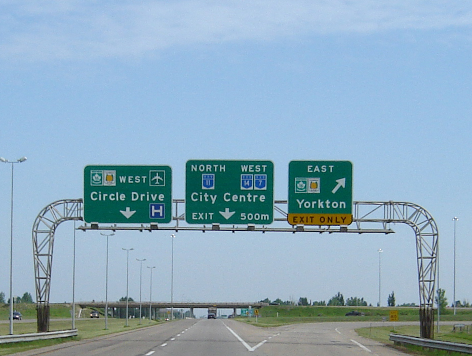
Highway 14 is a highway in the Canadian province of Saskatchewan. It runs from the Alberta border where it becomes Highway 13 to intersection of Circle Drive and 22nd Street in Saskatoon. It is approximately long. Prior to 1976, Highway 14 ran the width of the province, continuing east from Saskatoon to the Manitoba border where it transitioned to PTH 4. In 1970, the portion of Highway 14 east of Saskatoon was made part of the Yellowhead Highway along with the section of Highway 5 running west of Saskatoon. Six years later, in 1976, these two sections were re-designated as Highway 16 so that the Yellowhead Highway would carry one number through the four Western provinces (Manitoba would follow suit the next year, redesignating PTH 4 to PTH 16). Though Highway 14 is one of the three major highways leading from Saskatoon to Alberta, it is less used than Highway 7 or Highway 16 as the other highways provide direct access to Calgary and Edmonton respectively. Major communiti ... [...More Info...] [...Related Items...] OR: [Wikipedia] [Google] [Baidu] |
Ministry Of Highways And Infrastructure (Saskatchewan)
The Ministry of Highways is divided into the Operations, Policy and Programs, and Corporate Services Divisions and the Communications Branch. The ministry is the employer of over 1,476 employees diversified amongst 105 communities in Saskatchewan. The current Minister of Highways and Infrastructure is Fred Bradshaw. Operations Division The Operation Division has the responsibility of maintaining of asphalt concrete pavements, of granular pavements, of thin membrane surface (TMS) highways, of gravel highways, of ice roads, bridges, large culverts, 12 ferries, one barge and 17 northern airports. Operational maintenance includes surface repair activities like crack filling, sealing, and patching; snow and ice control; pavement marking; signing; and ferry operations. Along with engineering, construction and design of the provincial road network, the operations division provides regulations, inspections and advice to the rural municipalities (R.M.) for the municipal r ... [...More Info...] [...Related Items...] OR: [Wikipedia] [Google] [Baidu] |
Yellowhead Highway
The Yellowhead Highway (french: Route Yellowhead) is a major interprovincial highway in Western Canada that runs from Winnipeg to Graham Island off the coast of British Columbia via Saskatoon and Edmonton. It stretches across the four western Canadian provinces of British Columbia, Alberta, Saskatchewan, and Manitoba and is part of the Trans-Canada Highway system and the larger National Highway System, but should not be confused with the more southerly, originally-designated Trans-Canada Highway. The highway was officially opened in 1970. Beginning in 1990, the green and white Trans-Canada logo was used to designate the roadway. The highway is named for the Yellowhead Pass, the route chosen to cross the Canadian Rockies. The pass and the highway are named after a fur trader and explorer named Pierre Bostonais. He had yellow streaks in his hair, and was nicknamed "Tête Jaune" (Yellowhead). Almost the entire length of the highway is numbered as 16, except for the section in ... [...More Info...] [...Related Items...] OR: [Wikipedia] [Google] [Baidu] |
Rural Municipality Of Senlac No
In general, a rural area or a countryside is a geographic area that is located outside towns and cities. Typical rural areas have a low population density and small settlements. Agricultural areas and areas with forestry typically are described as rural. Different countries have varying definitions of ''rural'' for statistical and administrative purposes. In rural areas, because of their unique economic and social dynamics, and relationship to land-based industry such as agriculture, forestry and resource extraction, the economics are very different from cities and can be subject to boom and bust cycles and vulnerability to extreme weather or natural disasters, such as droughts. These dynamics alongside larger economic forces encouraging to urbanization have led to significant demographic declines, called rural flight, where economic incentives encourage younger populations to go to cities for education and access to jobs, leaving older, less educated and less wealthy popul ... [...More Info...] [...Related Items...] OR: [Wikipedia] [Google] [Baidu] |
Senlac, Saskatchewan
Senlac ( 2016 population: ) is a village in the Canadian province of Saskatchewan within the Rural Municipality of Senlac No. 411 and Census Division No. 13. The village was named after Senlac Hill, the location of the Battle of Hastings in England in 1066. History Senlac incorporated as a village on October 11, 1916. Demographics In the 2021 Census of Population conducted by Statistics Canada, Senlac had a population of living in of its total private dwellings, a change of from its 2016 population of . With a land area of , it had a population density of in 2021. In the 2016 Census of Population, the Village of Senlac recorded a population of living in of its total private dwellings, a change from its 2011 population of . With a land area of , it had a population density of in 2016. Notable people Senlac was the childhood home to professional ice hockey player Curtis Brown. See also * List of communities in Saskatchewan * Villages of Saskatchewan A vill ... [...More Info...] [...Related Items...] OR: [Wikipedia] [Google] [Baidu] |
Rural Municipality Of Eye Hill No
In general, a rural area or a countryside is a geographic area that is located outside towns and cities. Typical rural areas have a low population density and small settlements. Agricultural areas and areas with forestry typically are described as rural. Different countries have varying definitions of ''rural'' for statistical and administrative purposes. In rural areas, because of their unique economic and social dynamics, and relationship to land-based industry such as agriculture, forestry and resource extraction, the economics are very different from cities and can be subject to boom and bust cycles and vulnerability to extreme weather or natural disasters, such as droughts. These dynamics alongside larger economic forces encouraging to urbanization have led to significant demographic declines, called rural flight, where economic incentives encourage younger populations to go to cities for education and access to jobs, leaving older, less educated and less wealthy populati ... [...More Info...] [...Related Items...] OR: [Wikipedia] [Google] [Baidu] |
Exhibition, Saskatoon
The Exhibition subdivision of Saskatoon, Saskatchewan, Canada, is located on the banks of the South Saskatchewan River and was developed between the two major World Wars. To the west is the Diefenbaker Management Area which boasts the Diefenbaker park and Nutana Pioneer Cemetery, Pioneer Cemetery. The park includes a medium-sized hill which is used for tobogganing and snowboarding, and the park itself is a frequently-used venue for picnics and public events and performances. The Exhibition community is also known as Thornton, after a (now-demolished) public elementary school that formerly served the area and early in its history also went by the name Bellevue. History The Pioneer Cemetery received its first interment in 1884. On June 20, 1905, the Nutana Cemetery Co was awarded a special grant at SW Section 20 Township 36 Range 5 W of the 106th meridian west, 3rd Meridian. The Pioneer Cemetery was also called the Nutana Cemetery, and was the first municipal cemetery for the Cit ... [...More Info...] [...Related Items...] OR: [Wikipedia] [Google] [Baidu] |
Western Development Museum
The Western Development Museum is a network of four museums in Saskatchewan, Canada preserving and recording the social and economic development of the province. The museum has branches in Moose Jaw, North Battleford, Saskatoon and Yorkton. Respectively, each branch focuses on a different theme: transportation, agriculture, economy, and people. The museum is affiliated with the Canadian Museums Association, the Canadian Heritage Information Network, and Virtual Museum of Canada. History Originally started as a grass-roots movement, the museum was founded with the passage of the Western Development Museum Act in 1949. The first home for the museum in 1949 was a refurbished hangar in North Battleford. Later the same year a similar structure in Saskatoon was converted into a second location for the museum. A third hangar was procured in Yorkton in 1951 and was likewise converted. In 1972, the first purpose-built buildings were constructed to house new locations for the museums in York ... [...More Info...] [...Related Items...] OR: [Wikipedia] [Google] [Baidu] |
Central Business District, Saskatoon
The Central Business District is one of seven development districts in Saskatoon, Saskatchewan, Canada. The central business district is Ward 6 of a Mayor-Council government represented by councillor Cynthia Block. Formerly called West Saskatoon, this area arose when the steam engines built their pumping stations on the lower west bank of the South Saskatchewan River. Retail enterprises sprang up around the newly created train station and rail yards. The city of Saskatoon's Central Business District has shopping malls and boutiques. History In 1890 the Qu'Appelle, Long Lake and Saskatchewan Railway Line (QLLR) or The Qu'Appelle, Long Lake and Saskatchewan Steamboat and Railway Line (QLLSR) extended from Regina through to Prince Albert, crossing the South Saskatchewan River where the Senator Sid Buckwold Bridge crosses the river presently. Steam engines could be refilled easier on the west banks of the river which were not so steep. Businesses sprang up around the pumping statio ... [...More Info...] [...Related Items...] OR: [Wikipedia] [Google] [Baidu] |
Asquith, Saskatchewan
Asquith is a town in south-central Saskatchewan, Canada, approximately west of Saskatoon. It became a village in December 1907. According to the 2011 Census, its population is 603. The site was largely the original lands settled by Ontario pioneers Andrew Mather and Jennet Mather, née Ainslie. Demographics In the 2021 Census of Population conducted by Statistics Canada, Asquith had a population of living in of its total private dwellings, a change of from its 2016 population of . With a land area of , it had a population density of in 2021. See also * List of communities in Saskatchewan * List of towns in Saskatchewan A town is a type of incorporated urban municipality in the Canadian province of Saskatchewan. A resort village or a village can be incorporated as a town by the Minister of Municipal Affairs via section 52 of ''The Municipalities Act'' if: *Reques ... References External links * Towns in Saskatchewan Division No. 12, Saskatchewan {{SKDi ... [...More Info...] [...Related Items...] OR: [Wikipedia] [Google] [Baidu] |
Edmonton, Alberta
Edmonton ( ) is the capital city of the Canadian province of Alberta. Edmonton is situated on the North Saskatchewan River and is the centre of the Edmonton Metropolitan Region, which is surrounded by Alberta's central region. The city anchors the north end of what Statistics Canada defines as the "Calgary–Edmonton Corridor". As of 2021, Edmonton had a city population of 1,010,899 and a metropolitan population of 1,418,118, making it the fifth-largest city and sixth-largest metropolitan area (CMA) in Canada. Edmonton is North America's List of northernmost settlements, northernmost large city and metropolitan area comprising over one million people each. A resident of Edmonton is known as an ''Edmontonian''. Edmonton's historic growth has been facilitated through the absorption of five adjacent urban municipalities (Strathcona, Alberta, Strathcona, North Edmonton, Alberta, North Edmonton, West Edmonton, Alberta, West Edmonton, Beverly, Alberta, Beverly and Jasper Place) ... [...More Info...] [...Related Items...] OR: [Wikipedia] [Google] [Baidu] |
Calgary
Calgary ( ) is the largest city in the western Canadian province of Alberta and the largest metro area of the three Prairie Provinces. As of 2021, the city proper had a population of 1,306,784 and a metropolitan population of 1,481,806, making it the third-largest city and fifth-largest metropolitan area in Canada. Calgary is situated at the confluence of the Bow River and the Elbow River in the south of the province, in the transitional area between the Rocky Mountain Foothills and the Canadian Prairies, about east of the front ranges of the Canadian Rockies, roughly south of the provincial capital of Edmonton and approximately north of the Canada–United States border. The city anchors the south end of the Statistics Canada-defined urban area, the Calgary–Edmonton Corridor. Calgary's economy includes activity in the energy, financial services, film and television, transportation and logistics, technology, manufacturing, aerospace, health and wellness, retail, and ... [...More Info...] [...Related Items...] OR: [Wikipedia] [Google] [Baidu] |
Saskatchewan Highway 7
Saskatchewan Highway 7 is a major paved undivided provincial highway in the Canadian province of Saskatchewan, running from the Alberta border to Saskatoon. Highway 7 continues west into Alberta where it becomes Alberta Highway 9. Highway 7 is an important trade and travel route linking Saskatoon with several of its bedroom communities such as Delisle and Vanscoy, as well as larger centres farther afield such as Rosetown and Kindersley. Its primary use, however, is by travelers heading for Calgary, Alberta and the Canadian west coast. Despite being one of the most heavily used roads in the province, as of 2020, there is only approximately 36.5 km of the route that is divided highway; 34.5 km from Saskatoon to Delisle, including a recently completed bypass of Vanscoy, and 2 km just east of Rosetown at the Rosetown Airport and Cargill inland terminal. In 2020, the provincial government announced funding to install eight passing lanes east of Kindersley, as well as ... [...More Info...] [...Related Items...] OR: [Wikipedia] [Google] [Baidu] |


.jpg)


