|
Santa Cruz Creek
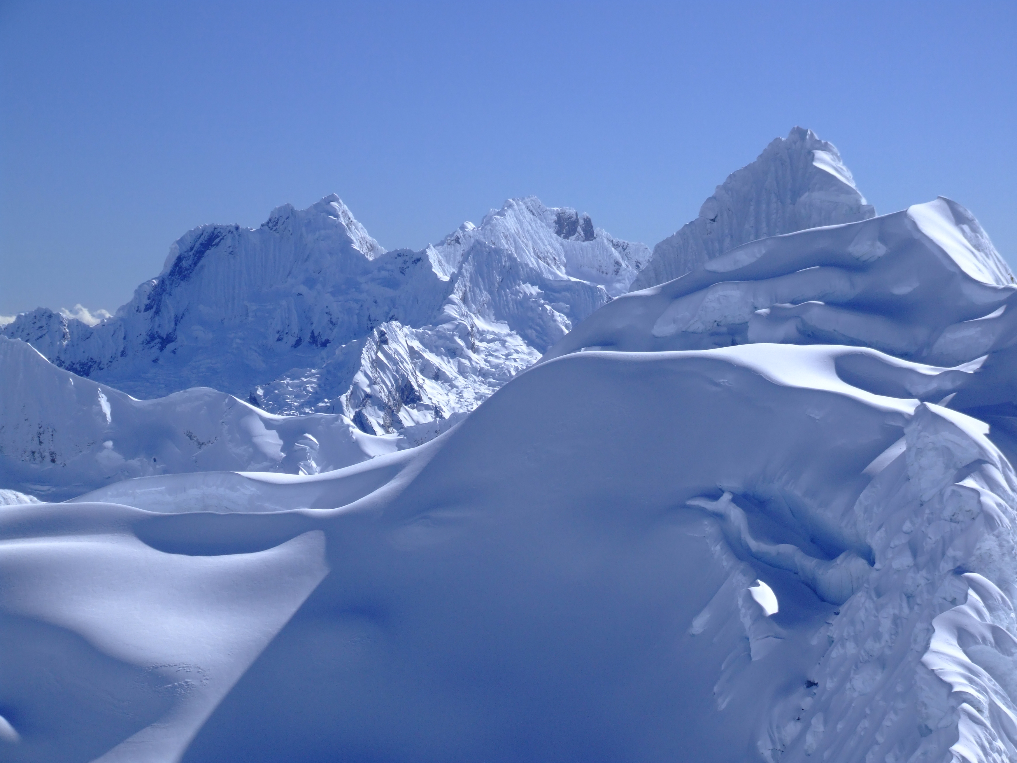
Santa Cruz, (called Yuraqmayu or Yuracma near its end) is a creek in Peru located in Santa Cruz District, Huaylas Province, Ancash. It is a right tributary of the Santa River. It originates in the Cordillera Blanca southwest of Taulliraju, near a lake named Tawlliqucha. It flows from northeast to southwest through lakes Jatuncocha and Ichiccocha and passing by the village of Llamacorral, flanked by the mountains Pucajirca, Quitaraju and Santa Cruz in the north and by Sintiru, Artesonraju and Caraz in the south. Southwest of Santa Cruz, near the village of Cashapampa, it turns to the northwest and then joins the Santa River near the villages of Colcas and Pacamayo, 140 km before the Santa River reaches the Pacific Ocean. The toponymy Yuraqmayu is of Quechua origin, possibly meaning: ''yuraq'' white, ''mayu'' river,Teofilo Laime Acopa, Diccionario Bilingüe, Iskay simipi yuyay k'ancha, Quechua – Castellano, Castellano – Quechua "white river". See also * Los Cedros C ... [...More Info...] [...Related Items...] OR: [Wikipedia] [Google] [Baidu] |
Sintiru
Sentilo (possibly Quechua for peccary) is a mountain in the Cordillera Blanca in the Andes of Peru. It is located in Ancash Region, Huaylas Province, Santa Cruz District. Sentilo lies at the Punta Unión pass, the highest point of the Santa Cruz valley, south of the mountains Rinrijirca and Pucajirca, southwest of Taulliraju, and northeast of mountains Artesonraju and Parón. "Piramide, Paria, Sentilo and Artesonraju from Punta Union." originates near Sentilo. See also * Lake Jatuncocha *[...More Info...] [...Related Items...] OR: [Wikipedia] [Google] [Baidu] |
Pucajirca
Pucajirca or Pucahirca (possibly from Quechua ''puka'' red, Ancash Quechua ''hirka'' mountain, "red mountain") is a mountain in the Cordillera Blanca in the Andes of Peru, about 6,046 m (19,836 ft) high. It is located in the Ancash Region, Pomabamba Province, Pomabamba District (Pucajirca Norte) as well as in the Huaylas Province, Yuracmarca District (Pucajirca Central) north of Rinrijirca. Its slopes are within Huascarán National Park. The mountain has three separate and independent summits: Pucajirca Norte (6,046 m), Central (6,014 m) and Oeste (6,039 m). The current DEM data has no enough evidence to confirm its official altitude. First Ascent The summit of Pucajirca Norte was first achieved on July 14, 1955, by Nick Clinch and Andrew Kauffman II (USA), also two days later by Harvey McMannis and David Sowles (USA). Erwin Schneider summited Pucajirca Oeste in the 1930s. See also * Arhuaycocha * Pucacocha * Taullicocha * Taulliraju Tau ... [...More Info...] [...Related Items...] OR: [Wikipedia] [Google] [Baidu] |
Los Cedros Creek
Los Cedros Creek (''Quebrada Los Cedros'' in Spanish) is a stream in Peru located in Huaylas Province, Ancash. It is a right tributary of the Santa River which flows to the Pacific Ocean. It originates west of mount Alpamayo and runs mainly to the west until its confluence with the Santa River near the village of Los Cedros. The upstream section receives the name Alpamayo (possibly from Quechua ''allpa'' earth, ''mayu'' river,Teofilo Laime Ajacopa, Diccionario Bilingüe Iskay simipi yuyayk'ancha, La Paz, 2007 (Quechua-Spanish dictionary) "earth river"). See also * Santa Cruz Creek Santa Cruz, (called Yuraqmayu or Yuracma near its end) is a creek in Peru located in Santa Cruz District, Huaylas Province, Ancash. It is a right tributary of the Santa River. It originates in the Cordillera Blanca southwest of Taulliraju, near ... References Rivers of Peru Rivers of Ancash Region {{Peru-river-stub ... [...More Info...] [...Related Items...] OR: [Wikipedia] [Google] [Baidu] |
Quechua Language
Quechua (, ; ), usually called ("people's language") in Quechuan languages, is an Indigenous languages of the Americas, indigenous language family spoken by the Quechua peoples, primarily living in the Peruvian Andes. Derived from a common ancestral language, it is the most widely spoken Pre-Columbian era, pre-Columbian language family of the Americas, with an estimated 8–10 million speakers as of 2004.Adelaar 2004, pp. 167–168, 255. Approximately 25% (7.7 million) of Peruvians speak a Quechuan language. It is perhaps most widely known for being the main language family of the Inca Empire. The Spanish encouraged its use until the Peruvian War of Independence, Peruvian struggle for independence of the 1780s. As a result, Quechua variants are still widely spoken today, being the co-official language of many regions and the second most spoken language family in Peru. History Quechua had already expanded across wide ranges of the central Andes long before the expansion of the ... [...More Info...] [...Related Items...] OR: [Wikipedia] [Google] [Baidu] |
Pacific Ocean
The Pacific Ocean is the largest and deepest of Earth's five oceanic divisions. It extends from the Arctic Ocean in the north to the Southern Ocean (or, depending on definition, to Antarctica) in the south, and is bounded by the continents of Asia and Oceania in the west and the Americas in the east. At in area (as defined with a southern Antarctic border), this largest division of the World Ocean—and, in turn, the hydrosphere—covers about 46% of Earth's water surface and about 32% of its total surface area, larger than Earth's entire land area combined .Pacific Ocean . '' Britannica Concise.'' 2008: Encyclopædia Britannica, Inc. The centers of both the |
Caraz (mountain)
Caraz, Carás or Caraz de Santa Cruz is a mountain in the Cordillera Blanca in the Andes of Peru, about high. It is located in the Ancash Region, Huaylas Province, in the districts Caraz and Santa Cruz District. This peak is inside Huascarán National Park, most precisely southwest of Artesonraju, northwest of Pirámide, north of Lake Parón and south of Santa Cruz Creek. Its slopes are within two Peruvian cities: Santa Cruz and Caraz. Elevation Although the official altitude is , there isn't enough evidence to provide the exact altitude of the peak as most digital elevation models currently have voids. The height of the nearest key col is 3253 meters, leading to a topographic prominence of 2772 meters. Caraz is considered a Mountain Sub-System according to the ''Dominance System'' and its dominance is 46.01%. Its parent peak is Chacraraju and the Topographic isolation is 6.6 kilometers. First Ascent Caraz was first climbed by Hermann Huber, Alfred Koch and Helmu ... [...More Info...] [...Related Items...] OR: [Wikipedia] [Google] [Baidu] |
Artesonraju
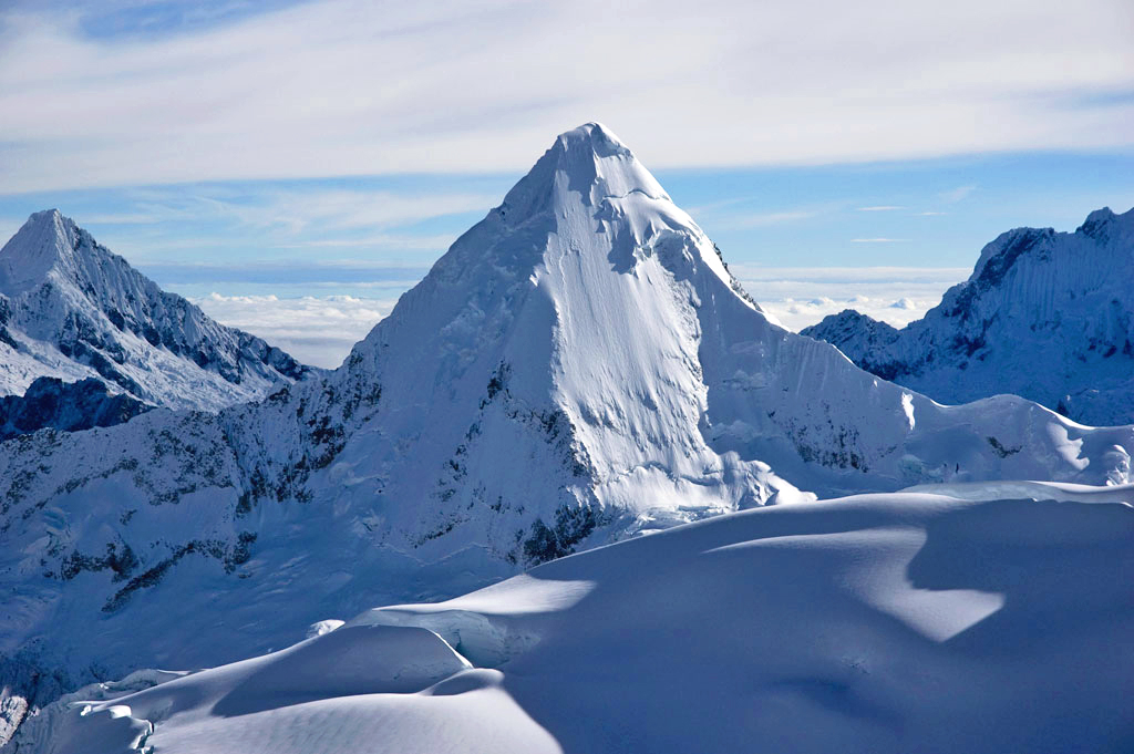
Artesonraju is a pyramidal mountain peak located near the city of Caraz in the Cordillera Blanca mountain range in the Peruvian Andes. It is located at the Peruvian province of Huaylas and its slopes are within two cities: Santa Cruz and Caraz. Its summit has an elevation of (or according to the IGN-Peru map). It is one of many prominent peaks (2772 metres) located within the boundaries of Peru's Huascarán National Park. Artesonraju has two distinguished climbing routes. Due to their difficulties, Artesonraju is seldom successfully climbed in comparison to other well known mountains in the Cordillera Blanca. This mountain serves as the inspiration mascot for the newer Paramount Pictures production logo. Elevation The available Digital elevation models show several voids in the region therefore its exact altitude may be shown differently in some sources. SRTM's highest point shows 5982 metres, Void filled SRTM shows 5918 metres, ASTER shows 5982 metres as its highest point ... [...More Info...] [...Related Items...] OR: [Wikipedia] [Google] [Baidu] |
Santa Cruz (mountain)
Santa Cruz, Pucaraju, Pukaraju (possibly from Quechua ''puka'' red, ''rahu'' snow, ice, mountain with snow) or Pico de Huaylas (Spanish for "peak of Huaylas") is a mountain in the Cordillera Blanca in the Andes of Peru; within Santa Cruz District, Huaylas Province, Ancash. It has a height of , although other maps cite a height of . See also * Lake Atuncocha * Caraz * Taulliraju Taulliraju (possibly from Quechua ''tawlli'' a kind of legume, ''rahu'' snow, ice, mountain with snow, References Mountains of Peru Mountains of Ancash Region[...More Info...] [...Related Items...] OR: [Wikipedia] [Google] [Baidu] |
Quitaraju
Quitaraju or Kitaraju (possibly from Ancash Quechua ''kita'' dam, Quechua ''rahu'' snow, ice) is a mountain in the Cordillera Blanca in the Andes of Peru, about high. It is situated in the Ancash Region, Huaylas Province, Santa Cruz District. Quitaraju lies north of the Santa Cruz Creek and the lakes named Ichiccocha, Jatuncocha and Quitacocha, between Santa Cruz in the west and Alpamayo in the northeast. Its slopes are within the Huascarán National Park. Elevation Other data from available digital elevation models: SRTM 6010 metres, ASTER filled 6010 metres and TanDEM-X 5961 metres. The height of the nearest key col is 3253 meters, leading to a topographic prominence of 2783 meters. Quitaraju is considered a Mountain Sub-System according to the ''Dominance System'' and its dominance is 46.11%. Its parent peak is Nevado Santa Cruz and the Topographic isolation is 4.9 kilometers The kilometre ( SI symbol: km; or ), spelt kilometer in American English, is a unit of ... [...More Info...] [...Related Items...] OR: [Wikipedia] [Google] [Baidu] |
Ichiccocha
Lake Ichiccocha (possibly from Ancash Quechua ''ichik'' small, little, few, (pdf) ''qucha'' lake, "little lake") or Lake Chica is a lake in the in the of |
Peru
, image_flag = Flag of Peru.svg , image_coat = Escudo nacional del Perú.svg , other_symbol = Great Seal of the State , other_symbol_type = Seal (emblem), National seal , national_motto = "Firm and Happy for the Union" , national_anthem = "National Anthem of Peru" , march = "March of Flags" , image_map = PER orthographic.svg , map_caption = , image_map2 = , capital = Lima , coordinates = , largest_city = capital , official_languages = Peruvian Spanish, Spanish , languages_type = Co-official languages , languages = , ethnic_groups = , ethnic_groups_year = 2017 , demonym = Peruvians, Peruvian , government_type = Unitary state, Unitary Semi-presidential system, semi-presidential republic , leader_title1 = President of Peru, President ... [...More Info...] [...Related Items...] OR: [Wikipedia] [Google] [Baidu] |
Jatuncocha (Caraz)
Jatuncocha (possibly from Quechua ''hatun'' (in Bolivia always ''jatun'') big, large ''qucha'' lake, "big lake") is a lake in the Cordillera Blanca in the Andes of Peru located in the Ancash Region, Huaylas Province, Santa Cruz District. It is situated at a height of comprising an area of . Jatunccocha lies in the Santa Cruz gorge between the peaks of Quitaraju in the north and Caraz in the south, northeast of a smaller lake named Ichiccocha (Quechua for "little lake"). The Santa Cruz Creek flows through the lake. It is a right tributary of the Santa River The Santa River ( es, Río Santa) is a river in the South American Andes mountain range in the Ancash Region of northwest central Peru. River Course Lake Conococha, at an altitude of 4,050 m above sea level and at , is considered the headwat .... References Lakes of Peru Lakes of Ancash Region {{Ancash-geo-stub ... [...More Info...] [...Related Items...] OR: [Wikipedia] [Google] [Baidu] |

.png)
.jpg)
