|
Sandlings Walk
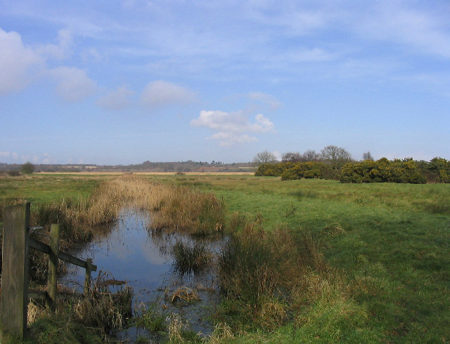
The Sandlings Walk is a long-distance path in Suffolk, England. It runs 91.6km through the Suffolk Sandling that used to stretch from the outskirts of Ipswich to Southwold which is an area of lowland heath, Britain's rarest wildlife habitat, and the Suffolk Coast and Heaths Area of Outstanding Natural Beauty. Starting on the outskirts of Ipswich (trailheads at , , and ), the route passes through Rushmere Common, Sutton Heath, Rendlesham Forest, Butley Corner, Tunstall Forest, Friston, North Warren, Thorpeness, Sizewell, Minsmere, Dunwich Heath, Dunwich Forest, the Suffolk Coast National Nature Reserve and Southwold (trailhead at ). See also * Long-distance footpaths in the UK There are hundreds of long-distance footpaths in the United Kingdom designated in publications from public authorities, guidebooks and OS maps. They are mainly used for hiking and walking, but some may also be used, in whole or in part, for mou ... * Suffolk Coast Path References External ... [...More Info...] [...Related Items...] OR: [Wikipedia] [Google] [Baidu] |
Suffolk
Suffolk () is a ceremonial county of England in East Anglia. It borders Norfolk to the north, Cambridgeshire to the west and Essex to the south; the North Sea lies to the east. The county town is Ipswich; other important towns include Lowestoft, Bury St Edmunds, Newmarket, and Felixstowe which has one of the largest container ports in Europe. The county is low-lying but can be quite hilly, especially towards the west. It is also known for its extensive farming and has largely arable land with the wetlands of the Broads in the north. The Suffolk Coast & Heaths and Dedham Vale are both nationally designated Areas of Outstanding Natural Beauty. History Administration The Anglo-Saxon settlement of Suffolk, and East Anglia generally, occurred on a large scale, possibly following a period of depopulation by the previous inhabitants, the Romanised descendants of the Iceni. By the fifth century, they had established control of the region. The Anglo-Saxon inhabitants later b ... [...More Info...] [...Related Items...] OR: [Wikipedia] [Google] [Baidu] |
North Warren RSPB Reserve
North Warren RSPB reserve is a nature reserve run by the Royal Society for the Protection of Birds (RSPB) in Suffolk, England. It lies on the Suffolk coast on the north edge of the town of Aldeburgh and to the south of Thorpeness and includes the Aldringham Walks area of heathland to the north. It is within the Suffolk Coast and Heaths Area of Outstanding Natural Beauty (AONB) and the Suffolk Heritage Coast area. Noted for its populations of Eurasian bittern, European nightjar and other bird species, it covers a range of coastal habitats and is protected with SSSI, SPA conservation status. Ecology The site covers a mix of coastal habitats, with areas of grassland, lowland heath, reed bed, shingle, dune and woodland. Rare shingle flora such as sea pea, sea kale, sea holly and yellow horned-poppy can be found at North Warren. Key conservation bird species found at the site include Eurasian bittern, European nightjar, nightingale and western marsh harrier. It is also ... [...More Info...] [...Related Items...] OR: [Wikipedia] [Google] [Baidu] |
Suffolk Coast Path
The Suffolk Coast Path is a long-distance footpath along the Suffolk Heritage Coast in England. It is long. Previously known as the Suffolk Coast and Heaths Path after the Suffolk Coast and Heaths Area of Outstanding Natural Beauty through which it runs, the path has been rebranded with new waymarkers bearing the new namehttps://www.flickr.com/photos/omcoc/3237114905/] The path runs along river and sea walls, across marsh, heath, foreshore and cliffs. It starts at Felixstowe and ends at Lowestoft , via Bawdsey, Snape Maltings, Aldeburgh, North Warren, Thorpeness, Minsmere, Dunwich, Southwold and Kessingland. It connects with the Sandlings Walk and (via the Stour and Orwell Walk) with the Essex Way and the Stour Valley Path. Much of W. G. Sebald's novel The Rings of Saturn describes a walking tour that roughly follows the Suffolk Coast Path. See also *Long-distance footpaths in the UK There are hundreds of long-distance footpaths in the United Kingdom designated i ... [...More Info...] [...Related Items...] OR: [Wikipedia] [Google] [Baidu] |
Long-distance Footpaths In The UK
There are hundreds of long-distance footpaths in the United Kingdom designated in publications from public authorities, guidebooks and OS maps. They are mainly used for hiking and walking, but some may also be used, in whole or in part, for mountain biking and horse riding. Most are in rural landscapes, in varying terrain, some passing through National Parks and Areas of Outstanding Natural Beauty. There is no formal definition of a long-distance path, though the British Long Distance Walkers Association defines one as a route "20 miles 2 kmor more in length and mainly off-road." They usually follow existing rights of way, often over private land, joined together and sometimes waymarked to make a named route. Generally, the surface is not specially prepared, with rough ground, uneven surfaces and stiles, which can cause accessibility issues for people with disabilities. Exceptions to this can be converted railways, canal towpaths and some popular fell walking routes where ston ... [...More Info...] [...Related Items...] OR: [Wikipedia] [Google] [Baidu] |
Southwold
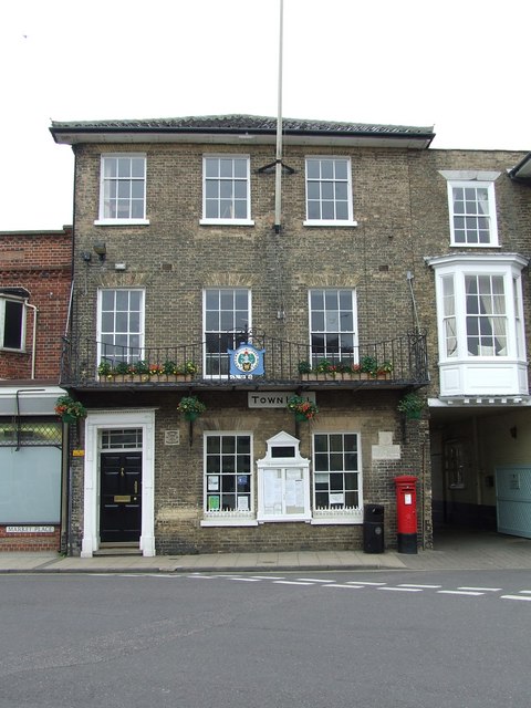
Southwold is a seaside town and civil parish on the English North Sea coast in the East Suffolk district of Suffolk. It lies at the mouth of the River Blyth within the Suffolk Coast and Heaths Area of Outstanding Natural Beauty. The town is about south of Lowestoft, north-east of Ipswich and north-east of London, within the parliamentary constituency of Suffolk Coastal. The "All Usual Residents" 2011 Census figure gives a total of 1,098 persons for the town. The 2012 Housing Report by the Southwold and Reydon Society concluded that 49 per cent of the dwellings are used as second homes or let to holiday-makers. History Southwold was mentioned in ''Domesday Book'' (1086) as a fishing port, and after the "capricious River Blyth withdrew from Dunwich in 1328, bringing trade to Southwold in the 15th century", it received its town charter from Henry VII in 1489. The grant of the charter is marked by the annual Trinity Fair, when it is read out by the Town Clerk. Over following ... [...More Info...] [...Related Items...] OR: [Wikipedia] [Google] [Baidu] |
Suffolk Coast National Nature Reserve
Suffolk Coast National Nature Reserve is a wildlife reserve on the North Sea coast of the English county of Suffolk. It is located around the village of Walberswick to the south of the town of Southwold. The reserve was designated in 2003, combining the existing Walberswick National Nature Reserve with reserves at Dingle Marshes and Hen Reedbeds to create a reserve.Suffolk Coast NNR ''Natural England''. Retrieved 2012-10-31.National nature reserve to be unveiled ''East Anglian Daily Times'', 2003-06-11. Retrieved 2012-10-31. The reserve is managed by |
Dunwich Forest
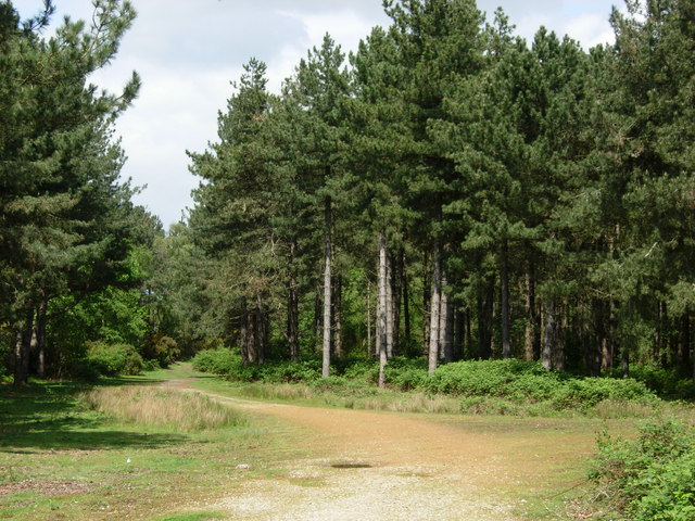
Dunwich Forest is an area of forest and lowland heath around north-west of the village of Dunwich in the English county of Suffolk. The forest covers an area of approximately and was originally planted by the Forestry Commission. The forest is within the Suffolk Coast and Heaths Area of Outstanding Natural Beauty and is in the area known as the Suffolk Sandlings. South of the reserve is the National Trust property of Dunwich Heath, one of the largest remaining areas of lowland heath on the Suffolk coast, and the RSPB reserve at Minsmere. To the north and east of the forest are Dingle Marshes, part of the Suffolk Coast National Nature Reserve. The Forestry Commission (now Forestry England) purchased land from the Dunwich and Westleton estates during the 1920s. Following the acquisition of this land, they began an afforestation programme to develop a conifer plantation, which became Dunwich Forest. The forest is now a mix of broadleaved and coniferous woodland with some areas of ... [...More Info...] [...Related Items...] OR: [Wikipedia] [Google] [Baidu] |
Dunwich Heath
Dunwich Heath is an area of coastal lowland heath just south of the village of Dunwich, in the Suffolk Coast and Heaths AONB, England. It is adjacent to the RSPB reserve at Minsmere. It lies within the area of the Minsmere-Walberswick Heaths and Marshes Site of Special Scientific Interest, Special Area of Conservation and Special Protection Area. It has been owned by the National Trust since 1968, when it was bought with the help of a donation from the Heinz company as part of Enterprise Neptune. Dunwich Heath is a rare survival of coastal lowland heath; the Suffolk Sandlings used to form a lot of the Suffolk coast, but have mostly been developed for agriculture or built upon. The heath is mostly covered with heather, both Common Heather and Bell Heather, and European and Western Gorse but there is also some woodland and grassland included in the reserve. The heather and gorse flower from June until September; the heather is purple and pink while the gorse is yellow. A ... [...More Info...] [...Related Items...] OR: [Wikipedia] [Google] [Baidu] |
Minsmere
Minsmere is a place in the English county of Suffolk. It is located on the North Sea coast around north of Leiston and south-east of Westleton within the Suffolk Coast and Heaths AONB. It is the site of the Minsmere RSPB reserve and the original site of Leiston Abbey. History At the Domesday Survey in 1086 Minsmere was known as ''Menesmara'' or ''Milsemere''.Minsmere ''Domesday book online''. Retrieved 2012-10-31. It is recorded as having six households headed by freemen with one plough team.Minsmere , ''Open Domesday''. Retrieved 2012-10-31. The manor, which was in the Hundred of Blythling< ... [...More Info...] [...Related Items...] OR: [Wikipedia] [Google] [Baidu] |
Sizewell
Sizewell is an English fishing hamlet in the East Suffolk district of Suffolk, England. It belongs to the civil parish of Leiston and lies on the North Sea coast just north of the larger holiday village of Thorpeness, between the coastal towns of Aldeburgh and Southwold. It is east of the town of Leiston and belongs within the Suffolk Coast and Heaths AONB. It is the site of two nuclear power stations, one of them still active. There have been tentative plans for a third station to be built at the site. Nuclear power stations The village is the location of two separate nuclear power stations, the Magnox Sizewell A and Pressurized Water Reactor (PWR) Sizewell B, which are readily visible to the north of the village. Sizewell A is decommissioned, having ceased to generate electricity in 2006. The decommissioning process is expected to take until 2027 to complete, with the site not expected to be cleared until 2098. [...More Info...] [...Related Items...] OR: [Wikipedia] [Google] [Baidu] |
Thorpeness
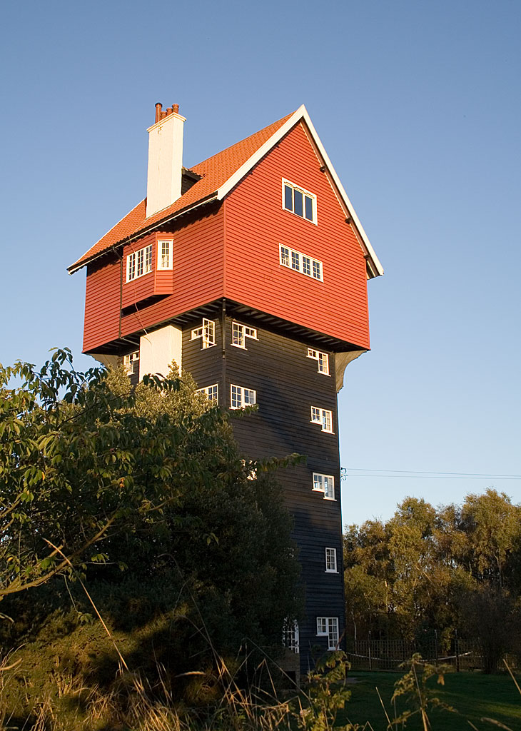
Thorpeness is a seaside village in the East Suffolk (district), East Suffolk district of Suffolk, England, which developed in the early 20th century into an exclusive holiday village. It belongs to the parish of Aldringham cum Thorpe and lies within the Suffolk Coast and Heaths AONB. Development ''For the earlier history of Thorpe, see Aldringham-cum-Thorpe.'' The village was a small fishing hamlet originating in the late 19th century, with folklore, folk tales of it being a route for smugglers into East Anglia. However in 1910, Glencairn Stuart Ogilvie, a Scottish barrister whose father had made a fortune building railways around the world, increased the family's local estates to cover the entire area from north of Aldeburgh to past Sizewell, up the coast and inland to Aldringham and Leiston. Most of this land was used for farming, but Ogilvie developed Thorpeness into an elite private fantasy holiday village, to which he invited his friends' and colleagues' families during ... [...More Info...] [...Related Items...] OR: [Wikipedia] [Google] [Baidu] |
Friston
Friston is a village and civil parish in the East Suffolk district, in the county of Suffolk, England. It is southeast of Saxmundham, its post town, and northwest of Aldeburgh. The River Alde bounds the village on the south. The surrounding land is chiefly arable. The soil becomes partly marshy in the lower grounds. The village is noted for its early nineteenth century post mill. It is located next to the village of Knodishall. Its name is recorded in the Domesday Book as ''Frisetuna'' and seems to come from Anglo-Saxon ''Frīsa tūn'' = "the farmstead of the Frisians"; some of them may have come with the Angles and Saxons The Saxons ( la, Saxones, german: Sachsen, ang, Seaxan, osx, Sahson, nds, Sassen, nl, Saksen) were a group of Germanic * * * * peoples whose name was given in the early Middle Ages to a large country (Old Saxony, la, Saxonia) near the Nor .... An alternative name for the parish is Freston. In 1887, John Bartholomew described Friston as:Frist ... [...More Info...] [...Related Items...] OR: [Wikipedia] [Google] [Baidu] |

