|
Sanders, Arizona
Sanders ( nv, ) is a census-designated place (CDP) in Apache County, Arizona, United States. Sanders is located at the junction of U.S. Route 191 and Interstate 40. As of the 2010 census, it had a population of 630. Sanders has the ZIP code 86512. History Sanders' English name either comes from C.W. Sanders, a railroad office engineer, or Art Saunders, who had a trading post nearby. The railroad station was named ''Cheto'' to avoid confusion with another station named Sanders already on the line. Sanders is located near Interstate 40 and the BNSF Railway. Old Route 66 runs near the town and some sections of the highway still exist. Sanders is surrounded by the Nahata Dziil and (north of the town) Houck chapters of the Navajo Nation. The latter is made up of local Navajos from the area and relocated Navajo refugees from the Navajo/Hopi land dispute. That dispute relocated hundreds of Navajos to the Sanders area from the western Navajo Nation, mainly around the Hopi partition ... [...More Info...] [...Related Items...] OR: [Wikipedia] [Google] [Baidu] |
Census-designated Place
A census-designated place (CDP) is a concentration of population defined by the United States Census Bureau for statistical purposes only. CDPs have been used in each decennial census since 1980 as the counterparts of incorporated places, such as self-governing cities, towns, and villages, for the purposes of gathering and correlating statistical data. CDPs are populated areas that generally include one officially designated but currently unincorporated community, for which the CDP is named, plus surrounding inhabited countryside of varying dimensions and, occasionally, other, smaller unincorporated communities as well. CDPs include small rural communities, edge cities, colonias located along the Mexico–United States border, and unincorporated resort and retirement communities and their environs. The boundaries of any CDP may change from decade to decade, and the Census Bureau may de-establish a CDP after a period of study, then re-establish it some decades later. Most unin ... [...More Info...] [...Related Items...] OR: [Wikipedia] [Google] [Baidu] |
Houck, Arizona
Houck ( nv, ) is a census-designated place (CDP) in Apache County, Arizona, United States. The population was 1,024 at the 2010 census. History Houck was founded by a mail carrier by that name working a route from Prescott to Fort Wingate. In 1877, he established a trading post called Houck's Tank here. Houck left in 1885. Houck was home to Fort Courage (a replica of the set of the 1960s television series F Troop, which was a tourist attraction along Route 66) and a Greyhound bus stop. It once had a gas station, a Taco Bell, and a pancake house. It is home to the Native American Baha'i Institute. Geography Houck is located at (35.283615, -109.237695). According to the United States Census Bureau, the CDP has a total area of , of which , or 0.05%, is water. Climate According to the Köppen Climate Classification system, Houck has a semi-arid climate, abbreviated "BSk" on climate maps. Demographics As of the census of 2000, there were 1,087 people, 312 households, ... [...More Info...] [...Related Items...] OR: [Wikipedia] [Google] [Baidu] |
Pronghorn
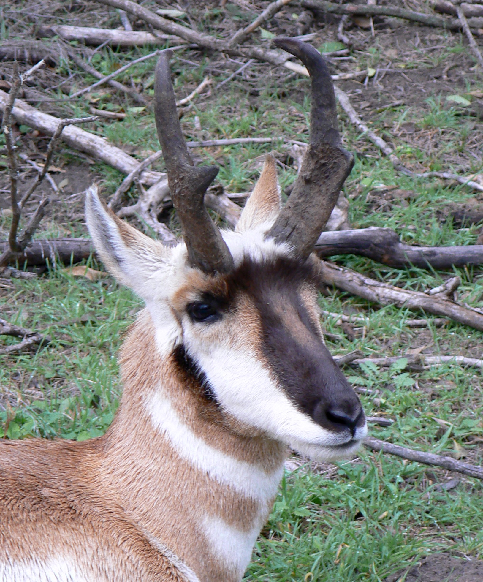
The pronghorn (, ) (''Antilocapra americana'') is a species of artiodactyl (even-toed, hoofed) mammal indigenous to interior western and central North America. Though not an antelope, it is known colloquially in North America as the American antelope, prong buck, pronghorn antelope and prairie antelope, because it closely resembles the antelopes of the Old World and fills a similar ecological niche due to parallel evolution. It is the only surviving member of the family Antilocapridae. During the Pleistocene epoch, about 11 other antilocaprid species existed in North America.Smithsonian Institution. North American MammalsPronghorn ''Antilocapra americana''/ref> Three other genera (''Capromeryx'', '' Stockoceros'' and ''Tetrameryx'') existed when humans entered North America but are now extinct. As a member of the superfamily Giraffoidea, the pronghorn's closest living relatives are the giraffe and okapi. See Fig. S10 in Supplementary Information. The Giraffoidea are in tu ... [...More Info...] [...Related Items...] OR: [Wikipedia] [Google] [Baidu] |
Artemisia Tridentata
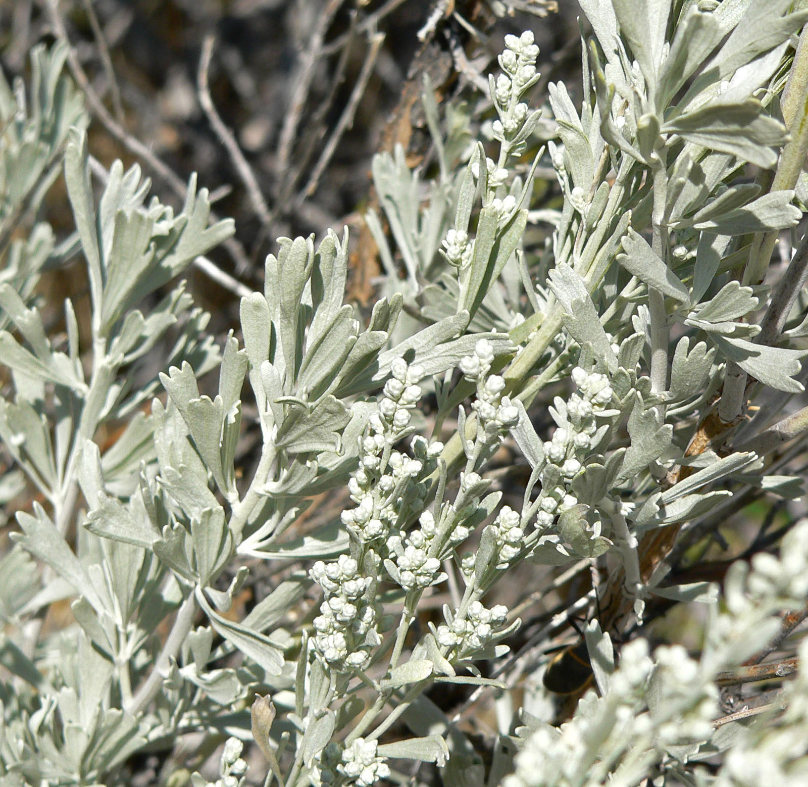
''Artemisia tridentata'', commonly called big sagebrush,MacKay, Pam (2013), ''Mojave Desert Wildflowers'', 2nd ed., , p. 264. Great Basin sagebrush or (locally) simply sagebrush, is an aromatic shrub from the family Asteraceae, which grows in arid and semi-arid conditions, throughout a range of cold desert, steppe, and mountain habitats in the Intermountain West of North America. The vernacular name "sagebrush" is also used for several related members of the genus ''Artemisia'', such as California sagebrush (''Artemisia californica''). Big sagebrush and other ''Artemisia'' shrubs are the dominant plant species across large portions of the Great Basin. The range extends northward through British Columbia's southern interior, south into Baja California, and east into the western Great Plains of New Mexico, Colorado, Nebraska, and the Dakotas. Several major threats exist to sagebrush ecosystems, including human settlements, conversion to agricultural land, livestock grazing, inva ... [...More Info...] [...Related Items...] OR: [Wikipedia] [Google] [Baidu] |
Prickly Pear Cactus
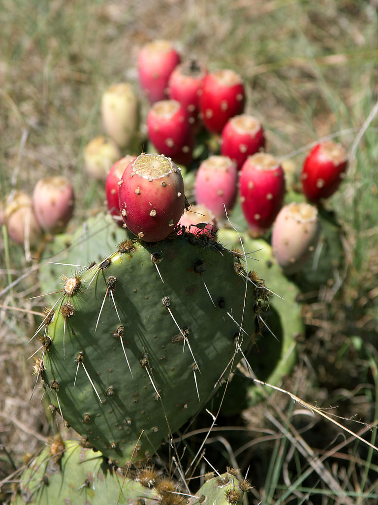
''Opuntia'', commonly called prickly pear or pear cactus, is a genus of flowering plants in the cactus family Cactaceae. Prickly pears are also known as ''tuna'' (fruit), ''sabra'', ''nopal'' (paddle, plural ''nopales'') from the Nahuatl word for the pads, or nostle, from the Nahuatl word for the fruit; or paddle cactus. The genus is named for the Ancient Greek city of Opus, where, according to Theophrastus, an edible plant grew and could be propagated by rooting its leaves. The most common culinary species is the Indian fig opuntia (''O. ficus-indica''). Description ''O. ficus-indica'' is a large, trunk-forming, segmented cactus that may grow to with a crown of over in diameter and a trunk diameter of . Cladodes (large pads) are green to blue-green, bearing few spines up to or may be spineless. Prickly pears typically grow with flat, rounded cladodes (also called platyclades) containing large, smooth, fixed spines and small, hairlike prickles called glochids that ... [...More Info...] [...Related Items...] OR: [Wikipedia] [Google] [Baidu] |
Pinyon Pine
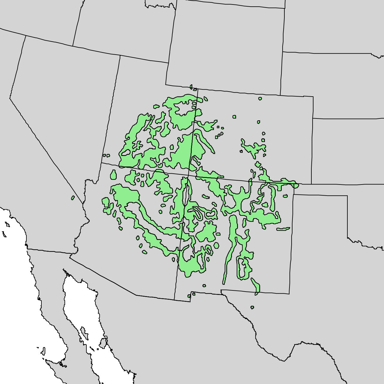
The pinyon or piñon pine group grows in southwestern North America, especially in New Mexico, Arizona, and Utah. The trees yield edible nuts, which are a staple food of Native Americans, and widely eaten as a snack and as an ingredient in New Mexican cuisine. The name comes from the Spanish ''pino piñonero'', a name used for both the American varieties and the stone pine common in Spain, which also produces edible nuts typical of Mediterranean cuisine. Harvesting techniques of the prehistoric American Indians are still used today to collect the pinyon seeds for personal use or for commercialization. The pinyon nut or seed is high in fats and calories. Pinyon wood, especially when burned, has a distinctive fragrance, making it a common wood to burn in chimeneas. Pinyon pine trees are also known to influence the soil in which they grow by increasing concentrations of both macronutrients and micronutrients. Some of the species are known to hybridize, the most notable ones being ... [...More Info...] [...Related Items...] OR: [Wikipedia] [Google] [Baidu] |
Juniper
Junipers are coniferous trees and shrubs in the genus ''Juniperus'' () of the cypress family Cupressaceae. Depending on the taxonomy, between 50 and 67 species of junipers are widely distributed throughout the Northern Hemisphere, from the Arctic, south to tropical Africa, throughout parts of West Asia, western, Central Asia, central and South Asia, southern Asia, east to eastern Tibet in the Old World, and in the mountains of Central America. The highest-known juniper forest occurs at an altitude of in southeastern Tibet and the northern Himalayas, creating one of the highest tree lines on earth. Description Junipers vary in size and shape from tall trees, tall, to columnar or low-spreading shrubs with long, trailing branches. They are evergreen with needle-like and/or scale-like leaves. They can be either monoecious or dioecious. The female Conifer cone, seed cones are very distinctive, with fleshy, fruit-like coalescing scales which fuse together to form Juniper berry, a&n ... [...More Info...] [...Related Items...] OR: [Wikipedia] [Google] [Baidu] |
Puerco River
The Puerco River or Rio Puerco is a tributary of the Little Colorado River in northwestern New Mexico and northeastern Arizona. It flows through arid terrain, including the Painted Desert. Name The Puerco River is sometimes called Rio Puerco of the West, to distinguish it from the Rio Puerco of the East that rises in the same vicinity but flows east to the Rio Grande. Although the word Puerco means ''pig'', it also used to mean dirty or filthy in Spanish, this usage in the southwest United States is better translated as ''Dirty River or Muddy River'' due its high content of silt and mud. Geography The intermittent river is the main tributary of the Little Colorado River, which is a tributary of the Colorado River. It drains an area of about and is long. The river's average discharge is very low, less than in normal years, because its drainage basin is extremely dry. For most of the year, the Puerco River is a braided wash containing little or no water, although large ... [...More Info...] [...Related Items...] OR: [Wikipedia] [Google] [Baidu] |
Defiance Plateau
The Defiance Plateau, part of the geologic Defiance Uplift, is an approximately 75-mile (121 km) long, mostly north-trending plateau of Apache County, Arizona, with its east and southeast perimeter, as parts of San Juan and McKinley Counties, New Mexico. The west and southwest of the plateau region borders the east, southeast of the Painted Desert, where the Puerco River enters the desert, flowing southwest from New Mexico then meeting the Little Colorado River which flows northwest through the Painted Desert – (light tan & arc-shaped), to the Colorado River (at the northeast of the Grand Canyon). The Puerco River is the plateau's border on the south and southeast; at the northwest, the Black Mesa is the northwest border, and the north of the Defiance Plateau is bounded by the south of the Chinle Valley, where Chinle Creek flows north to meet the San Juan River in southeast Utah. The north terminus region of the Defiance Plateau contains three canyons, with water ... [...More Info...] [...Related Items...] OR: [Wikipedia] [Google] [Baidu] |
United States Census Bureau
The United States Census Bureau (USCB), officially the Bureau of the Census, is a principal agency of the U.S. Federal Statistical System, responsible for producing data about the American people and economy. The Census Bureau is part of the U.S. Department of Commerce and its director is appointed by the President of the United States. The Census Bureau's primary mission is conducting the U.S. census every ten years, which allocates the seats of the U.S. House of Representatives to the states based on their population. The bureau's various censuses and surveys help allocate over $675 billion in federal funds every year and it assists states, local communities, and businesses make informed decisions. The information provided by the census informs decisions on where to build and maintain schools, hospitals, transportation infrastructure, and police and fire departments. In addition to the decennial census, the Census Bureau continually conducts over 130 surveys and programs ... [...More Info...] [...Related Items...] OR: [Wikipedia] [Google] [Baidu] |
Gallup, New Mexico
Zuni: ''Kalabwaki'' , settlement_type = City , nickname = "Indian Capital of the World" , motto = , image_skyline = Gallup, New Mexico.jpg , imagesize = 250px , image_caption = Motels and businesses in Gallup , image_flag = Flag of Gallup, New Mexico.svg , image_seal = , image_map = McKinley_County_New_Mexico_Incorporated_and_Unincorporated_areas_Gallup_Highlighted.svg , mapsize = 250px , map_caption = Location of Gallup in New Mexico , image_map1 = , mapsize1 = , map_caption1 = , pushpin_map = USA , pushpin_map_caption = Location in the United States , subdivision_type = Country , subdivision_type1 = State , subdivision_type2 = County , subdivision_name = United States , subdivision_name1 = New Mexico , subdivision_name2 = McKinley , governmen ... [...More Info...] [...Related Items...] OR: [Wikipedia] [Google] [Baidu] |
Holbrook, Arizona
Holbrook ( nv, Tʼiisyaakin) is a city in Navajo County, Arizona, United States. According to the 2010 census, the population of the city was 5,053. The city is the county seat of Navajo County. Holbrook was founded in 1881 or 1882, when the railroad was built, and named to honor the first chief engineer of the Atlantic and Pacific Railroad, Henry Randolph Holbrook. History The Holbrook area was inhabited first by the Ancestral Puebloans, then Puebloans, then the Navajo and Apache. In 1540 (some seventy years before Jamestown or the Pilgrims) Coronado searched for the Seven Cities of Cibola and camped some 60 miles east of Holbrook. Coronado sent an expedition west to find the Colorado River, and they crossed the Little Colorado some twenty-five miles east of Holbrook and found a wonderland of colors they named "El Desierto Pintada" – The Painted Desert. The expedition was then led by the Hopis to the Grand Canyon. U.S. settlements After the Mexican–American War e ... [...More Info...] [...Related Items...] OR: [Wikipedia] [Google] [Baidu] |


