|
Samuel Grashio
Samuel Charles Grashio (April 1, 1918 – October 3, 1999) was a United States Army Air Forces pilot who was captured by the Japanese in World War II. He survived the Bataan Death March and participated in the only successful mass escape from a Japanese prison camp. Grashio was born and raised in Spokane, Washington. He enlisted in the Army Air Corps in September 1940. After training, he was sent to the Philippines, arriving in Manila on November 20, 1941, to join the 24th Pursuit Group's 21st Pursuit Squadron as a second lieutenant. World War II On December 8, the same day as the attack on Pearl Harbor (on the other side of the International Date Line), he flew from Nichols Field to engage in aerial combat against the Japanese in his Curtis P-40E fighter airplane. Along with the rest of the 24th Group, he ended up at Bataan, where he flew the last combat mission on April 8, 1942. The Battle of Bataan ended the next day with an Allied surrender. Grashio joined the other prisoner ... [...More Info...] [...Related Items...] OR: [Wikipedia] [Google] [Baidu] |
Spokane, Washington
Spokane ( ) is the largest city and county seat of Spokane County, Washington, United States. It is in eastern Washington, along the Spokane River, adjacent to the Selkirk Mountains, and west of the Rocky Mountain foothills, south of the Canada–United States border, Canadian border, west of the Washington–Idaho border, and east of Seattle, along Interstate 90 in Washington, I-90. Spokane is the economic and cultural center of the Spokane metropolitan area, the Spokane–Coeur d'Alene combined statistical area, and the Inland Northwest. It is known as the birthplace of Father's Day (United States), Father's Day, and locally by the nickname of "Lilac City". Officially, Spokane goes by the nickname of ''Hooptown USA'', due to Spokane annually hosting Spokane Hoopfest, the world's largest basketball tournament. The city and the wider Inland Northwest area are served by Spokane International Airport, west of Downtown Spokane. According to the 2010 United States census, 2010 ce ... [...More Info...] [...Related Items...] OR: [Wikipedia] [Google] [Baidu] |
Washington (U
Washington commonly refers to: * Washington (state), United States * Washington, D.C., the capital of the United States ** A metonym for the federal government of the United States ** Washington metropolitan area, the metropolitan area centered on Washington, D.C. * George Washington (1732–1799), the first president of the United States Washington may also refer to: Places England * Washington, Tyne and Wear, a town in the City of Sunderland metropolitan borough ** Washington Old Hall, ancestral home of the family of George Washington * Washington, West Sussex, a village and civil parish Greenland * Cape Washington, Greenland * Washington Land Philippines *New Washington, Aklan, a municipality *Washington, a barangay in Catarman, Northern Samar *Washington, a barangay in Escalante, Negros Occidental *Washington, a barangay in San Jacinto, Masbate *Washington, a barangay in Surigao City United States * Washington, Wisconsin (other) * Fort Washington (disambiguati ... [...More Info...] [...Related Items...] OR: [Wikipedia] [Google] [Baidu] |
Davao Region
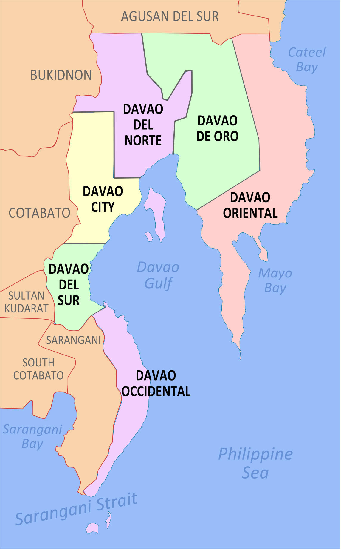
Davao Region, formerly called Southern Mindanao ( ceb, Rehiyon sa Davao; fil, Rehiyon ng Davao), is an administrative region in the Philippines, designated as Region XI. It is situated at the southeastern portion of Mindanao and comprises five provinces: Davao de Oro, Davao del Norte, Davao del Sur, Davao Oriental and Davao Occidental. The region encloses the Davao Gulf, and its regional center is Davao City. ''Dávao'' is the Hispanicized pronunciation of ''daba-daba'', the Bagobo word for "fire". Etymology Many historians believe that the name ''Davao'' is the mixture of the three names that three different tribes, the earliest settlers in the region, had for the Davao River. The Manobos, an aboriginal tribe, referred to the Davao Rivers as ''Davohoho''. Another tribe, the Bagobos, referred to the river as ''Davohaha'', which means "fire", while another tribe, the Guiangan tribe, called the river as ''Duhwow''. History The history of the region dates back to the times ... [...More Info...] [...Related Items...] OR: [Wikipedia] [Google] [Baidu] |
Mindanao
Mindanao ( ) ( Jawi: مينداناو) is the second-largest island in the Philippines, after Luzon, and seventh-most populous island in the world. Located in the southern region of the archipelago, the island is part of an island group of the same name that also includes its adjacent islands, notably the Sulu Archipelago. According to the 2020 census, Mindanao has a population of 26,252,442 people, while the entire island group has an estimated population of 27,021,036 according to the 2021 census. Mindanao is divided into six administrative regions: the Zamboanga Peninsula, Northern Mindanao, the Caraga region, the Davao region, Soccsksargen, and the autonomous region of Bangsamoro. According to the 2020 census, Davao City is the most populous city on the island, with 1,776,949 people, followed by Zamboanga City (pop. 977,234), Cagayan de Oro (pop. 728,402), General Santos (pop. 697,315), Butuan (pop. 372,910), Iligan (pop. 363,115) and Cotabato City (pop. 325,079). ... [...More Info...] [...Related Items...] OR: [Wikipedia] [Google] [Baidu] |
Lumber Camp
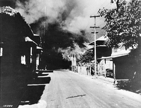
A logging camp (or lumber camp) is a transitory work site used in the logging industry. Before the second half of the 20th century, these camps were the primary place where lumberjacks would live and work to fell trees in a particular area. Many place names (e.g. Bockman Lumber Camp, Whitestone Logging Camp, Camp Douglas) are legacies of old logging camps. Camps were often placed next to river tributaries so that the winter's log harvest could be floated to the lumbermills in the spring. Design The requirements of the logging industry involved the creation of a working site and housing from the pristine wilderness. The construction of the logging camp consisted of a transformation of the natural environment to the built environment. Logging was seasonal in nature, with farmers often working as lumberjacks during the winter. Camps were placed next to a river so that the logs harvested could be floated to the lumbermills in the spring. By their nature logging camps were temporar ... [...More Info...] [...Related Items...] OR: [Wikipedia] [Google] [Baidu] |
Cabanatuan
Cabanatuan, officially the City of Cabanatuan ( fil, Lungsod ng Cabanatuan; ilo, Siudad ti Cabanatuan), is a 1st class component city in the province of Nueva Ecija, Philippines. According to the 2020 census, it has a population of 327,325 people, making it the most populous city in Nueva Ecija and the fifth-most populous in Central Luzon. The city is popular for being home to more than 30,000 motorized tricycles, making it the "Tricycle Capital of the Philippines" and its strategic location along the Cagayan Valley Road has made the city a major economic, educational, medical, entertainment shopping and transportation center in Nueva Ecija and nearby provinces in the region such as Tarlac, Aurora, and Bulacan. It has also earned the moniker "Gateway to the North". Cabanatuan remained Nueva Ecija's capital until 1965, when the government created nearby Palayan City as the new provincial capital. Nueva Ecija's old capitol and other government offices are still used and maintain ... [...More Info...] [...Related Items...] OR: [Wikipedia] [Google] [Baidu] |
Camp O'Donnell
Camp O'Donnell is a former United States military reservation in the Philippines located on Luzon island in the municipality of Capas in Tarlac. It housed the Philippine Army's newly created 71st Division and after the Americans' return, a United States Army camp. During World War II, the reservation was used as a prisoner-of-war camp for Filipino and American soldiers captured by Japan during its successful invasion of the Philippines. About 60,000 Filipino and 9,000 Americans were housed at the camp. During the few months in 1942 that Camp O'Donnell was used as a prisoner-of-war camp, about 20,000 Filipinos and 1,500 Americans died there of disease, starvation, neglect, and brutality. After World War II, it became a base of the United States Air Force and the location of the U.S. Naval Radio Station, Tarlac, with the Philippine Army installation occupying its eastern side. It housed the Training and Doctrine Command's Philippine Army Officer Candidate School, NCO Academy, an ... [...More Info...] [...Related Items...] OR: [Wikipedia] [Google] [Baidu] |
Prisoner Of War
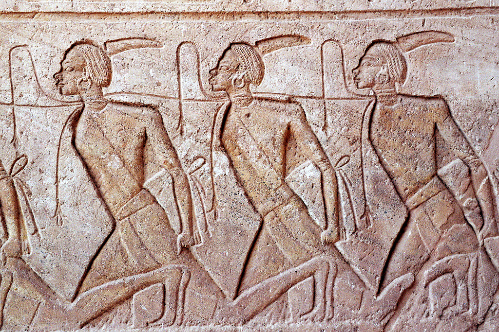
A prisoner of war (POW) is a person who is held captive by a belligerent power during or immediately after an armed conflict. The earliest recorded usage of the phrase "prisoner of war" dates back to 1610. Belligerents hold prisoners of war in custody for a range of legitimate and illegitimate reasons, such as isolating them from the enemy combatants still in the field (releasing and repatriating them in an orderly manner after hostilities), demonstrating military victory, punishing them, prosecuting them for war crimes, exploiting them for their labour, recruiting or even conscripting them as their own combatants, collecting military and political intelligence from them, or indoctrinating them in new political or religious beliefs. Ancient times For most of human history, depending on the culture of the victors, enemy fighters on the losing side in a battle who had surrendered and been taken as prisoners of war could expect to be either slaughtered or enslaved. Ear ... [...More Info...] [...Related Items...] OR: [Wikipedia] [Google] [Baidu] |
Bataan
Bataan (), officially the Province of Bataan ( fil, Lalawigan ng Bataan ), is a province in the Central Luzon region of the Philippines. Its capital is the city of Balanga while Mariveles is the largest town in the province. Occupying the entire Bataan Peninsula on Luzon, Bataan is bordered by the provinces of Zambales and Pampanga to the north. The peninsula faces the South China Sea to the west and Subic Bay to the north-west, and encloses Manila Bay to the east. The Battle of Bataan is known in history as one of the last stands of American and Filipino soldiers before they were overwhelmed by the Japanese forces in World War II. The Bataan Death March was named after the province, where the infamous march started. History Classical Period The first inhabitants of the Bataan peninsula are the Ayta Magbeken people, who are one of the first Negrito ancestors of present-day Filipinos. Later on, Tagalog communities from southern Luzon migrated to parts of Bataan and the Ayta Ma ... [...More Info...] [...Related Items...] OR: [Wikipedia] [Google] [Baidu] |
Curtis P-40 Warhawk
The Curtiss P-40 Warhawk is an American single-engined, single-seat, all-metal fighter and ground-attack aircraft that first flew in 1938. The P-40 design was a modification of the previous Curtiss P-36 Hawk which reduced development time and enabled a rapid entry into production and operational service. The Warhawk was used by most Allied powers during World War II, and remained in frontline service until the end of the war. It was the third most-produced American fighter of World War II, after the P-51 and P-47; by November 1944, when production of the P-40 ceased, 13,738 had been built,Murphy and McNiece 2009, p. 83. all at Curtiss-Wright Corporation's main production facilities in Buffalo, New York. P-40 Warhawk was the name the United States Army Air Corps gave the plane, and after June 1941, the USAAF adopted the name for all models, making it the official name in the U.S. for all P-40s. The British Commonwealth and Soviet air forces used the name Tomahawk for models equ ... [...More Info...] [...Related Items...] OR: [Wikipedia] [Google] [Baidu] |
Nichols Field
Nichols Field was a U.S. military airfield located south of Manila in Pasay and Parañaque, Metro Manila, Luzon, the Philippines. The complex is located at Andrews Avenue by the north, Domestic Road by the west, NAIA Road and Ninoy Aquino Avenue by the southwest, Multinational Avenue by the south (the future C-5 Extension), South Luzon Expressway and the Metro Manila Skyway by the east, and Sales Street by the northeast. History Origins Camp Nichols was established by the Air Service, United States Army in 1919. Located near Fort William McKinley, south of Manila, it initially was the home of the 1st Group (Observation), being activated on 14 August 1919, Nichols Field became the headquarters of the Philippine Department Air Force, under the Army Philippine Department.Clay, Steven E. (2011). US Army Order of Battle 1919–1941. 3 The Services: Air Service, Engineers, and Special Troops 1919–1941. Fort Leavenworth, KS: Combat Studies Institute Press. . LCCN 2010022326. OCL ... [...More Info...] [...Related Items...] OR: [Wikipedia] [Google] [Baidu] |
International Date Line
The International Date Line (IDL) is an internationally accepted demarcation on the surface of Earth, running between the South and North Poles and serving as the boundary between one calendar day and the next. It passes through the Pacific Ocean, roughly following the 180° line of longitude and deviating to pass around some territories and island groups. Crossing the date line eastbound decreases the date by one day, while crossing the date line westbound increases the date. Geography Circumnavigating the globe People traveling westward around the world must set their clocks: *Back by one hour for every 15° of longitude crossed, and *Forward by 24 hours upon crossing the International Date Line. People traveling eastward must set their clocks: *Forward by one hour for every 15° of longitude crossed, and *Back by 24 hours upon crossing the International Date Line. Failing to do this would make their time inaccurate to the local time. The Arab geographer Abulfed ... [...More Info...] [...Related Items...] OR: [Wikipedia] [Google] [Baidu] |


.jpg)


