|
Samarskaya Oblast
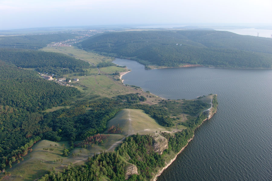
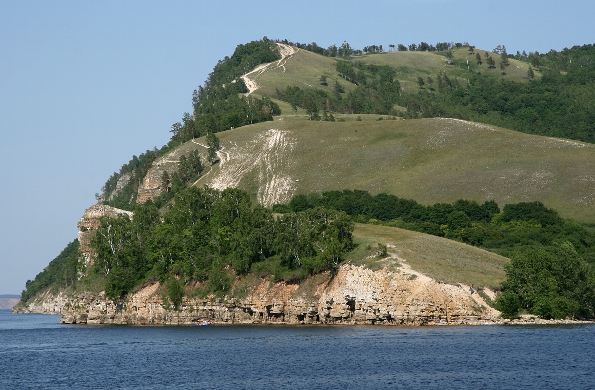
Samara Oblast ( rus, Сама́рская о́бласть, r=Samarskaya oblast, p=sɐˈmarskəjə ˈobləsʲtʲ) is a federal subject of Russia (an oblast). Its administrative center is the city of Samara. From 1935 to 1991, it was known as Kuybyshev Oblast ( rus, Ку́йбышевская о́бласть, r=Kuybyshevskaya Oblast, p=ˈkujbɨʂɨfskəjə ˈobləsʲtʲ). As of the 2010 Census, the population of the oblast was 3,215,532. The oblast borders Tatarstan in the north, Orenburg Oblast in the east, Kazakhstan (West Kazakhstan Province) in the south, Saratov Oblast in the southwest and Ulyanovsk Oblast in the west. History The Samara region contains a remarkable succession of archaeological cultures from 7000 BC to 4000 BC. These sites have revealed Europe's earliest pottery (Elshanka culture), the world's oldest horse burial and signs of horse worship (the Syezzheye cemetery of Samara culture) and the earliest kurgans associated with Proto-Indo-European ... [...More Info...] [...Related Items...] OR: [Wikipedia] [Google] [Baidu] |
Samara
Samara ( rus, Сама́ра, p=sɐˈmarə), known from 1935 to 1991 as Kuybyshev (; ), is the largest city and administrative centre of Samara Oblast. The city is located at the confluence of the Volga and the Samara (Volga), Samara rivers, with a population of over 1.14 million residents, up to 1.22 million residents in the urban agglomeration, not including Novokuybyshevsk, which is not conurbated. The city covers an area of , and is the List of cities and towns in Russia by population, eighth-largest city in Russia and tenth agglomeration, the Volga#Biggest cities on the shores of the Volga, third-most populous city on the Volga, as well as the Volga Federal District. Formerly a closed city, Samara is now a large and important social, political, economic, industrial, and cultural centre in Russia and hosted the European Union—Russia Summit in May 2007. It has a continental climate characterised by hot summers and cold winters. The life of Samara's citizens has always been in ... [...More Info...] [...Related Items...] OR: [Wikipedia] [Google] [Baidu] |
Volga Federal District
Volga (Privolzhsky) Federal District (russian: Приво́лжский федера́льный о́круг, ''Privolzhsky federalny okrug'') is one of the eight federal districts of Russia. It forms the southeastern part of European Russia. It is the second most populated federal district (after Central). Its population was 29,899,699 (70.8% urban) according to the 2010 Census, living on an area of . Igor Komarov was appointed the federal district's Presidential Envoy on 18 September 2018. Demographics Federal subjects The district comprises the Volga (part), Volga-Vyatka and Urals (part) economic regions and fourteen federal subjects: Ethnic composition, according to the 2010 census: Total - 29,899,699 people. Russians - 19,811,351 (66.26%) Tatars - 3,999,568 (13.38%) Bashkirs - 1,282,794 (4.29%) Chuvash - 1,272,790 (4.26%) Mordva - 617,050 (2.06%) Udmurts - 497,214 (1.66%) Mari - 473 015 (1.58%) Ukrainians - 272 385 (0.91%) Kazakhs - 221,047 (0.74%) Armenia ... [...More Info...] [...Related Items...] OR: [Wikipedia] [Google] [Baidu] |
Saratov Oblast
Saratov Oblast (russian: Сара́товская о́бласть, ''Saratovskaya oblast'') is a federal subjects of Russia, federal subject of Russia (an oblast), located in the Volga Federal District. Its administrative center is the types of inhabited localities in Russia, city of Saratov. As of the Russian Census (2010), 2010 Census, its population was 2,521,892. Geography The oblast is located in the southeast of European Russia, in the northern part of the Lower Volga region. From west to east its territory stretches for , and from north to south for . The highest point of Saratov Oblast is an unnamed hill of the Khvalynsk Mountains reaching above sea level. The oblast borders on: * Volgograd Oblast to the south * Voronezh Oblast, Voronezh and Tambov Oblast, Tambov oblasts to the west * Penza Oblast, Penza, Samara Oblast, Samara and Ulyanovsk Oblast, Ulyanovsk oblasts to the north; * Kazakhstan (West Kazakhstan Region) to the east Natural resources Of particular ag ... [...More Info...] [...Related Items...] OR: [Wikipedia] [Google] [Baidu] |
Revolution Of 1905
The Russian Revolution of 1905,. also known as the First Russian Revolution,. occurred on 22 January 1905, and was a wave of mass political and social unrest that spread through vast areas of the Russian Empire. The mass unrest was directed against the Tsar, nobility, and ruling class. It included worker strikes, peasant unrest, and military mutinies. In response to the public pressure, Tsar Nicholas II enacted some constitutional reform (namely the October Manifesto). This took the form of establishing the State Duma, the multi-party system, and the Russian Constitution of 1906. Despite popular participation in the Duma, the parliament was unable to issue laws of its own, and frequently came into conflict with Nicholas. Its power was limited and Nicholas continued to hold the ruling authority. Furthermore, he could dissolve the Duma, which he often did. The 1905 revolution was primarily spurred by the international humiliation as a result of the Russian defeat in the Russo-Japa ... [...More Info...] [...Related Items...] OR: [Wikipedia] [Google] [Baidu] |
Samara Governorate
Samara Governorate (russian: Самарская губерния) was an administrative division (a '' guberniya'') of the Russian Empire and Russian SFSR, located in the Volga Region. It existed from 1850 to 1928; its seat was in the city of Samara. Administrative divisions The governorate was divided into seven uyezds (counties). These were: * Bugulminsky Uyezd * Buguruslansky Uyezd * Buzuluksky Uyezd * Nikolayevsky Uyezd * Novouzensky Uyezd * Samarsky Uyezd * Stavropolsky Uyezd Stavropolsky (masculine), Stavropolskaya (feminine), or Stavropolskoye (neuter) may refer to: * Stavropol Krai (''Stavropolsky kray''), a federal subject of Russia * Stavropolsky District, a district of Samara Oblast, Russia * Stavropolsky, Russia, ... References 1851 establishments in the Russian Empire 1928 disestablishments in Russia States and territories disestablished in 1928 States and territories established in 1851 {{Russia-geo-stub ... [...More Info...] [...Related Items...] OR: [Wikipedia] [Google] [Baidu] |
Governorate (Russia)
A governorate, gubernia, province, or government ( rus, губе́рния, p=ɡʊˈbʲɛrnʲɪjə, also romanized ; uk, губернія, huberniia), was a major and principal administrative subdivision of the Russian Empire. After the empire was ended by revolution, they remained as subdivisions in Belarus, the Russian republic, Ukraine, and in the Soviet Union from its formation until 1929. The term is also translated as ''government'', ''governorate'', or ''province''. A governorate was ruled by a governor (, ''gubernator''), a word borrowed from Latin , in turn from Greek . Selected governorates were united under an assigned governor general such as the Grand Duchy of Finland, Congress Poland, Russian Turkestan and others. There also were military governors such as Kronstadt, Vladivostok, and others. Aside from governorates, other types of divisions were oblasts (region) and okrugs (district). First reform This subdivision type was created by the edict (ukase) of Peter ... [...More Info...] [...Related Items...] OR: [Wikipedia] [Google] [Baidu] |
Russian Empire
The Russian Empire was an empire and the final period of the Russian monarchy from 1721 to 1917, ruling across large parts of Eurasia. It succeeded the Tsardom of Russia following the Treaty of Nystad, which ended the Great Northern War. The rise of the Russian Empire coincided with the decline of neighbouring rival powers: the Swedish Empire, the Polish–Lithuanian Commonwealth, Qajar Iran, the Ottoman Empire, and Qing China. It also held colonies in North America between 1799 and 1867. Covering an area of approximately , it remains the third-largest empire in history, surpassed only by the British Empire and the Mongol Empire; it ruled over a population of 125.6 million people per the 1897 Russian census, which was the only census carried out during the entire imperial period. Owing to its geographic extent across three continents at its peak, it featured great ethnic, linguistic, religious, and economic diversity. From the 10th–17th centuries, the land ... [...More Info...] [...Related Items...] OR: [Wikipedia] [Google] [Baidu] |
Marija Gimbutas
Marija Gimbutas ( lt, Marija Gimbutienė, ; January 23, 1921 – February 2, 1994) was a Lithuanian archaeologist and anthropologist known for her research into the Neolithic and Bronze Age cultures of " Old Europe" and for her Kurgan hypothesis, which located the Proto-Indo-European homeland in the Pontic Steppe. Biography Early life Marija Gimbutas was born as Marija Birutė Alseikaitė to Veronika Janulaitytė-Alseikienė and Danielius Alseika in Vilnius, the capital of the Republic of Central Lithuania; her parents were members of the Lithuanian intelligentsia. Her mother received a doctorate in ophthalmology at the University of Berlin in 1908, while her father received his medical degree from the University of Tartu in 1910. After Lithuania regained independence in 1918, Gimbutas's parents organized the Lithuanian Association of Sanitary Aid which founded the first Lithuanian hospital in the capital. During this period, her father also served as the publisher of the ne ... [...More Info...] [...Related Items...] OR: [Wikipedia] [Google] [Baidu] |
Khvalynsk Culture
The Khvalynsk culture was a Middle Copper Age ("Eneolithic") culture (c. 4900 – 3500 BC) of the middle Volga region. It takes its name from Khvalynsk in Saratov Oblast. The Khvalynsk culture extended from the Samara Bend in the north (the location of some of the most important sites such as Krivoluchye) to the North Caucasus in the south, from the Sea of Azov in the west to the Ural River in the east. It was preceded by the Early Eneolithic Samara culture, from which it came, and succeeded by the Late Eneolithic, Early Yamna culture, into which it developed. The Khvalynsk culture is associated with speakers of an early stage of the Proto-Indo-European language. Dating A number of calibrated C-14 readings obtained from material in the graves of the type site date the culture certainly to the approximate window, 5000–4500 BCE. This material is from Khvalynsk I, or Early Khvalynsk. Khvalynsk II, or Late Khvalynsk, is Late Eneolithic. Asko Parpola regards Khvalynsk culture t ... [...More Info...] [...Related Items...] OR: [Wikipedia] [Google] [Baidu] |
Proto-Indo-Europeans
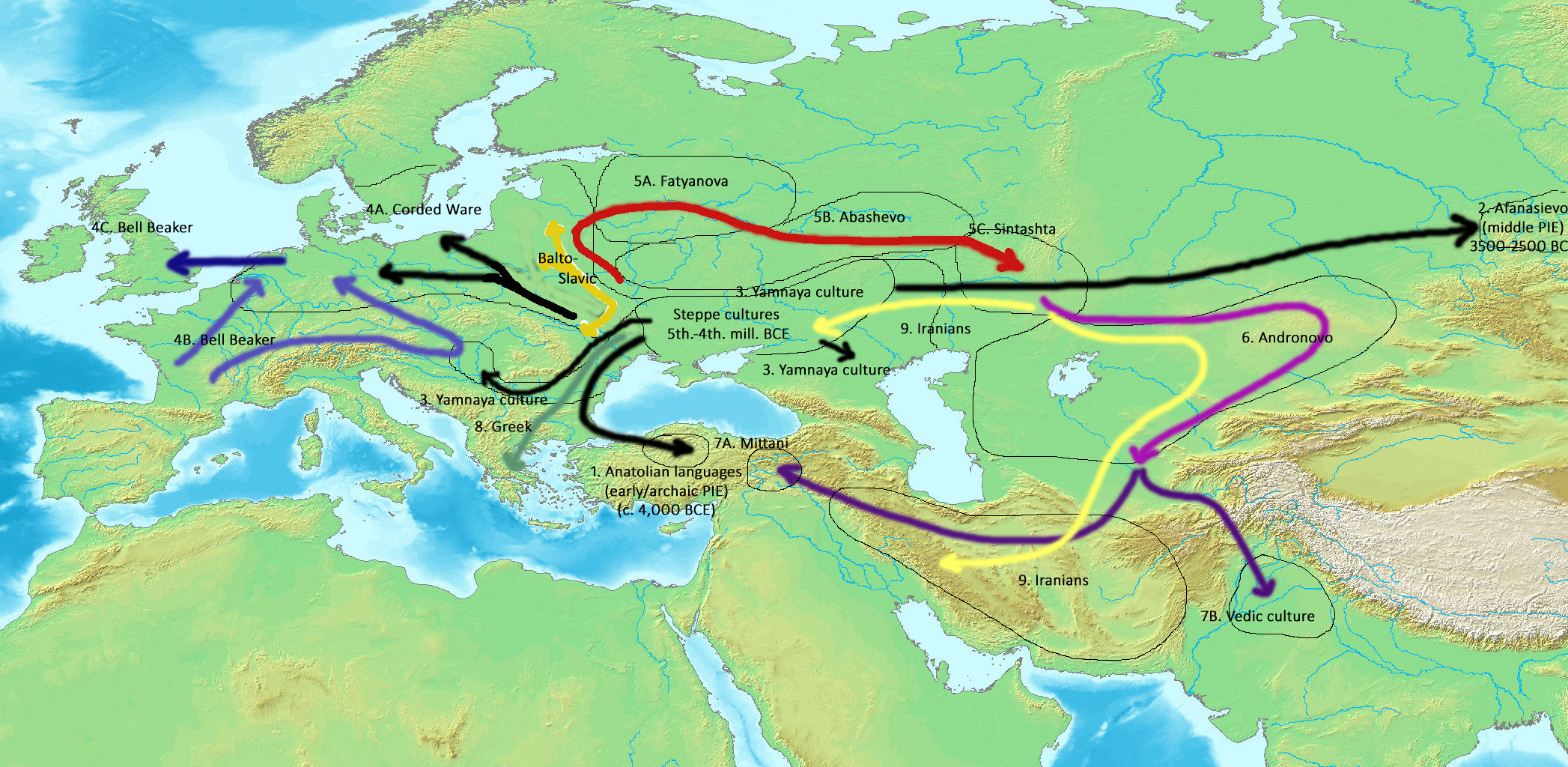
The Proto-Indo-Europeans are a hypothetical prehistoric population of Eurasia who spoke Proto-Indo-European (PIE), the ancestor of the Indo-European languages according to linguistic reconstruction. Knowledge of them comes chiefly from that linguistic reconstruction, along with material evidence from archaeology and archaeogenetics. The Proto-Indo-Europeans likely lived during the late Neolithic, or roughly the 4th millennium BC. Mainstream scholarship places them in the Pontic–Caspian steppe zone in Eurasia (present-day Ukraine and southern Russia). Some archaeologists would extend the time depth of PIE to the middle Neolithic (5500 to 4500 BC) or even the early Neolithic (7500 to 5500 BC) and suggest alternative location hypotheses. By the early second millennium BC, descendants of the Proto-Indo-Europeans had reached far and wide across Eurasia, including Anatolia (Hittites), the Aegean (the linguistic ancestors of Mycenaean Greece), the north of Europe (Corded War ... [...More Info...] [...Related Items...] OR: [Wikipedia] [Google] [Baidu] |
Kurgan
A kurgan is a type of tumulus constructed over a grave, often characterized by containing a single human body along with grave vessels, weapons and horses. Originally in use on the Pontic–Caspian steppe, kurgans spread into much of Central Asia and Eastern, Southeast, Western and Northern Europe during the 3rd millennium BC. The earliest kurgans date to the 4th millennium BC in the Caucasus, and a part of researchers associate these with the Indo-Europeans. Kurgans were built in the Eneolithic, Bronze, Iron, Antiquity and Middle Ages, with ancient traditions still active in Southern Siberia and Central Asia. Etymology According to the Etymological dictionary of the Ukrainian language the word "kurhan" is borrowed directly from the "Polovtsian" language ( Kipchak, part of the Turkic languages) and means: fortress, embankment, high grave. The word has two possible etymologies, either from the Old Turkic root ''qori-'' "to close, to block, to guard, to protect", or ''qur-'' "t ... [...More Info...] [...Related Items...] OR: [Wikipedia] [Google] [Baidu] |
Samara Culture
The Samara culture was an Eneolithic (Copper Age) culture that flourished around the turn of the 5th millennium BCE, at the Samara Bend of the Volga River (modern Russia). The Samara culture is regarded as related to contemporaneous or subsequent prehistoric cultures of the Pontic–Caspian steppe, such as the Khvalynsk, Repin and Yamna (or Yamnaya) cultures. The Proto-Indo-European homeland is often linked to one or more of these cultures. Place and time The Samara culture was an Eneolithic culture of the early 5th millennium BCE at the Samara bend region of the middle Volga, at the northern edge of the steppe zone. It was discovered during archaeological excavations in 1973 near the village of Syezzheye (Съезжее) near Bogatoye. Related sites are Varfolomeyevka on the Russian-Kazakh border (5500 BCE), which has parallels in Dzhangar (Kalmykia), and Mykol'ske, on the Dnieper. The later stages of the Samara culture are contemporaneous with its successor culture in th ... [...More Info...] [...Related Items...] OR: [Wikipedia] [Google] [Baidu] |


