|
Salus Populi Suprema Lex Esto
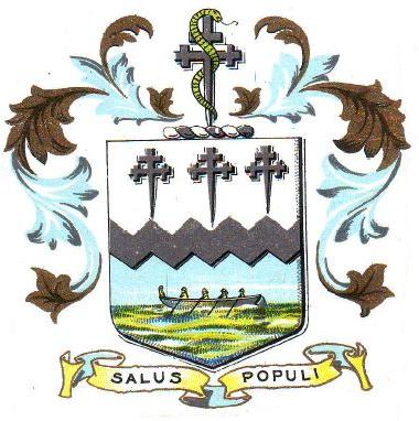
(Latin: "The health (welfare, good, salvation, felicity) of the people should be the supreme law", "Let the good (or safety) of the people be the supreme (or highest) law", or "The welfare of the people shall be the supreme law") is a maxim or principle found in Cicero's ''De Legibus'' (book III, part III, sub. VIII). Uses John Locke uses it as the epigraph in the form in his ''Second Treatise on Government'' and refers to it as a fundamental rule for government. It was the inscription on the cornet of Roundhead and Leveller William Rainsborowe during the English Civil War. This motto was also endorsed by Hobbes at the beginning of Chapter 30 of ''Leviathan'' and by Spinoza in Chapter 19 of his '' Theological-Political Treatise.'' It was frequently quoted as since at least 1737. In the United States, the phrase is the state motto of Missouri and the University of Missouri, and accepted, like many other states, as an element of its state seal. It is also used for Manassa ... [...More Info...] [...Related Items...] OR: [Wikipedia] [Google] [Baidu] |
Salus Publica Suprema Lex Esto (cropped)
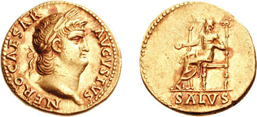
Salus ( la, salus, "safety", "salvation", "welfare") was the Roman goddess of safety and well-being (welfare, health and prosperity) of both the individual and the state. She is sometimes equated with the Greek goddess Hygieia, though their functions differ considerably. Salus is one of the oldest Roman goddesses: she has also been referred to as ''Salus Semonia'', a fact that might hint at her belonging to the category of the ''Semones'' (gods such as ''Semo Sancus Dius Fidius''). The two gods had temples in Rome on the ''Collis Salutaris'' and ''Mucialis'' respectively, two adjacent hilltops of the Quirinal located in the ''regio'' ''Alta Semita''. The temple of Salus, as ''Salus Publica Populi Romani'', was voted in 304 BC, during the Samnite Wars, by dictator Gaius Junius Bubulcus Brutus, dedicated on 5 August 302, and adorned with frescos at the order of Gaius Fabius Pictor. The high antiquity and importance of the cult of Salus is testified by the little-known ceremony of ... [...More Info...] [...Related Items...] OR: [Wikipedia] [Google] [Baidu] |
Missouri
Missouri is a U.S. state, state in the Midwestern United States, Midwestern region of the United States. Ranking List of U.S. states and territories by area, 21st in land area, it is bordered by eight states (tied for the most with Tennessee): Iowa to the north, Illinois, Kentucky and Tennessee to the east, Arkansas to the south and Oklahoma, Kansas and Nebraska to the west. In the south are the Ozarks, a forested highland, providing timber, minerals, and recreation. The Missouri River, after which the state is named, flows through the center into the Mississippi River, which makes up the eastern border. With more than six million residents, it is the List of U.S. states and territories by population, 19th-most populous state of the country. The largest urban areas are St. Louis, Kansas City, Missouri, Kansas City, Springfield, Missouri, Springfield and Columbia, Missouri, Columbia; the Capital city, capital is Jefferson City, Missouri, Jefferson City. Humans have inhabited w ... [...More Info...] [...Related Items...] OR: [Wikipedia] [Google] [Baidu] |
Mid Sussex District
Mid Sussex is a local government district in the English non-metropolitan county of West Sussex, within the historic county of Sussex. It contains the towns of East Grinstead, Haywards Heath and Burgess Hill. The district was created on 1 April 1974 from parts of East Sussex: the urban districts of Cuckfield, Burgess Hill, and East Grinstead and nearly all of Cuckfield Rural, the far north-west of which was transferred to Crawley. The district borders the Tandridge district of Surrey to the north, Wealden and Lewes districts to the east, and Brighton and Hove to the south, all in East Sussex, and Horsham district to the west and Crawley, northwest, equally in West Sussex. The Prime Meridian passes through the district. The district contains most headwaters of the River Ouse, Sussex and its largest body of water is Ardingly reservoir which is used by watersports clubs. The north of the area is the High Weald and has sections of Ashdown Forest. Civil parishes Within the ... [...More Info...] [...Related Items...] OR: [Wikipedia] [Google] [Baidu] |
Lytham St
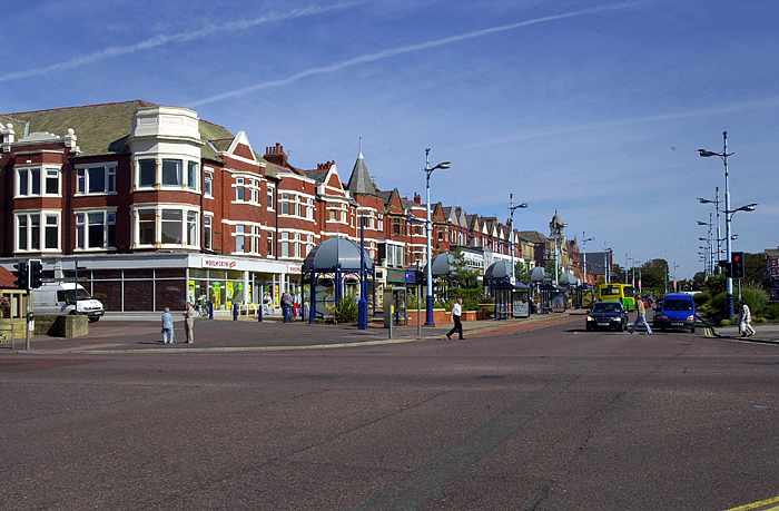
Lytham St Annes () is a seaside town in the Borough of Fylde in Lancashire, England. It is on the Fylde coast, directly south of Blackpool on the Ribble Estuary. The population at the 2011 census was 42,954. The town is almost contiguous with Blackpool but is separated from it by Blackpool Airport. The town is made up of the four areas of Lytham, Ansdell, Fairhaven and St Annes-on-Sea. Lytham St Annes has four golf courses and links, the most notable being the Royal Lytham & St Annes Golf Club, which regularly hosts the Open Championship. Lytham St Annes is a reasonably affluent area with residents' earnings among the highest in the North of England. Towns and districts Lytham St Annes consists of four main areas: Lytham, Saint Anne's-on-the-Sea, Ansdell and Fairhaven. Lytham The name Lytham comes from the Old English ''hlithum,'' plural of ''hlith'' meaning (place at) the slopes'.'' The Green, a strip of grass running between the shore and the main coastal road, i ... [...More Info...] [...Related Items...] OR: [Wikipedia] [Google] [Baidu] |
Southport
Southport is a seaside town in the Metropolitan Borough of Sefton in Merseyside, England. At the 2001 census, it had a population of 90,336, making it the eleventh most populous settlement in North West England. Southport lies on the Irish Sea coast and is fringed to the north by the Ribble estuary. The town is north of Liverpool and southwest of Preston. Within the boundaries of the historic county of Lancashire, the town was founded in 1792 when William Sutton, an innkeeper from Churchtown, built a bathing house at what is now the south end of Lord Street.''North Meols and Southport – a History'', Chapter 9, Peter Aughton (1988) At that time, the area, known as South Hawes, was sparsely populated and dominated by sand dunes. At the turn of the 19th century, the area became popular with tourists due to the easy access from the nearby Leeds and Liverpool Canal. The rapid growth of Southport largely coincided with the Industrial Revolution and the Victorian ... [...More Info...] [...Related Items...] OR: [Wikipedia] [Google] [Baidu] |
London Borough Of Harrow
The London Borough of Harrow () is a London borough in northwest London, England; it forms part of Outer London. It borders four other London boroughs Barnet to the east of ancient Watling Street (now the A5 road), Brent to the southeast, Ealing to the south and Hillingdon to the west plus the Hertfordshire districts of Three Rivers and Hertsmere to the north. The local authority is Harrow London Borough Council. The London borough was formed in 1965, based on boundaries that had been established in 1934. The borough is made up of three towns: Harrow, Pinner and Stanmore, but also includes western parts of Edgware. Administrative history The modern borough has its roots in three Ancient Parishes: Harrow on the Hill and the much smaller areas of Great Stanmore and Little Stanmore (also known as Whitchurch). These had consistent boundaries from the High Middle Ages down to the modern era. Pinner became independent of ''Harrow on the Hill'' in 1766 and the remaining ar ... [...More Info...] [...Related Items...] OR: [Wikipedia] [Google] [Baidu] |
Eastleigh
Eastleigh is a town in Hampshire, England, between Southampton and Winchester. It is the largest town and the administrative seat of the Borough of Eastleigh, with a population of 24,011 at the 2011 census. The town lies on the River Itchen, one of England's premier chalk streams for fly fishing, and a designated site of Special Scientific Interest. The area was originally villages until the 19th century, when Eastleigh was developed as a railway town by the London and South-Western Railway. History The modern town of Eastleigh lies on the old Roman road, built in A.D.79 between Winchester ''( Venta Belgarum)'' and Bitterne ''( Clausentum)''. Nicola Gosling: 1986, Page 4 Roman remains discovered in the Eastleigh area, including a Roman lead coffin excavated in 1908, indicate that a settlement probably existed here in Roman times. A Saxon village called 'East Leah' has been recorded to have existed since 932 AD. ('Leah' is an ancient Anglo-Saxon word meaning 'a cl ... [...More Info...] [...Related Items...] OR: [Wikipedia] [Google] [Baidu] |
London Borough Of Lewisham
Lewisham () is a London borough in south-east London; it forms part of Inner London. The principal settlement of the borough is Lewisham. The local authority is Lewisham London Borough Council, based in Catford. The Prime Meridian passes through Lewisham. Blackheath, Goldsmiths, University of London and Millwall F.C. are located within the borough. History The borough was formed in 1965, by the London Government Act 1963, as an amalgamation of the former area of the Metropolitan Borough of Lewisham and the Metropolitan Borough of Deptford, which had been created in 1900 as divisions of the County of London. Minor boundary changes have occurred since its creation. The most significant amendments were made in 1996, when the former area of the Royal Docks in Deptford was transferred from the London Borough of Greenwich. The metropolitan borough of Lewisham corresponded to the ancient parishes of Lee and Lewisham and the borough of Deptford corresponded to the parish of De ... [...More Info...] [...Related Items...] OR: [Wikipedia] [Google] [Baidu] |
City Of Salford
The City of Salford () is a metropolitan borough within Greater Manchester, England. The borough is named after its main settlement, Salford. The borough covers the towns of Eccles, Swinton, Walkden and Pendlebury, as well as the villages and suburbs of Monton, Little Hulton, Boothstown, Ellenbrook, Clifton, Cadishead, Pendleton, Winton and Worsley. The borough has a population of 270,000, and is administered from the Salford Civic Centre in Swinton. Salford is the historic centre of the Salford Hundred an ancient subdivision of Lancashire. The City of Salford is the 5th-most populous district in Greater Manchester. The city's boundaries, set by the Local Government Act 1972, include five former local government districts. It is bounded on the southeast by the River Irwell, which forms part of its boundary with Manchester to the east, and by the Manchester Ship Canal to the south, which forms its boundary with Trafford. The metropolitan boroughs of Wigan, Bolton ... [...More Info...] [...Related Items...] OR: [Wikipedia] [Google] [Baidu] |
Coats Of Arms
A coat of arms is a heraldic visual design on an escutcheon (i.e., shield), surcoat, or tabard (the latter two being outer garments). The coat of arms on an escutcheon forms the central element of the full heraldic achievement, which in its whole consists of a shield, supporters, a crest, and a motto. A coat of arms is traditionally unique to an individual person, family, state, organization, school or corporation. The term itself of 'coat of arms' describing in modern times just the heraldic design, originates from the description of the entire medieval chainmail 'surcoat' garment used in combat or preparation for the latter. Rolls of arms are collections of many coats of arms, and since the early Modern Age centuries, they have been a source of information for public showing and tracing the membership of a noble family, and therefore its genealogy across time. History Heraldic designs came into general use among European nobility in the 12th century. Systemat ... [...More Info...] [...Related Items...] OR: [Wikipedia] [Google] [Baidu] |
Duquesne University School Of Law
The Thomas R. Kline School of Law of Duquesne University is a private Catholic university law school located in Pittsburgh, Pennsylvania. It is approved by the American Bar Association and is a member of the Association of American Law Schools. Dean April M. Barton joined the school in 2019 as its 13th dean. The School of Law was founded in 1911, and is the only multiple-division law school in western Pennsylvania. Located on the Duquesne University campus, the law school is walking distance to Pittsburgh's downtown legal, corporate, and government communities. The School of Law currently boasts over 5,800 alumni practicing in every field of law, in all 50 states and several foreign countries. Additionally, as of 2017, Duquesne's Legal Writing program is ranked 14th in the United States. According to Duquesne's 2018 ABA-required disclosures, admission acceptance rate is 58% while 71.6% of the Class of 2018 obtained full-time, long-term, JD-required employment ten months af ... [...More Info...] [...Related Items...] OR: [Wikipedia] [Google] [Baidu] |
Manassas Park, Virginia
Manassas Park is an independent city in the U.S. state of Virginia. As of the 2020 census, the population was 17,219. Manassas Park is bordered by the city of Manassas and Prince William County. Manassas Park is a part of the Washington-Arlington-Alexandria, DC-VA-MD-WV Metropolitan Statistical Area. History During the American Civil War, the Manassas Park area was used as a campsite by the Confederate States Army during both the First and Second Battles of Bull Run. Manassas Park was created as a subdivision of Prince William County, with the first houses being constructed in 1955. In 1957, Manassas Park was incorporated as a town. Approximately 600 acres of land was annexed by the town of Manassas Park in 1974, and the town was incorporated as a city independent from the county the next year in 1975. Since then, it has been Virginia's newest city. Geography Manassas Park is located at (38.771944, -77.45250). It is roughly dumbbell-shaped and lies to the south of B ... [...More Info...] [...Related Items...] OR: [Wikipedia] [Google] [Baidu] |
.jpg)


