|
Sakhizari Cliff Natural Monument
Sakhizari Cliff Natural Monument ( ka, სახიზარის კლდის ბუნების ძეგლი) is a complex geologic structure that was formed due to abundant rainfall causing erosion of the volcanic mountain Khabarjina. Local population call this place "the ruins of the rocks" and in the past centuries at wartime villagers would seek refuge by climbing the cliffs when the enemy approached. Scenic cliffs are located in Kazbegi Municipality in river Terek Gorge near village Sioni at 3136 meters above sea level. It is part of ''Kazbegi Protected Areas'' Support Programme for Protected Areas in the Caucasus - Georgia (SPPA-Georgia) along with Kazbegi National Park
[...More Info...] [...Related Items...] OR: [Wikipedia] [Google] [Baidu] |
Stepantsminda
Stepantsminda ( ka, სტეფანწმინდა; formerly Kazbegi, ), is a townlet in the Mtskheta-Mtianeti region of north-eastern Georgia. Historically and ethnographically, the town is part of the Khevi province. It is the center of the Kazbegi Municipality. Etymology Stepantsminda was named after a Georgian Orthodox monk named Stephan, who constructed a hermitage at this location, as well as advicing people to relocate a little bit south in order to avoid the effect of regular snow avalanche. Geography and climate The town is located along the banks of the Terek River, to the north of Tbilisi at an elevation of 1,740 meters (5,710 feet) above sea level. Stepantsminda’s climate is moderately humid with relatively dry, cold winters and long and cool summers. The average annual temperature is 4.9 degrees Celsius. January is the coldest month with an average temperature of -5.2 degrees Celsius while July is the warmest month with an average temperature of 14.4 degrees ... [...More Info...] [...Related Items...] OR: [Wikipedia] [Google] [Baidu] |
Sioni (townlet)
Sioni () is a townlet in Georgia, the part of Tianeti Municipality, in the Mtskheta-Mtianeti region In geography, regions, otherwise referred to as zones, lands or territories, are areas that are broadly divided by physical characteristics (physical geography), human impact characteristics (human geography), and the interaction of humanity and t .... Located from the Tbilisi railway station, it arose in 1951 during the construction of the Sioni reservoir. Sioni obtained status of a townlet in 1960. Until the 1970s, it was called Sionmsheni. References External links Cities and towns in Mtskheta-Mtianeti {{georgia-geo-stub ... [...More Info...] [...Related Items...] OR: [Wikipedia] [Google] [Baidu] |
Mount Khabarjina
Mount Khabarjina ( ka, ქაბარჯინა) is a mountain and dormant volcano in the Caucasus of Georgia. It has an elevation of 3,142 metres. It is located near Mount Kazbek Mount Kazbek or Mount Kazbegi is a dormant stratovolcano and one of the major mountains of the Caucasus, located on the Russian-Georgian border - in Russia's North Ossetia region and Georgia's Kazbegi District. At 5,034 m (16,515 ft) high, it ... and is a part of its volcanic group. It is better known under the name Mount Kabardzhin. See also * Sakhizari Cliff Natural Monument References Mountains of Georgia (country) Volcanoes of Georgia (country) Dormant volcanoes {{Georgia-geo-stub ... [...More Info...] [...Related Items...] OR: [Wikipedia] [Google] [Baidu] |
Kazbegi Municipality
Kazbegi ( ka, ყაზბეგის მუნიციპალიტეტი) is a district of Georgia, in the region of Mtskheta-Mtianeti in east-north Georgia. The main settlement is Stepantsminda, accounting for about half of the total population. Kazbegi Municipality is situated in the upper valley of the Terek River, which goes on to traverse the Georgia–Russia border to the north and eventually drains into the Caspian Sea in Dagestan, Russian Federation. By the conventional definition of the Europe-Asia boundary as following the watershed of the Greater Caucasus, Kazbegi Municipality geographically is European part of Georgia. Landmarks Kazbegi Municipality is known for its scenic location in the Greater Caucasus mountains, and it is a center for trekkers and mountain climbing. Local attractions include the Kazbegi Museum and Ethnographic Museum in town, and the Gergeti Trinity Church outside of town, as well as Mount Kazbegi itself and the alpine meadows and f ... [...More Info...] [...Related Items...] OR: [Wikipedia] [Google] [Baidu] |
Terek (river)
The Terek (; , Tiyrk; , Tərč; , ; , ; , ''Terk''; , ; , ) is a major river in the Northern Caucasus. It originates in the Mtskheta-Mtianeti region of Georgia and flows through North Caucasus region of Russia into the Caspian Sea. It rises near the juncture of the Greater Caucasus Mountain Range and the Khokh Range, to the southwest of Mount Kazbek, winding north in a white torrent between the town of Stepantsminda and the village of Gergeti toward the Russian region North Ossetia and the city of Vladikavkaz. It turns east to flow through Chechnya and Dagestan before dividing into two branches which empty into the Caspian Sea. Below the city of Kizlyar it forms a swampy river delta around wide. The river is a key natural asset in the region, providing irrigation and hydroelectric power in its upper reaches. The main cities on the Terek include Vladikavkaz, Mozdok, and Kizlyar. Several minor hydroelectric power stations dam the Terek: Dzau electrostation (in Vladikavkaz), ... [...More Info...] [...Related Items...] OR: [Wikipedia] [Google] [Baidu] |
Kazbegi National Park
Kazbegi National Park is in Kazbegi Municipality in the Mtskheta-Mtianeti region of north-eastern Georgia.Kazbegi National Park in Georgia ''Protected Planet'' Kazbegi National Park is a popular tourist destination despite the lack of basic tourism infrastructure. Historical monuments worth a visit are the fourteenth-century Sameba temple, the tenth-century Garbanikerk, the Sioni basilica, the Akhaltsikhe basilica and the seventeenth-century Sno Cast ... [...More Info...] [...Related Items...] OR: [Wikipedia] [Google] [Baidu] |
Abano Mineral Lake Natural Monument
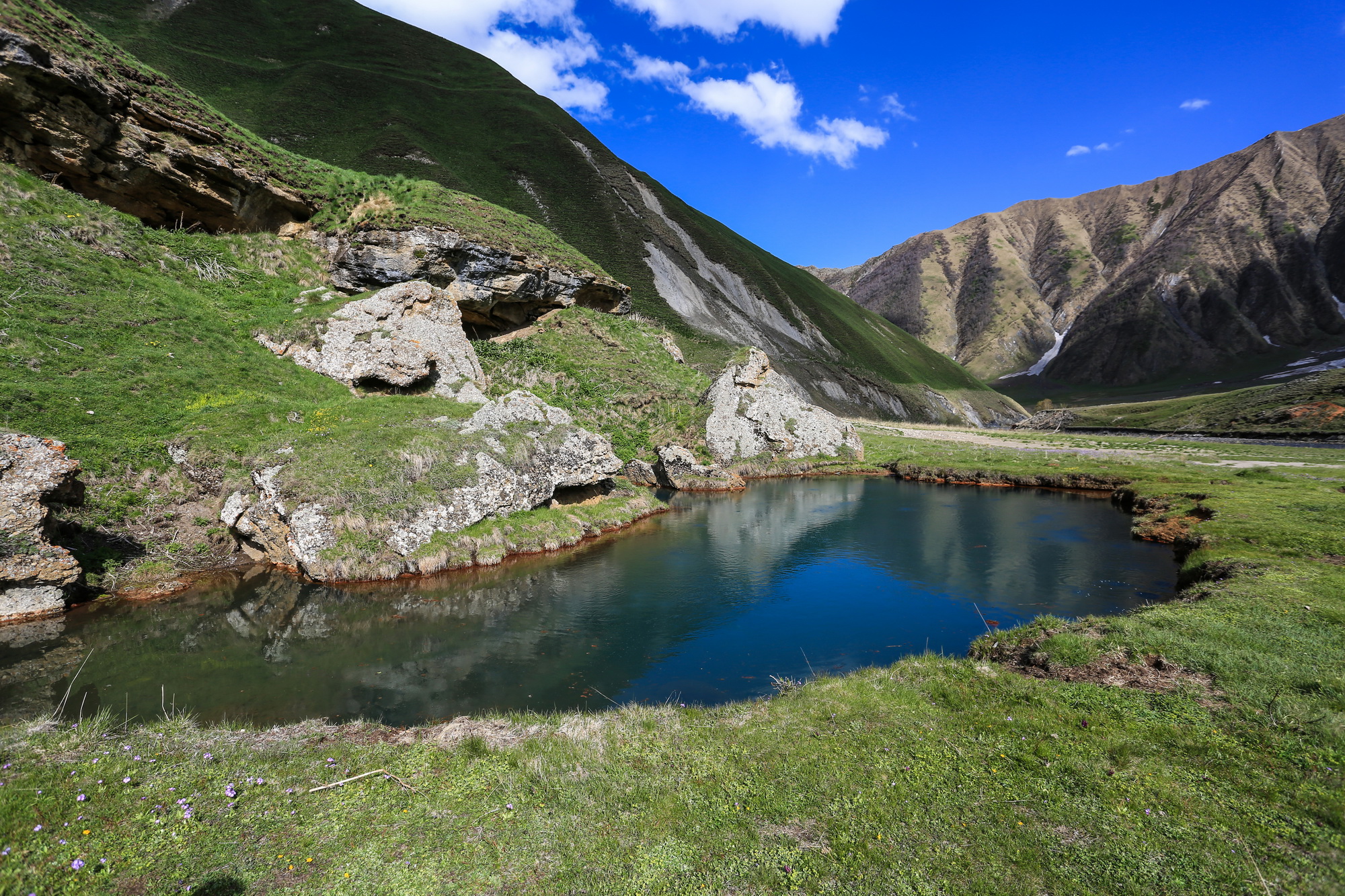
Abano Mineral Lake Natural Monument ( ka, აბანოს მინერალური ტბა, tr) is a small karst lake in Kazbegi Municipality in Truso valley on the left bank of Terek River, to the east of the village Abano at 2,127 m above sea level. Lake characteristics The lake was created by a carbon dioxide filled underground stream flowing to the surface through carbonate rocks from the late Jurassic period. The lake "boils" loudly with carbon dioxide bubbles bursting. The outflow of the stream is 2.5 million liters per 24 hours. The total surface area of the lake is 0.04 ha. The emission of gas in calm weather causes carbon dioxide to accumulate in lower levels. Small animals suffocate when they get near the lake, which is why there are dead animals there, such as mice, lizards, frogs and some birds. It is part of ''Kazbegi Protected Areas'' [...More Info...] [...Related Items...] OR: [Wikipedia] [Google] [Baidu] |
Truso Travertines Natural Monument
Truso Travertines Natural Monument ( ka, თრუსოს ტრავერტინი) is calcareous sinter or tufa in :ka:თრუსოს ხეობა, Truso valley on the right bank of Terek river at 2093 meters above the sea level in Kazbegi Municipality, Georgia (country), Georgia. It is located about 2 km from village Keterisi where local population lives only seasonally. This limestone was formed when carbonate minerals precipitation (chemistry), precipitate out of ambient temperature water. Travertine in some places is covered with a thin layer of transparent water on the white surface of the slopes where intensive development process is still ongoing. It is part of ''Kazbegi Protected Areas'' Support Programme for Protected Areas in the Caucasus - Georgia (SPPA-Georgia) along with Kazbegi National Park and fi ... [...More Info...] [...Related Items...] OR: [Wikipedia] [Google] [Baidu] |

.jpg)


