|
Sakahogi, Gifu
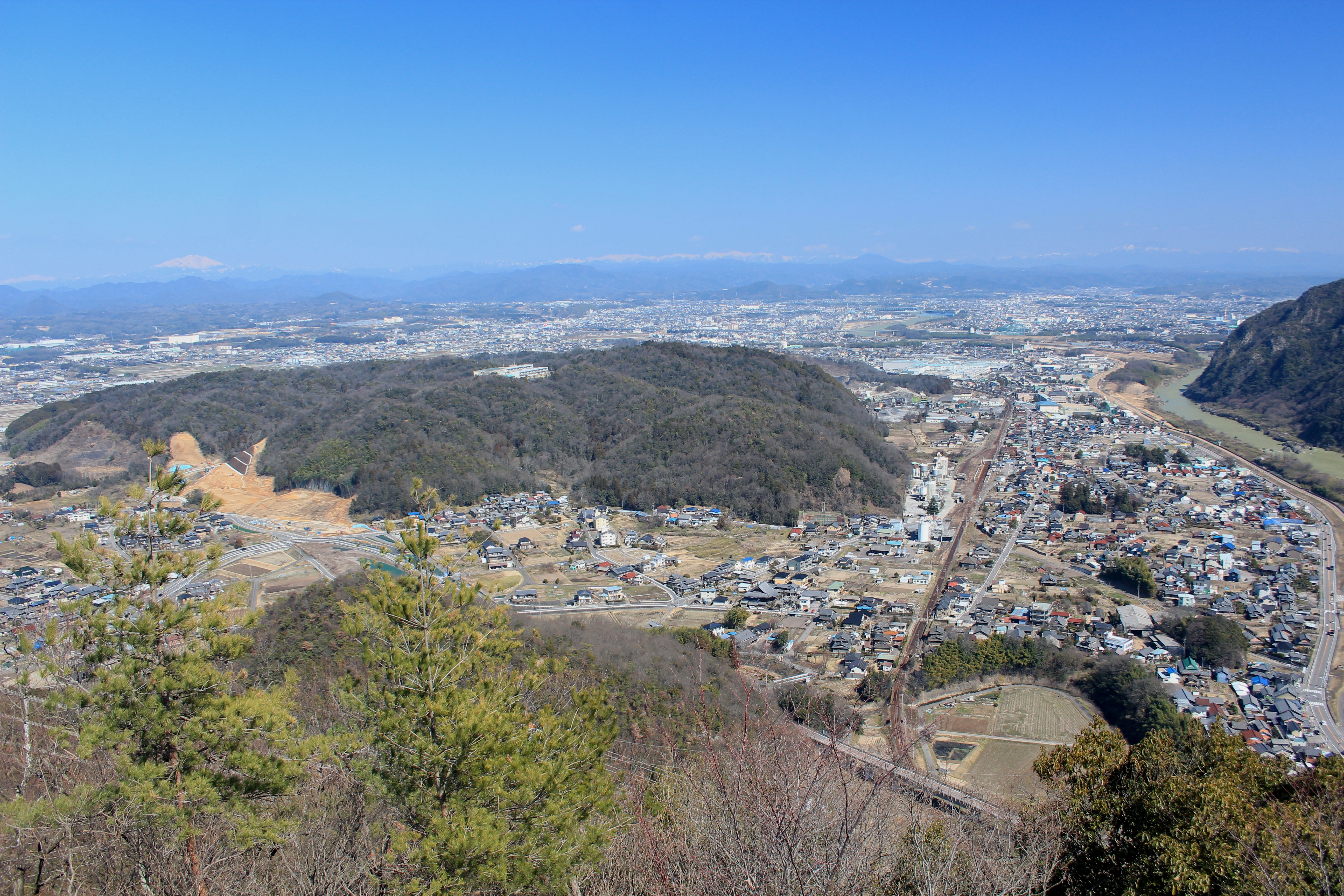
is a town located in Kamo District, Gifu Prefecture, Japan. , the town had an estimated population of 8,253 and a population density of 640 persons per km2, in 3359 households. The total area of the town was . Geography Sakahogi is located on the edge of the Nōbi Plain in south-central Gifu Prefecture. The town has a climate characterized by hot and humid summers, and mild winters (Köppen climate classification ''Cfa''). The average annual temperature in Sakahogi is 15.3 °C. The average annual rainfall is 1975 mm with September as the wettest month. The temperatures are highest on average in August, at around 27.9 °C, and lowest in January, at around 3.6 °C. Neighbouring municipalities *Gifu Prefecture ** Seki ** Minokamo **Kakamigahara **Kani *Aichi Prefecture ** Inuyama Demographics Per Japanese census data, the population of Sakahogi has remained relatively steady over the past 30 years. History The area around Sakahogi was part of traditional Mi ... [...More Info...] [...Related Items...] OR: [Wikipedia] [Google] [Baidu] |
Towns Of Japan
A town (町; ''chō'' or ''machi'') is a local administrative unit in Japan. It is a local public body along with prefecture (''ken'' or other equivalents), city (''shi''), and village (''mura''). Geographically, a town is contained within a district. Note that the same word (町; ''machi'' or ''chō'') is also used in names of smaller regions, usually a part of a ward in a city. This is a legacy of when smaller towns were formed on the outskirts of a city, only to eventually merge into it. Towns See also * Municipalities of Japan * Japanese addressing system The Japanese addressing system is used to identify a specific location in Japan. When written in Japanese characters, addresses start with the largest geographical entity and proceed to the most specific one. When written in Latin characters, ad ... References {{reflist External links "Large_City_System_of_Japan";_graphic_shows_towns_compared_with_other_Japanese_city_types_at_p._1_[PDF_7_of_40/nowiki>">DF_7_of_4 ... [...More Info...] [...Related Items...] OR: [Wikipedia] [Google] [Baidu] |
Köppen Climate Classification
The Köppen climate classification is one of the most widely used climate classification systems. It was first published by German-Russian climatologist Wladimir Köppen (1846–1940) in 1884, with several later modifications by Köppen, notably in 1918 and 1936. Later, the climatologist Rudolf Geiger (1894–1981) introduced some changes to the classification system, which is thus sometimes called the Köppen–Geiger climate classification system. The Köppen climate classification divides climates into five main climate groups, with each group being divided based on seasonal precipitation and temperature patterns. The five main groups are ''A'' (tropical), ''B'' (arid), ''C'' (temperate), ''D'' (continental), and ''E'' (polar). Each group and subgroup is represented by a letter. All climates are assigned a main group (the first letter). All climates except for those in the ''E'' group are assigned a seasonal precipitation subgroup (the second letter). For example, ''Af'' indi ... [...More Info...] [...Related Items...] OR: [Wikipedia] [Google] [Baidu] |
Sport Utility Vehicle
A sport utility vehicle (SUV) is a car classification that combines elements of road-going passenger cars with features from off-road vehicles, such as raised ground clearance and four-wheel drive. There is no commonly agreed-upon definition of an SUV and usage of the term varies between countries. Thus, it is "a loose term that traditionally covers a broad range of vehicles with four-wheel drive." Some definitions claim that an SUV must be built on a light truck chassis; however, broader definitions consider any vehicle with off-road design features to be an SUV. A crossover SUV is often defined as an SUV built with a unibody construction (as with passenger cars), however, the designations are increasingly blurred because of the capabilities of the vehicles, the labelling by marketers, and electrification of new models. The predecessors to SUVs date back to military and low-volume models from the late 1930s, and the four-wheel drive station wagons and carryalls that began ... [...More Info...] [...Related Items...] OR: [Wikipedia] [Google] [Baidu] |
Mitsubishi Pajero
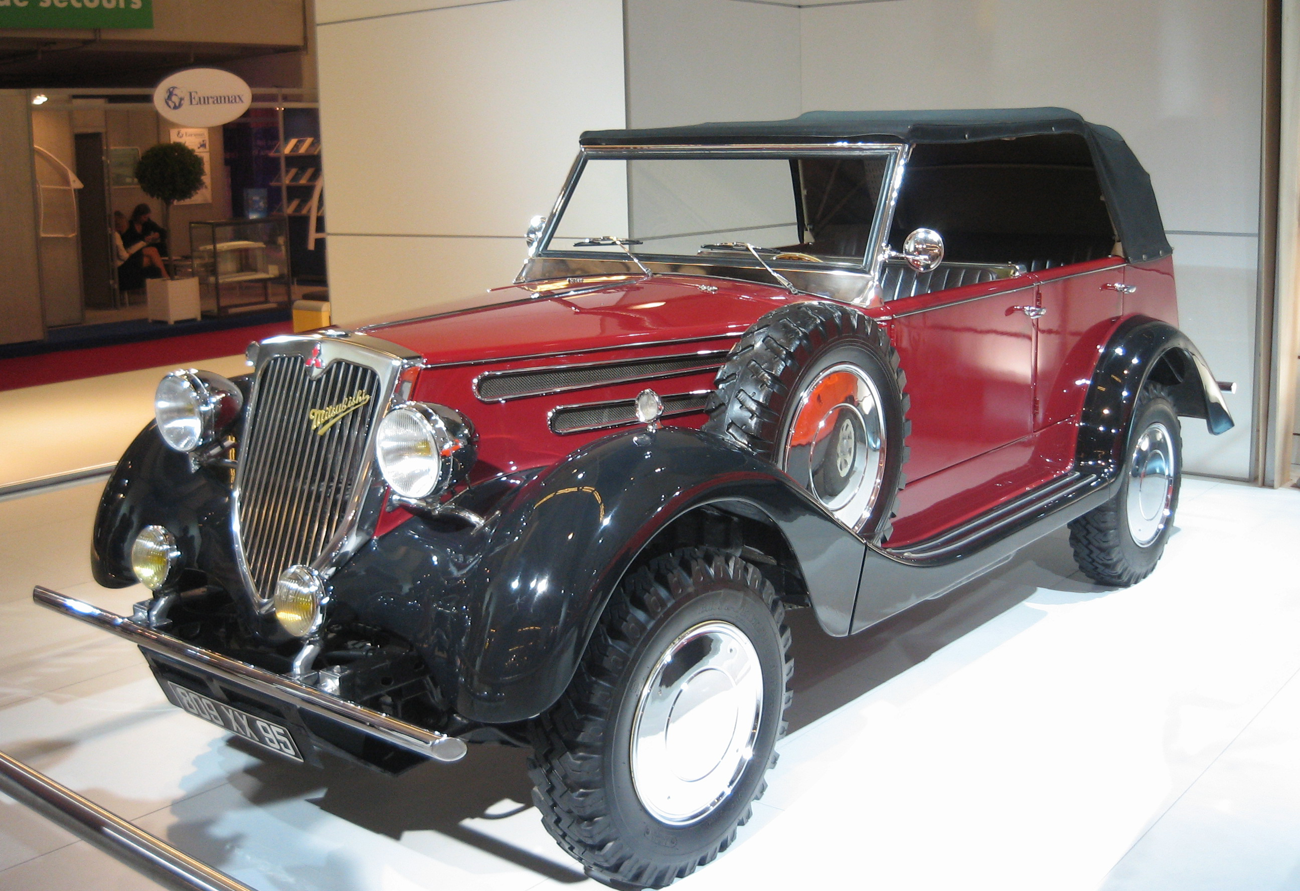
The Further information on the Mitsubishi Pajero SUV p.2, Chameleon Translations Further information on the Mitsubishi Pajero SUV p.1, Chameleon Translations is a (sport utility vehicle) manufactured and marketed globally by over four generations — introduced in 1981 and discontinued in ... [...More Info...] [...Related Items...] OR: [Wikipedia] [Google] [Baidu] |
Mitsubishi Motors
is a Japanese multinational automobile manufacturer headquartered in Minato, Tokyo, Japan.Corporate Profile , Mitsubishi Motors website, 19 June 2008 In 2011, Mitsubishi Motors was the sixth-largest Japanese and the 19th-largest worldwide by production. Since October 2016, Mitsubishi has been one-third (34%) owned by , thus a part of the Renault–Nissan–Mitsubishi Alliance. Besides being part of the ... [...More Info...] [...Related Items...] OR: [Wikipedia] [Google] [Baidu] |
Meiji Restoration
The , referred to at the time as the , and also known as the Meiji Renovation, Revolution, Regeneration, Reform, or Renewal, was a political event that restored practical imperial rule to Japan in 1868 under Emperor Meiji. Although there were ruling emperors before the Meiji Restoration, the events restored practical abilities and consolidated the political system under the Emperor of Japan. The goals of the restored government were expressed by the new emperor in the Charter Oath. The Restoration led to enormous changes in Japan's political and social structure and spanned both the late Edo period (often called the Bakumatsu) and the beginning of the Meiji era, during which time Japan rapidly Industrialisation, industrialized and adopted Western culture, Western ideas and production methods. Foreign influence The Japanese knew they were behind the Western powers when US Commodore (United States), Commodore Matthew C. Perry came to Japan in 1853 in Black Ships, large warshi ... [...More Info...] [...Related Items...] OR: [Wikipedia] [Google] [Baidu] |
Tokugawa Shogunate
The Tokugawa shogunate (, Japanese 徳川幕府 ''Tokugawa bakufu''), also known as the , was the military government of Japan during the Edo period from 1603 to 1868. Nussbaum, Louis-Frédéric. (2005)"''Tokugawa-jidai''"in ''Japan Encyclopedia'', p. 978.Nussbaum"''Edo-jidai''"at p. 167. The Tokugawa shogunate was established by Tokugawa Ieyasu after victory at the Battle of Sekigahara, ending the civil wars of the Sengoku period following the collapse of the Ashikaga shogunate. Ieyasu became the ''shōgun,'' and the Tokugawa clan governed Japan from Edo Castle in the eastern city of Edo (Tokyo) along with the ''daimyō'' lords of the ''samurai'' class.Nussbaum"Tokugawa"at p. 976. The Tokugawa shogunate organized Japanese society under the strict Tokugawa class system and banned most foreigners under the isolationist policies of ''Sakoku'' to promote political stability. The Tokugawa shoguns governed Japan in a feudal system, with each ''daimyō'' administering a ''han'' (f ... [...More Info...] [...Related Items...] OR: [Wikipedia] [Google] [Baidu] |
Tenryō
The Tokugawa shogunate (, Japanese 徳川幕府 ''Tokugawa bakufu''), also known as the , was the military government of Japan during the Edo period from 1603 to 1868. Nussbaum, Louis-Frédéric. (2005)"''Tokugawa-jidai''"in ''Japan Encyclopedia'', p. 978.Nussbaum"''Edo-jidai''"at p. 167. The Tokugawa shogunate was established by Tokugawa Ieyasu after victory at the Battle of Sekigahara, ending the civil wars of the Sengoku period following the collapse of the Ashikaga shogunate. Ieyasu became the ''shōgun,'' and the Tokugawa clan governed Japan from Edo Castle in the eastern city of Edo (Tokyo) along with the ''daimyō'' lords of the ''samurai'' class.Nussbaum"Tokugawa"at p. 976. The Tokugawa shogunate organized Japanese society under the strict Tokugawa class system and banned most foreigners under the isolationist policies of '' Sakoku'' to promote political stability. The Tokugawa shoguns governed Japan in a feudal system, with each ''daimyō'' administering a ''han'' ( ... [...More Info...] [...Related Items...] OR: [Wikipedia] [Google] [Baidu] |
Edo Period
The or is the period between 1603 and 1867 in the history of Japan, when Japan was under the rule of the Tokugawa shogunate and the country's 300 regional '' daimyo''. Emerging from the chaos of the Sengoku period, the Edo period was characterized by economic growth, strict social order, isolationist foreign policies, a stable population, perpetual peace, and popular enjoyment of arts and culture. The period derives its name from Edo (now Tokyo), where on March 24, 1603, the shogunate was officially established by Tokugawa Ieyasu. The period came to an end with the Meiji Restoration and the Boshin War, which restored imperial rule to Japan. Consolidation of the shogunate The Edo period or Tokugawa period is the period between 1603 and 1867 in the history of Japan, when Japan was under the rule of the Tokugawa shogunate and the country's regional '' daimyo''. A revolution took place from the time of the Kamakura shogunate, which existed with the Tennō's court, to the Tok ... [...More Info...] [...Related Items...] OR: [Wikipedia] [Google] [Baidu] |
Mino Province
was a province of Japan in the area of Japan that is today southern Gifu Prefecture. Mino was bordered by Ōmi to the west, Echizen and Hida to the north, and Shinano to the east, and Ise, Mikawa, and Owari to the south. Its abbreviated form name was . Under the ''Engishiki'' classification system, Mino was ranked as one of the 13 "great countries" (大国) in terms of importance, and one of the "near countries" (近国) in terms of distance from the capital. The provincial capital and ''ichinomiya'' were located in what is now the town of Tarui. Historical record "Mino" is an ancient place name, and appears in ''mokkan'' wooden tags from the ruins of Asuka-kyō, Fujiwara-kyō, and other ancient sites, but using the ''kanji'' "三野国". Per the ''Kujiki'', there were originally three separate countries in Mino, centered around what is now Ōgaki, Ōno, and Kakamigahara. Each had its own ''Kuni no miyatsuko'', and together with Motosu (in eastern Gifu) and Mugetsu ... [...More Info...] [...Related Items...] OR: [Wikipedia] [Google] [Baidu] |
Inuyama, Aichi
is a city in Aichi Prefecture, Japan. , the city had an estimated population of 73,420 in 31,276 households, and a population density of 980 persons per km2. The total area of the city is . The name of the city literally transliterates to "Dog Mountain". The name appears in historical records from 1336 AD, but its origin is unknown. Geography Inuyama lies along the northwestern edge of Aichi Prefecture, separated from neighboring Gifu Prefecture by the Kiso River. Climate The city has a climate characterized by hot and humid summers, and relatively mild winters (Köppen climate classification ''Cfa''). The average annual temperature in Inuyama is 15.1 °C. The average annual rainfall is 1910 mm with September as the wettest month. The temperatures are highest on average in August, at around 27.6 °C, and lowest in January, at around 3.4 °C. Demographics Per Japanese census data, the population of Inuyama has been increasing over the past 70 years. Surro ... [...More Info...] [...Related Items...] OR: [Wikipedia] [Google] [Baidu] |
Kani, Gifu
Flower Festival Commemorative Park is a city located in Gifu, Japan. , the city had an estimated population of 102,143, and a population density of 1200 persons per km2, in 42,233 households. The total area of the city was . Geography Kani is located in the south-central Gifu Prefecture, about 30 km from either Gifu city or Nagoya city, in the Kani basin. The Kiso River flows in the northern part of the city and roughly flat terrain continues to the Ota Basin on the opposite bank. The eastern portion of the city is hilly, and has many golf courses (golf courses occupy nearly 10% of the city area). Climate The city has a climate characterized by characterized by hot and humid summers, and mild winters (Köppen climate classification ''Cfa''). The average annual temperature in Kani is 15.0 °C. The average annual rainfall is 1984 mm with September as the wettest month. The temperatures are highest on average in August, at around 27.6 °C, and lowest in Janua ... [...More Info...] [...Related Items...] OR: [Wikipedia] [Google] [Baidu] |


