|
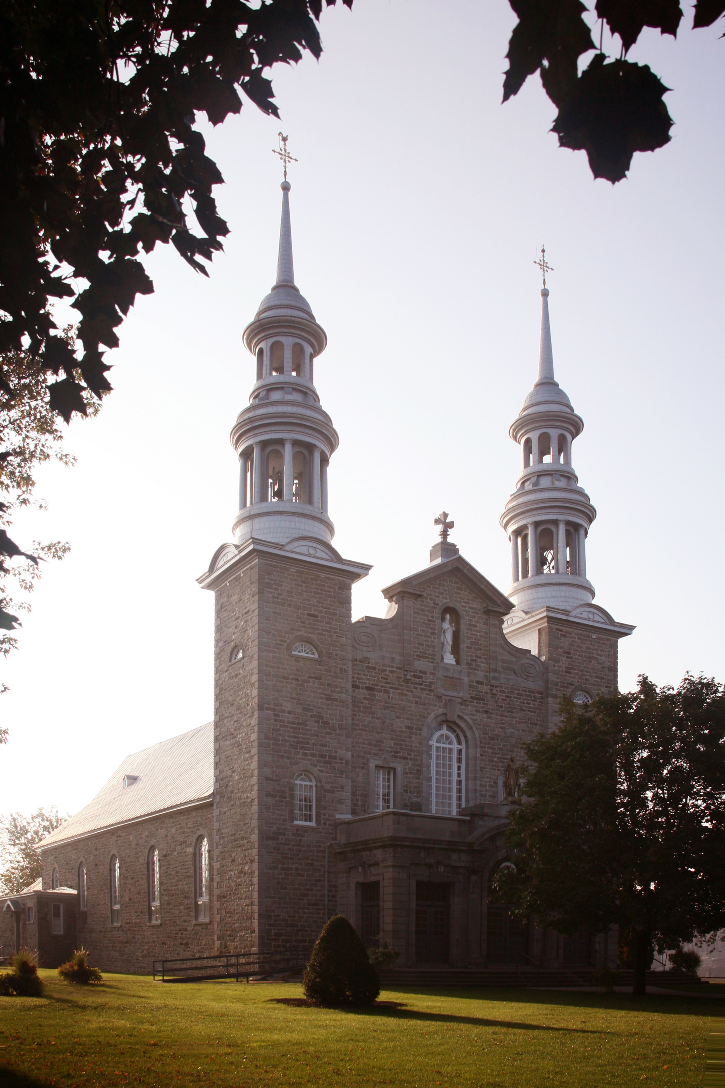
Saint-Mathieu, Quebec
Saint-Mathieu is a municipality situated in the Montérégie administrative region in Quebec, Canada. The population as of the Canada 2016 Census was 2,156. It is part of the Roussillon Regional County Municipality. Demographics Population Language See also *Les Jardins-de-Napierville Regional County Municipality *Rivière de la Tortue (Delson) *List of municipalities in Quebec __FORCETOC__ Quebec is the second-most populous province in Canada with 8,501,833 residents as of 2021 and is the largest in land area at . For statistical purposes, the province is divided into 1,282 census subdivisions, which are m ... References Municipalities in Quebec Incorporated places in Roussillon Regional County Municipality Greater Montreal {{Quebec-geo-stub ... [...More Info...] [...Related Items...] OR: [Wikipedia] [Google] [Baidu] |
Saint-Mathieu-du-Parc, Quebec
Saint-Mathieu-du-Parc is a municipality in the Mauricie region of the province of Quebec in Canada. Prior to March 28, 1998, it was known simply as Saint-Mathieu. It is home to the Mokotakan Museum, showcasing the First Nations First Nations or first peoples may refer to: * Indigenous peoples, for ethnic groups who are the earliest known inhabitants of an area. Indigenous groups *First Nations is commonly used to describe some Indigenous groups including: **First Natio ... of Quebec. References External links * Incorporated places in Mauricie Municipalities in Quebec {{Quebec-geo-stub ... [...More Info...] [...Related Items...] OR: [Wikipedia] [Google] [Baidu] |
Canada
Canada is a country in North America. Its ten provinces and three territories extend from the Atlantic Ocean to the Pacific Ocean and northward into the Arctic Ocean, covering over , making it the world's second-largest country by total area. Its southern and western border with the United States, stretching , is the world's longest binational land border. Canada's capital is Ottawa, and its three largest metropolitan areas are Toronto, Montreal, and Vancouver. Indigenous peoples have continuously inhabited what is now Canada for thousands of years. Beginning in the 16th century, British and French expeditions explored and later settled along the Atlantic coast. As a consequence of various armed conflicts, France ceded nearly all of its colonies in North America in 1763. In 1867, with the union of three British North American colonies through Confederation, Canada was formed as a federal dominion of four provinces. This began an accretion of provinces an ... [...More Info...] [...Related Items...] OR: [Wikipedia] [Google] [Baidu] |
Saint-Rémi, Quebec
Saint-Rémi is a city in the province of Quebec, Canada. Located on the south-shore of the Saint Lawrence River and the Island of Montreal. Saint-Rémi is part of Les Jardins-de-Napierville Regional County Municipality, in the Montérégie administrative region. The population as of the 2021 Canada Census was 8 957. Name The territory was known as Saint-Rémi early into the European settling. It is thought that the name was chosen to honor Daniel de Rémy de Courcelle, Governor General of New France from 1665 to 1672, but this fact is still in doubt today. History At the start of the 19th century, Lord Christophe Sanguinet experienced legal disputes with the British colonial administration and after two trials in 1805 and 1807, the territory of the Lordship of La Salle was reduced by 20% of its area, the most developed by being removed. He and his successors, his son Ambroise Sanguinet and his grandsons Christophe-Ambroise and Charles-Amable Sanguinet tried to recover this part ... [...More Info...] [...Related Items...] OR: [Wikipedia] [Google] [Baidu] |
Saint-Michel, Quebec
Saint-Michel is a municipality in the Jardins de Napierville Regional County Municipality in Quebec, Canada, situated in the Montérégie Montérégie () is an administrative region in the southwest part of Quebec. It includes the cities of Boucherville, Brossard, Châteauguay, Longueuil, Saint-Hyacinthe, Saint-Jean-sur-Richelieu, Salaberry-de-Valleyfield and Vaudreuil-Dorion. ... administrative region. The population as of the Canada 2021 Census was 3,521. History Saint-Michel was created on July 1, 1855 when the county of Huntingdon was disbanded into multiple municipalities. Demographics Population Language Education The Riverside School Board operates anglophone public schools, including: * John Adam Memorial School in Delson * Saint-Lambert International High School in Saint-Lambert See also * List of municipalities in Quebec * Saint-Michel References External links Incorporated places in Les Jardins-de-Napierville Regional County Municip ... [...More Info...] [...Related Items...] OR: [Wikipedia] [Google] [Baidu] |
Saint-Édouard, Quebec
Saint-Édouard is a municipality in the Jardins de Napierville Regional County Municipality in Quebec, Canada, situated in the Montérégie administrative region. The population as of the Canada 2016 census was 1,321. Demographics Population Language See also *Les Jardins-de-Napierville Regional County Municipality *Rivière de la Tortue (Delson) The rivière de la Tortue (''English: Turtle River'') is a tributary of the south shore of the St. Lawrence River, flowing in the administrative region of Montérégie, southwest of the province of Quebec, in Canada. This river flows in the Regio ... * List of municipalities in Quebec References {{DEFAULTSORT:Saint-Edouard Incorporated places in Les Jardins-de-Napierville Regional County Municipality Municipalities in Quebec ... [...More Info...] [...Related Items...] OR: [Wikipedia] [Google] [Baidu] |
Saint-Philippe, Quebec
Saint-Philippe () is a city located in Roussillon Regional County Municipality in the Montérégie region of Quebec, Canada. It was established on July 1, 1855. The population as of the Canada 2021 Census was 7,597. It's the birthplace of Pierre-Adolphe Pinsonnault, first Roman Catholic bishop of London. History The City of Saint-Philippe, officially constituted as a city in 2016, has origins that date back to the 17th century. Originally, Saint-Philippe was part of the territory of the Seigneurie de La Prairie-de-la-Magdeleine, which covered the current territory of the municipalities of La Prairie, Brossard, Candiac, Sainte-Catherine and Saint -Philippe, as well as part of the territory of the municipalities of Saint-Lambert, Delson, Saint-Constant, Saint-Jean-sur-Richelieu and Saint-Jacques-le-Mineur. In 1647, the seigneury of La Prairie-de-la-Madeleine was granted by Jean de Lauzon to Abbé Jean de Laferté, a Jesuit and parish priest of La Madeleine in Paris. I ... [...More Info...] [...Related Items...] OR: [Wikipedia] [Google] [Baidu] |
Candiac, Quebec
Candiac is an off-island suburb of Montreal, in the Canadian province of Quebec; it is located on the south shore of the Saint Lawrence River opposite Montreal near La Prairie. The population as of the Canada 2016 Census was 21,047. History Candiac was created January 31, 1957, when the government of Quebec accepted the request of a Canadian-European investors group, the ''Candiac Development Corporation''. The investors had collected over $4.5 million and bought of land from farmers and the neighbouring towns. In its early days, Candiac was home to 320 people who mostly lived near the St. Lawrence River. Most of the inhabitants were either farmers or Montrealers who owned a second residence in Candiac. Candiac was named after the birthplace of Louis-Joseph de Montcalm, who was born in 1712 at Château de Candiac in Vestric-et-Candiac, near Nîmes, in France. Montcalm died at the Battle of the Plains of Abraham at Quebec City while fighting for the Kingdom of France in ... [...More Info...] [...Related Items...] OR: [Wikipedia] [Google] [Baidu] |
Saint-Constant, Quebec
Saint-Constant is a Types of municipalities in Quebec, city in southwestern Quebec, Canada. It is located on the South Shore (Montreal), south shore of Montreal in the Roussillon Regional County Municipality of the Montérégie region. The population as of the Canada 2016 Census was 27,359. History Early settlement took place in 1725 as a result of the opening of the St. Pierre concession. The Côte Saint-Pierre mission (first name of the parish) began in 1750 with the construction of a church and two years later, the parish registers opened. Rang Saint-Pierre was the central concession of the Sault-Saint-Louis Seigneurial system of New France, seigneurie and extended into the seigneurie of LaSalle. In 1815 Rang Saint-Pierre was nicknamed "Black Cattle Road" because it was the way cattle were transported from New York City, New York to Montreal. Centrally located in what was then Laprairie County, Quebec, Laprairie County, the village of Saint-Constant was the only location of vot ... [...More Info...] [...Related Items...] OR: [Wikipedia] [Google] [Baidu] |
List Of Municipalities In Quebec
__FORCETOC__ Quebec is the second-most populous province in Canada with 8,501,833 residents as of 2021 and is the largest in land area at . For statistical purposes, the province is divided into 1,282 census subdivisions, which are municipalities and equivalents. Quebec's 1,218 municipalities include 87 regional county municipalities at the supralocal level and 1,131 local municipalities ( of its census subdivisions). Generally, most local municipalities, as well as some unorganized territories, are nested within regional county municipalities. The 1,218 municipalities are directly responsible for the provision of public transit, fire protection, potable water, water purification, and waste management services to its residents. They also share responsibility with the province in the provision of housing, road networks, police protection, recreation and culture, parks and natural spaces, and land use planning and development. Below the regional county municipality lev ... [...More Info...] [...Related Items...] OR: [Wikipedia] [Google] [Baidu] |
Rivière De La Tortue (Delson)
The rivière de la Tortue (''English: Turtle River'') is a tributary of the south shore of the St. Lawrence River, flowing in the administrative region of Montérégie, southwest of the province of Quebec, in Canada. This river flows in the Regional County Municipality (RCM) of: *Les Jardins-de-Napierville Regional County Municipality: in the municipalities of Saint-Patrice-de-Sherrington and Saint-Édouard; *Roussillon Regional County Municipality: in the municipalities of Saint-Mathieu, Delson and Candiac. The river surface is generally frozen from mid-December to the end of March. Safe traffic on the ice is generally from late December to early March. The water level of the river varies with the seasons and the precipitation. Geography The main hydrographic slopes neighboring the rivière de la Tortue are: * north side: St. Lawrence Seaway, St. Lawrence River; * east side: Saint-André stream, Saint Jacques River (Roussillon); * south side: Laffite stream, Acadia River; ... [...More Info...] [...Related Items...] OR: [Wikipedia] [Google] [Baidu] |
Les Jardins-de-Napierville Regional County Municipality
Les Jardins-de-Napierville ''(English: The Gardens of Napierville)'' is a regional county municipality ''(French: Municipalité régionale de comté (MRC))'' in southwestern Quebec, Canada in the Montérégie region. Founded on January 1, 1982. Its seat is Napierville. History The RCM was formed on January 1, 1982 by combining historic Napierville County with other municipalities. Subdivisions There are 11 subdivisions within the RCM: ;Cities & Towns (1) * Saint-Rémi ;Municipalities (8) * Napierville * Saint-Bernard-de-Lacolle * Saint-Cyprien-de-Napierville * Saint-Édouard * Saint-Jacques-le-Mineur * Saint-Michel * Saint-Patrice-de-Sherrington * Sainte-Clotilde ;Townships (1) * Hemmingford ;Villages (1) * Hemmingford Demographics Language Transportation Access Routes Highways and numbered routes that run through the municipality, including external routes that start or finish at the county border: * Autoroutes ** * Principal Highways ** None * Seco ... [...More Info...] [...Related Items...] OR: [Wikipedia] [Google] [Baidu] |


