|
Sacramento Wash (California)
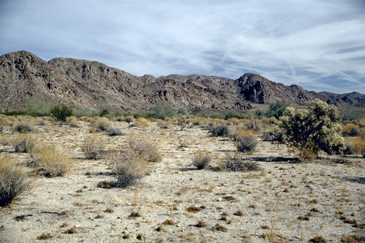
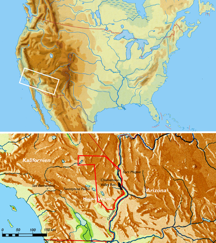
The Sacramento Wash (California) is the drainage southward, then east from the Lanfair Valley of extreme eastern San Bernardino County, California. The drainage combines with the Piute Wash-(mostly of Nevada) at the south terminus of the Dead Mountains, and immediately enters the Colorado River, just north of Needles, California. Another Sacramento Wash occurs across the Colorado, as an eastern drainage from northwest Arizona, also at Needles, CA. The Lanfair Valley and Sacramento Wash are at the eastern perimeter region of the Mojave National Preserve. Geography The Sacramento Wash (California) is part of a 2-valley south-trending drainage system, shaped like a U; Piute Wash is the eastern part of the drainage; the Sacaramento Wash is the western. The Sacramento Wash turns eastward, combines with other bajada drainages from the west and south, and merges with the Piute Wash, to rapidly descend down from the foothills of the Dead Mountains to the western bank of the Colorado R ... [...More Info...] [...Related Items...] OR: [Wikipedia] [Google] [Baidu] |
California
California is a U.S. state, state in the Western United States, located along the West Coast of the United States, Pacific Coast. With nearly 39.2million residents across a total area of approximately , it is the List of states and territories of the United States by population, most populous U.S. state and the List of U.S. states and territories by area, 3rd largest by area. It is also the most populated Administrative division, subnational entity in North America and the 34th most populous in the world. The Greater Los Angeles area and the San Francisco Bay Area are the nation's second and fifth most populous Statistical area (United States), urban regions respectively, with the former having more than 18.7million residents and the latter having over 9.6million. Sacramento, California, Sacramento is the state's capital, while Los Angeles is the List of largest California cities by population, most populous city in the state and the List of United States cities by population, ... [...More Info...] [...Related Items...] OR: [Wikipedia] [Google] [Baidu] |
Bajada (geography)
A bajada consists of a series of coalescing alluvial fans along a mountain front. These fan-shaped deposits form by the deposition of sediment within a stream onto flat land at the base of a mountain.Desert Processes Working Grou"Summary: Alluvial Features, Bajadas", ''Knowledge Sciences, Inc.''. Retrieved on 9 October 2012 The usage of the term in landscape description or geomorphology derives from the Spanish word ''bajada'', generally having the sense of "descent" or "inclination". Formation and occurrence When a stream flows downhill, it picks up sediment along with other materials. As this stream emerges from a mountain front, the sediment carried begins to be deposited, such that coarser sediment is deposited closest to the base and the finer sediment grades outwards and deposits in a fan-shape away from the mountain face.National Geographic Society"Alluvial Fan" ''National Geographic''. Retrieved on 9 October 2012 The sediment is transported across a pediment into a clos ... [...More Info...] [...Related Items...] OR: [Wikipedia] [Google] [Baidu] |
Rice Valley Wilderness
The Rice Valley Wilderness is a wilderness area near Blythe and Rice in the Mojave Desert region of California, managed by the Bureau of Land Management.Rice Valley Wilderness Bureau of Land Management The 41,777-acre wilderness includes portions of the , along with a stretch of sand dunes that is part of one of the state's largest dune systems. Congress designated the area as part of the 1994 [...More Info...] [...Related Items...] OR: [Wikipedia] [Google] [Baidu] |
Riverside County, California
Riverside County is a County (United States), county located in the southern California, southern portion of the U.S. state of California. As of the 2020 United States Census, 2020 census, the population was 2,418,185, making it the fourth-most populous county in California and the List of the most populous counties in the United States, 10th-most populous in the United States. The name was derived from the city of Riverside, California, Riverside, which is the county seat. Riverside County is included in the Riverside-San Bernardino, California, San Bernardino-Ontario, California, Ontario Metropolitan Statistical Area, also known as the Inland Empire. The county is also included in the Los Angeles-Long Beach, California, Long Beach Greater Los Angeles Area, Combined Statistical Area. Roughly rectangular, Riverside County covers in Southern California, spanning from the greater Los Angeles area to the Arizona border. Geographically, the county is mostly desert in the central a ... [...More Info...] [...Related Items...] OR: [Wikipedia] [Google] [Baidu] |
Colorado Desert
California's Colorado Desert is a part of the larger Sonoran Desert. It encompasses approximately , including the heavily irrigated Coachella and Imperial valleys. It is home to many unique flora and fauna. Geography and geology The Colorado Desert is a subdivision of the larger Sonoran Desert encompassing approximately . The desert encompasses Imperial County and includes parts of San Diego County, Riverside County, and a small part of San Bernardino County, California, United States. Most of the Colorado Desert lies at a relatively low elevation, below , with the lowest point of the desert floor at below sea level, at the Salton Sea. Although the highest peaks of the Peninsular Ranges reach elevations of nearly , most of the region's mountains do not exceed . In this region, the geology is dominated by the transition of the tectonic plate boundary from rift to fault. The southernmost strands of the San Andreas Fault connect to the northernmost extensions of the East Pacif ... [...More Info...] [...Related Items...] OR: [Wikipedia] [Google] [Baidu] |
Sonoran Desert
The Sonoran Desert ( es, Desierto de Sonora) is a desert in North America and ecoregion that covers the northwestern Mexican states of Sonora, Baja California, and Baja California Sur, as well as part of the southwestern United States (in Arizona and California). It is the hottest desert in both Mexico and the United States. It has an area of . In phytogeography, the Sonoran Desert is within the Sonoran Floristic province of the Madrean Region of southwestern North America, part of the Holarctic realm of the northern Western Hemisphere. The desert contains a variety of unique endemic plants and animals, notably, the saguaro (''Carnegiea gigantea'') and organ pipe cactus (''Stenocereus thurberi''). The Sonoran Desert is clearly distinct from nearby deserts (e.g., the Great Basin, Mojave, and Chihuahuan deserts) because it provides subtropical warmth in winter and two seasons of rainfall (in contrast, for example, to the Mojave's dry summers and cold winters). This creates an ex ... [...More Info...] [...Related Items...] OR: [Wikipedia] [Google] [Baidu] |
Old Woman Mountains
The Old Woman Mountains are located south of the town of Essex, California, and north of Danby Dry Lake. The range reaches an elevation of at the west end (Old Woman Mountain), and lies in San Bernardino County in the Mojave Desert. Geography The mountain range is approximately wide east to west at the widest point, and in length from north to south. The mountains receive very little precipitation, with just 4-10 inches of rain falling in a normal year. The Old Woman Statue, a prominent rock formation, is found on the eastern side of the range about two miles (3 km) south of Paramount Spring. Old Woman Mountains Wilderness Area The Old Woman Mountains Wilderness Area, with many natural features, protects much of the range for recreation. Flora and fauna The lower elevations of the range are dominated by |
Lower Colorado River Valley
The Lower Colorado River Valley (LCRV) is the river region of the lower Colorado River of the southwestern United States in North America that rises in the Rocky Mountains and has its outlet at the Colorado River Delta in the northern Gulf of California in northwestern Mexico, between the states of Baja California and Sonora. This north–south stretch of the Colorado River forms the border between the U.S. states of California/Arizona and Nevada/Arizona, and between the Mexican states of Baja California/Sonora. It is commonly defined as the region from below Hoover Dam and Lake Mead to its outlet at the northern Gulf of California (Sea of Cortez); it includes the Colorado River proper, canyons, the valley, mountain ranges with wilderness areas, and the floodplain and associated riparian environments. It is home to recreation activities from the river, the lakes created by dams, agriculture, and the home of various cities, communities, and towns along the river, or associated wi ... [...More Info...] [...Related Items...] OR: [Wikipedia] [Google] [Baidu] |
Rice Valley
The Rice Valley is a valley of the southeastern Mojave Desert, located within Riverside County, California, Riverside County, California. Geography Rice Valley is a mostly endorheic valley filled with bajada (geography), bajadas from neighboring mountain ranges draining into Rice Dry Lake, and sand dune fields formed by northwest and westerly winds. In the non-endorheic southeast region of Rice Valley the small drainage named Big Wash seasonally flows out between the Big Maria Mountains on the south, and the West Riverside Mountains on the north, to its mouth on the Colorado River on the west side of the Parker Valley. The endorheic Ward Valley (California), Ward Valley, adjacent on the northwest, has Danby Lake, Danby Dry Lake as its low point. Southwest across neighboring mountain ranges are the endorheic Palen Valley with Palen Dry Lake as its lowpoint, and Chuckwalla Valley with Ford Dry Lake as its lowpoint. California State Route 62 is an east/west highway passing through ... [...More Info...] [...Related Items...] OR: [Wikipedia] [Google] [Baidu] |
Vidal Valley
Vidal Valley is a 20-mile (32 km) long valley in the far eastern Colorado Desert bordering the Colorado River. Most of the valley is in eastern San Bernardino County, California, but the outfall on the Colorado River is in northeast Riverside County. Vidal Valley forms the large border of the south side of the east-west block of the Whipple Mountains massif, the landform that forces the Colorado to flow southeast, then back southwest. The southeast exit of the valley into Parker Valley on the Colorado River skirts the north end of the Riverside Mountains (see photo). The Colorado River Aqueduct crosses the midpoint of the valley at Vidal Junction, California. The Vidal Valley also lies due east of the Danby Dry Lake landform. Geography Vidal Valley is bordered by the Whipple Mountains on the northeast and the Riverside Mountains on the south. The valley drains mostly northwest-to-southeast, with its outfall into a southwest-flowing section of the Colorado River. The north of ... [...More Info...] [...Related Items...] OR: [Wikipedia] [Google] [Baidu] |
Chemehuevi Valley
The Chemehuevi are an indigenous people of the Great Basin. They are the southernmost branch of Southern Paiute."California Indians and Their Reservations." ''SDSU Library and Information Access.'' Retrieved 12 April 2010. Today, Chemehuevi people are enrolled in the following : * * [...More Info...] [...Related Items...] OR: [Wikipedia] [Google] [Baidu] |
Dry Lake
A dry lake bed, also known as a playa, is a basin or depression that formerly contained a standing surface water body, which disappears when evaporation processes exceeds recharge. If the floor of a dry lake is covered by deposits of alkaline compounds, it is known as an alkali flat. If covered with salt, it is known as a '' salt flat.'' Terminology If its basin is primarily salt, then a dry lake bed is called a '' salt pan'', ''pan'', or ''salt flat'' (the latter being a remnant of a salt lake). ''Hardpan'' is the dry terminus of an internally drained basin in a dry climate, a designation typically used in the Great Basin of the western United States. Another term for dry lake bed is ''playa''. The Spanish word ''playa'' () literally means "beach". Dry lakes are known by this name in some parts of Mexico and the western United States. This term is used e.g. on the Llano Estacado and other parts of the Southern High Plains and is commonly used to address paleolake sediments ... [...More Info...] [...Related Items...] OR: [Wikipedia] [Google] [Baidu] |


