|
Saanen
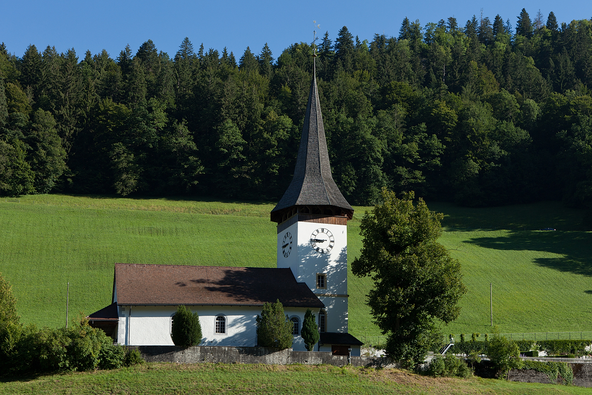
Saanen (french: Gessenay; Highest Alemannic: ''Saanä'') is a municipality in the canton of Bern in Switzerland. It is the capital of the Obersimmental-Saanen administrative district. History The village was first mentioned in 1228 as ''Gissinay''. In 1340 it was mentioned as ''Sanon''. During the Bronze Age there was a hill fort on the Cholis Grind near the modern village of Saanen. The region was occupied by the Gallo-Romans until the 10th or 11th century when the Alamanni began to drive them out. This migration created the modern language borders in Switzerland. During the Middle Ages several forts were built to guard the mule trails into the Valais and Vaud. These included the Kramburg (which was first mentioned in 1331 but is now covered by later construction), the Swabia Ried tower (11th-12th century) and the Schönried tower (remains are visible as part of house number 349). During the Middle Ages it was part of the vogtei of Vanel in the county of Gruyère. In ... [...More Info...] [...Related Items...] OR: [Wikipedia] [Google] [Baidu] |
Bern (canton)
The canton of Bern or Berne (german: Kanton Bern; rm, Chantun Berna; french: canton de Berne; it, Canton Berna) is one of the 26 cantons forming the Swiss Confederation. Its capital city, Bern, is also the ''de facto'' capital of Switzerland. The bear is the heraldic symbol of the canton, displayed on a red-yellow background. Comprising ten districts, Bern is the second-largest canton by both surface area and population. Located in west-central Switzerland, it is surrounded by eleven cantons. It borders the canton of Jura and the canton of Solothurn to the north. To the west lie the canton of Neuchâtel, the canton of Fribourg and canton of Vaud. To the south lies the canton of Valais. East of the canton of Bern lie the cantons of Uri, Nidwalden, Obwalden, Lucerne and Aargau. The geography of the canton includes a large share of all three natural regions of Switzerland: the Jura Mountains (the Bernese Jura), the Swiss Plateau (the Bernese Mittelland) and the Alps (t ... [...More Info...] [...Related Items...] OR: [Wikipedia] [Google] [Baidu] |
Gstaad
Gstaad ( ; ) is a town in the German-speaking section of the Canton of Bern in southwestern Switzerland. It is part of the municipality of Saanen and is known as a major ski resort and a popular destination amongst high society and the international jet set. The winter campus of the Institut Le Rosey is located in Gstaad. Gstaad has a population of about 9,200 and is located above sea level. History During the Middle Ages it was part of the district of Saanen (Gessenay) belonging to the Savoyard county of Gruyère. The town core developed at the fork in the trails into the Valais and Vaud. It had an inn, a warehouse for storing trade goods and oxen to help pull wagons over the alpine passes by the 13th-14th centuries. The St. Nicholas chapel was built in the town in 1402, while the murals are from the second half of the 15th century. The town was dominated by cattle farming and agriculture until the great fire of 1898. It was then rebuilt to support the growing tourism ind ... [...More Info...] [...Related Items...] OR: [Wikipedia] [Google] [Baidu] |
Gsteig Bei Gstaad
Gsteig bei Gstaad is a municipality in the Obersimmental-Saanen administrative district in the canton of Bern in Switzerland. Gsteig was formerly known by the French name of ''Châtelet''. History Gsteig is first mentioned in 1312 as ''Chastelet''. In 1453, it was mentioned as ''Steig''. The villages of Gsteig and Feutersoey grew up along the roads over the Col du Pillon and the Sanetsch Pass. During the Middle Ages, a castle was built in the valley to protect and control the passes. The castle is first mentioned in 1458 and today is in ruins. At one time there was a settlement at Ussers Gründ which was destroyed by a landslide. Originally Gsteig was part of the district and parish of Saanen. The village church of St. Theodul was consecrated in 1453. It became a filial church of Saanen in 1500. In the early 16th century, Bern adopted the new faith of the Protestant Reformation, however Gsteig did not convert until 1556. Traditionally the villagers practiced season ... [...More Info...] [...Related Items...] OR: [Wikipedia] [Google] [Baidu] |
Lauenen
Lauenen (French: ''Lauvine'', Romansh: ''Lavina'') is a municipality in the Obersimmental-Saanen administrative district in the canton of Bern in Switzerland. History Lauenen is first mentioned in 1296 as ''an der Lowinon''. Lauenen is known as an area with substantial danger of landslides and avalanches, which is the origin of its name (German ''Lawine'' "landslide," from Latin ''labina'' "slide"). The oldest trace of a settlement in the area is a single Bronze Age artifact found at Feissenalp. Roman coins were found on the Wildhorn and near the village church. During much of the Middle Ages, Lauenen was part of the municipality and parish of Saanen. After years of negotiations, Lauenen became an independent parish in 1522 and finished building the parish church in 1524. When Bern accepted the new faith of the Protestant Reformation in 1528, Lauenen remained by the old faith. Finally, in 1556, the Reformation was introduced to this mountain village and they converted. T ... [...More Info...] [...Related Items...] OR: [Wikipedia] [Google] [Baidu] |
Boltigen
Boltigen is a municipality in the Obersimmental-Saanen administrative district in the canton of Bern in Switzerland. Boltigen is a mixed community, with traits both of a burgess community and a village community. Beside it, there is also a reformed evangelical Church community. The history of the community goes back to 1386 and the so-called ''Freiheitsbrief von 1386''. The community president is Hermann Maurer, since 1 January 2005. History Boltigen is first mentioned in 1276. The oldest trace of a settlement in the area is the mesolithic shelter in the ''Ranggiloch'' cave. A few Bronze Age artifacts have also been found. During the Middle Ages there were forts or castles at Simmenegg, Eichstalden and Laubegg though all three have fallen into ruin. Many of the villages and '' Bäuerten'' were founded in the Early Middle Ages and grew slowly over the following centuries. The villages and farm lands came under Bernese control partly in 1386 and completely in 1391. Whe ... [...More Info...] [...Related Items...] OR: [Wikipedia] [Google] [Baidu] |
Zweisimmen
Zweisimmen is a municipality in the Obersimmental-Saanen administrative district in the canton of Bern in Switzerland. History Zweisimmen is first mentioned in 1228 as ''Duessimenes''. In 1257 it was mentioned as ''Zweinlixhenun''. The oldest trace of a settlement in the area are some scattered mesolithic artifacts from Mannenberg-Riedli. The remains of a Roman era settlement were found at Mannried. During the Middle Ages a significant trade route over the Alps to Valais and Lake Geneva passed through the Zweisimmen region. A number of farming villages probably existed in the area during the Middle Ages. In the 13th and 14th centuries, local nobles built several castles, Upper Mannenberg and Lower Mannenberg, Reichenstein-Terenstein, Blankenburg and Steinegg Castles, to protect and collect taxes from the roads. The villages and castles passed through several noble families until 1378 when the Lord of Düdingen sold the lands to Fribourg following an uprising. After the ... [...More Info...] [...Related Items...] OR: [Wikipedia] [Google] [Baidu] |
Obersimmental-Saanen (administrative District)
Obersimmental-Saanen District in the Canton of Bern The canton of Bern or Berne (german: Kanton Bern; rm, Chantun Berna; french: canton de Berne; it, Canton Berna) is one of the 26 cantons forming the Swiss Confederation. Its capital city, Bern, is also the ''de facto'' capital of Switzerland. ... was created on 1 January 2010. It is part of the Oberland administrative region. It contains 7 municipalities with an area of and a population () of 16,784. References {{coord, 46, 29, N, 7, 16, E, source:kolossus-eowiki, display=title Districts of the canton of Bern ... [...More Info...] [...Related Items...] OR: [Wikipedia] [Google] [Baidu] |
Lenk Im Simmental
Lenk im Simmental (or simply Lenk) is a municipality in the Obersimmental-Saanen administrative district in the canton of Bern in Switzerland. History Lenk is first mentioned in 1370 as ''An der Leng''. The oldest traces of a settlement in the area come from neolithic artifacts that have been found scattered around the municipality. During the Bronze Age Burgbühl and Bürstehubel were both fortified. Under the Romans the area was on along a major north–south road that passed over the Rawil and Kaltwasser Passes. They built a way station and a small shrine at the Iffigsee and a road and lime kiln at Iffigenalp. By the Middle Ages the Bronze Age fortifications were reoccupied and the area was split between the '' Herrschaft'' of Mannenberg and the estates of the Freiherr von Raron. The lands passed through several owners and by 1502 Bern ruled over the lands of the modern municipality. The municipality split from the neighboring St. Stephan in 1504–1505. In 1522 i ... [...More Info...] [...Related Items...] OR: [Wikipedia] [Google] [Baidu] |
Saane/Sarine
The Sarine (; frp, Sarena ) or Saane () is a major river of Switzerland.6th longest, 7th largest basin, see List of rivers of Switzerland It is long and has a drainage area of . It is a tributary of the Aare. The Sarine rises in the Bernese Alps, near Sanetschhorn, in the Canton of Valais. It forms the Lac de Sénin (French; german: Sanetschsee) reservoir at 2034 m, and then enters the Canton of Bern, traversing the Sanetsch falls between 1900 and 1400 m. It then forms the westernmost valley of the Bernese Oberland, flowing past Gsteig, Gstaad and Saanen in the Obersimmental-Saanen district. Downstream of Saanen, at 982 m, it enters the Canton of Vaud, passing Rougemont, Château-d'Œx and Rossinière, forming the ''Lac du Vernex'' at 859 m. At 833, it traverses the ''Creux de l'Enfer'' and enters the Canton of Fribourg, forming ''Lac de Montbovon'' at 777 m. From this point, it more or less follows the linguistic boundary between French- and German-speaking Switzerland ... [...More Info...] [...Related Items...] OR: [Wikipedia] [Google] [Baidu] |
Rougemont, Switzerland
Rougemont () is a municipality in the Pays-d'Enhaut of the canton of Vaud in Switzerland. History Rougemont is first mentioned in 1115 as ''Rubeus Mons'' and ''Rogemot''. The name of the village also appears in various forms in medieval chronicles: ''Rubeimontis'', ''Rogemont'', ''Rubeo monte'', ''Rogo mons'', and ''Rojomont''. The name stems from the red rock outcroppings north of the village. The site was probably first settled by a religious order coming from Cluny in France, which had received the land in 1080 from the Count of Gruyère. In 1569, the priory was replaced by the château of Rougemont, which became the residence of the bailiffs of Bern, who succeeded the Count of Gruyère. The area became part of the canton of Vaud in 1798. Diana, Princess of Wales lived for some time at the city, in the late 1970s while a student at the Institut Alpin Videmanette. Geography Rougemont has an area, , of . Of this area, or 47.8% is used for agricultural purposes, while ... [...More Info...] [...Related Items...] OR: [Wikipedia] [Google] [Baidu] |
Darmstadt
Darmstadt () is a city in the state of Hesse in Germany, located in the southern part of the Rhine-Main-Area (Frankfurt Metropolitan Region). Darmstadt has around 160,000 inhabitants, making it the fourth largest city in the state of Hesse after Frankfurt am Main, Wiesbaden, and Kassel. Darmstadt holds the official title "City of Science" (german: link=no, Wissenschaftsstadt) as it is a major centre of scientific institutions, universities, and high-technology companies. The European Organisation for the Exploitation of Meteorological Satellites (EUMETSAT) and the European Space Operations Centre (ESOC) are located in Darmstadt, as well as GSI Centre for Heavy Ion Research, where several chemical elements such as bohrium (1981), meitnerium (1982), hassium (1984), darmstadtium (1994), roentgenium (1994), and copernicium (1996) were discovered. The existence of the following elements were also confirmed at GSI Centre for Heavy Ion Research: nihonium (2012), flerovium ... [...More Info...] [...Related Items...] OR: [Wikipedia] [Google] [Baidu] |
Château-d'Œx
Château-d'Œx () is a municipality in the canton of Vaud in Switzerland. It is in the district of Riviera-Pays-d'Enhaut. History Château-d'Œx is first mentioned in 1115 as ''Oit'', ''Oyz'', ''Oix'' and ''Oyez''. Prehistoric settlements During the late Paleolithic and Mesolithic (9500 BC to at least 6000 BC) caves around Château-d'Œx served as a seasonal settlement. Bronze Age knives indicate that there was a settlement during that era as well. Many of the local names (''combe'' = valley, ''joeur'' = forest, ''man''= rock) and the local dialect are the only traces of a Celtic settlement in the area. The lack of iron ore and the sparseness of the soil probably prevented the romanization of lowland valleys. During the Gallo-Roman era, the region may have been only sparsely populated. By the 10th century, the Alamannic settlements had only reached Le Vanel but then spread even higher and reached the pastures in L'Étivaz in the southern part of the municipality. The ... [...More Info...] [...Related Items...] OR: [Wikipedia] [Google] [Baidu] |


