|
Route 417 (Israel–Palestine)
Route 417 ( he, כביש 417, "Kvish Arba'-Achat-Sheva'") is an intercity road in Israel and the West Bank that stretches from the west side of Jerusalem to Ma'ale Adumim and Highway 1 east to the Jordan Valley. History Most of the road serves as a local thoroughfare within Jerusalem and East Jerusalem. The road has been non-contiguous since the construction of the Israeli West Bank barrier through Abu Dis in 2006. Route 417 used to be the main route from the west to the Jordan Valley and the Dead Sea, bypassing downtown Jerusalem. With the opening of Jerusalem Road 9 (Derech Yitzhak Shamir and Yigal Yadin Boulevard) and the Ma'ale Adumim Road, the historic route lost that distinction. With the closure of the road in Abu Dis, the route no longer serves that option at all. Route The route's name changes many times along the way. From west to east: Yirmiyahu Street Named after the biblical prophet, the route begins at Weizmann Boulevard at the base of the Strings Bridge, an a ... [...More Info...] [...Related Items...] OR: [Wikipedia] [Google] [Baidu] |
Jerusalem
Jerusalem (; he, יְרוּשָׁלַיִם ; ar, القُدس ) (combining the Biblical and common usage Arabic names); grc, Ἱερουσαλήμ/Ἰεροσόλυμα, Hierousalḗm/Hierosóluma; hy, Երուսաղեմ, Erusałēm. is a city in Western Asia. Situated on a plateau in the Judaean Mountains between the Mediterranean Sea, Mediterranean and the Dead Sea, it is one of the List of oldest continuously inhabited cities, oldest cities in the world and is considered to be a holy city for the three major Abrahamic religions: Judaism, Christianity, and Islam. Both Israelis and Palestinians claim Jerusalem as their Capital city, capital, as Israel maintains its primary governmental institutions there and the State of Palestine ultimately foresees it as its seat of power. Because of this dispute, Status of Jerusalem, neither claim is widely recognized internationally. Throughout History of Jerusalem, its long history, Jerusalem has been destroyed at least twice, Sie ... [...More Info...] [...Related Items...] OR: [Wikipedia] [Google] [Baidu] |
Old City (Jerusalem)
The Old City of Jerusalem ( he, הָעִיר הָעַתִּיקָה, translit=ha-ir ha-atiqah; ar, البلدة القديمة, translit=al-Balda al-Qadimah; ) is a walled area in East Jerusalem. The Old City is traditionally divided into four uneven quarters, namely: the Muslim Quarter, the Christian Quarter, the Armenian Quarter, and the Jewish Quarter. A fifth area, the Temple Mount, known to Muslims as the ''Haram al-Sharif'', is home to the Dome of the Rock, Al-Aqsa Mosque and was once the site of two Jewish Temples. The current designations were introduced in the 19th century. The Old City's current walls and city gates were built by the Ottoman Empire from 1535 to 1542 under Suleiman the Magnificent. The Old City is home to several sites of key importance and holiness to the three major Abrahamic religions: the Temple Mount and Western Wall for Judaism, the Church of the Holy Sepulchre for Christianity, and the Dome of the Rock and al-Aqsa Mosque for Islam. The ... [...More Info...] [...Related Items...] OR: [Wikipedia] [Google] [Baidu] |
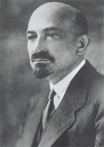
Chaim Weizmann
Chaim Azriel Weizmann ( he, חיים עזריאל ויצמן ', russian: Хаим Евзорович Вейцман, ''Khaim Evzorovich Veytsman''; 27 November 1874 – 9 November 1952) was a Russian-born biochemist, Zionist leader and Israeli statesman who served as president of the Zionist Organization and later as the first president of Israel. He was elected on 16 February 1949, and served until his death in 1952. Weizmann was fundamental in obtaining the Balfour Declaration and later convincing the United States government to recognize the newly formed State of Israel. As a biochemist, Weizmann is considered to be the 'father' of industrial fermentation. He developed the acetone–butanol–ethanol fermentation process, which produces acetone, n-butanol and ethanol through bacterial fermentation. His acetone production method was of great importance in the manufacture of cordite explosive propellants for the British war industry during World War I. He founded the Sieff ... [...More Info...] [...Related Items...] OR: [Wikipedia] [Google] [Baidu] |
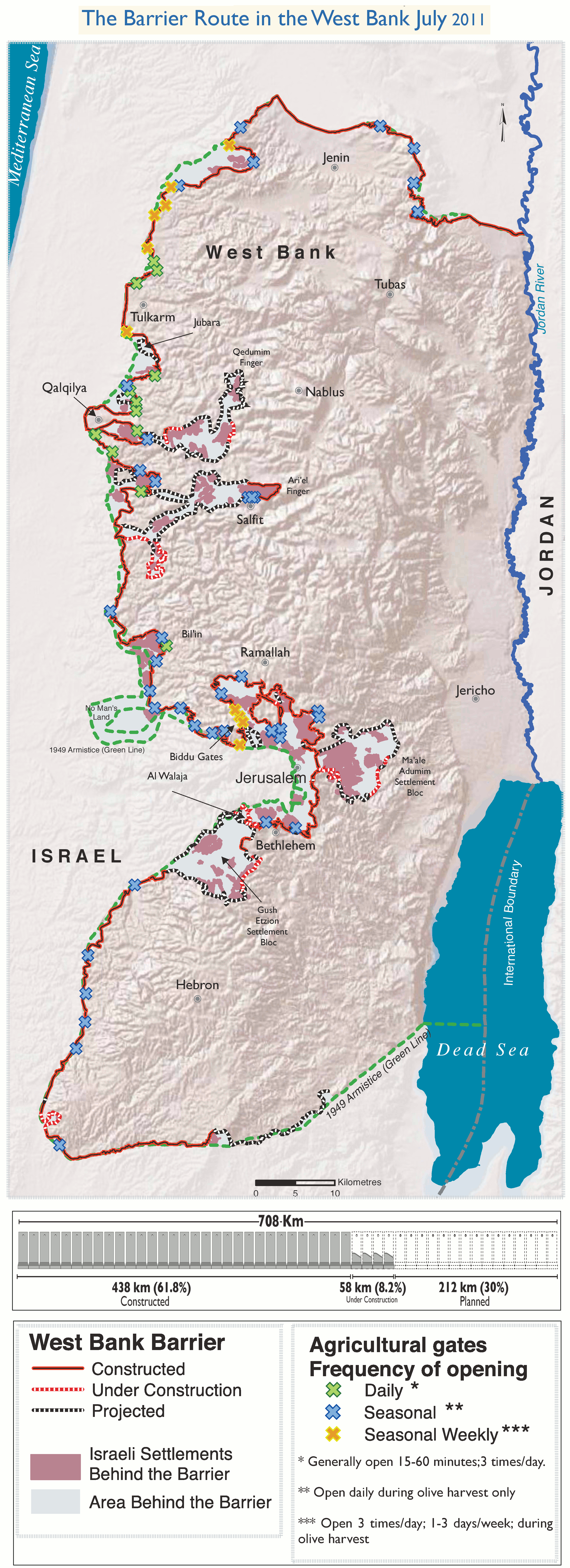
Israeli West Bank Barrier
The Israeli West Bank barrier, comprising the West Bank Wall and the West Bank fence, is a separation barrier built by Israel along the Green Line and inside parts of the West Bank. It is a contentious element of the Israeli–Palestinian conflict: Israel describes the wall as a necessary security barrier against Palestinian terrorism, whereas Palestinians describe it as an element of racial segregation and a representation of Israeli apartheid. At a total length of upon completion, the route traced by the barrier is more than double the length of the Green Line, with 15% of its length running along the Green Line or inside Israel, and the remaining 85% running as much as inside the West Bank, effectively isolating about 9% of the land and approximately 25,000 Palestinians from the rest of the Palestinian territory. The barrier was built by Israel following a wave of Palestinian political violence and incidents of terrorism inside Israel during the Second Intifada, which ... [...More Info...] [...Related Items...] OR: [Wikipedia] [Google] [Baidu] |
Highway 1 (Israel)
The following highways are numbered 1. For roads numbered A1, see list of A1 roads. For roads numbered B1, see list of B1 roads. For roads numbered M1, see List of M1 roads. For roads numbered N1, see list of N1 roads. For roads numbered S1, see List of highways numbered S1. International * AH1, Asian Highway 1, an international route from Japan to the Turkey, Turkish-Bulgarian border * European route E01 (Northern Ireland to Spain) * *Highway 1 (Afghanistan), also called A01 and formally called the Ring Road, circles Afghanistan connecting Kabul, Ghazni, Kandahar, Farah, Herat, and Mazar. Albania * National Road 1 (Albania), road running from border Montenegro (Hani i Hotit) to Tirana. * Albania–Kosovo Highway Algeria * Algeria East–West Highway Andorra * CG-1 Argentina * National Route 1 (Argentina), National Route 1 * National Route A001 (Argentina), National Route A001 * Brigadier Estanislao López Highway, Santa Fe Provincial Highway 01 Austria * West A ... [...More Info...] [...Related Items...] OR: [Wikipedia] [Google] [Baidu] |
West Bank
The West Bank ( ar, الضفة الغربية, translit=aḍ-Ḍiffah al-Ġarbiyyah; he, הגדה המערבית, translit=HaGadah HaMaʽaravit, also referred to by some Israelis as ) is a landlocked territory near the coast of the Mediterranean Sea, Mediterranean in Western Asia that forms the main bulk of the Palestinian territories. It is bordered by Jordan and the Dead Sea to the east and by Israel (see Green Line (Israel), Green Line) to the south, west, and north. Under Israeli occupation of the West Bank, an Israeli military occupation since 1967, its area is split into 165 Palestinian enclaves, Palestinian "islands" that are under total or partial civil administration by the Palestinian National Authority (PNA), and 230 Israeli settlements into which Israeli law in the West Bank settlements, Israeli law is "pipelined". The West Bank includes East Jerusalem. It initially emerged as a Jordanian-occupied territory after the 1948 Arab–Israeli War, before being Jordani ... [...More Info...] [...Related Items...] OR: [Wikipedia] [Google] [Baidu] |
Israel
Israel (; he, יִשְׂרָאֵל, ; ar, إِسْرَائِيل, ), officially the State of Israel ( he, מְדִינַת יִשְׂרָאֵל, label=none, translit=Medīnat Yīsrāʾēl; ), is a country in Western Asia. It is situated on the southeastern shore of the Mediterranean Sea and the northern shore of the Red Sea, and shares borders with Lebanon to the north, Syria to the northeast, Jordan to the east, and Egypt to the southwest. Israel also is bordered by the Palestinian territories of the West Bank and the Gaza Strip to the east and west, respectively. Tel Aviv is the economic and technological center of the country, while its seat of government is in its proclaimed capital of Jerusalem, although Israeli sovereignty over East Jerusalem is unrecognized internationally. The land held by present-day Israel witnessed some of the earliest human occupations outside Africa and was among the earliest known sites of agriculture. It was inhabited by the Canaanites ... [...More Info...] [...Related Items...] OR: [Wikipedia] [Google] [Baidu] |
Ma'ale Adumim
Ma'ale Adumim ( he, מַעֲלֵה אֲדֻמִּים; ar, معالي أدوميم) is an urban Israeli settlement organized as a city council in the West Bank, seven kilometers () east of Jerusalem. Ma'ale Adumim achieved city status in 1991. In 2015 its population was . It is located along Highway 1, which connects it to Jerusalem and the Tel Aviv Metropolitan Area. The international community considers Israeli settlements in the West Bank illegal under international law, but the Israeli government disputes this. Etymology The town name "Ma'ale Adumim" is taken from two mentions made of an area marking the boundaries between two Israelite tribes in the Book of Joshua. At , in a passage on the inheritance of the Tribe of Judah, it is stated that from the Stone of Bohan the border went up to Debir from the Valley of Achor, turning north to Gilgal, which faces the Ascent of Adummim south of the ravine. At , in a description of the inheritance by the casting of lots that fel ... [...More Info...] [...Related Items...] OR: [Wikipedia] [Google] [Baidu] |
Kedar, Gush Etzion
Kedar ( he, קֵדָר) is a rural Israeli settlement in the West Bank. Located to the south of Ma'ale Adumim and organised as a community settlement, it falls under the jurisdiction of Gush Etzion Regional Council. In it had a population of . The international community considers Israeli settlements in the West Bank illegal under international law, but the Israeli government disputes this. History According to ARIJ, Israel confiscated 45 dunums of land in 1984 from the Palestinian village of as-Sawahira ash-Sharqiya as-Sawahira ash Sharqiya ( ar, السواحرة الشرقية) or Al-Sawahreh al-Sharqiyeh is a Palestinian town in the Jerusalem Governorate, located 6 kilometers south-east of East Jerusalem in the West Bank. According to the Palestinian Centra ... in order to construct Kedar. The council was established in 1984 by families linked to the Betar movement. The name is taken from Song of Songs (1:5):"Carta's Official Guide to Israel and Complete Gazetteer to ... [...More Info...] [...Related Items...] OR: [Wikipedia] [Google] [Baidu] |
'Arab Al-Jahalin
ʿArab al-Jahalin also known as al-Jabal ( ar, عرب الجهالّين; he, ערב אל-ג'האלין) is a Palestinian Bedouin neighborhood in the Jerusalem Governorate, located five kilometers southeast of Jerusalem in the West Bank. According to the Palestinian Central Bureau of Statistics (PCBS), ʿArab al-Jahalin had a population of approximately 1,205 inhabitants in mid-year 2006. The village is situated on a hillside outside al-Eizariya and 300 meters away from the Jerusalem Municipal dump. It is located in Area C of the West Bank. While the Israeli government has full control over the village, the populace hold Palestinian IDs. ʿArab al-Jahalin contains a mosque, a seven-class school and a 12-class school. The village is linked to the East Jerusalem electricity system and has running water. As-Sawahira ash-Sharqiya shares the facilities, particularly schools and health amenities with the villages of ʿArab al-Jahalin, Jabal Mukaber and ash-Sheikh Sa'd. The healthcar ... [...More Info...] [...Related Items...] OR: [Wikipedia] [Google] [Baidu] |
Al-Eizariya
Bethany ( grc-gre, Βηθανία,Murphy-O'Connor, 2008, p152/ref> Syriac: ܒܝܬ ܥܢܝܐ ''Bēṯ ʿAnyā'') or what is locally known as Al-Eizariya or al-Azariya ( ar, العيزرية, " laceof Lazarus"), is a Palestinian town in the West Bank. The name al-Eizariya refers to the New Testament figure Lazarus of Bethany, who according to the Gospel of John, was raised from the dead by Jesus. The traditional site of the miracle, the Tomb of Lazarus, in the city is a place of pilgrimage. The town is located on the southeastern slope of the Mount of Olives, less than from Jerusalem. According to the Palestinian Central Bureau of Statistics, it is the second largest Palestinian city in the Jerusalem Governorate (not including East Jerusalem, which is under Israeli control), with a population of 17,606 inhabitants. Being mostly in Area C, it is controlled by the Israeli military rather than the Palestinian Authority. Name Al-Eizariya The name Al-Eizariya ( ar, العيزري ... [...More Info...] [...Related Items...] OR: [Wikipedia] [Google] [Baidu] |
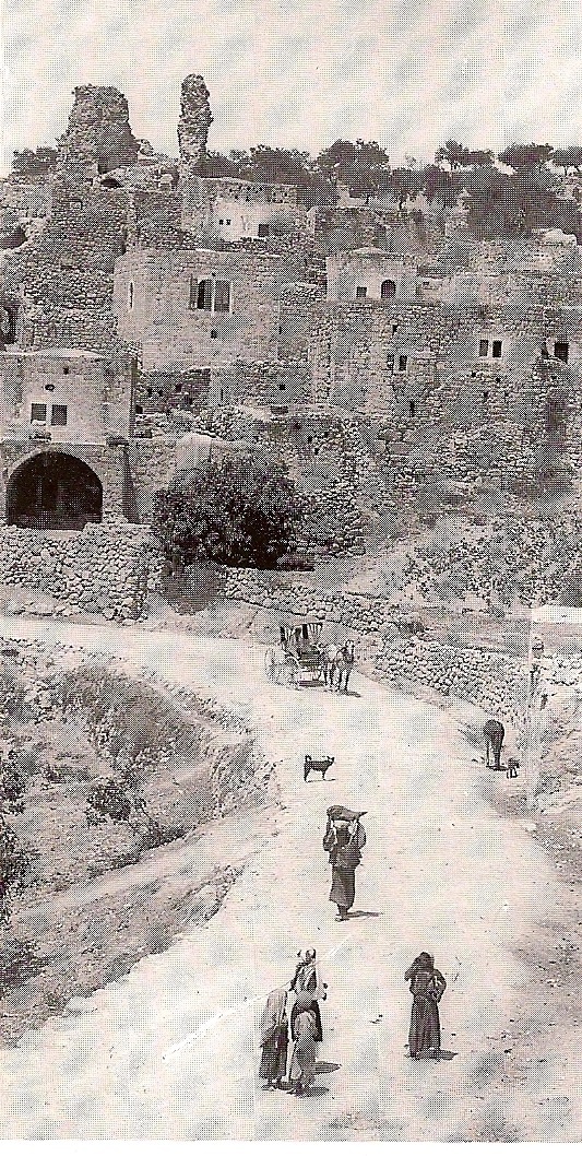
Abu Dis
Abu Dis or Abu Deis ( ar, أبو ديس) is a Palestinian village in the West Bank, in the Jerusalem Governorate of the State of Palestine, bordering Jerusalem. Since the 1995 Oslo II Accord, Abu Dis land has been mostly part of "Area B", under Israeli military control and Palestinian civic control. According to the Palestinian Central Bureau of Statistics (PCBS) census, Abu Dis had a population of 12,604 in 2016. History Abu Dis is situated on an ancient site, surrounded by deep valleys. Ruins have been found of ancient buildings, cisterns, grape presses and caves, one with a columbarium. Ceramics from Late Roman and Byzantine period has also been found. The French explorer Victor Guérin thought Abu Dis was identical with ancient Bahurim, but this identification is not accepted today. Ottoman era Abu Dis was one of the most populous villages in the Sanjak of Jerusalem during the 16th century, with a population of several hundred. Wheat and barley formed the bulk of cash ... [...More Info...] [...Related Items...] OR: [Wikipedia] [Google] [Baidu] |


