|
Roe Beck
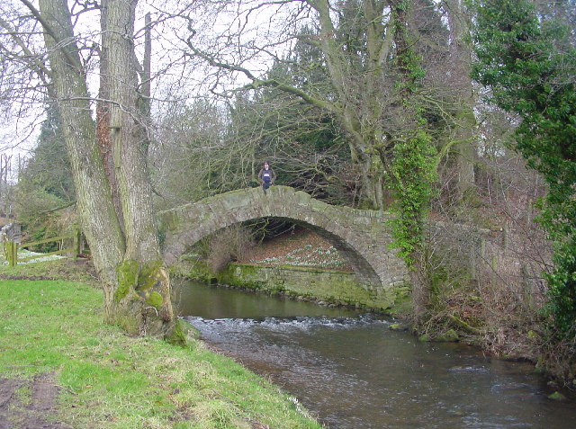
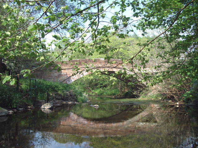
Roe Beck also known as the River Roe in its lower reaches, is a beck that flows through Cumbria, England. It is a lower tributary of the River Caldew which it joins near Gaitsgill south of Dalston. The total length of the beck including Peel Gill is and it has a catchment of , which includes the area of its major tributary the River Ive. Course Its headwaters rise on high ground near Hardrigg Hall between Lamonby and Skelton, it then flows north-west where it is joined by Peel Gill near Skelton Wood End. Other tributaries such as Whale Gill and Cockley Beck merge as it flows past Sowerby Row and Middlesceugh, where it turns northwards to meet its tributary, the River Ive near Highbridge. Beyond this confluence it is known as the River Roe, here it changes back to a north-westerly direction and is then joined by Bassen Brook before continuing through Stockdalewath, to join the River Caldew near Gaitsgill. Hydrology The flow of the beck has been measured at a gauging station ... [...More Info...] [...Related Items...] OR: [Wikipedia] [Google] [Baidu] |
England
England is a country that is part of the United Kingdom. It shares land borders with Wales to its west and Scotland to its north. The Irish Sea lies northwest and the Celtic Sea to the southwest. It is separated from continental Europe by the North Sea to the east and the English Channel to the south. The country covers five-eighths of the island of Great Britain, which lies in the North Atlantic, and includes over 100 smaller islands, such as the Isles of Scilly and the Isle of Wight. The area now called England was first inhabited by modern humans during the Upper Paleolithic period, but takes its name from the Angles, a Germanic tribe deriving its name from the Anglia peninsula, who settled during the 5th and 6th centuries. England became a unified state in the 10th century and has had a significant cultural and legal impact on the wider world since the Age of Discovery, which began during the 15th century. The English language, the Anglican Church, and Engli ... [...More Info...] [...Related Items...] OR: [Wikipedia] [Google] [Baidu] |
Cumbria
Cumbria ( ) is a ceremonial and non-metropolitan county in North West England, bordering Scotland. The county and Cumbria County Council, its local government, came into existence in 1974 after the passage of the Local Government Act 1972. Cumbria's county town is Carlisle, in the north of the county. Other major settlements include Barrow-in-Furness, Kendal, Whitehaven and Workington. The administrative county of Cumbria consists of six districts ( Allerdale, Barrow-in-Furness, Carlisle, Copeland, Eden and South Lakeland) and, in 2019, had a population of 500,012. Cumbria is one of the most sparsely populated counties in England, with 73.4 people per km2 (190/sq mi). On 1 April 2023, the administrative county of Cumbria will be abolished and replaced with two new unitary authorities: Westmorland and Furness (Barrow-in-Furness, Eden, South Lakeland) and Cumberland ( Allerdale, Carlisle, Copeland). Cumbria is the third largest ceremonial county in England by area. It i ... [...More Info...] [...Related Items...] OR: [Wikipedia] [Google] [Baidu] |
Skelton, Cumbria
Skelton is a small village and civil parish about north west of Penrith in the English county of Cumbria. It is on the former route of the B5305 road, which is now about to the north. The parish had a population of 1,059 in 2001, increasing slightly to 1,153 at the 2011 Census. The village has a primary school, pub, and Anglican and Methodist churches. Close to the village is the Skelton transmitting station and the stately home of Hutton-in-the-Forest, the family home of Lord Inglewood. Skelton Agricultural Show is one of the largest in Cumbria and takes place on the first Saturday in July at Hutton-in-the-Forest. The large parish of Skelton includes the villages and hamlets of Ellonby, Ivegill, Lamonby, Unthank, Unthank End, Skelton Wood End, Laithes, Hutton End, Hutton Row, New Rent, Braithwaite and Middlesceugh. In 1934 the parish absorbed the former civil parishes of Hutton-in-the-Forest, and Middlesceugh and Braithwaite, plus part of Dalston. Hutton-in-th ... [...More Info...] [...Related Items...] OR: [Wikipedia] [Google] [Baidu] |
River Caldew
The River Caldew is a river running through Cumbria in England. The river rises high up on the northern flanks of Skiddaw, in the Northern Fells area of the English Lake District, and flows in a northerly direction until it joins the River Eden on the north side of the city of Carlisle. The Cumbria Way follows most of the course of the river, from its early stages in the ''Skiddaw Forest'' to Carrock Fell and again from Caldbeck through to the centre of Carlisle. Etymology " Probably 'the cold river', from OE 'cald' and OE 'éa' 'river', influenced by OFr 'ewe' 'water'....However, the possibility that this is a Brit. shname meaning 'swift river' from the same root as 'Calder' cannot be ruled out altogether." (OE=Old English, OFr=Old French, Brit.= British language). Source of river The River Caldew's source is high up on Skiddaw, between the summit and Sale How. Candleseaves Bog is an area of wetland between Skiddaw and Great Calva that contributes to the flow ... [...More Info...] [...Related Items...] OR: [Wikipedia] [Google] [Baidu] |
River Ive
The River Ive is a river in the county of Cumbria, England. The Ive rises near the settlement of Hutton End and flows north-north-west, through Ivegill, below which it joins the Roe Beck. The Roe Beck joins its waters with those of the River Caldew, which continues to join with the River Eden in Carlisle. See also *List of rivers of England This is a list of rivers of England, organised geographically and taken anti-clockwise around the English coast where the various rivers discharge into the surrounding seas, from the Solway Firth on the Scottish border to the Welsh Dee on the Wel ... References Ive, River 2Ive {{England-river-stub ... [...More Info...] [...Related Items...] OR: [Wikipedia] [Google] [Baidu] |
Gill (ravine)
A gill or ghyll is a ravine or narrow valley in the North of England and other parts of the United Kingdom. The word originates from the Old Norse . Examples include Dufton Ghyll Wood, Dungeon Ghyll, Troller's Gill and Trow Ghyll. As a related usage, Gaping Gill is the name of a cave, not the associated stream, and Cowgill, Masongill and Halton Gill are derived names of villages. The stream flowing through a gill is often referred to as a beck: for example in Swaledale, Gunnerside Beck flows through Gunnerside Ghyll. ''Beck ''is also used as a more general term for streams in the north of England – examples include Ais Gill Beck, Arkle Beck and Peasey Beck. In the North Pennines, the word sike or syke is found in similar circumstances. This is particularly common in the Appleby Fells area where sikes significantly outnumber the becks and gills; it can also be seen in the name of Eden Sike Cave in Mallerstang. In the High Weald gills are deeply cut ravines, usually with a ... [...More Info...] [...Related Items...] OR: [Wikipedia] [Google] [Baidu] |
Dalston, Cumbria
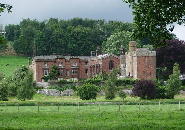
Dalston is a large village and civil parish within the Carlisle district of Cumbria, historically part of Cumberland. It is situated on the B5299 road south-south-west of Carlisle city centre, and approximately from Junction 42 of the M6 motorway. The village is on the River Caldew, just to the north of where the Roe Beck joins the river. It is served by the Dalston railway station on the Cumbrian Coast Line between , + . Historic buildings Rose Castle, home of the Bishop of Carlisle for many centuries until 2009, is within the parish of Dalston, from the heart of the village. The Architects Anthony Salvin and Thomas Rickman were responsible for the alterations which took place in the 19th Century. Dalston Hall is a grade II* listed fortified house which is now a country house hotel. Dalston has two churches; St Michael's + All Angels Church. Governance There is a county electoral division of Dalston, stretching north towards Carlisle, with a total population at ... [...More Info...] [...Related Items...] OR: [Wikipedia] [Google] [Baidu] |
Catchment
A drainage basin is an area of land where all flowing surface water converges to a single point, such as a river mouth, or flows into another body of water, such as a lake or ocean. A basin is separated from adjacent basins by a perimeter, the ''drainage divide'', made up of a succession of elevated features, such as ridges and hills. A basin may consist of smaller basins that merge at river confluences, forming a hierarchical pattern. Other terms for a drainage basin are catchment area, catchment basin, drainage area, river basin, water basin, and impluvium. In North America, they are commonly called a watershed, though in other English-speaking places, "watershed" is used only in its original sense, that of a drainage divide. In a closed drainage basin, or endorheic basin, the water converges to a single point inside the basin, known as a sink, which may be a permanent lake, a dry lake, or a point where surface water is lost underground. Drainage basins are similar but no ... [...More Info...] [...Related Items...] OR: [Wikipedia] [Google] [Baidu] |
Lamonby
Lamonby is an agricultural hamlet in the Eden district, in the county of Cumbria, England, about 2 km from the edge of the Lake District National Park. It is located near the B5305 road and the village of Skelton, in whose parish it lies. Public transport and social or commercial facilities are absent there. The surname Lamonby originates from the hamlet. History The name "Lambenemy" is recorded for the hamlet in 1257. Limestone was quarried at Lamonby in earlier centuries. A topographical dictionary of 1808 records 43 houses and 244 inhabitants. Lamonby Hall, a Grade II listed building, is described as late 16th- or early 17th-century with 20th-century alterations. It is built of large blocks of sandstone rubble with cement rendering and a greenslate roof with banded sandstone chimney stacks. After the Reformation, the hall is said to have included a Roman Catholic chapel. In the reign of Elizabeth, a certain Juliana Buckle of Yorkshire bought the hall on account of the ... [...More Info...] [...Related Items...] OR: [Wikipedia] [Google] [Baidu] |
Stockdalewath
Stockdalewath is a small village in Cumbria, approximately 7.5 miles south of Carlisle in the extreme northwest of England. It is located on the River Roe, and is in the civil parish of Dalston. As of the 2011 census, the population is estimated to be 74. Archaeological evidence, mostly based on aerial surveys of crop marks, suggests that Stockdalewath was a rural settlement in Roman Cumbria. Within a half mile of the village are three camps thought to be Roman, with the names Castlesteads, Stoneraise, and Whitestones. They are equal distance from each other and form a triangle. Notable people * Susanna Blamire, poet known as ''The Muse of Cumberland''; raised in Stockdalewath See also *Listed buildings in Dalston, Cumbria Dalston is a civil parish in the Carlisle district of Cumbria, England. It contains 93 buildings that are recorded in the National Heritage List for England. Of these, three are listed at Grade I, the highest of the three grades, four are ... ... [...More Info...] [...Related Items...] OR: [Wikipedia] [Google] [Baidu] |
Gauging Station
A stream gauge, streamgage or stream gauging station is a location used by hydrologists or environmental scientists to monitor and test terrestrial bodies of water. Hydrometric measurements of water level surface elevation ("stage") and/or volumetric discharge (flow) are generally taken and observations of biota and water quality may also be made. The locations of gauging stations are often found on topographical maps. Some gauging stations are highly automated and may include telemetry capability transmitted to a central data logging facility. Measurement equipment Automated direct measurement of streamflow discharge is difficult at present. In place of the direct measurement of streamflow discharge, one or more surrogate measurements can be used to produce discharge values. In the majority of cases, a stage (the elevation of the water surface) measurement is used as the surrogate. Low gradient (or shallow-sloped) streams are highly influenced by variable downstream c ... [...More Info...] [...Related Items...] OR: [Wikipedia] [Google] [Baidu] |
List Of Rivers Of England
This is a list of rivers of England, organised geographically and taken anti-clockwise around the English coast where the various rivers discharge into the surrounding seas, from the Solway Firth on the Scottish border to the Welsh Dee on the Welsh border, and again from the Wye on the Welsh border anti-clockwise to the Tweed on the Scottish border. Tributaries are listed down the page in an upstream direction, i.e. the first tributary listed is closest to the sea, and tributaries of tributaries are treated similarly. Thus, in the first catchment below, the River Sark is the lowermost tributary of the Border Esk and the Hether Burn is the lowermost tributary of the River Lyne. The main stem (or principal) river of a catchment is labelled as (MS), left-bank tributaries are indicated by (L), right-bank tributaries by (R). Note that in general usage, the 'left (or right) bank of a river' refers to the left (or right) hand bank, as seen when looking downstream. Where a named river ... [...More Info...] [...Related Items...] OR: [Wikipedia] [Google] [Baidu] |


