|
River Tiddy
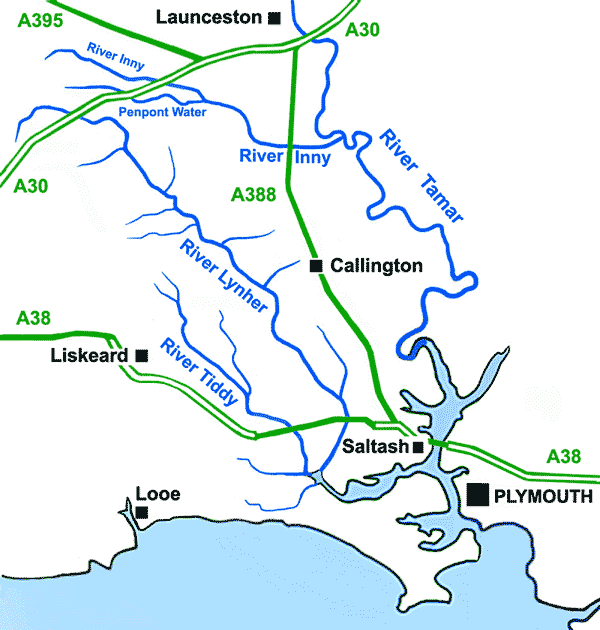
The River Tiddy ( kw, Teudhi) List of place-names agreed by the MAGA Signage Panel . is a small in south-east , the main tributary of the |
England
England is a country that is part of the United Kingdom. It shares land borders with Wales to its west and Scotland to its north. The Irish Sea lies northwest and the Celtic Sea to the southwest. It is separated from continental Europe by the North Sea to the east and the English Channel to the south. The country covers five-eighths of the island of Great Britain, which lies in the North Atlantic, and includes over 100 smaller islands, such as the Isles of Scilly and the Isle of Wight. The area now called England was first inhabited by modern humans during the Upper Paleolithic period, but takes its name from the Angles, a Germanic tribe deriving its name from the Anglia peninsula, who settled during the 5th and 6th centuries. England became a unified state in the 10th century and has had a significant cultural and legal impact on the wider world since the Age of Discovery, which began during the 15th century. The English language, the Anglican Church, and Engli ... [...More Info...] [...Related Items...] OR: [Wikipedia] [Google] [Baidu] |
Cornwall
Cornwall (; kw, Kernow ) is a historic county and ceremonial county in South West England. It is recognised as one of the Celtic nations, and is the homeland of the Cornish people. Cornwall is bordered to the north and west by the Atlantic Ocean, to the south by the English Channel, and to the east by the county of Devon, with the River Tamar forming the border between them. Cornwall forms the westernmost part of the South West Peninsula of the island of Great Britain. The southwesternmost point is Land's End and the southernmost Lizard Point. Cornwall has a population of and an area of . The county has been administered since 2009 by the unitary authority, Cornwall Council. The ceremonial county of Cornwall also includes the Isles of Scilly, which are administered separately. The administrative centre of Cornwall is Truro, its only city. Cornwall was formerly a Brythonic kingdom and subsequently a royal duchy. It is the cultural and ethnic origin of the Cornish dias ... [...More Info...] [...Related Items...] OR: [Wikipedia] [Google] [Baidu] |
Pensilva
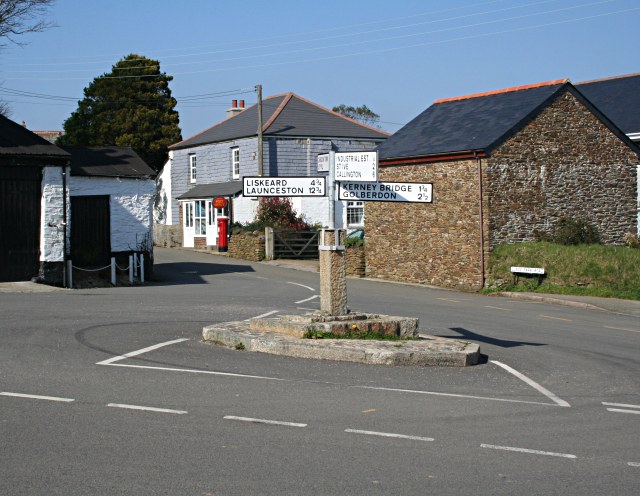
Pensilva ( kw, Pennsilva) is a village in the civil parish of St Ive and Pensilva, in east Cornwall, England, United Kingdom. It is at about four miles (6 km) northeast of Liskeard. Nearby settlements include Charaton Cross and Middlehill. The original small settlement grew quickly during the nineteenth century in response to industrial activity on the moorland north and west of the village. website. Retrieved April 2010 There is a Church of England chapel of St John (a chapel-of-ease to St Ive
St Ive ( ; kw, Sen Iv) is a village in the civil parish of St Ive and Pensilva in eastern Cornwall, England, United Kingdom. The village is split into four parts: St Ive Church End, ...
[...More Info...] [...Related Items...] OR: [Wikipedia] [Google] [Baidu] |
River Lynher
The River Lynher ( kw, Linar) (or St Germans River downstream from its confluence with the Tiddy) flows through east Cornwall, England, and enters the River Tamar at the Hamoaze, which in turn flows into Plymouth Sound. Navigation The normal tidal limit is a weir upstream of Notter Bridge. St Germans is a historic fishing village situated on the River Tiddy just upstream of its confluence with the Lynher. The Quay Sailing Club are based at St Germans Quay. The Queen's Harbour Master for Plymouth is responsible for managing navigation on the tidal Lynher and its tributaries (up to the normal tidal limits). Geography The river is about 21 miles (34 km long), rising at a height of about 920 feet (280m) on Bodmin Moor and flowing into the Tamar Estuary near Plymouth. It has four main tributaries, the largest of which is the River Tiddy. The smaller tributaries include Deans Brook, Withey Brook, Marke Valley and Darleyford streams and Kelly Brook. Ecology The Lynher and ... [...More Info...] [...Related Items...] OR: [Wikipedia] [Google] [Baidu] |
Polbathic Lake
Polbathic ( kw, Polbarthek) is a small village situated on the A374 Trerulefoot to Torpoint road, within the parish of St Germans, in south-east Cornwall, England, UK. The village is situated on the edge of a tidal creek, known as Polbathick Lake, which is a branch of the River Tiddy and River Lynher river system. Polbathick Lake is within the Lynher Estuary SSSI A Site of Special Scientific Interest (SSSI) in Great Britain or an Area of Special Scientific Interest (ASSI) in the Isle of Man and Northern Ireland is a conservation designation denoting a protected area in the United Kingdom and Isle of .... Polbathic is home to the Halfway Public House, drinkers at the pub tried to buy it but were not successful. The pub was bought at auction for £110,000 by the owners of the Pickwick inn St Issey, the pub was run by landlord Kevin Rix, when he left the owners daughter took over and ran it for 4 years. In 2019 the freehold of the pub was put up for sale for £350,000 or ... [...More Info...] [...Related Items...] OR: [Wikipedia] [Google] [Baidu] |
Hay Lake, Cornwall
Hay is grass, legumes, or other herbaceous plants that have been cut and dried to be stored for use as animal fodder, either for large grazing animals raised as livestock, such as cattle, horses, goats, and sheep, or for smaller domesticated animals such as rabbits and guinea pigs. Pigs can eat hay, but do not digest it as efficiently as herbivores do. Hay can be used as animal fodder when or where there is not enough pasture or rangeland on which to graze an animal, when grazing is not feasible due to weather (such as during the winter), or when lush pasture by itself would be too rich for the health of the animal. It is also fed when an animal is unable to access pasture—for example, when the animal is being kept in a stable or barn. Composition Commonly used plants for hay include mixtures of grasses such as ryegrass (''Lolium'' species), timothy, brome, fescue, Bermuda grass, orchard grass, and other species, depending on region. Hay may also include legumes, such as ... [...More Info...] [...Related Items...] OR: [Wikipedia] [Google] [Baidu] |
Cornish Language Partnership
The Cornish Language Partnership ( kw, Keskowethyans an Taves Kernewek , ) is a representative body that was set up in Cornwall, England, UK in 2005 to promote and develop the use of the Cornish language. It is a public and voluntary sector partnership and consists of representatives from various Cornish language societies, Cornish cultural and economic organisations and local government in Cornwall. The organisation is part-funded by the European Union's Objective One programme, the United Kingdom government's Department for Communities and Local Government and Cornwall Council. The Partnership is the chief regulator of the Standard Written Form of Cornish, an orthography that was published in 2008 with the intention of uniting the previous conflicting orthographies, and for use on road signs, in official documents, and in school examinations. Organisations represented * Agan Tavas * Cussel an Tavas Kernuak * Kesva an Taves Kernewek * Kowethas an Yeth Kernewek See also * ' ... [...More Info...] [...Related Items...] OR: [Wikipedia] [Google] [Baidu] |
River
A river is a natural flowing watercourse, usually freshwater, flowing towards an ocean, sea, lake or another river. In some cases, a river flows into the ground and becomes dry at the end of its course without reaching another body of water. Small rivers can be referred to using names such as Stream#Creek, creek, Stream#Brook, brook, rivulet, and rill. There are no official definitions for the generic term river as applied to Geographical feature, geographic features, although in some countries or communities a stream is defined by its size. Many names for small rivers are specific to geographic location; examples are "run" in some parts of the United States, "Burn (landform), burn" in Scotland and northeast England, and "beck" in northern England. Sometimes a river is defined as being larger than a creek, but not always: the language is vague. Rivers are part of the water cycle. Water generally collects in a river from Precipitation (meteorology), precipitation through a ... [...More Info...] [...Related Items...] OR: [Wikipedia] [Google] [Baidu] |
Tideford
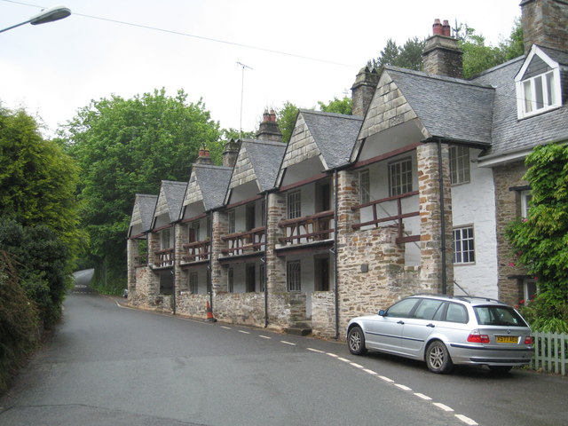
Tideford (; kw, Resteudhi) is a small village in east Cornwall, England, United Kingdom. It is twinned with Plouguerneau in Brittany, France. Its name derives from its location on the River Tiddy, literally meaning "Ford on the River Tiddy". Tideford is not listed in the Domesday Book but the earliest settlement is thought to have been around 1100AD. The bridge over the River Tiddy at the bottom of Bridge Road dates from the 14th century and this is the earliest surviving structure. Tideford grew in the eighteenth century as the nearby Port Eliot country estate built a number of houses in the village. Many of these have now been sold, but of note is 'Bridge House', located at the bottom of Bridge Road, which remains a gatehouse onto the estate. The village is on the busy A38 between Saltash and Liskeard, one of two main road routes into Cornwall (the other being the A30 which runs into north Cornwall). Tideford does not have a railway station, the nearest being at St Germa ... [...More Info...] [...Related Items...] OR: [Wikipedia] [Google] [Baidu] |
St Germans, Cornwall
St Germans ( kw, Lannaled) is a village and civil parish in east Cornwall, England. It stands on the River Tiddy, just upstream of where that river joins the River Lynher; the water way from St Germans to the Hamoaze is also known as St Germans River. It takes its name from the St. German's Priory, generally associated with St Germanus, although the church may have been associated initially with a local saint, who was gradually replaced by the 14th century. This Norman church is adjacent to the Port Eliot estate of the present Earl of St Germans. The other villages in the historic parish were Tideford, Hessenford, Narkurs, Polbathic, and Bethany, but new ecclesiastical parishes were established in 1834 ( St Anne's Church, Hessenford) and 1852 (Tideford). In 1997 part of the St Germans parish was made into Deviock parish. The area of the civil parish is , and it has a population of 1,427, increasing to 1,453 at the 2011 census. An electoral ward with the name ''St Germans'' ... [...More Info...] [...Related Items...] OR: [Wikipedia] [Google] [Baidu] |
Quay Sailing Club
St Germans ( kw, Lannaled) is a village and civil parish in east Cornwall, England. It stands on the River Tiddy, just upstream of where that river joins the River Lynher; the water way from St Germans to the Hamoaze is also known as St Germans River. It takes its name from the St. German's Priory, generally associated with St Germanus, although the church may have been associated initially with a local saint, who was gradually replaced by the 14th century. This Norman church is adjacent to the Port Eliot estate of the present Earl of St Germans. The other villages in the historic parish were Tideford, Hessenford, Narkurs, Polbathic, and Bethany, but new ecclesiastical parishes were established in 1834 ( St Anne's Church, Hessenford) and 1852 (Tideford). In 1997 part of the St Germans parish was made into Deviock parish. The area of the civil parish is , and it has a population of 1,427, increasing to 1,453 at the 2011 census. An electoral ward with the name ''St Germans' ... [...More Info...] [...Related Items...] OR: [Wikipedia] [Google] [Baidu] |
Tidal River Tiddy, North Of St Germans - Geograph
{{disambiguation ...
Tidal is the adjectival form of tide. Tidal may also refer to: * ''Tidal'' (album), a 1996 album by Fiona Apple * Tidal (king), a king involved in the Battle of the Vale of Siddim * TidalCycles, a live coding environment for music * Tidal (service), a music streaming service * Tidal, Manitoba, Canada ** Tidal station, Tidal, Manitoba See also * Tidal flow (traffic), the flow of traffic thought of as an analogy with the flow of tides * Tidal force, a secondary effect of the force of gravity and is responsible for the tides * Tide (other) A tide is the rise and fall of a sea level caused by the Moon's gravity and other factors. Tide may also refer to: Media * The Tide (Nigeria), ''The Tide'' (Nigeria), a newspaper *Tide (TV series), ''Tide'' (TV series), 2019 Irish/Welsh/Scottish ... [...More Info...] [...Related Items...] OR: [Wikipedia] [Google] [Baidu] |


